Best Destinations in Europe é um site que possui parceria com mais de 300 escritórios de turismo europeus, incluindo 80 destinos de turismo sustentável. Esse site elaborou rankings temáticos criados com base na votação de viajantes de diversas partes mundo. Com base no ranking publicado pelo “Best Destinations in Europe” apresentamos os 20 melhores destinos europeus 2023 eleitos por turistas de 178 países. São os seguintes:
Varsóvia, Polônia

Atenas, Grécia
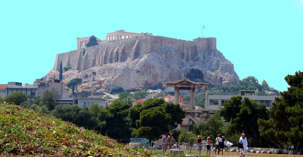 Foto: Erich Ettensperger
Maribor, Eslovênia

Viena, Áustria
 Foto: Erich Ettensperger
Cittadella, Itália

Essen, Alemanha

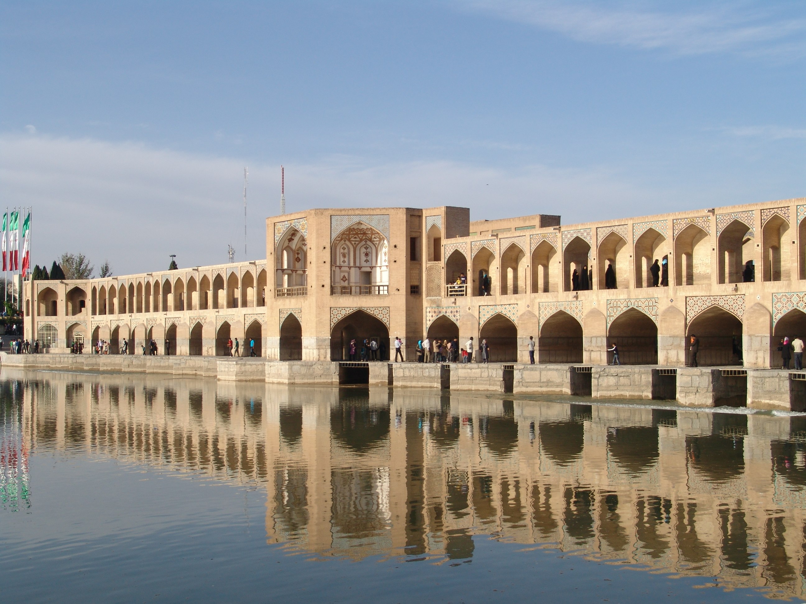
Veszprem, Hungria

Londres, Reino Unido

Grenoble Alpes, França

Mannheim, Alemanha
 Foto: https://www.mannheim.de/en
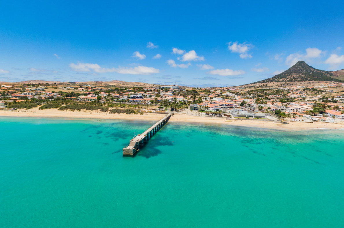
Porto-Santo, Ilha da Madeira
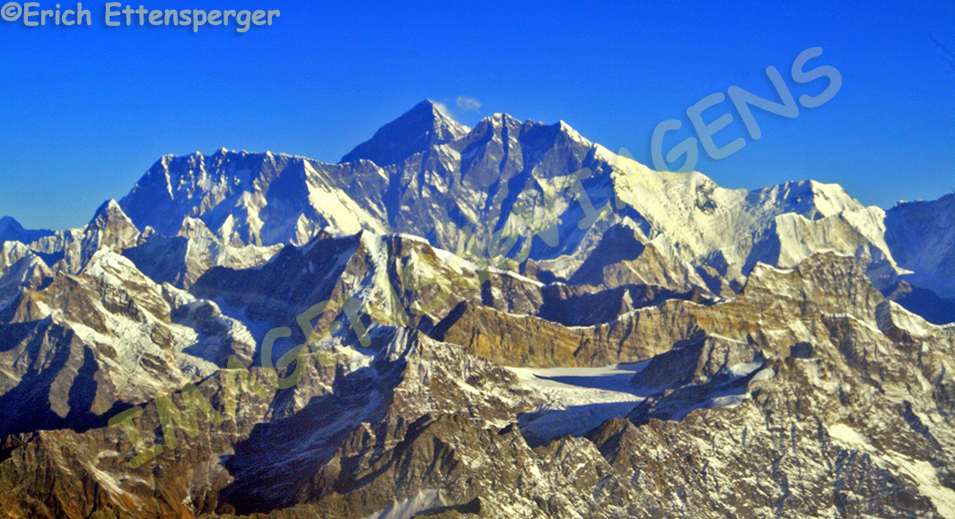
Toledo, Espanha

Faial, Açores

Rodes, Grécia
 Foto: Erich Ettensperger
Copenhage, Dinamarca
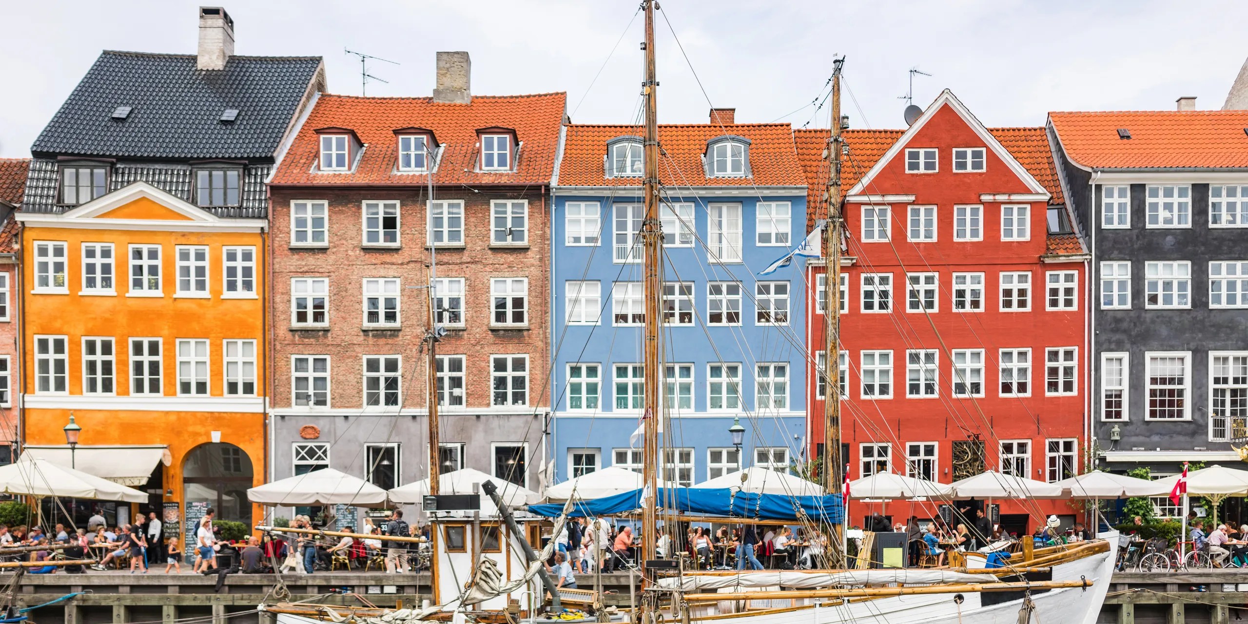 Foto: Getty Images
Tossa de Mar, Espanha

Ascona-Locarno, Suíça

Milos, Grécia

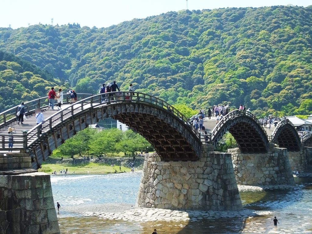
Praga, República Tcheca
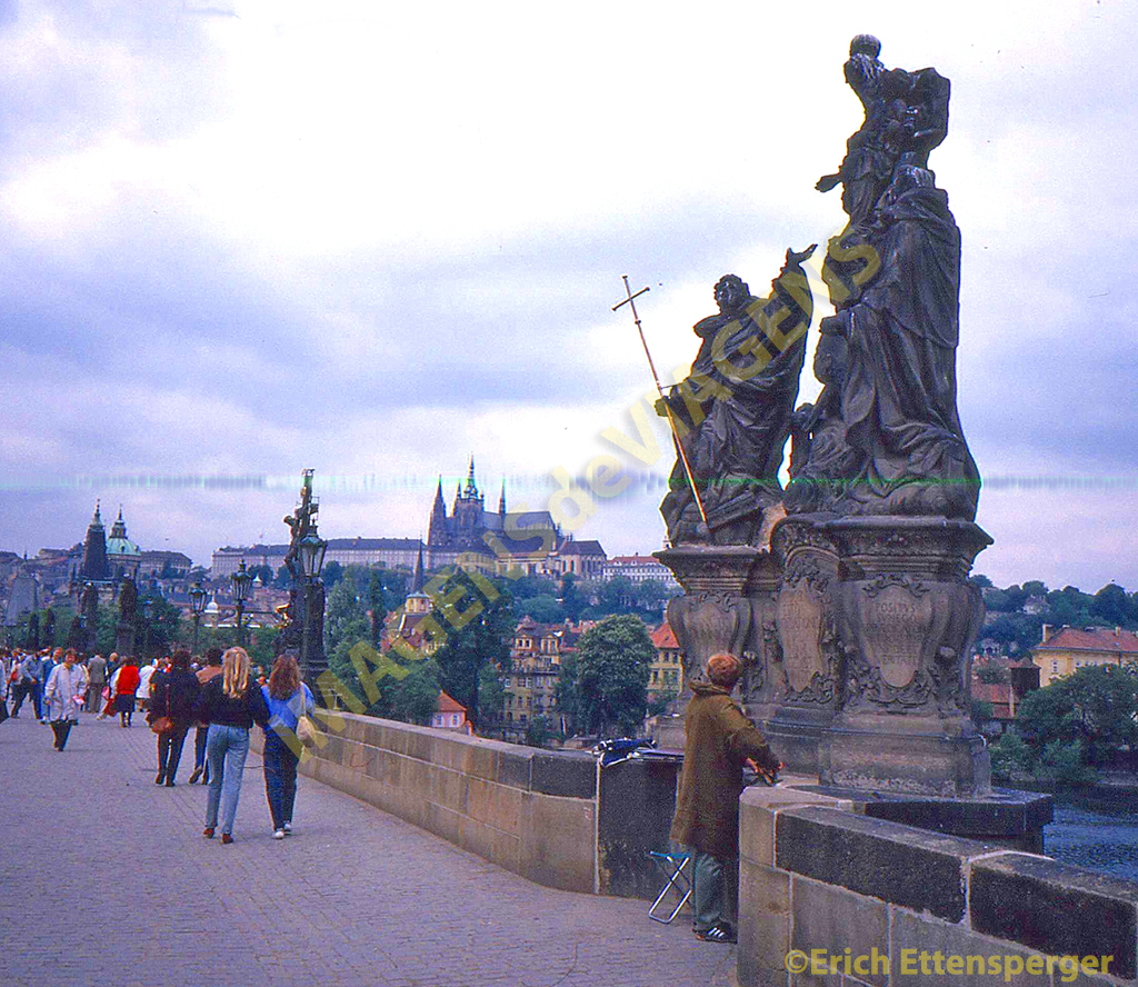 Foto: Erich Ettensperger
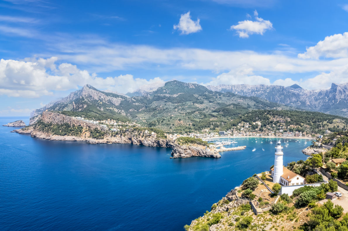
Sóller, Espanha
Quer conhecer mais sobre esses destinos? Visite o site “Best Destinations in Europe” aqui.
ATENÇÃO: Todas as fotos sem legendas foram retiradas do site “Best Destinations in Europe.
 Beste europäische Reiseziele 2023
Best Destinations in Europe ist eine Website, die mit mehr als 300 europäischen Tourismusbüros zusammenarbeitet, darunter 80 nachhaltige Tourismusdestinationen. Diese Seite hat thematische Rankings ausgearbeitet, die auf der Grundlage der Meinungen von Reisenden aus verschiedenen Teilen der Welt erstellt wurden. Basierend auf dem von „Best Destinations in Europe“ veröffentlichten Ranking präsentieren wir die 20 besten europäischen Reiseziele im Jahr 2023, die von Touristen aus 178 Ländern ausgewählt wurden. Es sind:
Warschau, Polen
Foto: from the site Best Destinations in Europe.Athen, Griechenland
Foto: Erich EttenspergerMaribor, Slowenien
Foto: from the site Best Destinations in Europe.Wien, Österreich
Foto: Erich EttenspergerCittadella, Italien
Foto: from the site Best Destinations in Europe.Essen, Deutschland
Foto: from the site Best Destinations in Europe.Veszprem, Ungarn
Foto: from the site Best Destinations in Europe.London, Vereinigtes Königreich
Foto: Erich EttenspergerGrenoble-Alpen, Frankreich
Foto: from the site Best Destinations in Europe.Mannheim, Deutschland
Foto: https://www.mannheim.de/enPorto Santo, Insel Madeira
Foto: from the site Best Destinations in Europe.Toledo, Spanien
Foto: from the site Best Destinations in Europe.Faial, Azoren
Foto: from the site Best Destinations in Europe.Rhodos, Griechenland
Foto: Erich EttenspergerKopenhagen, Dänemark
Foto: Getty ImagesTossa de Mar, Spanien
Foto: from the site Best Destinations in Europe.Ascona-Locarno, Schweiz
Foto: from the site Best Destinations in Europe.Milos, Griechenland
Foto: from the site Best Destinations in Europe.Prag, Tschechische Republik
Foto: Erich EttenspergerSoller, Spanien
Foto: from the site Best Destinations in Europe.Möchten Sie mehr über diese Reiseziele erfahren? Besuchen Sie die Website „Beste Reiseziele in Europa“ hier.
Best European Destinations 2023
Best Destinations in Europe is a website that partners with more than 300 European tourism offices, including 80 sustainable tourism destinations. This site elaborated thematic rankings created based on the vote of travelers from different parts of the world. Based on the ranking published by “Best Destinations in Europe”, we present the 20 best European destinations in 2023 chosen by tourists from 178 countries. They are:
Warsaw, Poland
Foto: from the site Best Destinations in Europe.Athens, Greece
Foto: Erich EttenspergerMaribor, Slovenia
Foto: from the site Best Destinations in Europe.Vienna, Austria
Foto: Erich EttenspergerCittadella, Italy
Foto: from the site Best Destinations in Europe.Essen, Germany
Foto: from the site Best Destinations in Europe.Veszprem, Hungary
Foto: from the site Best Destinations in Europe.London, United Kingdom
Foto: Erich EttenspergerGrenoble Alps, France
Foto: from the site Best Destinations in Europe.Mannheim, Germany
Foto: https://www.mannheim.de/enPorto Santo, Madeira Island
Foto: from the site Best Destinations in Europe.Toledo, Spain
Foto: from the site Best Destinations in Europe.Faial, Azores

Rhodes, Greece
Foto: Erich EttenspergerCopenhagen, Denmark
Foto: Getty ImagesTossa de Mar, Spain
Foto: from the site Best Destinations in Europe.Ascona-Locarno, Switzerland
Foto: from the site Best Destinations in Europe.Milos, Greece
Foto: from the site Best Destinations in Europe.Prague, Czech Republic
Foto: Erich EttenspergerSoller, Spain
Foto: from the site Best Destinations in Europe.Want to know more about these destinations? Visit the “Best Destinations in Europe” website here.