Texto e fotos: Mary Sorage, bióloga, gestora do Parque das Dunas em Natal, adora viajar!

Quando fui a Minas Gerais pela primeira vez,

busquei apenas conhecer um pouco mais da história do Brasil através dos seus museus, igrejas e casarões antigos. Depois tive que voltar para fazer um percurso para apreciar as belezas naturais de algumas áreas naturais.
Minas Gerais, como o próprio nome fala, é um estado muito rico em vários minerais, principalmente, o minério de ferro. No entanto, também é um estado que se destaca pelas suas belezas naturais, abrigadas em áreas protegidas.
Fiz um percurso a trabalho e tive a oportunidade de viver momentos inesquecíveis, ao lado de uma natureza exuberante e diversa.
Fiz o seguinte roteiro:
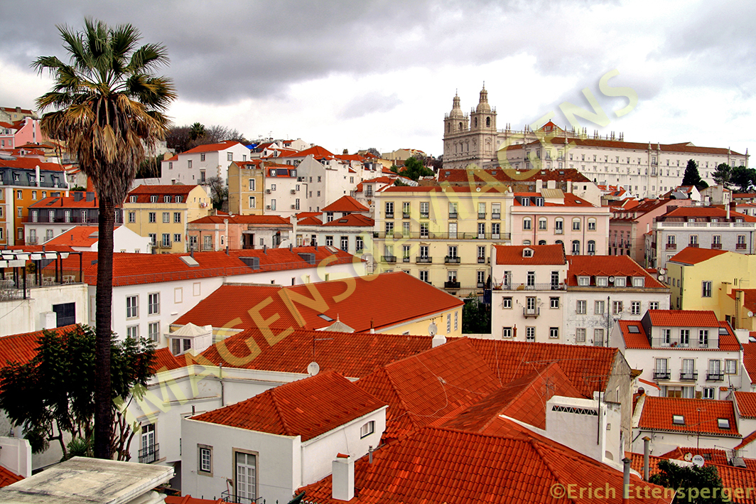
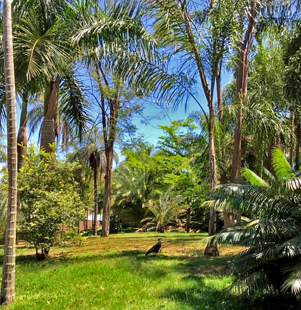
Cheguei no aeroporto de Belo Horizonte (que fica em Confins), aluguei um carro e parti para conhecer o INHOTIM , localizado em Brumadinho, a cerca de 90km. É o maior museu de arte contemporânea, a céu aberto, do mundo! É espetacular!

Em uma área de 140ha é possível visitar várias galerias de artes,

aliadas a uma grande área verde com jardins, orquidários, lagos, gramados, esculturas.

Importante dizer que você vai precisar de uns dois ou três dias para conhecer todo o espaço.

É possível conhecer tudo andando a pé, mas há a disponibilidade de fazer a locação de um carrinho elétrico com motorista, que transporta até 5 passageiros ao custo de R$ 500,00 a diária.

Você pode se hospedar em Brumadinho que fica mais cômodo para voltar ao INHOTIM nos dias da visita. O valor do ingresso é R$ 44,00 (inteira), sendo a entrada gratuita as quartas feiras. Também é possível comprar um combo de ingressos que fica mais em conta.
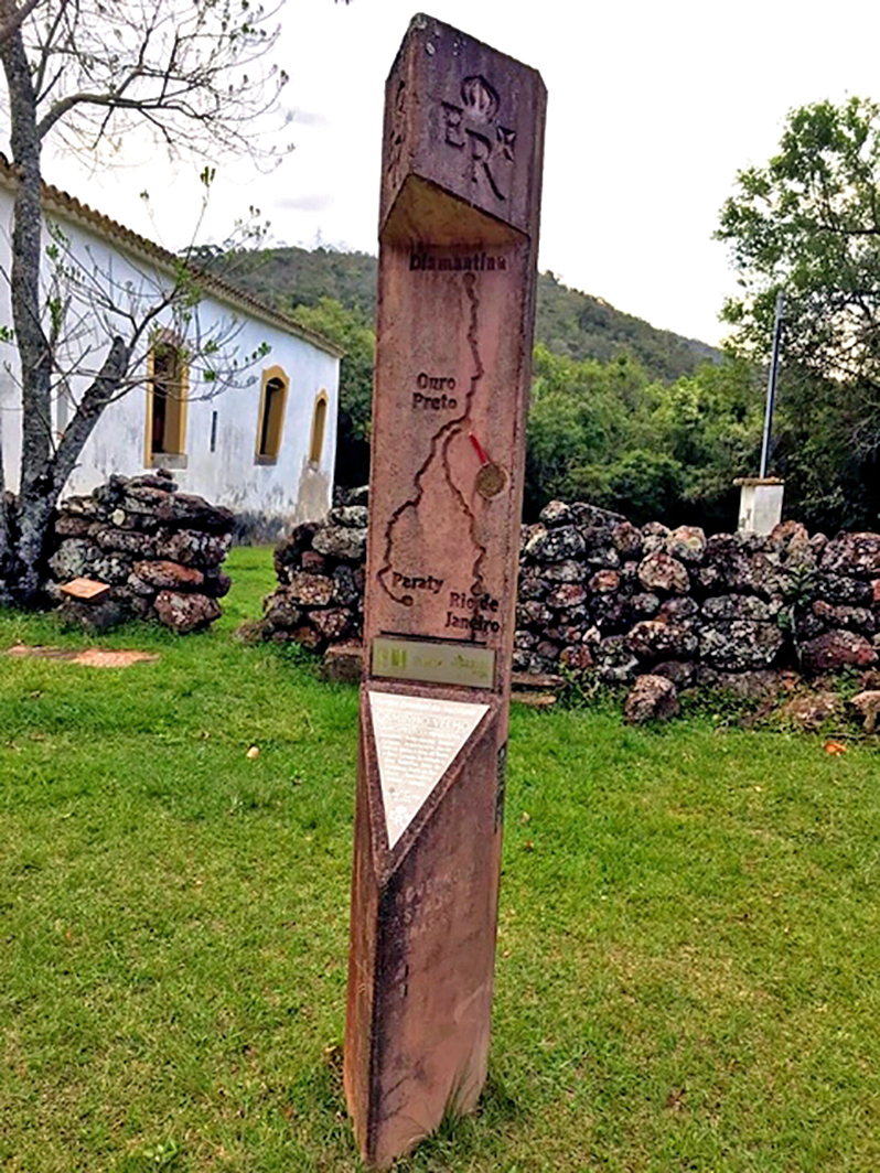
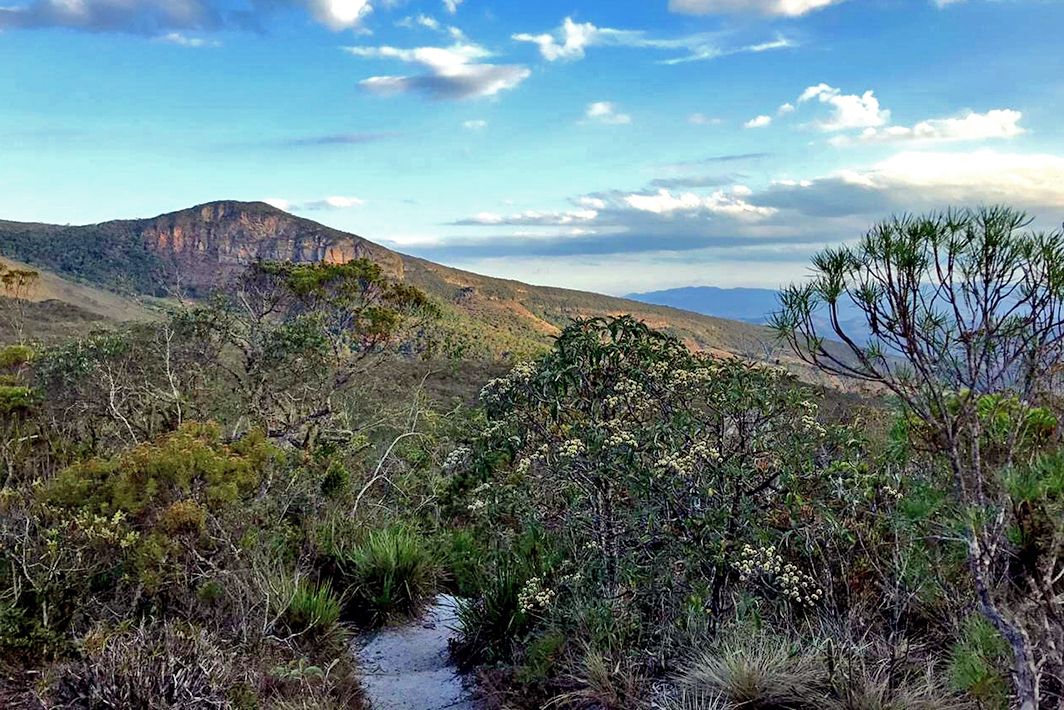
2 – Em seguida, segui em direção a Ouro Preto, mas dessa vez o destino foi o Parque Estadual do Itacolomi ).
O parque abriga o Pico do Itacolomi, com 1.772 metros de altitude, que era ponto de referência para os antigos viajantes da Estrada Real, como o bandeirante paulista Antônio Dias, que o chamava de “Farol dos Bandeirantes”.A palavra itacolomy vem da língua tupi e significa “pedra menino”, os índios viam o pico como o “filhote” da montanha ou “pedra mãe”. É um lugar maravilhoso!!! Inesquecível!!!

E você pode ficar hospedado dentro do Parque, por apenas R$ 50,00 a diária/pessoa! Gente é um privilégio poder dormir no meio da Mata Atlântica ao som da natureza e acordar ao som de uma linda e afinadíssima orquestra de pássaros. O alojamento dispõe de fogão, geladeira e camas com lençóis e cobertas (não tem roupa de banho).


Aí, você acorda,

toma aquele café, veste uma roupa confortável, coloca comida na mochila e vai se encher de natureza através dos seguinte atrativos e trilhas:

Trilha do Pico do Itacolomi: Do alto do Pico do Itacolomi, a 1.772 m de altitude, tem-se vista de 360º e uma paisagem magnífica, abrangendo a cidade de Ouro Preto e as serras e o relevo de mares de morros do entorno. A trilha possui extensão de 6 km (a partir do Centro de Visitantes), permitido saída até as 11hs, por questões de segurança. O tempo aproximado do percurso total de 12Km é de 4 horas (ida e volta), e tem uma dificuldade de média para alto. O pico que motivou a criação da unidade de conservação, está localizado no Vale do Tripuí, município de Mariana, embora seu acesso seja pelo parque em Ouro Preto.
Trilha dos Sentidos: Esta trilha é curta e leva aos visitantes uma aventura emocionante e que torna a conexão com a natureza potencializada em um caminho preparado para proporcionar sensações extraordinárias, através do toque e do caminhar descalço em pequenos trechos. Para fazer a trilha deve ser realizado o agendamento pelo e-mail do parque. A realização da atividade tem capacidade para 15 pessoas, com duração de 40 min, em média. Obs: Para esta trilha é necessário levar toalha e chinelos.

Trilha do Forno: Tem 1.200 metros de extensão e abriga, no final, as ruínas de um antigo forno que pertenceu à Olaria Roque Pinto no século XIX. Percorre uma área de mata atlântica com trechos alagadiços e tem como objetivo mostrar a importância da água para a manutenção da vida. Tempo de duração da trilha é de aproximadamente 1 hora e possui fácil acesso.
Trilha da Capela: Tem 1.400 metros de extensão e localiza-se em uma área que sofreu significativa interferência humana na primeira metade do século XX, com as extensas plantações de chá e com o cultivo de eucalipto. Inicia-se ao lado da Capela de São José e em seu percurso é possível perceber diferentes tipos de vegetação e de solos existentes no parque. Tempo de duração da trilha é de aproximadamente 1 hora e possui fácil acesso.
Lagoa da Capela: com a água límpida e paisagem agradável no entorno, a lagoa é destinada para banhos, possui deque e bancos. Está localizada a 200 metros da sede.
Trilha da Lagoa: com 450 m, circunda a área da Lagoa da Capela, passando por áreas planas e alagadiças, com vegetação predominante de mata atlântica. Trilha de fácil acesso com percurso durando 20 minutos, em média.
Trilha do Mirante do Custódio: trata-se de um mirante natural de onde avista-se a represa do Custódio, sua mata ciliar e o distrito de Lavras Novas. A trilha possui uma extensão de 6 km a partir do Centro de Visitantes e o tempo aproximado para realizar o percurso é de 3 horas (ida e volta). A trilha tem dificuldade baixa a média.
Represa do Custódio: Construída na década de 1940. Situa-se a 8 km de distância da sede do parque, no distrito de Lavras Novas. Bom para apreciação da vista, mas não é permitido o banho ou a prática de esportes náuticos. Grau de dificuldade: médio.
Trilha do Mirante do Morro do Cachorro: caminho por estrada de terra até o local onde se avista as cidades de Ouro Preto e Mariana, a Serra do Caraça, o Pico do Itacolomi, o Pico de Itabirito e o distrito de Lavras Novas. Sua extensão é de 2Km ida/volta, a partir do centro de visitantes, o tempo de percurso é de 1h30min e dificuldade média.
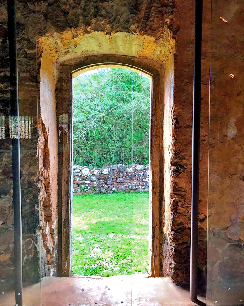
Casa Bandeirista: é a antiga sede da fazenda São José do Manso, construída entre 1706 e 1708, e após restaurada passou a funcionar como centro de visitantes do parque, exibindo uma exposição permanente sobre os naturalistas viajantes que passaram por Minas. Esta é considerada por especialistas uma das três amostras da arquitetura paulista em Minas Gerais e o primeiro prédio público do Estado, que servia para cobrança de impostos e vigilância das minas sendo, por isso, tombada pelo IEPHA em 1998.
Museu do Chá: Situa-se na antiga Fazenda São José do Manso, que foi polo produtor de chá na primeira metade do século 20. Grande parte do maquinário alemão utilizado na produção se encontra ainda no galpão e é hoje a principal parte da exposição.
Capela de São José: Construída em meados do século 20, sob a recomendação de um padre após relatos de aparições de almas penadas nas imediações. Possui uma Via-Sacra diferente, feita por artistas plásticas ouropretanas que utilizaram materiais colhidos na natureza para sua confecção. A entrada no Parque custa R$ 20,00 por pessoa e tem a opção de acampar. Contatos através do e-mail: peitacolomi@meioambiente.mg.gov.br. Tel: (31) 3551 6193. Endereço: BR 3. 56, km 97.6, em frente o trevo do Hospital Santa Casa, Ouro Preto, MG CEP: 35.400-000.
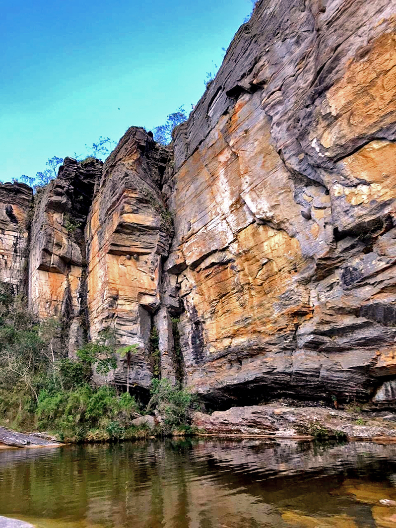
3 – Seguindo a aventura e já renovada, fui para o Parque Estadual Serra do Ibitipoca, localizado na Região Sudeste do Brasil e na Zona da Mata do Estado de Minas Gerais, municípios: Lima Duarte e Santa Rita do Ibitipoca. O melhor local para se hospedar é na Vila de Conceição do Ibitipoca que fica 3 Km antes da portaria do Parque.
Gente é um lugar paradisíaco!!! Inebriante!!! Maravilhoso!!!! Indescritível.

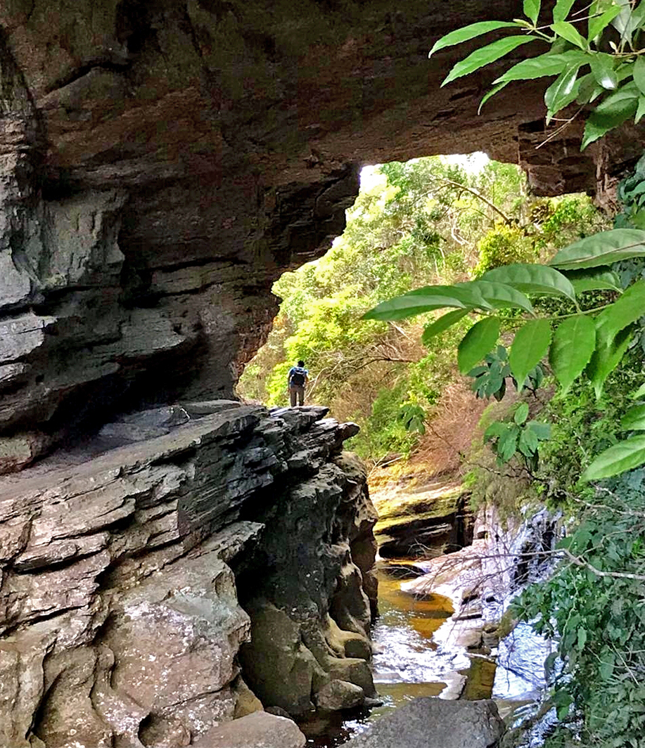
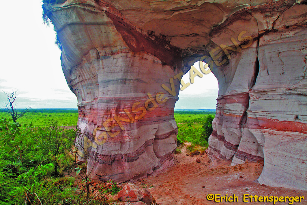
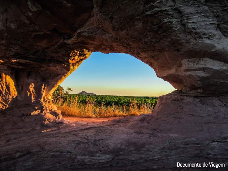
O parque abre as 7h e fecha as 18h. Você tem o dia todo para fazer percursos cheios de magia através de cachoeiras,
rios, serras, cavernas, mirantes, Mata Atlântica, Cerrado!!!


O estacionamento no parque custa R$ 20 para motos, R$ 25 para veículos de passeio para até sete pessoas e R$ 65 para vans, micro-ônibus, ônibus caminhão e outros. Os interessados em usar a área de camping pagam R$ 50 por pessoa/dia.
Você pode fazer os seguintes roteiros: Roteiro Janela do Céu – Percurso total: 16Km. Na trilha: Cruzeiro, Gruta da Cruz, Pico do Ibitipoca, Gruta dos Três Arcos, Gruta dos Fugitivos, Gruta dos Moreiras, Cachoeirinha, Janela do Céu, Rio Vermelho. Roteiro Pico do Pião – Percurso total: 11 Km. Na trilha: Gruta do Monjolinho, Gruta do Pião, Gruta dos Viajantes, Pico do Pião, Ruínas da Capela no Pico do Pião. Roteiro Das Águas – Percurso total: 5Km.
Na trilha: Lago dos Espelhos, Lago Negro, Prainha, Lago das Miragens, Ponte de Pedra, Cachoeira dos Macacos, Rio do Salto.
Nota da editora: Mary informou que Minas Gerais tem outras Unidades de Conservação belas, como o Parque Estadual da Serra do Rola-Moça, mas, isso é assunto para outro post…

Observação: se você quiser continuar “viajando” com o nosso blog, clique no botão “seguir” localizado no canto inferior direito dessa página. Você também pode “viajar” pelo Brasil conhecendo nosso livro impresso 66 Brasil e sua versão digital 66 Belezas do Brasil.

Kennen Sie Minas Gerais jenseits des köstlichen Käsebrotes!
Text und Fotos: Mary Sorage, Biologin, Managerin des “Dünen Parks” in Natal, sie liebt es zu reisen!
Als ich zum ersten Mal nach Minas Gerais kam,
habe ich versucht, etwas mehr über die Geschichte Brasiliens durch seine Museen, Kirchen und alten Herrenhäuser zu erfahren. Dann musste ich es wieder besuchen gehen, um die natürliche Schönheit einiger Naturgebiete zu genießen.
Minas Gerais ist wie der Name schon sagt ein sehr mineralreicher Bundesstaat, insbesondere Eisenerz. Es ist aber auch ein Staat, der sich durch seine natürliche Schönheit auszeichnet, geschützt in Schutzgebieten.
Ich unternahm meine Geschäftsreise und hatte die Gelegenheit, unvergessliche Momente neben einer üppigen und abwechslungsreichen Natur zu erleben.
Ich habe folgende Tour gemacht:
Ich kam am Flughafen Belo Horizonte (in Confins) an, mietete ein Auto und fuhr zu INHOTIM (http://inhotim.org.br/) in Brumadinho, ca. 90 km entfernt. Es ist das größte Freilichtmuseum für zeitgenössische Kunst der Welt, spektakulär!
Auf einer Fläche von 140 ha können Sie mehrere Kunstgalerien besuchen,
die mit einer großen Grünfläche mit Gärten, Kindergärten, Seen, Rasenflächen und Skulpturen verbunden sind.
Es ist wichtig zu erwähnen, dass Sie ungefähr zwei oder drei Tage benötigen, um den gesamten Bereich kennenzulernen.
Es ist möglich, alles zu Fuß zu machen, aber es ist auch möglich, einen Trolley mit Fahrer zu mieten, der bis zu 5 Passagiere zum Preis von R $ 500,00 pro Tag befördert.
Sie können sich in Brumadinho übernachten, um an den Tagen des Besuchs bequemer zu INHOTIM zurückzukehren. Der Ticketpreis beträgt R$ 44,00 (Vollpreis), mittwochs ist der Eintritt frei. Sie können aber auch eine günstigere Kombination von Tickets kaufen.
2. Dann fuhr ich in Richtung Ouro Preto, aber dieses Mal war das Ziel der Itacolomi State Park Der Park beherbergt den 1.772 Meter hohen Itacolomi Gipfel, der ein Bezugspunkt für ehemalige Reisende der Estrada Real war, wie der aus São Paulo stammende Reisende Antonio Dias, der ihn „Bandeirantes Leuchtturm“ nannte. Das Wort Itakolomie kommt aus der Tupi-Sprache und bedeutet “Jungenstein”, die Indianer sahen den Gipfel als “Jungtier” des Berges oder “Mutterstein”. Es ist ein wunderbarer Ort !!! Unvergesslich !!
Und Sie können für nur R $ 50,00 pro Tag / Person im Park bleiben! Dort haben Sie dann das Privileg inmitten des Atlantischen Waldes zu den Klängen der Natur zu schlafen und mit den Klängen eines wunderschönen und fein abgestimmten Vogelorchesters aufzuwachen. Die Unterkunft verfügt über einen Herd, einen Kühlschrank und Betten mit Laken und Bezügen (keine Handtücher).
Dann wachst du auf,
trinkst Kaffee, ziehst ein bequemes Outfit an, packst Essen in deinen Rucksack und fühlst dich dann durch die folgenden Attraktionen und Wanderwege stärkstens mit der Natur verbunden:
Wanderweg Pico do Itacolomi: Vom Gipfel des Pico do Itacolomi auf 1.772 m haben Sie einen Rundumblick auf eine herrliche Landschaft, die die Stadt Ouro Preto und die umliegenden Hügel und Hügelmeere einschließt. Der Weg hat eine Länge von 6 km (vom Besucherzentrum aus) und muss aus Sicherheitsgründen bis 11 Uhr morgens initiiert werden.
Die ungefähre gesamte benötigte Zeit von 12 km beträgt 4 Stunden (Hin- und Rückfahrt) und hat einen mittleren bis hohen Schwierigkeitsgrad. Der Gipfel, der zur Schaffung des Naturschutzgebiets geführt hat, befindet sich im Tripuí-Tal in der Gemeinde Mariana, obwohl der Zugang über den Park in Ouro Preto erfolgt.
Trilha dos Sentidos (Weg der Sinne): Dieser Weg ist kurz und bietet den Besuchern ein aufregendes Abenteuer, das die Verbindung mit der kraftvollen Natur zu einem Weg macht, der außergewöhnliche Empfindungen durch Berühren und barfußes Gehen auf kleinen Strecken hervorruft. Um den Trail zu machen, muss eine E-Mail an den Park gesendet werden. Die Aktivität bietet Platz für 15 Personen und dauert durchschnittlich 40 Minuten. Hinweis: Für diesen Trail müssen Handtuch und Hausschuhe mitgebracht werden.
Trilha do Forno (Ofenweg): Er ist 1.200 Meter lang und beherbergt am Ende die Ruinen eines alten Ofens, der im 19. Jahrhundert der Roque Pinto Pottery gehörte. Es umfasst ein Gebiet mit atlantischen Wäldern und Feuchtgebieten und soll die Bedeutung von Wasser für die Erhaltung des Lebens demonstrieren. Die Trackdauer beträgt ca. 1 Stunde und ist leicht zugänglich.
Kapellenweg: Er ist 1.400 Meter lang und befindet sich in einem Gebiet, das in der ersten Hälfte des 20. Jahrhunderts von Menschen stark beeinträchtigt wurde mit ausgedehnten Teeplantagen und Eukalyptusanbau. Er beginnt neben der Kapelle des hl. Josef und auf seinem Weg können Sie verschiedene Arten von Vegetation und Böden im Park sehen. Die Trackdauer beträgt ca. 1 Stunde und ist leicht zugänglich.
Lagoa da Capela: Die Lagune lädt mit ihrem klaren Wasser und der angenehmen Landschaft zum Schwimmen ein, offeriert auch Liegen und Bänke. Sie wohnen 200 m vom Hauptsitz entfernt.
Lagoon Trail: 450 m, umfasst das Gebiet des Lagoa da Capela und führt durch flache und sumpfige Gebiete mit vorherrschender Vegetation des atlantischen Waldes. Einfacher Zugangsweg mit durchschnittlich 20 Minuten.
Custódio-Aussichtspfad: Dies ist ein natürlicher Aussichtspfad, von dem aus Sie den Custódio-Damm, seinen Auwald und das Lavras-Novas-Viertel sehen können. Der Weg hat eine Länge von 6 km vom Besucherzentrum aus und die ungefähre benötigte Gesamtzeit beträgt 3 Stunden (Hin- und Rückfahrt). Der Weg ist leicht bis mittelschwer.
Custodio-Staudamm: Erbaut in den 1940er Jahren und 8 km vom Hauptsitz des Parks im Stadtteil Lavras Novas entfernt. Gut um die Aussicht zu genießen, aber Baden oder Wassersport sind nicht erlaubt. Schwierigkeitsgrad: mittel
Morro do Cachorro Aussichtspfad: Route über eine unbefestigte Straße zu dem Ort, von dem aus Sie die Städte Ouro Preto und Mariana, Serra do Caraça, Itacolomi, Itabirito und Lavras Novas sehen können. Seine Länge beträgt 2 km Hin- und Rückfahrt ab dem Besucherzentrum die Zeit hierfür beträgt 1h30min und offeriert einen durchschnittlichen Schwierigkeitsgrad.
Bandeirista-Haus: Das alte Hauptquartier des zwischen 1706 und 1708 erbauten Gutshofs São José do Manso wurde restauriert und diente als Besucherzentrum für den Park. Es zeigt eine ständige Ausstellung über die naturkundlichen orientierten Reisenden, die in Minas unterwegs waren. Dies wird von Experten als eines der drei Muster der Architektur von São Paulo in Minas Gerais und als erstes öffentliches Gebäude des Bundesstaates angesehen, das zur Erhebung von Steuern und zur Überwachung der Minen diente und daher 1998 von der IEPHA aufgelistet wurde.
Museu do Chá (Teemuseum): Es befindet sich in der ehemaligen Farm São José do Manso, die in der ersten Hälfte des 20. Jahrhunderts Tee produzierte. Ein Großteil der deutschen Maschinen, die für die Herstellung verwendet wurden, befindet sich noch im Schuppen und sind heute Hauptteil der Ausstellung.
St.Josephs-Kapelle: Erbaut in der Mitte des 20. Jahrhunderts auf Empfehlung eines Priesters nach Berichten über Erscheinungen von verlorenen Seelen in der Nähe. Es gibt einen anderen Kreuzweg, der von bildenden Künstlern aus Ouro Preto hergestellt wurde, die für ihre Herstellung die in der Natur geerntete Materialien verwendeten. Der Eintritt in den Park kostet R$ 20,00 pro Person und es besteht auch die Möglichkeit zu campen. Kontakte per E-Mail: peitacolomi@meioambiente.mg.gov.br. Tel: (31) 3551 6193. Adresse: BR 3. 56, km 97.6, vor dem Kleeblatt des Santa Casa Hospital, Ouro Preto, MG Postleitzahl: 35.400-000.
3. Nach diesen Abenteuern bin ich in die Serra do Ibitipoca State Park gefahren, der sich im Südosten Brasiliens und in der Mata-Zone des Bundesstaates Minas Gerais befindet, Gemeinden: Lima Duarte und Santa Rita do Ibitipoca.
Die beste Unterkunft ist das Dorf Conceição do Ibitipoca, das 3 km vor dem Parkeingang liegt. Die Menschen leben an einem himmlischen Ort !!! Berauschend !!! Wunderbar !!!! Unbeschreiblich.
Der Park öffnet um 7 Uhr und schließt um 18 Uhr. Sie haben den ganzen Tag Zeit, magische Routen mit Wasserfällen,
Flüssen, Bergen, Höhlen, Aussichtspunkten, Atlantikwald und Cerrado zu unternehmen !!!
Das Parken im Park kostet 20 USD für Motorräder, 25 USD für PKWs für bis zu sieben Personen und 65 USD für Lieferwagen, Kleinbusse, LKW-Busse und andere. Diejenigen, die den Campingplatz nutzen möchten, zahlen 50 USD pro Person und Tag. Sie können die folgenden Touren unternehmen:
Roteiro Janela do Céu Route – Gesamtroute: 16 km. Auf dem Weg: Cruzeiro, Gruta (Grotte) da Cruz, Pico (Gipfel) do Ibitipoca, Gruta dos Três Arcos, Gruta dos Fugitivos, Gruta dos Moreiras, Cachoeirinha (Wasserfall), Janela do Céu (Himmelsfenster), Rio (Fluss) Vermelho.
Pico Pião Route – Gesamtstrecke: 11 km Auf dem Weg: Monjolinho-Höhle, Pião-Höhle, Travellers ‘Cave, Pião Pião, Kapellenruine in Pião Pião.
Roteiro Das Águas (Wasser-Route) – Gesamtstrecke: 5 km.
Auf dem Weg: Lago (See) dos Espelhos, Lago Negro, Prainha (Strand), Lago das Miragens, Ponte de Pedra (Steinbrücke), Cachoeira dos Macacos (Wasserfall), Rio (Fluss) do Salto.

Anmerkung der Redaktion: Mary berichtete, dass Minas Gerais andere schöne Naturschutzgebiete hat, wie den Serra do Rola-Moça State Park, aber das ist das Thema eines anderen Beitrags …
Hinweis: Falls Sie unserem Blog folgen wollen, dann klicken Sie unten rechts einfach auf “Weiter”, Sie werden dann zukünftig automatisch informiert. Sie können auch durch Brasilien reisen und unser Buch 66 SEHENSWÜRDIGKEITEN IN BRASILIEN kennenlernen und 66 x Brazil – A Mosaic of Beauties.

Knowing Minas Gerais beyond the delicious cheese bread!
Text and photos: Mary Sorage, biologist, manager of the “Dune Park” in Natal, loves to travel!
When I first went to Minas Gerais
I just tried to know a little more about the history of Brazil through its museums, churches and old mansions. Then I had to go back to enjoy the natural beauty of some natural areas.
Minas Gerais, as its name implies, is a state very rich in various minerals, especially iron ore. However, it is also a state that stands out for its natural beauty, sheltered in protected areas.
I took a business trip and had the opportunity to live unforgettable moments, alongside a lush and diverse nature.
I made the following tour:
I arrived at Belo Horizonte airport (located in Confins), rented a car and left to visit INHOTIM (http://inhotim.org.br/), located in Brumadinho, about 90km away. It is the largest open-air museum of contemporary art in the world! It’s spectacular!
In an area of 140ha it is possible to visit several art galleries,
allied to a large green area with gardens, nurseries, lakes, lawns, sculptures.
Important to say that you will need about two or three days to know the whole space.
It is possible to know everything by walking, but it is also possible to rent a trolley with driver, which carries up to 5 passengers at the cost of R $ 500.00 per day.
You can stay in Brumadinho which is more comfortable to return to INHOTIM on the days of the visit. The price of the ticket is R $ 44,00 (full), with free admission on Wednesdays. You can also buy a cheaper combo of tickets.
2. Then I headed towards Ouro Preto, but this time the destination was the Itacolomi State Park The park is home to the 1,772-meter-high Itacolomi Peak, which was a point of reference for former Estrada Real travelers, such as the São Paulo bandeirante Antonio Dias, who called it “Bandeirantes Lighthouse”. The word itacolomy comes from the Tupi language and means “boy stone”, the Indians saw the peak as the “cub” of the mountain or “mother stone”. It is a wonderful place!!! Unforgettable!!!
And you can stay inside the Park for only R $ 50,00 per day / person! People havethen a privilege to sleep in the middle of the Atlantic Forest to the sound of nature and wake up to the sound of a beautiful and finely tuned bird orchestra. The accommodation has a stove, refrigerator and beds with sheets and covers (no towels).
Then you wake up,
drink coffee, put on a comfortable outfit, put food in your backpack and you will be filled with nature through the following attractions and trails:
Pico do Itacolomi Trail: From the top of Pico do Itacolomi, at 1,772 m, it has a 360º view and a magnificent landscape, encompassing the city of Ouro Preto and the surrounding hills and seas of hills. The trail has a length of 6 km (from the Visitor Center), allowed to leave until 11am, for safety reasons. The approximate travel time of 12km is 4 hours (round trip), and has a medium to high difficulty. The peak that motivated the creation of the conservation unit is located in the Tripuí Valley, Mariana municipality, although its access is through the park in Ouro Preto.
Trilha dos Sentidos (Trail of Senses): This trail is short and takes visitors an exciting adventure that makes connecting with empowered nature a path prepared to provide extraordinary sensations through touch and barefoot walking in small stretches. To make the trail must be done by emailing the park. The activity has capacity for 15 people, lasting 40 minutes on average. Note: For this trail is necessary to bring towel and slippers.
Trilha do Forno (Oven Trail): It is 1,200 meters long and houses at the end the ruins of an old oven that once belonged to the Roque Pinto Pottery in the 19th century. It traverses an area of Atlantic forest with wetlands and aims to show the importance of water for the maintenance of life. Track duration time is approximately 1 hour and has easy access.
Chapel Trail: It is 1,400 meters long and is located in an area that suffered significant human interference in the first half of the twentieth century with extensive tea plantations and eucalyptus cultivation. It begins next to the Chapel of St. Joseph and on its path you can see different types of vegetation and soil of the park. Track duration time is approximately 1 hour and has easy access.
Lagoa da Capela: With its clear water and pleasant landscape around it, the lagoon is intended for swimming, deck and benches. It is located 200 meters from the headquarters.
Lagoon Trail: 450 m, surrounds the area of Lagoa da Capela, passing through flat and swampy areas, with predominant vegetation of the Atlantic forest. Easy access trail with an average of 20 minutes.
Custódio Lookout Trail: This is a natural lookout path from which you can see the Custódio Dam, its riparian forest and the Lavras Novas district. The trail has a length of 6 km from the Visitor Center and the approximate time to make the route is 3 hours (round trip). The trail has low to medium difficulty.
Custodio Dam: Built in the 1940s. It is 8 km away from the park headquarters in the Lavras Novas district. Good for enjoying the view, but bathing or water sports are not allowed. Degree of difficulty: medium.
Morro do Cachorro Lookout Trail: route by dirty road to the place where you can see the cities of Ouro Preto and Mariana, Serra do Caraça, Itacolomi Peak, Itabirito Peak and Lavras Novas district. Its length is a 2 Km round trip from the visitor center, the travel time is 1h30min and the difficulty is average.
Bandeirista House: is the old headquarters of the São José do Manso farm, built between 1706 and 1708, and after being restored it began to function as a visitor center for the park, displaying a permanent exhibition about the naturalist travelers who passed through Minas. This is considered by experts one of the three samples of São Paulo architecture in Minas Gerais and the first public building in the state, which served to collect taxes and mine surveillance and was therefore listed by the IEPHA in 1998.
Museu do Chá (Tea Museum): It is located in the former São José do Manso Farm, which was a tea producer in the first half of the 20th century. Much of the German machinery used in the production is still in the shed and is today the main part of the exhibition.
St. Joseph’s Chapel: Built in the mid-20th century, on the recommendation of a priest after reports of apparitions of lost souls in the vicinity. It has also a different Way of the Cross made by Ouropretan plastic artists who used materials harvested in nature for their making. Admission to the Park costs R $ 20,00 per person and has also the option of camping. Contacts via e-mail: peitacolomi@meioambiente.mg.gov.br. Tel: (31) 3551 6193. Address: BR 3. 56, km 97.6, in front of the Santa Casa Hospital clover, Ouro Preto, MG ZIP Code: 35.400-000.
3. Following the adventure and already renewed I went to the Serra do Ibitipoca State Park, located in the Southeast Region of Brazil and in the Mata Zone of the State of Minas Gerais, municipalities: Lima Duarte and Santa Rita do Ibitipoca. The best place to stay is in the village of Conceição do Ibitipoca, which is 3 km before the entrance of the park. People live in a heavenly place !!! Intoxicating !!! Wonderful!!!! Indescribable.
The park opens at 7am and closes at 6pm. You have all day to do magical routes through waterfalls,
rivers, mountains, caves, lookouts, Atlantic Forest, Cerrado !!!
Parking in the park costs $ 20 for motorcycles, $ 25 for passenger vehicles for up to seven people and $ 65 for vans, minibuses, truck buses and others. Those interested in using the campsite pay $ 50 per person / day.
You can make the following itineraries: Itinerary Roteiro Janela do Céu – Total route: 16Km. On the trail: Cruzeiro, Gruta da Cruz, Summit Pico do Ibitipoca, Gruta dos Três Arcos, Gruta dos Fugitivos, Gruta dos Moreiras, Cachoeirinha (waterfall), Janela do Céu (sky window), Rio (river) Vermelho.
Pico Pião Route – Total route: 11 Km. On the trail: Monjolinho Cave, Pião Cave, Travelers’ Cave, Pião Pião, Chapel Ruins at Pião Pião.
Roteiro The Águas (water route) – total distance: 5 km.
Along the way: Lake Lago Espelhos, Lago Negro, Prainha (Beach), Lago das Miragens, Ponte de Pedra (stone bridge), Cachoeira dos Macacos (waterfall), Rio (river) do Salto.
Editor’s note: Mary reported that Minas Gerais has other beautiful Conservation Units, such as the Serra do Rola-Moça State Park, but this is the subject of another post …
Note: If you want to follow our “Travels” on the blog, simply click on “Seguir” in the lower right corner, you will be then automatically informed in the future. You can continue traveling with us with our book Brazil´s 66 Beautiful Sites and 66 x Brazil – A Mosaic of Beauties.