A verdejante Ilha de Boipeba (PARTE I)/Die grüne Insel Boipeba (TEIL I)/The green island of Boipeba (PART I)

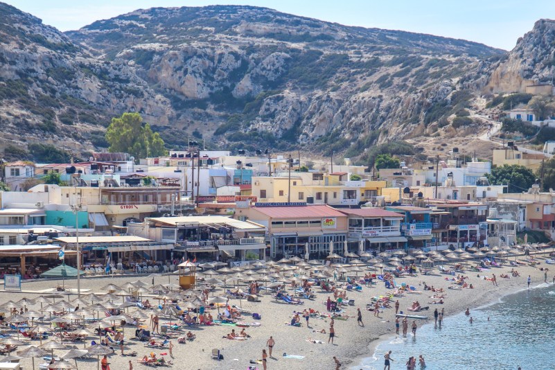
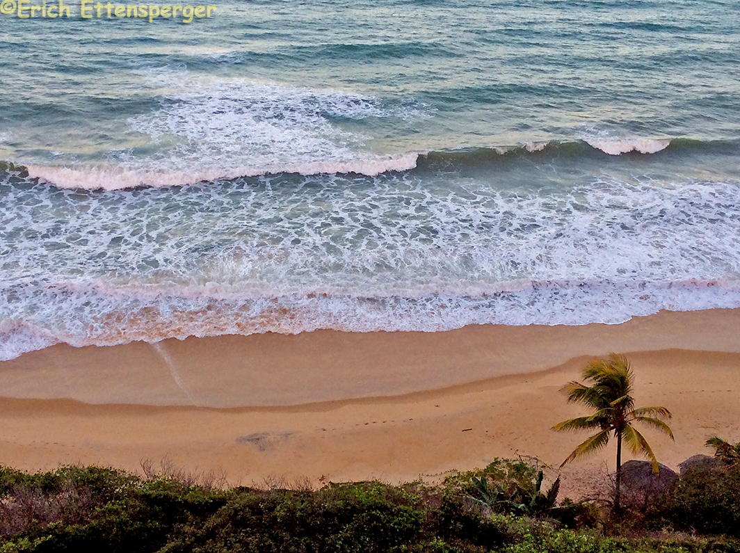
A Ilha de Boipeba integra a Área de Proteção Ambiental (APA) das Ilhas de Tinharé e Boipeba pertencente ao município de Cairu no Estado da Bahia. Essa APA é famosa devido à beleza de suas praias, principalmente das da Ilha de Boipeba e Morro de São Paulo (assunto de outro post).

Fonte/Quelle/Source: https://www.ilhaboipeba.org.br/boipeba.html

A APA mencionada possui 43.300,00 ha. e foi criada em 1992. Erich e eu visitamos a Ilha de Boipeba no mês de março e nos encantamos pela beleza e tranquilidade do lugar.

O que fazer na Ilha de Boipeba?

A ilha é um lugar de descanso e paz, não espere encontrar grandes festas e badalações em Boipeba.

O Passeio “Volta à ilha”

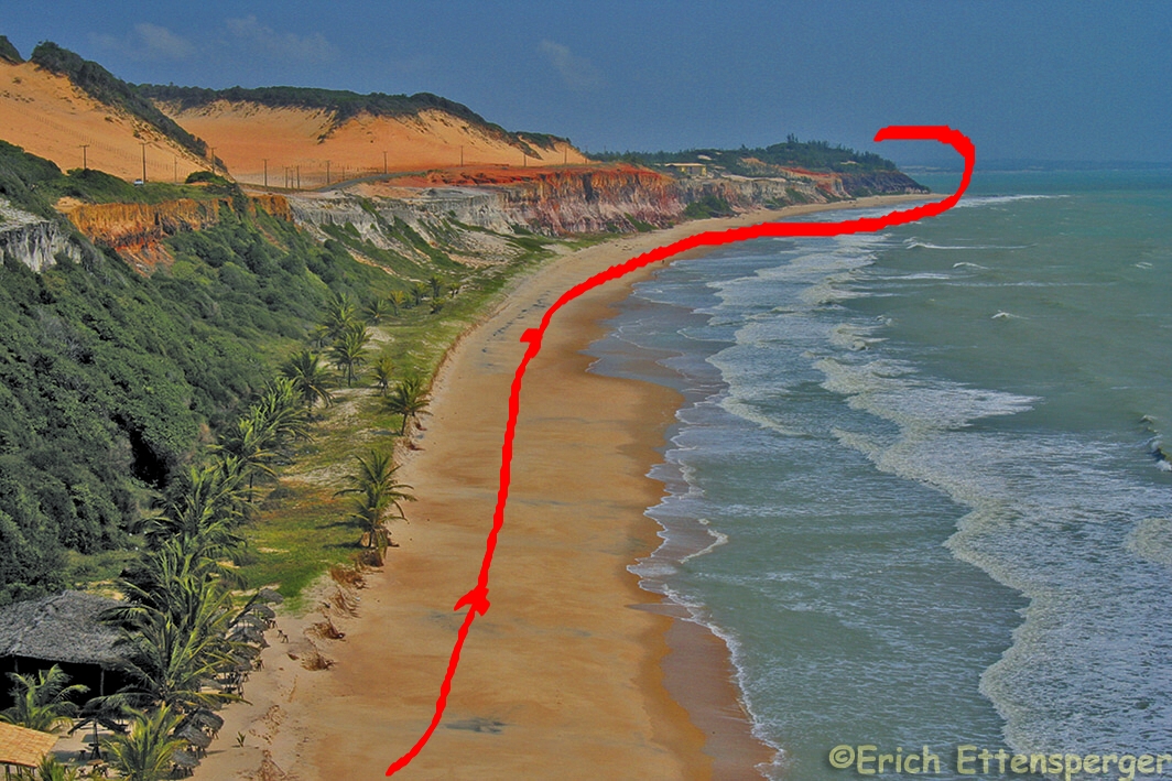
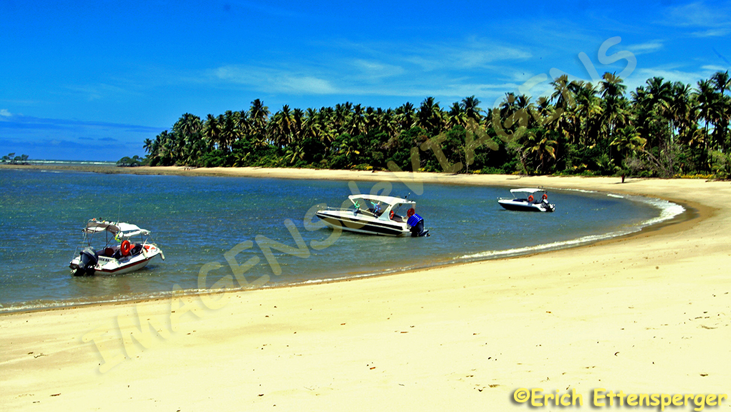
O passeio faz um tour com a extensão aproximada de 47 milhas náuticas. A volta completa na ilha sem paradas demora 1 hora. O principal passeio para fazer lá é o  “Volta a Ilha” realizado em uma lancha rápida. Fizemos com a agencia Coco Dendê, saímos às 10 horas da praia de Foz da Barra, em frente ao escritório da agencia que fica vizinha a Pousada Perola do Atlântico e somente retornamos às 17h30min. Esse tour é composto de cinco paradas:

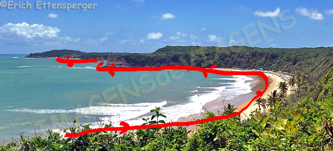
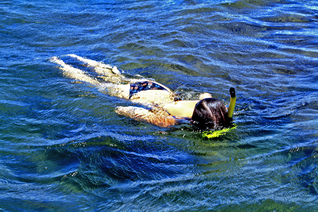
Piscinas naturais de Moreré: parada para banho e/ou mergulho com snorkel.

Há dias em que chegam 70 a 80 rápidas que trazem turistas da Ilha de Boipeba e também de Morro de São Paulo.

O barco não oferece snorkel e se você quiser usar um precisa alugar antes de embarcar. O aluguel custava por volta de R$ 15,00 no dia em que fiz esse passeio e não usei snorkel porque a pessoa que estava alugando o equipamento não ofereceu ao grupo no qual eu estava incluída, apenas algumas pessoas conseguiram alugar o snorkel;

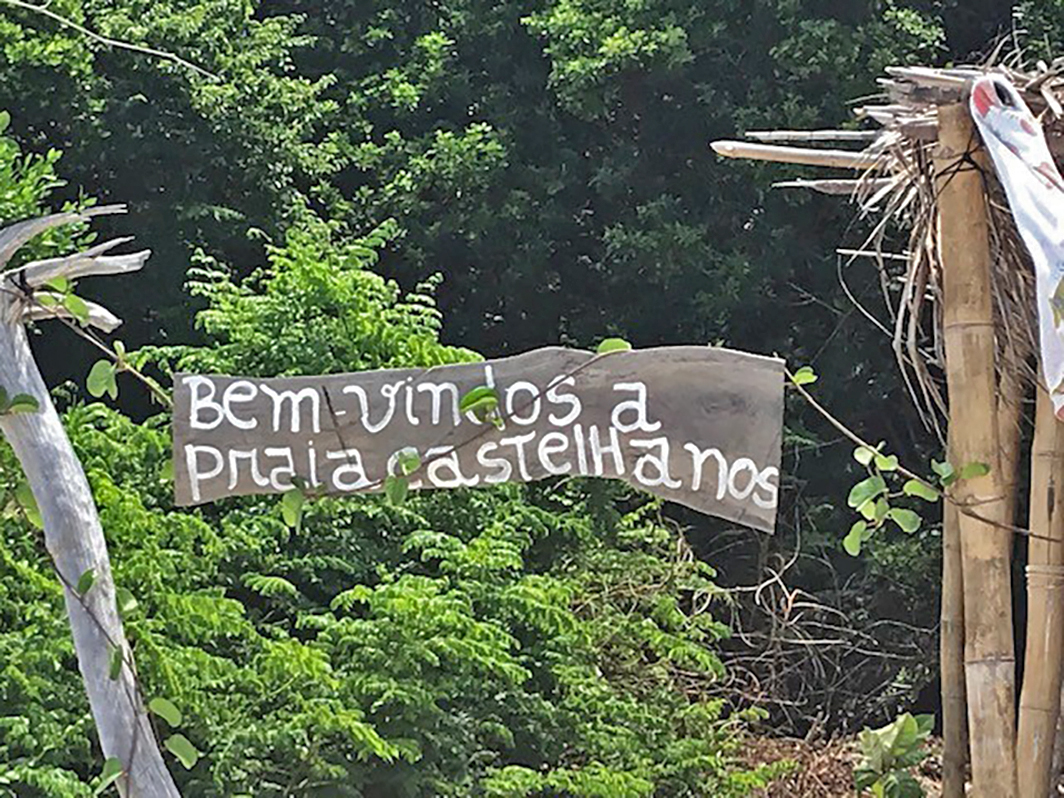
Piscina naturais de Castelhanos: essa parada não é frequente, apenas acontece quando as piscinas se formam durante a lua cheia, tivemos sorte e também visitamos essa área;

Praia dos Castelhanos,

barraca “Paraíso”,

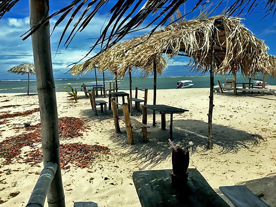
onde comemos um delicioso pastel de lagosta (R$15,00) e uma caipirinha de cacau e umbu.

Parada de 2 horas. Essa praia tem esse nome devido ter sido o local onde o navio espanhol “Madre de Dios” naufragou em 1535, pelo menos foi o que disse o guia. Somente é possível chegar nessa praia de barco ou através de uma trilha guiada por dentro do mangue;

Povoado de São Sebastião, também conhecido como Cova da Onça: parada para almoço em um pequeno vilarejo da ilha. Nesse dia a maré estava excepcionalmente alta

e nosso embarque para continuar o passeio não foi tranquilo.

A última parada foi no Portal das Ostras,

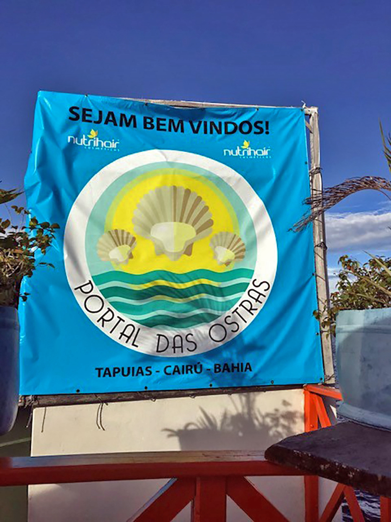
um bar flutuante no Rio dos Patos, em frente ao povoado de Tapuias,

onde há produção desse tipo de molusco.

Qual é nossa opinião sobre o passeio? Considerando-se que ele acontece por volta de 40% em mar aberto e 60% por mar abrigado, esteja preparado para sentir a lancha “pular” fortemente em mar aberto, caso o mar não esteja calmo. Apesar disso, eu não senti enjoo. Dependendo da maré, esse passeio pode se tornar bem desgastante.

Observação: se você quiser continuar “viajando” com o nosso blog, clique no botão “seguir” localizado no canto inferior direito dessa página. Você também pode “viajar”pelo Brasil conhecendo nosso  livro impresso 66 Brasil e sua versão digital 66 Belezas do Brasil.

Die grüne Insel Boipeba (TEIL I)

Die Insel Boipeba ist Teil des Umweltschutzgebiets (APA) der Inseln Tinharé und Boipeba, die zur Gemeinde Cairu im Bundesstaat Bahia gehören. Diese APA ist berühmt für die Schönheit ihrer Strände, insbesondere die Strände der Inseln Ilha de Boipeba und Morro de São Paulo (Gegenstand eines anderen Beitrags).

Fonte/Quelle/Source: https://www.ilhaboipeba.org.br/boipeba.html

Die erwähnte APA hat 43.300 ha. Erich und ich besuchten Ilha de Boipeba im März und wir waren verzaubert von der Schönheit und Ruhe des Ortes.

Was tun auf der Insel Boipeba?

Die Insel ist ein Ort der Ruhe und des Friedens. Erwarten Sie keine großen Partys und keinen Hype in Boipeba.

“Volta à ilha” (die einmal um die Insel Tour)

Die Tour hat eine ungefähre Länge von 47 Seemeilen. Die komplette Inselrundfahrt ohne Zwischenstopp dauert 1 Stunde. Wir buchten diese Tour via Schnellbootmit bei der Agentur Coco Dendê.  Um 10 Uhr morgens ging es los vom Strand Foz da Barra   vor dem Büro der Agentur, das sich neben der Pousada Perola do Atlântico befindet und um 17:30 Uhr kamen wir zurück. Diese Tour besteht aus fünf Etappem:

Moreré Naturpools: Ein Stopp zum Baden und / oder v.a. Schnorcheln.

Es gibt Tage, an denen 70 bis 80 Schnellboote ankommen, um die Touristen aus Ilha de Boipeba und auch aus Morro de São Paulo zu bringen.

 Schnorchel sollten Sie mieten bevor Sie an Bord gehen. Die Miete kostete an dem Tag, an dem ich diese Tour machte, ungefähr R$ 15.

Castelhanos Naturpools: Dieser Stopp ist nicht so häufig, nur dann, wenn sich die Pools während des Vollmondes bilden. Wir hatten Glück und konnten so auch diesen Abschnitt besuchen.

Strand Praia dos Castelhanos:

 hier am “Paraíso“- Kiosk

genoss ich einen köstlichen Hummerkuchen (R $ 15.00) und einen Kakao und Umbu Caipirinha.

2 Stunden Pause. Dieser Strand hat diesen Namen, weil hier 1535 das spanische Schiff „Madre de Dios“ Schiffbruch erlitten hat, zumindest wurde dies so uns kommuniziert. Diesen Strand kann man nur mit dem Boot oder über einen geführten Pfad innerhalb der Mangroven erreichen.

Das Städtchen Povoado de São Sebastião, auch bekannt als Cova da Onça: Mittagspause in einem kleinen Dorf auf der Insel.

An diesem Tag (Vollmond) war die Flut außergewöhnlich hoch und unser Re-Boarding, um die Tour fortzusetzen, verlief nicht ganz reibungslos.

Die letzte Station war das Portal das Ostras,

eine schwimmende Plattform mit Bar im Fluss Rio dos Patos vor dem Dorf Tapuias,

wo diese Art von Mollusken (Weichtiere) produziert werden.

Unsere Meinung zu dieser Tour?

Wenn man bedenkt, dass die Tour zu etwa 40% auf offener See realisiert wird (und 60% in ruhigen Gewässern), dann sollte man sich darauf einstellen, dass das Boot auf offener und nicht ruhiger See starke „Sprünge“ macht. Trotzdem fühlte ich mich nicht krank. Je nach Gezeiten kann diese Tour jedoch ziemlich anstrengend werden.

Hinweis: Falls Sie unserem  Blog folgen wollen, dann klicken Sie unten rechts einfach auf “Weiter”, Sie werden dann zukünftig automatisch informiert. Sie können auch durch Brasilien reisen und unser Buch 66 SEHENSWÜRDIGKEITEN IN BRASILIEN  kennenlernen und 66 x Brazil – A Mosaic of Beauties.

The green island of Boipeba (PART I)

Boipeba Island is part of the Tinharé and Boipeba Islands Environmental Protection Area (APA), which is part of the Cairu municipality of Bahia. This APA is famous for the beauty of its beaches, especially the beaches of the Ilha de Boipeba and Morro de São Paulo islands (the subject of another contribution).

Fonte/Quelle/Source: https://www.ilhaboipeba.org.br/boipeba.html

The mentioned APA has 43,300 ha. Erich and I visited Ilha de Boipeba in March and we were enchanted by the beauty and tranquility of the place.

What to do on Boipeba Island?

The island is a place of rest and peace. Don’t expect big parties and hype in Boipeba.

“Volta à ilha” (the once around the island tour)

The tour is approximately 47 nautical miles long. The entire island tour without a stopover takes 1 hour. We booked this tour via speedboat with the Coco Dendê agency. At 10 a.m. we started from the Foz da Barra beach in front of the agency’s office, which is next to the Pousada Perola do Atlântico, and we came back at 5:30 p.m. This tour consists of five stages:

Moreré natural pools: a stop for swimming and / or especially snorkeling.

There are days when 70 to 80 speedboats arrive to bring tourists from Ilha de Boipeba and also from Morro de São Paulo.

You should rent snorkels before boarding. The rent was around R $ 15 the day I did this tour.

Castelhanos Natural Pools: This stop is not that common, only if the pools are formed during the full moon. We were lucky and were able to visit this section.

Praia dos Castelhanos beach:

here at the “Paraíso” kiosk

I enjoyed a delicious lobster cake (R $ 15.00) and a cocoa and Umbu Caipirinha.

2 hour break. This beach has this name because here in 1535 the Spanish ship “Madre de Dios” shipwrecked, at least this was communicated to us, and you can only reach this beach by boat or along a guided path within the mangroves.

The town of Povoado de São Sebastião, also known as Cova da Onça: lunch break in a small village on the island.

On that day (full moon) the tide was exceptionally high and our re-boarding to continue the tour was not entirely smooth.

The last stop was the Portal das Ostras,

a floating platform and bar in the river Rio dos Patos in front of the village of Tapuias

where these types of molluscs are produced.

Our opinion about this tour

If you consider that around 40% of the tour is realized on the open sea (and 60% in calm waters), you should be prepared for the boat to make strong “jumps” on the open and not calm sea. Still, I didn’t feel sick. Depending on the tide, however, this tour can be quite exhausting.

Note: If you want to follow our “Travels” on the blog, simply click on “Seguir” in the lower right corner, you will be then automatically informed in the future. You can continue traveling with us with our book Brazil´s 66 Beautiful Sites and 66 x Brazil – A Mosaic of Beauties.  


A fabulosa mesquita de Abu Dhabi/Die fabelhafte Moschee von Abu Dhabi/The fabulous mosque of Abu Dhabi

Se você visitar Dubai, não deixe de dar uma esticadinha até Abu Dhabi e visitar a fabulosa Mesquita Sheik Zayed,

nomeada em homenagem ao fundador dos Emirados Árabes Unidos. Ela foi inaugurada em 2007 e trata-se de uma magnifica obra da arquitetura islâmica moderna, a terceira maior do planeta com capacidade para 40.000 mil pessoas! É muita gente! Ela fica atrás apenas de Meca e Medina na Arábia Saudita.

Eu como arquiteta, fiquei impressionada com os elementos arquitetônicos do edifício como as colunas,

cúpulas,

os arabescos,

os mosaicos, oh,os mosaicos, que maravilhosos!

Observei características similares em antigos edifícios mouros e persas. Achei tudo muitíssimo interessante, tanto no exterior quanto no interior!

Há espelhos d´água, jardins, pátios na parte externa.

O interior é constituído por salões, sendo um grande e dois menores, onde ocorrem as preces de homens e mulheres, separados. Os turistas podem visitar o salão grande. O que me chamou mais atenção pela beleza e grandiosidade foi o tapete persa com 5.627 m2 confeccionado por mais de 1200 artesãos. Que coisa espetacular!!!!!

Fiquei também impressionada com os lustres

cravejados de pedras semipreciosas!

Há também um mural decorado com flores que contém os 99 nomes de Alá citados na religião islâmica.

Compramos a visita à mesquita num pacote de turismo que também estava incluído uma visita no Parque da Ferrari. A distância entre a mesquita e o centro de Dubai é de 115 km, aproximadamente.

Quando chegamos na área da mesquita, a van da excursão nos deixou nas proximidades do acesso principal

e a partir daí o procedimento, quando entramos no prédio, foi o seguinte:

1 – Preencher os nossos dados (país, gênero, idade, procedência – você escreve Dubai) para que a máquina lhe forneça o ticket de entrada;

2 – Você entra numa fila para passar com a bolsa no detector de metais;

3 – Outra fila para que seu ticket seja escaneado;

4 – Caminhar em um túnel de cerca de 1 km para chegar nos jardins da mesquita.

Todo esse percurso é feito por muitos turistas. Na saída do túnel, há essa placa com informações importantes:

INFORMAÇÃO IMPORTANTE: é preciso seguir as regras de vestuário. As mulheres precisam estar com a cabeça coberta, dentre outros aspectos. Veja a placa na entrada:

5 – Seguir a sinalização para visitantes.

Para quem gosta de beleza arquitetônica e se interessa em visitar lugares espetaculares no mundo, recomendo esse passeio!

Para maiores informações sobre esse mesquita, clique aqui.

Observação: se você quiser continuar “viajando” com o nosso blog, clique no botão “seguir” localizado no canto inferior direito dessa página. Você também pode “viajar”pelo Brasil conhecendo nosso  livro impresso 66 Brasil e sua versão digital 66 Belezas do Brasil.

Die fabelhafte Moschee von Abu Dhabi

Falls Sie Dubai besuchen, sollten Sie unbedingt auch einen Ausflug nach Abu Dhabi unternehmen und die fabelhafte Sheik Zayed Moschee besuchen, die nach dem Gründer der Vereinigten Arabischen Emirate benannt ist.

Sie wurde 2007 eingeweiht und ist ein großartiges Werk der modernen islamischen Architektur, die drittgrößte der Welt mit einer Kapazität für 40.000 Menschen! Das sind sehr viele Leute! Sie liegt somit nach Mekka und Medina in Saudi-Arabien an zweiter Stelle im Ländervergleich.

Als Architektin war ich beeindruckt von den architektonischen Elementen des Gebäudes wie Säulen,

Kuppeln,

Arabesken,

Mosaiken, oh, Mosaiken, wie wunderbar!

Ich konnte ähnliche Merkmale in alten maurischen und persischen Gebäuden beobachten. Ich fand alles sehr interessant, sowohl von außen als auch innen!

Es gibt Pools mit Wasser, Gärten und Terrassen draußen.

Der Innenraum besteht aus Hallen, eine große und zwei kleinere, in denen die getrennten Gebete von Männern und Frauen stattfinden.

Touristen können die große Halle besuchen. Was meine Aufmerksamkeit für ihre Schönheit und Größe auf sich zog, war der 5.627 m2 große Perserteppich, der von über 1200 Handwerkern hergestellt wurde. Was für eine spektakuläre Sache!!!!!

Ich war auch beeindruckt von den Kronleuchtern

mit Halbedelsteinen!

Es gibt auch ein mit Blumen geschmücktes Wandbild, das die 99 Namen Allahs enthält, die in der islamischen Religion erwähnt werden.

Wir haben den Besuch der Moschee in einem Tour-Paket gekauft, das auch einen Besuch im Ferrari-Park beinhaltete. Die Entfernung zwischen der Moschee und dem Zentrum von Dubai beträgt ca. 115 km. Unser Bus brachte uns in die Nähe des Haupteinganges.

Das Verfahren beim Betreten des Gebäudes ist wie folgt:

1 – Geben Sie ihre Daten ein (Land, Geschlecht, Alter, Herkunft – Sie schreiben hier Dubai), damit der Automat Ihnen die Eintrittskarte zur Verfügung stellt.

2 – Sie stehen in einer Schlange, um den Metalldetektor mit Ihrer Tasche zu passieren.

3 – Eine weitere Warteschlange für das Scannen Ihres Tickets.

4 – Gehen Sie durch einen Tunnel von ca. 1 km Länge, um die Moscheegärten zu erreichen.

Am Ausgang des Tunnels befindet sich dieses Schild mit wichtigen Informationen:

Diese gesamte Strecke wird von sehr vielen Touristen zurückgelegt.

WICHTIGE INFORMATIONEN: Kleidungsregeln müssen unbedingt befolgt werden. Frauen müssen unter anderem den Kopf bedeckt haben. Siehe das Schild am Eingang:

5 – Folgen Sie den Schildern für Besucher.

Für diejenigen, die architektonische Schönheit mögen und spektakuläre Orte auf der Welt besuchen möchten, empfehle ich diese Tour!

Weitere Informationen zu dieser Moschee finden Sie hier.

Hinweis: Falls Sie unserem  Blog folgen wollen, dann klicken Sie unten rechts einfach auf “Weiter”, Sie werden dann zukünftig automatisch informiert. Sie können auch durch Brasilien reisen und unser Buch 66 SEHENSWÜRDIGKEITEN IN BRASILIEN  kennenlernen und 66 x Brazil – A Mosaic of Beauties.

The fabulous mosque of Abu Dhabi

If you are visiting Dubai you should definitely take a trip to Abu Dhabi and visit the fabulous Sheik Zayed Mosque named after the founder of the United Arab Emirates.

It was inaugurated in 2007 and is a great work of modern Islamic architecture, the third largest in the world with a capacity for 40,000 people! That’s a lot of people! It is the second in country comparison after Mecca and Medina in Saudi Arabia.

As an architect I was impressed by the architectural elements of the building such as columns,

domes,

arabesques,

mosaics, oh, mosaics, how wonderful!

I saw similar features in old Moorish and Persian buildings. I found everything very interesting both outside and inside!

There are pools with water, gardens and patios outside.

The interior consists of halls, one large and two smaller where the separate prayers of men and women take place.

Tourists can visit the great hall. What caught my attention for its beauty and size was the 5,627 m2 Persian carpet that was made by over 1200 artisans. What a spectacular thing !!!!!

I was also impressed by the chandeliers

with semi-precious stones!

There is also a mural decorated with flowers that contains the 99 names of Allah mentioned in the Islamic religion.

We bought the visit to the mosque in a tour package that included also a visit to Ferrari Park. The distance between the mosque and the center of Dubai is approximately 115 km. Our bus brought us close to the main entrance.

The procedure when entering the building is as follows:

1 – Enter your data (country, gender, age, origin – you are writing Dubai here) so that the machine will provide you with the ticket.

2 – You are standing in line to pass the metal detector with your bag.

3 – Another queue is for scanning your ticket.

4 – Go through a tunnel about 1 km long to reach the mosque gardens.

At the exit of the tunnel, there is this sign with important information:

This entire route is covered by a large number of tourists.

IMPORTANT INFORMATION: Clothing rules must be followed. Among other things, women must have their heads covered. See the sign at the entrance:

5 – Follow the signs for visitors.

For those who like architectural beauty and want to visit spectacular places around the world, I recommend this tour!

More information about this mosque can be found here.

Note: If you want to follow our “Travels” on the blog, simply click on “Seguir” in the lower right corner, you will be then automatically informed in the future. You can continue traveling with us with our book Brazil´s 66 Beautiful Sites and 66 x Brazil – A Mosaic of Beauties.  


Ilha de Creta, a princesa do Mar Egeu/Insel Kreta – Prinzessin der Ägäis/Crete Island – Princess of the Aegean

Desde adolescente sempre fui interessada em ler sobre Mitologia. Então, quando Erich me disse que nós iríamos visitar a Ilha de Creta, pensei imediatamente em Cnossos, onde se encontrava o Labirinto que segundo a lenda, foi construído por Ícaro e Dédalo para servir de abrigo para o Minotauro, metade homem, metade touro.

Durante sua história turbulenta, a partir do século XII, Creta foi ocupada pelos romanos, venezianos, turcos, bizantinos, nazistas.

A Ilha de Creta foi provavelmente o berço da civilização egeia e era habitada desde os tempos pré-históricos. A ilha tem 600 mil habitantes, 300 dias de sol por ano e é a quinta maior do Mar Mediterrâneo (as outras maiores ilhas são Sicília, Sardenha, Chipre e Córsega). Essa ilha é montanhosa, tem vales profundos e seu clima é temperado.

A Ilha de Creta é dividida em quatro prefeituras: Chania, Rethymno, Heráclito e Lasithi. A capital da ilha é a simpática Heráclito com 170 mil habitantes.

Fonte/Quelle/Source: https://www.worldatlas.com/webimage/countrys/europe/grcrete.htm

Creta tem mais de 300 dias de sol por ano e recebe em torno de 12 milhões de turistas (oriundos de 26 países) no verão (alta temporada de março a começo de novembro) e por isso, o Aeroporto Nikos Kazantizakis é o número dois em quantidade de voos da Grécia e em número de charters. De Creta é possível avistar a Ilha Dia, o ponto mais próximo da África, local de nascimento do deus Zeus, de acordo com a lenda. Definitivamente a indústria número um da ilha é o turismo.

A Ilha de Creta possui clima temperado e pode ter neve nas montanhas e frio. No verão, temperaturas entre 36 a 42 graus. A mais alta montanha tem 2456 metros de altura. Durante nossa visita a ilha, percorrermos áreas montanhosas com muito verde. Creta tem terras férteis para a agricultura e está entre os maiores produtores de azeite de oliva do mundo, ficando atrás apenas da Itália e Espanha.

Na região de Maila há produção de bananas, laranjas, tomates, berinjela, limão, abacate, manga, batatas e olivas. Nessa área no começo do século 20 foi descoberto um dos quatro mais importantes palácios minoicos. Por ter sol durante todo o ano é possível produzir ininterruptamente.

Creta é a maior ilha da Grécia e seu litoral de 1.046 m (650 milhas) oferece centenas de belas praias. Localizada entre o lado sul do Mar Egeu e o norte do mar da Líbia,

Fonte/Quelle/Source: https://br.pinterest.com/pin/180214422566021476/?autologin=true

Creta fica muito popular no verão devido às lindas praias, ao estilo de vida tradicional dos habitantes locais e à bela natureza.

Creta tem praias lindas! Dentre elas, citamos: Balos, na região da Chania;

Fonte/Quelle/Source: https://www.madeincrete.com/balos/

Elafonissi, no sudoeste da ilha,

Fonte/Quelle/Source: https://www.rental-center-crete.com/blog/elafonissi-crete/

outra praia famosa pelas palmeiras é a Vai, localizada na região de Lassithi. Dizem que essa praia tem a maior concentração dessas árvores da Europa.

Fonte/Quelle/Source: https://creti.co/blog/vai-beach-palm-forest/

Falassarna é uma grande praia de areia no lado oeste de Creta, próxima à cidade de Kissamos.

Fonte/Quelle/Source: https://www.greekboston.com/travel/falassarna-beach-crete/

Matala era famosa nas décadas de 1960 e 1970 como um lugar hippie.

Fonte/Quelle/Source: https://www.nothingfamiliar.com/hippie-caves-of-matala-crete/

No lado sul de Rethymno, perto da vila turística de Plakias, fica a grande e arenosa praia de Rodakino.

Fonte/Quelle/Source: https://www.greeka.com/crete/rethymno/beaches/rodakino/

Enfim, Creta tem muitas belas praias que atraem anualmente milhões de turistas, se você gosta de beleza natural, praia e história, a Ilha de Creta é definitivamente um destino certo para você!

Leia mais sobre Creta aqui.

Observação: se você quiser continuar “viajando” com o nosso blog, clique no botão “seguir” localizado no canto inferior direito dessa página. Você também pode “viajar”pelo Brasil conhecendo nosso  livro impresso 66 Brasil e sua versão digital 66 Belezas do Brasil.

Insel Kreta – Prinzessin der Ägäis

Seit meiner Jugend war ich immer daran interessiert, über Mythologie zu lesen. Als Erich mir dann sagte, daβ wir die Insel Kreta besuchen würden, dachte ich sofort an Knossos, wo sich das Labyrinth befand, das der Legende nach von Ikarus und Daedalus gebaut wurde, um Minotaurus, halb Mann, halb Stier, als Schutz zu dienen.

Während seiner turbulenten Geschichte ab dem 12. Jahrhundert wurde Kreta von Römern, Venezianern, Türken, Byzantinern und Nazis besetzt.

Kreta war wahrscheinlich der Geburtsort der ägäischen Zivilisation und wird seit prähistorischen Zeiten bewohnt. Die Insel hat 600.000 Einwohner, 300 Sonnentage im Jahr und ist die fünftgrößte im Mittelmeer (die anderen größeren Inseln sind Sizilien, Sardinien, Zypern und Korsika). Die Insel ist bergig, hat tiefe Täler und das Klima ist gemäßigt.

Die Insel Kreta ist in vier Präfekturen unterteilt: Chania, Rethymno, Heraklit und Lasithi. Die Hauptstadt der Insel ist das freundliche Heráclito mit 170.000 Einwohnern.

Fonte/Quelle/Source: https://www.worldatlas.com/webimage/countrys/europe/grcrete.htm

Kreta hat mehr als 300 Sonnentage im Jahr und empfängt im Sommer (Hochsaison von März bis Anfang November) rund 12 Millionen Touristen (aus 26 Ländern). Aus diesem Grund ist der Flughafen Nikos Kazantizakis die Nummer zwei in Bezug auf Flüge von Griechenland aus und in Bezug auf die Anzahl der Charterflüge.

Von Kreta aus kann man der Legende nach Dia Island sehen, den nächstgelegenen Punkt zu Afrika, dem Geburtsort des Gottes Zeus. Auf jeden Fall ist der Tourismus die unbestrittene Nummer eins auf der Insel.

Die Insel Kreta hat ein gemäßigtes Klima und kann Schnee in den Bergen und Kälte haben. Im Sommer Temperaturen zwischen 36 und 42 Grad. Der höchste Berg ist 2456 Meter hoch.

Während unseres Besuchs auf der Insel fuhren wir durch bergige Gegenden mit viel Grün.  Kreta offeriert fruchtbares Land für die Landwirtschaft und gehört nach Italien und Spanien zu den größten Olivenölproduzenten der Welt.

In der Region Maila werden Bananen, Orangen, Tomaten, Auberginen, Zitrone, Avocado, Mango, Kartoffeln und Oliven produziert.  Da es das ganze Jahr über Sonne hat, ist es möglich, kontinuierlich zu ernten.

In dieser Gegend wurde Anfang des 20. Jahrhunderts einer der vier wichtigsten minoischen Paläste entdeckt.

Kreta ist die größte Insel Griechenlands und ihre 1.046 m lange Küste bietet Hunderte von wunderschönen Stränden. Kreta liegt zwischen der Südseite der Ägäis und dem Norden des Libyschen Meeres

Fonte/Quelle/Source: https://br.pinterest.com/pin/180214422566021476/?autologin=true

und ist im Sommer aufgrund der schönen Strände, des traditionellen Lebensstils der Einheimischen und der wunderschönen Natur sehr beliebt.

Kreta gilt als eine Insel mit den schönsten Strände Griechenlands. Unter ihnen erwähnen wir: Balos in der Region Chania;

Fonte/Quelle/Source: https://www.madeincrete.com/balos/

Elafonissi im Südwesten der Insel.

Fonte/Quelle/Source: https://www.rental-center-crete.com/blog/elafonissi-crete/

Ein weiterer Strand, der für seine Palmen bekannt ist, ist Vai in der Region Lassithi. Dieser Strand soll die höchste Konzentration dieser Bäume in Europa haben.

Fonte/Quelle/Source: https://creti.co/blog/vai-beach-palm-forest/

Falassarna ist ein großer Sandstrand auf der Westseite von Kreta in der Nähe der Stadt Kissamos.

Fonte/Quelle/Source: https://www.greekboston.com/travel/falassarna-beach-crete/

Matala war in den 1960er und 1970er Jahren als Hippie-Ort berühmt.

Fonte/Quelle/Source: https://www.nothingfamiliar.com/hippie-caves-of-matala-crete/

Auf der Südseite von Rethymno, in der Nähe des Touristendorfs Plakias, liegt der große Sandstrand von Rodakino.

Fonte/Quelle/Source: https://www.greeka.com/crete/rethymno/beaches/rodakino/

Auf Kreta gibt es jedenfalls viele schöne Strände, die jährlich Millionen von Touristen anziehen, wenn Sie natürliche Schönheit, Strand und Geschichte mögen, dann ist die Insel Kreta definitiv das richtige Ziel für Sie!

Lesen sie hier mehr.

Hinweis: Falls Sie unserem  Blog folgen wollen, dann klicken Sie unten rechts einfach auf “Weiter”, Sie werden dann zukünftig automatisch informiert. Sie können auch durch Brasilien reisen und unser Buch 66 SEHENSWÜRDIGKEITEN IN BRASILIEN  kennenlernen und 66 x Brazil – A Mosaic of Beauties.

Crete Island – Princess of the Aegean

Since my youth I have always been interested in reading about mythology. When Erich then told me that we were going to visit the island of Crete, I immediately thought of Knossos, where there was the labyrinth, which according to legend was built by Icarus and Daedalus to protect Minotaurs, half men, half bull.

During its turbulent history from the 12th century Crete was occupied by the Romans, Venetians, Turks, Byzantines and Nazis.

Crete was probably the birthplace of the Aegean civilization and has been inhabited since prehistoric times. The island has 600,000 inhabitants, 300 days of sunshine a year and is the fifth largest in the Mediterranean (the other larger islands are Sicily, Sardinia, Cyprus and Corsica). The island is mountainous, has deep valleys and the climate is temperate.

The island of Crete is divided into four prefectures: Chania, Rethymno, Heraclitus and Lasithi. The capital of the island is the friendly Heráclito with 170,000 inhabitants.

Fonte/Quelle/Source: https://www.worldatlas.com/webimage/countrys/europe/grcrete.htm

Crete has more than 300 days of sunshine a year and receives around 12 million tourists (from 26 countries) in summer (high season from March to early November). For this reason Nikos Kazantizakis Airport is number two in terms of flights from Greece and in terms of the number of charter flights.

Legends say it that from Crete you can see Dia Island, the closest point to Africa, the birthplace of the god Zeus. In any case, tourism is the undisputed number one on the island.

The island of Crete has a temperate climate and can have snow in the mountains and cold. In summer temperatures between 36 and 42 degrees. The highest mountain is 2456 meters high.

During our visit to the island we drove through mountainous areas with lots of green. Crete offers fertile land for agriculture and is one of the largest olive oil producers in the world after Italy and Spain.

Banana, oranges, tomatoes, eggplants, lemon, avocado, mango, potatoes and olives are produced in the Maila region. Since it has sun all year round, it is possible to harvest continuously.

One of the four most important Minoan palaces was discovered in this area in the early 20th century.

Crete is the largest island in Greece and its 1,046 m long coast offers hundreds of beautiful beaches. Crete lies between the south side of the Aegean and the north of the Libyan Sea

Fonte/Quelle/Source: https://br.pinterest.com/pin/180214422566021476/?autologin=true

and is very popular in summer due to the beautiful beaches, the traditional lifestyle of the locals and the beautiful nature.

Crete is considered the island with the most beautiful beaches in Greece. Among them we mention: Balos in the Chania region;

Fonte/Quelle/Source: https://www.madeincrete.com/balos/

Elafonissi in the southwest of the island.

Fonte/Quelle/Source: https://www.rental-center-crete.com/blog/elafonissi-crete/

Another beach known for its palm trees is Vai in the Lassithi region. This beach is said to have the highest concentration of these trees in Europe.

Fonte/Quelle/Source: https://creti.co/blog/vai-beach-palm-forest/

Falassarna is a large sandy beach on the west side of Crete near the city of Kissamos.

Fonte/Quelle/Source: https://www.greekboston.com/travel/falassarna-beach-crete/

Matala was famous as a hippie place in the 1960s and 1970s.

Fonte/Quelle/Source: https://www.nothingfamiliar.com/hippie-caves-of-matala-crete/

On the south side of Rethymno, near the tourist village of Plakias, is the large sandy beach of Rodakino.

Fonte/Quelle/Source: https://www.greeka.com/crete/rethymno/beaches/rodakino/

In any case, Crete has many beautiful beaches that attract millions of tourists every year, if you like natural beauty, beach and history then the island of Crete is definitely the right destination for you!

Read more about Creta here.

Note: If you want to follow our “Travels” on the blog, simply click on “Seguir” in the lower right corner, you will be then automatically informed in the future. You can continue traveling with us with our book Brazil´s 66 Beautiful Sites and 66 x Brazil – A Mosaic of Beauties.  


As praias espetaculares de Tibau do Sul no Rio Grande do Norte/Die spektakulären Strände von Tibau do Sul in Rio Grande do Norte/The spectacular beaches of Tibau do Sul in Rio Grande do Norte

Tibau do Sul é um município litorâneo localizado no sul do Rio Grande do Norte com uma população estimada em torno de 3600 habitantes. O grande chamariz desse lugar são as praias espetaculares que encantam turistas de muitas partes do mundo, onde se destaca a Praia de Pipa.

Erich e eu sempre visitamos Tibau do Sul, tanto na baixa quanto na alta estação turística. Da última vez, tivemos a oportunidade de estarmos em Tibau do Sul durante o Carnaval de 2020. Não ficamos em Pipa, porém fomos jantar lá no Restaurante Exótica, uma das novidades desse destino. Ficamos impressionados com a quantidade de pessoas que circulavam na principal avenida da praia, conhecida como Broadway. Era muita, muita gente!

Nós preferimos nos hospedar fora de Pipa, em um hotel muito especial localizado na Ponta do Madeiro e por isso, é denominado Hotel Ponta do Madeiro.

Erich e eu gostamos muito de caminhar pela praia. Fizemos duas lindas caminhadas. Na primeira andamos da Ponta do Madeiro até ao day-use Ponta do Pirambu.


Caminhada linda emoldurada por belas falésias.

Foram 4 km de cenário espetacular, passando pela Praia de Cacimbinhas até a Praia do Giz. Esse passeio deve ser feito quando a maré está baixa.

A segunda caminhada foi no sentido Ponta do Madeiro até a Praia do Centro de Pipa

passando pela deslumbrante Praia do Madeiro

e pela Baía dos Golfinhos.

Mas, atenção: só realize essa caminhada com a maré baixa, de modo que você possa atravessar os dois pontos com muitas pedras

andando pela beira do mar, pela areia,  e não por cima das pedras, o que aconteceu conosco,

pois nós atrasamos para iniciar nossa caminhada e então a maré já estava começando a subir e não foi possível caminhar pela areia, o que nós já havíamos feito em outra ocasião. Foi horrível! Caso, você queira experimentar essa aventura, pelo menos vá de tênis! Esse trecho tem em torno de 4,5 km.

Depois da Praia do Centro que possui muitas barracas e muito movimento de pessoas e vendedores ambulantes,

você vai chegar na Praia do Amor e depois na Praia das Minas. A grande sensação desse trecho é o Chapadão de Pipa, área localizada entre a Praia do Amor e das Minas. Trata-se de um conjunto de falésias avermelhadas que é acessível de carro e de lá você tem uma vista sensacional das praias.

Além dessas belas praias você também pode se deslocar até Sibaúma, vilarejo originado de um quilombo com uma praia tranquila, sendo o oposto da agitada Pipa. Sibaúma está distante aproximadamente 10 km da Praia de Pipa.

Antes que eu termine, vale destacar que Tibau do Sul tem também uma lagoa muito bonita chamada Lagoa de Guaraíras,

que faz parte dos passeios obrigatórios para quem visita à região.

Está esperando o que para desfrutar desse paraíso?

Como chegar em Tibau do Sul e Praia de Pipa usando transporte público

Você pode chegar em Tibau do Sul de ônibus, pela Viação Riograndense , esse ônibus parte da Rodoviária de Natal. Porém, é possível pegar esse ônibus e outros no ponto de parada de ônibus localizado em frente ao supermercado Carrefour, localizado nas margens de Br-101. Outra possibilidade também de chegar a Tibau do Sul e Pipa, é tomar um ônibus com destino a Baía Formosa, Espírito Santo, Várzea e outros destinos que passam pela BR-101 e passam em Goianinha (confirme com o motorista se o transporte tem um ponto de parada em Goianinha). O bilhete entre Natal e Tibau do Sul custa cerca de R$ 15,00 (quinze reais).De Goianinha é possível pegar vans que se destinam a Tibau do Sul e Pipa. A distância entre Natal e Tibau do Sul são de 82 km, aproximadamente, e a distância entre Natal e a Praia de Pipa fica em torno de 90 km.Leia mais sobre transporte entre Pipa e Natal aqui.

Observação: se você quiser continuar “viajando” com o nosso blog, clique no botão “seguir” localizado no canto inferior direito dessa página. Você também pode “viajar”pelo Brasil conhecendo nosso  livro impresso 66 Brasil e sua versão digital 66 Belezas do Brasil.

Die spektakulären Strände von Tibau do Sul in Rio Grande do Norte

Tibau do Sul ist eine Küstengemeinde im Süden von Rio Grande do Norte mit einer geschätzten Bevölkerung von rund 3.600 Einwohnern. Die große Attraktion dieses Ortes sind die spektakulären Strände, die Touristen aus vielen Teilen dieser Welt verzaubern, wobei v.a. Pipa Beach auffällt.

Erich und ich besuchen Tibau do Sul sowohl in der Neben- als auch in der Hauptsaison. Das letzte Mal hatten wir die Gelegenheit während des Karnevals 2020 in Tibau do Sul zu sein. Wir übernachteten zwar nicht in Pipa aber dinierten dort im Exotica Restaurant, eine der Neuheiten dieses Reiseziels.

Wir waren beeindruckt von der Menge der Menschen, die auf der Hauptstraße, bekannt als „Broadway“, zirkulierten. Es waren viele, sehr viele Leute unterwegs!

Wir bevorzugen es meist, außerhalb von Pipa in einem ganz besonderen Hotel in Ponta do Madeiro zu übernachten. Aus diesem Grund heißt das Hotel Ponta do Madeiro.

Erich und ich lieben es, am Strand spazieren zu gehen. Wir haben zwei schöne Spaziergänge gemacht. Zuerst gingen wir von Ponta do Madeiro zum Day-Use Ponta do Pirambu.

EIN Schöner Spaziergang, umrahmt von wunderschönen Klippen.

Wir genossen 4 km spektakuläre Landschaften, die  entlang dem Strand Praia de Cacimbinhas zum Strand Praia do Giz führten. Diese Tour sollte v.a. bei Ebbe durchgeführt werden.

Der zweite Spaziergang, mehr eine Wanderung, führte von  Ponta do Madeiro nach Praia do Centro de Pipa

entlang der atemberaubenden Bucht Baía dos Golfinhos.

Aber seien Sie vorsichtig: Machen Sie diesen Spaziergang nur bei Ebbe, damit Sie die beiden Bereiche mit vielen Felsen

am Meer entlang im Sand durchqueren können. Wir begannen unseren Spaziergang zu spät

und dann begann die Flut zu steigen und es war nicht möglich, auf dem Sand zu laufen, was wir bereits bei einer anderen Gelegenheit erfolgreich getan hatten. Es war schrecklich! Wenn Sie dieses Abenteuer „durchlaufen“ möchten, dann gehen Sie zumindest mit Tennisschuhen oder ähnlichem! Diese Wanderstrecke ist ca. 4,5 km lang.

Nach dem Strand Praia do Centro mit vielen Kiosken und vielen Menschen und Straßenverkäufern

erreichen Sie Praia do Amor und dann Praia das Minas. Die große Sensation dieses Abschnittes ist Chapadão de Pipa, zwischen Praia do Amor und Minas gelegen. Es ist eine Reihe von roten Klippen, die mit dem Auto erreichbar sind und von dort haben Sie einen sensationellen Blick auf die genannten Strände.

Neben diesen wunderschönen Stränden können Sie auch nach Sibaúma fahren, einem Dorf, das aus einem Quilombo (Quilombo war in der Vergangenheit ein Zufluchtsort für afrikanische Sklaven und Afro-Nachkommen auf dem gesamten amerikanischen Kontinent) mit einem ruhigen Strand stammt und das Gegenteil zum geschäftigen Pipa darstellt. Sibaúma liegt etwa 10 km vom Strand Pipa entfernt.

Erwähnenswert ist auch noch, dass Tibau do Sul eine sehr schöne Lagune namens Lagoa de Guaraíras hat,

die Teil der obligatorischen Touren für jeden ist, der diese Region besucht.

Worauf warten Sie noch, um dieses Paradies zu genießen?

Wie erreicht man mit öffentlichen Verkehrsmitteln Tibau do Sul und Praia de Pipa?

Sie erreichen Tibau do Sul mit dem Bus über die Viação Riograndense .

Dieser Bus fährt vom Busbahnhof Rodoviária de Natal ab. Es ist jedoch möglich, diesen Bus und andere an der Bushaltestelle vor dem Carrefour-Supermarkt am Rande der Br-101 zu erreichen.

Eine andere Möglichkeit, Tibau do Sul und Pipa zu erreichen, besteht darin, einen Bus zu nehmen, der nach Baía Formosa, Espírito Santo, Várzea und anderen Zielen fährt, die an der BR-101 liegen und Sie in Goianinha aussteigen.   Von Goianinha aus können Sie dann Kleinbusse nach Tibau do Sul und Pipa genommen werden.

Das Ticket zwischen Natal und Tibau do Sul kostet ungefähr 15,00 R$ (3 EURO).

Die Entfernung zwischen Natal und Tibau und Praia de Pipa beträgt ungefähr 90 km.

Lesen Sie hier mehr über Transportmöglichkeiten zwischen Pipa und Natal.

Hinweis: Falls Sie unserem  Blog folgen wollen, dann klicken Sie unten rechts einfach auf “Weiter”, Sie werden dann zukünftig automatisch informiert. Sie können auch durch Brasilien reisen und unser Buch 66 SEHENSWÜRDIGKEITEN IN BRASILIEN  kennenlernen und 66 x Brazil – A Mosaic of Beauties.

The spectacular beaches of Tibau do Sul in Rio Grande do Norte

Tibau do Sul is a coastal community in the south of Rio Grande do Norte with an estimated population of around 3,600 inhabitants.

The great attraction of this place are the spectacular beaches which enchant tourists from many parts of this world and with Pipa Beach outstanding.

Erich and I visit Tibau do Sul both during the low and high season. The last time we had the opportunity to be in Tibau do Sul was during the 2020 Carnival. We didn’t stay directly in Pipa but dined there in the Exotica Restaurant, one of the novelties of this destination.

We were impressed by the amount of people circulating on the main street known as “Broadway”. There were many, many people on the way!

We usually prefer to stay in a very special hotel in Ponta do Madeiro outside of Pipa. For this reason the hotel is called Ponta do Madeiro.

Erich and I love to walk on the beach. We made two nice walks. First we went from Ponta do Madeiro to the Day-Use Ponta do Pirambu.

A nice walk framed by beautiful cliffs.

We enjoyed 4 km of spectacular landscapes that led along Praia de Cacimbinhas beach to Praia do Giz beach. This tour preferable should be done at low tide.

The second walk, more of a hike, led from Ponta do Madeiro to Praia do Centro de Pipa

along the breathtaking Bay of Golfinhos.

But be careful: only take this walk at low tide so that you can cross the two areas with lots of rocks

along the sea in the sand. We started our walk too late

and then the tide started rising and it was not possible to walk on the sand, which we had successfully done on another occasion. It was terrible!

If you want to “go through” this adventure, at least go with tennis shoes or something similar! This hiking route is about 4.5 km long.

After Praia do Centro beach with many kiosks and lots of people and street vendors,

you will reach Praia do Amor and then Praia das Minas.

The great sensation of this section is Chapadão de Pipa, located between Praia do Amor and Minas. It is a series of red cliffs that can be reached by car and from there you have a sensational view of the beaches mentioned.

In addition to these beautiful beaches, you can also go to Sibaúma, a village that comes from a Quilombo (Quilombos, in the past, were places of refuge for African slaves and Afro-descendants across the American continent) with a quiet beach and is the opposite of the busy Pipa. Sibaúma is about 10 km from Pipa Beach.

It is also worth noting that Tibau do Sul has a very beautiful lagoon called Lagoa de Guaraíras,

which is part of the mandatory tours for anyone visiting this region.

What are you waiting for to enjoy this paradise?

 How to get to Tibau do Sul and Praia de Pipa by public transport?

You can reach Tibau do Sul by bus via Viação Riograndense. 

This bus leaves from Rodoviária de Natal bus station. However, it is possible to reach this bus and others at the bus stop in front of the Carrefour supermarket on the edge of Br-101.

Another way to get to Tibau do Sul and Pipa is to take a bus that goes to Baía Formosa, Espírito Santo, Várzea and other destinations that are on the BR-101 and you get off in Goianinha. From Goianinha you can then take minibuses to Tibau do Sul and Pipa.

The ticket between Natal and Tibau do Sul costs approximately   R$ 15. (3 EURO).

The distance between Natal and Tibau and Praia de Pipa is approximately 90 km.

Read more about transportation between Pipa and Natal here.

Note: If you want to follow our “Travels” on the blog, simply click on “Seguir” in the lower right corner, you will be then automatically informed in the future. You can continue traveling with us with our book Brazil´s 66 Beautiful Sites and 66 x Brazil – A Mosaic of Beauties.