Realizamos uma viagem muito interessante ao sul da América do Sul, visitamos El Calafate
e o Parque Nacional Torres del Paine (você pode ler relatos dessas viagens aqui e aqui).
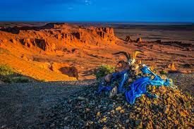
Viajamos de El Calafate até esse parque em um automóvel do Hotel Tierra Patagôniaque foi nos buscar em El Calafate e foi durante essa viagem de quase 3 horas, em torno de 215 km, que tivemos o prazer de sentir o gostinho de percorrer a Rota 40.
A Rota 40 é conhecida por ser a mais famosa rodovia da Argentina. O seu traçado segue paralelo à Cordilheira dos Andes, ela corta a Argentina de norte a sul, desde La Quiaca, na borda com a Bolívia e o Cabo Virgenes, na Patagônia Argentina.
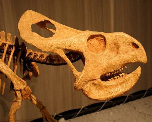
A Rota 40 corta o país em três regiões: o Norte, o Cuyo e a Patagônia. É uma estrada espetacular, ela é amada pelos amantes do motociclismo que almejam percorrê-la. Numa viagem por essa estrada se atravessa, 11 províncias, 13 lagos e 20 parques nacionais, cruza 236 pontes e percorre trechos com altitudes perto dos 5000 metros! A partir dessa rodovia é possível visitar sítios arqueológicos e paleontológicos, além de interligar 27 caminhos pela Cordilheira dos Andes. Para quem ama a natureza, vale a pena realizar essa viagem.
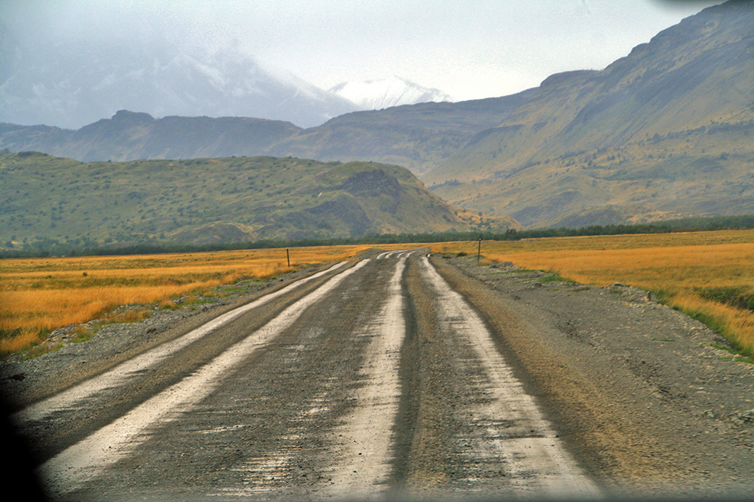
Nós viajamos na Rota 40 no trecho entre a cidade de El Calafate, na Argentina e o Parque Nacional Torres del Paine, no Chile.
Durante nossa viagem apreciamos a tranquilidade dessa rodovia quase desértica, nessa parte, e pudemos também observar a presença de grupos de guanacos liderados pelo macho alpha.Nesta área aparecem os pumas durante a noite que caçam os guanacos.
Eles os seguem para atacar durante a noite. O motorista disse que eles, os guanacos, representam um perigo, pois tem a mesa cor da estepe. Também pudemos ver algumas pessoas caminhando. Aliás, por falar em estepe, vegetação característica dessa parte do continente, ela compõe a paisagem de forma deslumbrante com suas nuances de cinza misturado com amarelo. O branco da neve confere um toque especial ao cenário.
Enfim, a Rota 40 é definitivamente um percurso que atrai milhares de turistas que amam a natureza. Que tal incluí-la na lista dos seus destinos de viagem após o fim da pandemia?
Route 40 – die berühmteste Straße in Argentinien
Wir machten eine sehr interessante Reise ins südliche Südamerika, besuchten Calafate
und den Nationalpark Torres del Paine (Berichte über diese Reisen können Sie hier und hier lesen).
das uns in El Calafate abholte, und während dieser fast 3 Stunden langen Fahrt, ca. 215 km, hatten wir das Vergnügen, einen Streckenabbschnitt auf der Route 40 geniessen zu dürfen.
Die Route 40 ist als die berühmteste Autostrada Argentiniens bekannt. Ihre Route verläuft parallel zu den Anden, sie durchquert Argentinien von Norden nach Süden, von La Quiaca, an der Grenze zu Bolivien und Kap Virgenes im argentinischen Patagonien.
Die Route 40 teilt das Land in drei Regionen: den Norden, Cuyo und Patagonien. Es ist eine spektakuläre Straße, die von Motorradliebhabern favorisiert wird, die sich danach sehnen, sie zu bereisen. Auf einer Fahrt auf dieser Straße durchqueren Sie 11 Provinzen, entlang 13 Seeen und durch 20 Nationalparks, sie überqueren 236 Brücken und legen Abschnitte mit einer Höhe von fast 5000 Metern zurück!
Von dieser Autostrada aus ist es möglich, archäologische und paläontologische Stätten zu besuchen und mit 27 Strecken durch die Anden zu verbinden. Für Naturliebhaber lohnt sich diese Reise absolut.
Wir reisten auf der Route 40 zwischen der Stadt El Calafate, Argentinien, und dem Nationalpark Torres del Paine, Chile.
Während unserer Fahrt genossen wir die Ruhe dieser fast wüstenhaften Straße
und wir konnten die Anwesenheit von Guanakosgruppen beobachten, die von Alpha-Männchen angeführt wurden.
In dieser Gegend tauchen nachts dann auch Pumas auf, die die Guanakos jagen. Sie folgen ihnen, um sie dann nachts anzugreifen.
Der Fahrer sagte, dass die Guanakos eine Gefahr darstellen, da sie diese steppentypische Farbe haben. Wir konnten auch einige Menschen laufen sehen.
Apropos Steppe, eine für diesen Teil des Kontinents charakteristische Vegetation, die mit ihren mit Gelb gemischten Grautönen die Landschaft auf schillernde Weise prägt. Das Weiß des Schnees verleiht dann der Landschaft eine besondere Note.
Abschließend ist festzuhalten, dass die Route 40 definitiv eine Route verkörpert, die Tausende von naturverbundenen Touristen anzieht. Wie wäre es, wenn auch Sie diese nach Ende der Pandemie in die Liste Ihrer Reiseziele aufnehmen?
Route 40 – the most famous road in Argentina
We made a very interesting trip to southern South America, visiting Calafate
and the Torres del Paine National Park (you can read reports about these trips here and here).
which picked us up in El Calafate, and during this almost 3 hour long drive, about 215 km we had the pleasure of enjoying a section of the Route 40.
Route 40 is known as the most famous autostrada in Argentina. Its route runs parallel to the Andes, it crosses Argentina from north to south, from La Quiaca, on the border with Bolivia and Cape Virgenes in Argentine Patagonia.
Route 40 divides the country into three regions: the north, Cuyo, and Patagonia. It is a spectacular road favored by motorcycle enthusiasts who desire to travel it. On a trip on this road you cross 11 provinces, along 13 lakes and through 20 national parks, you cross 236 bridges and cover sections with a height of almost 5000 meters!
From this autostrada it is possible to visit archaeological and paleontological sites and connect them with 27 routes through the Andes. This trip is absolutely worthwhile for nature lovers.
We traveled on Route 40 between the city of El Calafate, Argentina and the Torres del Paine National Park, Chile.
During our drive we enjoyed the quiet of this almost desert road
and we could observe the presence of groups of guanacos led by alpha males.
Pumas that hunt the guanacos also appear in this area at night. They follow them only to attack them at night.
The driver said that the guanacos are dangerous because they are this typical steppe color. We could also see some people walking.
Speaking of steppe, a vegetation characteristic of this part of the continent, which with its shades of gray mixed with yellow shapes the landscape in a dazzling way. The white of the snow then gives the landscape a special touch.
In conclusion, Route 40 definitely embodies a route that attracts thousands of nature-loving tourists. How about adding it to your list of travel destinations after the pandemic is over?
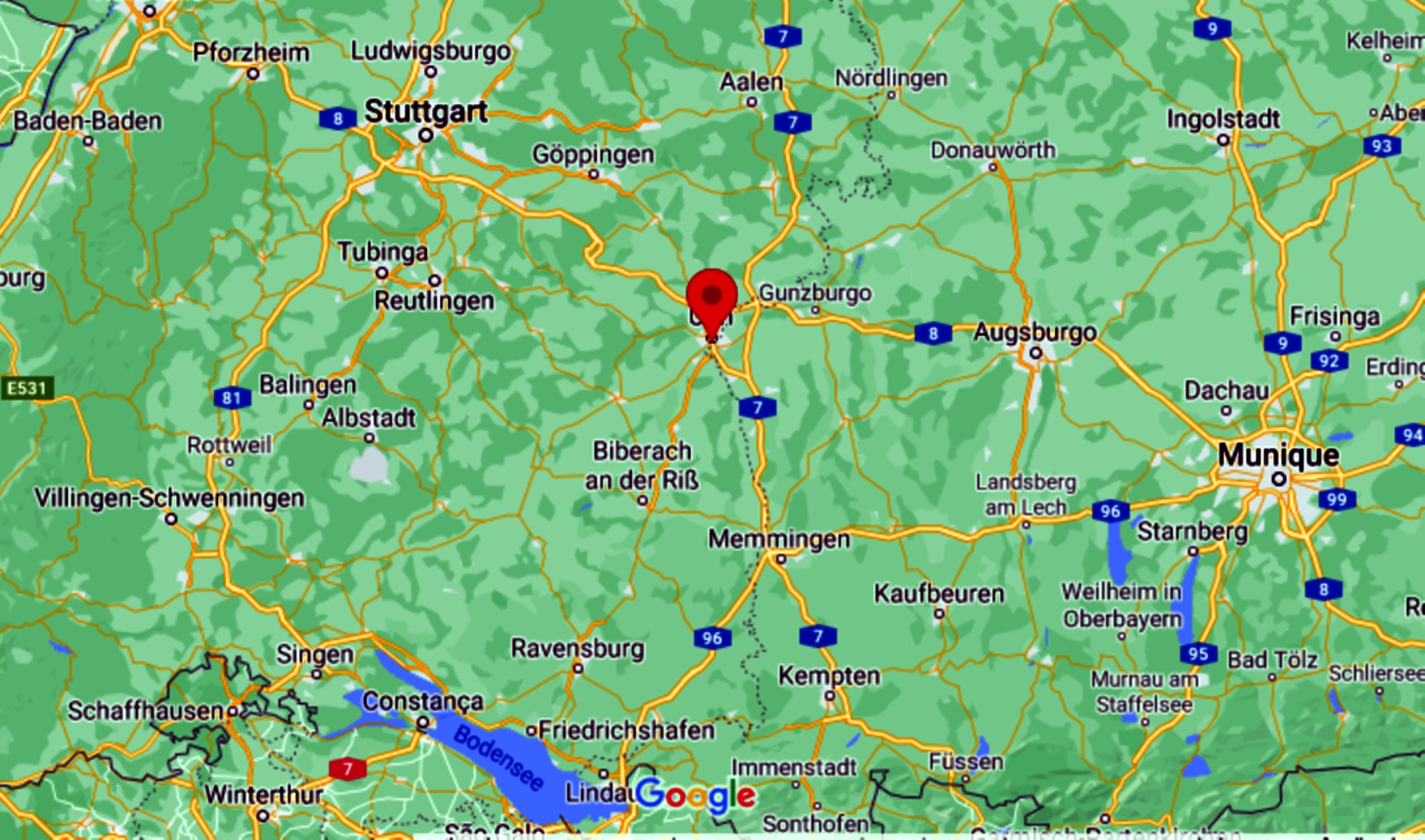
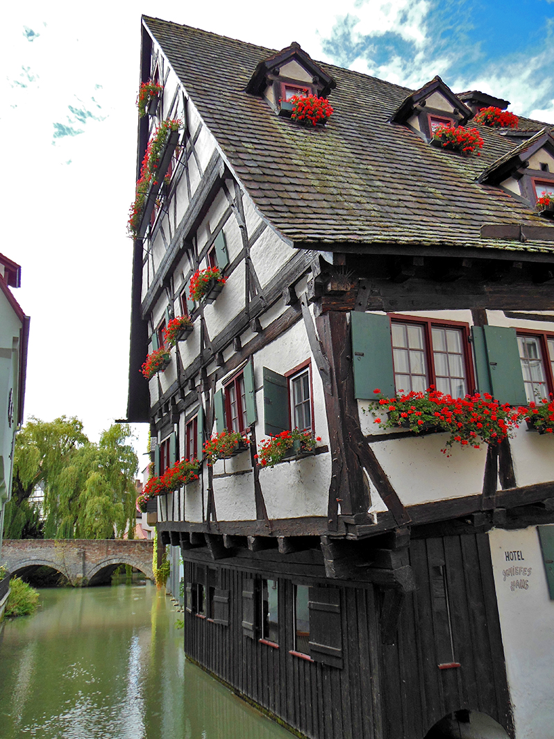
Quando estávamos voltando de Freiburg para o Brasil, achei que valeria a pena fazer uma breve parada em Ulm, no Danúbio, a caminho do aeroporto de Munique. Assim dito e feito. Ulm é definitivamente uma cidade que vale a pena visitar.
Ulm está localizada no Danúbio, no extremo sudeste da Alb da Suábia, na fronteira com a Baviera, é uma cidade universitária em Baden-Württemberg. A cidade tem 125.000 habitantes e, junto com Neu-Ulm na Baviera, forma um dos centros duais transnacionais da Alemanha com cerca de 183.000 habitantes, daí o nome Zweilandstadt.
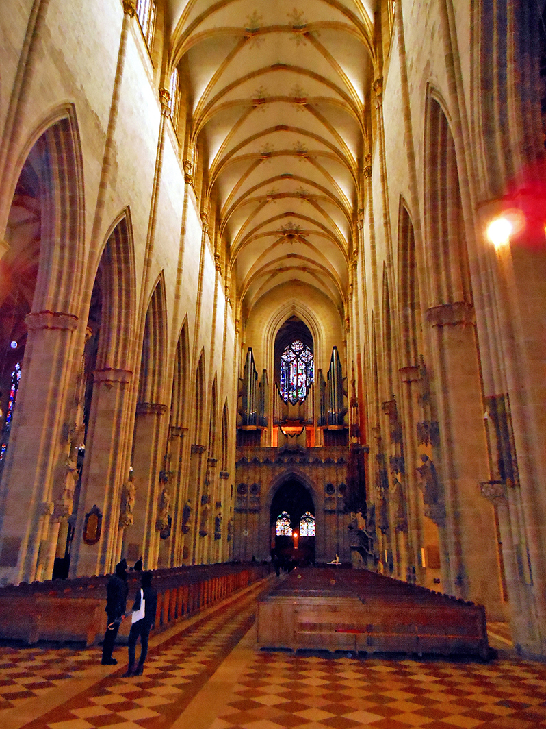
Famosa e imponente é a catedral gótica, com mais de 161 metros a torre de igreja mais alta do mundo.
No passado, Ulm foi o ponto de partida para a emigração dos suábios do Danúbio, que viajaram para seus novos países de origem no sudeste da Europa nas chamadas Ulmer Schachteln (caixas de Ulmer).
Ulm é berço de personalidades famosas como Albert Einstein, que nasceu em Ulm e os lutadores da resistência Hans e Sophie Scholl.
Nós apreciamos os 2 dias em Ulm,
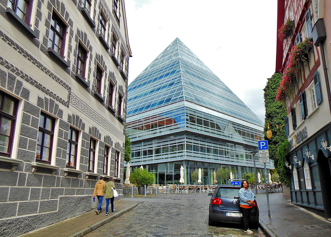
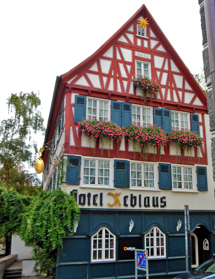
fizeram longas caminhadas na cidade velha e ao longo do Danúbio e também ficaram impressionados com a justaposição e o encontro da arquitetura histórica com a moderna!
O medieval e o moderno se encontram, a cidade velha com seus becos e riachos,
a muralha da cidade,
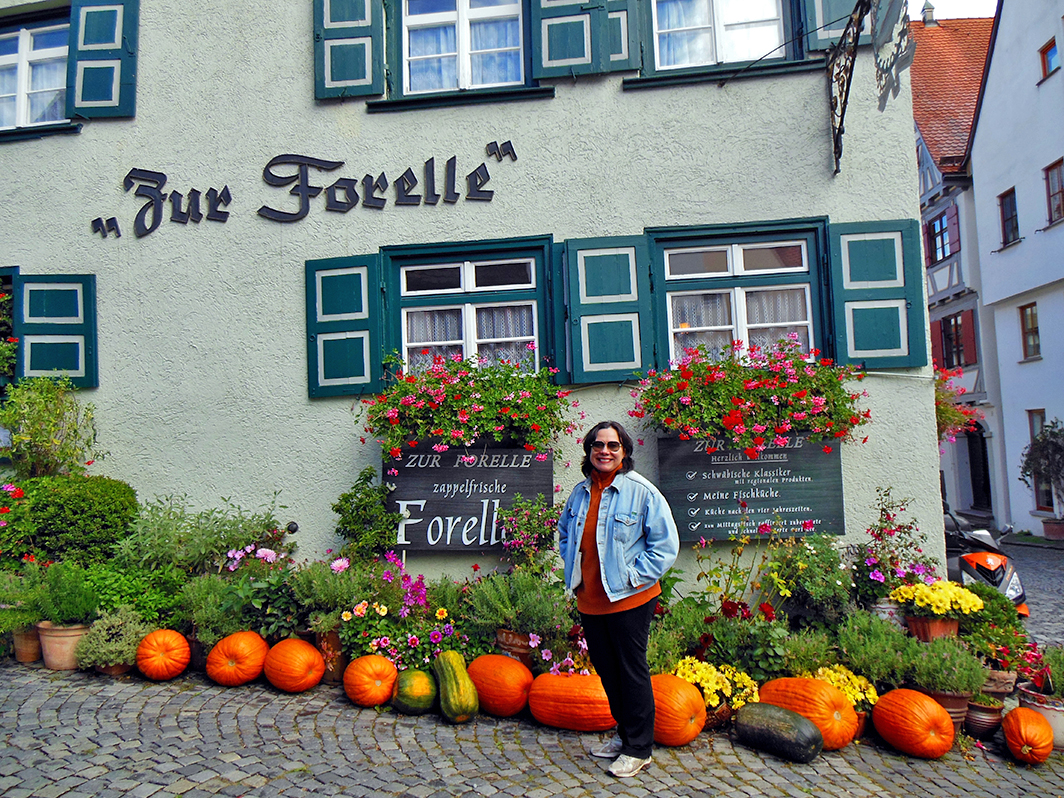
além de restaurantes rústicos,
Ofertas culturais e muitos eventos convidam você a ficar, uma curta visita à cidade, mas também uma estadia mais longa com muitas excursões à Alb da Suábia, a Stuttgart, Munique, Lago Constança e a vizinha Suíça, etc. (ver mapa)
Observação: se você quiser continuar “viajando” com o nosso blog, clique no botão “seguir” localizado no canto inferior direito dessa página. Você também pode “viajar” pelo Brasil conhecendo nosso livro impresso 66 x Brasil e sua versão digital 66 Belezas do Brasil.
Ulm an der Donau – Zweilandstadt mit höchstem Kirchturm der Welt
Als wir uns wieder einmal von Freiburg aus auf unseren Heimweg nach Brasilien machten, dachte ich, es könnte auf dem Weg nach München zum Flughafen lohnenswert sein, in Ulm an der Donau noch einen kurzen Stop einzulegen. Also gesagt- getan und es ist definitiv eine besuchenswerte Stadt.
Ulm liegt an der Donau am südöstlichen Rand der Schwäbischen Alb an der Grenze zu Bayern, sie ist Universitätsstadt in Baden-Württemberg. Die Stadt hat hat 125.000 Einwohner und bildet mit Neu-Ulm in Bayern eines der länderübergreifenden Doppelzentren Deutschlands mit etwa 183.000 Einwohnern, deswegen auch der der Name Zweilandstadt.
Berühmt und imposant das gotische Münster, mit über 161 Metern der höchste Kirchturm der Welt.
In der Vergangenheit war Ulm Ausgangspunkt der Auswanderung der Donauschwaben, die mit sogenannten Ulmer Schachteln in ihre neuen Heimatländer im Südosten Europas fuhren.
Berühmte Persönlichkeiten sind v.a. der in Ulm geborene Albert Einstein und die Widerstandskämpfer Hans und Sophie Scholl.
Wir genossen die 2 Tage in Ulm,
machten lange Spaziergänge in der Altstadt und an der Donau und waren auch beeindruckt durch das Nebeneinander und Aufeinandertreffen von historischer und sehr moderner Architektur!
Mittelalter und Moderne treffen aufeinander, die Altstadt mit ihren Gassen und Bächen,
die Stadtmauer,
dazu rustikale Restaurants,
Kulturangebote und viele Veranstaltungen laden ein zum Verweilen, einem kurzen City-Visit, aber auch einem längeren Aufenthalt mit vielen Ausflugsmöglichkeiten zur Schwäbischen Alb, nach Stuttgart, München, den Bodensee und die nahe Schweiz usw.usw. (siehe Karte)
Hinweis: Falls Sie unserem Blog folgen wollen, dann klicken Sie unten rechts einfach auf “Weiter”, Sie werden dann zukünftig automatisch informiert. Sie können auch durch Brasilien reisen und unser Buch 66 SEHENSWÜRDIGKEITEN IN BRASILIEN kennenlernen und 66 x Brazil – A Mosaic of Beauties.
Two-country city with the highest church tower in the world
When we were on our way home to Brazil from Freiburg, I thought it might be worthwhile to make a short stop in Ulm on the Danube on the way to the airport in Munich. So said and done and it is definitely a city worth visiting.
Ulm is located on the Danube on the southeastern edge of the Swabian Alb on the border with Bavaria, it is a university town in Baden-Württemberg. The city has 125,000 inhabitants and, together with Neu-Ulm in Bavaria, forms one of the transnational dual centers in Germany with around 183,000 inhabitants, hence the name Zweilandstadt.
Famous and imposing is the Gothic cathedral, with over 161 meters the highest church tower in the world.
Ulm was the starting point for the emigration of the Danube Swabians, who traveled to their new home countries in southeastern Europe in so-called Ulmer Schachteln (Ulmer boxes).
Famous personalities are above all Albert Einstein, who was born in Ulm, and the resistance fighters Hans and Sophie Scholl.
We enjoyed the 2 days in Ulm,
took long walks in the old town and along the Danube and were also impressed by the juxtaposition and meeting of historical and very modern architecture!
Medieval and modern meet, the old town with its alleys and streams,
the city wall,
plus rustic restaurants,
Cultural offers and many events invite you to linger, a short city visit, but also a longer stay with many excursions to the Swabian Alb, to Stuttgart, Munich, Lake Constance and nearby Switzerland, etc. etc. (see map)
Note: If you want to follow our “Travels” on the blog, simply click on “Seguir” in the lower right corner, you will be then automatically informed in the future. You can continue traveling with us with our book Brazil´s 66 Beautiful Sites and 66 x Brazil – A Mosaic of Beauties.
A Mongólia é um país localizado na Ásia oriental, sem acesso à costa marítima e limita-se com a Rússia e China. A capital da Mongólia é Ulan Bator e as outras principais cidades são: Darhan, Erdenet e Choybalsan.
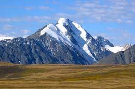
Quando tratamos sobre a Mongólia vem à mente a cultura nômade e o grande Deserto de Gobi localizado a sudeste do país, as montanhas de Altai no Oeste. A Mongólia é formada na maior parte do seu território por um planalto. Sua população é estimada em 3.278.290 pessoas em 2020, de acordo com dados da ONU. A população da Mongólia é equivalente a 0,04% da população mundial total. A densidade populacional na Mongólia é de 2 habitantes por km2 . A idade média na Mongólia é 28,2 anos, ou seja, a maioria de sua população é jovem.
A maioria de nós, ocidentais, não lemos e nem assistimos na mídia internacional muitas notícias sobre a Mongólia. A história dessa nação está diretamente relacionada com o Império Mongol, que no século XIII dominou grande parte da Ásia sob o comando de Gengis Khan. Com o fim do império, a partir do século XIV, os mongóis voltaram a se dividir em tribos.
Esse país possui cinco bens inscritos na Lista do Patrimônio Mundial da Organização das Nações Unidas para a Educação, a Ciência e a Cultura UNESCO, sendo três bens culturais e dois bens naturais.
Você deve estar se perguntando por que escrevemos este post sobre a Mongólia. É muito simples, por causa da pandemia, tivemos que adiar duas vezes uma viagem planejada e agendada à Mongólia para viajar de lá para a Europa com a Ferrovia Transiberiana e, finalmente, para visitar Moscou e São Petersburgo. Vamos ver e esperar agora se isso funcionará na 3ª tentativa em 2022.
Os bens culturais são os seguintes, a data entre parênteses indica quando foi inscrito na lista da UNESCO:
– A Grande Montanha Burkhan Khaldun Mountain e sua paisagem sagrada circundante (2015)
Quer conhecer mais sobre a Mongólia? Clique aqui e aqui
Observação: se você quiser continuar “viajando” com o nosso blog, clique no botão “seguir” localizado no canto inferior direito dessa página. Você também pode “viajar” pelo Brasil conhecendo nosso livro impresso 66 x Brasil e sua versão digital 66 Belezas do Brasil.
Natur- und Kulturerbe der Mongolei
Die Mongolei ist ein Land in Ostasien ohne Zugang zu Meeresküsten und grenzt an Russland und China. Die Hauptstadt der Mongolei ist Ulan Bator und die weiteren wichtigen Städte sind: Darhan, Erdenet und Choybalsan.
Wenn wir über die Mongolei sprechen, dann kommen einem sofort die Nomadenkultur und die große Wüste Gobi im Südosten des Landes und das Altai-Gebirge im Westen in den Sinn. Die Mongolei wird in den meisten Regionen durch ein Plateau geformt.
Die Bevölkerung der Mongolei wird nach UN-Angaben auf 3.278.290 Menschen im Jahr 2020 geschätzt, die Bevölkerung der Mongolei entspricht 0,04 % der gesamten Weltbevölkerung. Die Bevölkerungsdichte in der Mongolei beträgt 2 Einwohner pro km2. Das Durchschnittsalter in der Mongolei beträgt 28,2 Jahre, was bedeutet, dass die Mehrheit der Bevölkerung jung ist.
Die meisten von uns Westlern lesen oder sehen nicht viele Nachrichten über die Mongolei in den internationalen Medien. Die Geschichte dieser Nation ist direkt mit dem Mongolenreich verbunden, das im 13. Jahrhundert unter Dschingis Khan einen Großteil Asiens beherrschte. Mit dem Ende dieses Reiches ab dem 14. Jahrhundert wurden die Mongolen dann wieder in Stämme aufgeteilt.
Sie fragen sich nun vielleicht, warum wir über die Mongolei diesen Blogpost verfasst haben. Es ist ganz einfach, wegen der Pandmie mussten wir nun schon zweimal eine geplante und gebuchte Reise in die Mongolei verschieben, um dann von dort aus mit der Transsibirischen Eisenbahn nach Europa zu reisen um abschlie noch Moskau und Sankt Petersburg zu besuchen. Mal sehen und hoffen nun, ob dies nun im 3. Anlauf 2022 funktionieren könnte.
Dieses Land hat fünf Einträge in der UNESCO-Welterbeliste der Organisation der Vereinten Nationen für Bildung, Wissenschaft und Kultur, drei hiervon sind Kulturgüter und zwei Naturgüter.
Die Kulturgüter sind wie folgt, das Datum in Klammern gibt an, wann es in die UNESCO-Liste aufgenommen wurde :
– Der Große Burkhan Khaldun Berg und seine umgebende heilige Landschaft (2015)
Möchten Sie mehr über die Mongolei erfahren? Klicken Sie hier und hier
Hinweis: Falls Sie unserem Blog folgen wollen, dann klicken Sie unten rechts einfach auf “Weiter”, Sie werden dann zukünftig automatisch informiert. Sie können auch durch Brasilien reisen und unser Buch 66 SEHENSWÜRDIGKEITEN IN BRASILIEN kennenlernen und 66 x Brazil – A Mosaic of Beauties.
Natural and cultural heritage of Mongolia
Mongolia is a country in East Asia with no access to sea coasts and borders with Russia and China. The capital of Mongolia is Ulan Bator and the other important cities are: Darhan, Erdenet and Choybalsan.
When we talk about Mongolia, the nomadic culture and the great Gobi Desert in the southeast of the country and the Altai Mountains in the west immediately come to mind. Mongolia is formed by a plateau in most regions.
According to UN data the population of Mongolia is estimated at 3,278,290 people in 2020, the population of Mongolia corresponds to 0.04% of the total world population. The population density in Mongolia is 2 people per km2. The median age in Mongolia is 28.2 years, which means that the majority of the population is young.
Most of us Westerners do not read or see much news about Mongolia in the international media. The history of this nation is directly linked to the Mongol Empire, which ruled much of Asia under Genghis Khan in the 13th century. With the end of this empire from the 14th century the Mongols were then again divided into tribes.
You might be wondering why we wrote this blog post about Mongolia. It’s very simple, because of the pandemic we have had to postpone a planned and booked trip to Mongolia twice in order to travel from there to Europe with the Trans-Siberian Railway and finally to visit Moscow and Saint Petersburg. Let’s see and hope now whether this could work in the 3rd attempt in 2022.
This country has five entries on the UNESCO World Heritage List of the United Nations Education, Science and Culture, three of which are cultural assets and two are natural assets.
The cultural assets are as follows, the date in brackets indicates when it was added to the UNESCO list :
– The Great Burkhan Khaldun Mountain and its surrounding sacred landscape (2015)
Note: If you want to follow our “Travels” on the blog, simply click on “Seguir” in the lower right corner, you will be then automatically informed in the future. You can continue traveling with us with our book Brazil´s 66 Beautiful Sites and 66 x Brazil – A Mosaic of Beauties.
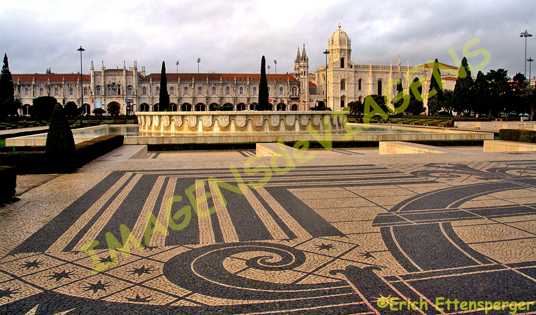
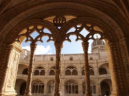
Portugal definitivamente é um país com muitos atrativos que encantam os turistas que o visitam. A sua capital tem um conjunto de atrações naturais e histórico-culturais que encantam a todos. A Torre de Belém e o Mosteiro dos Jerônimos são caracterizados por grande beleza e simbolismo histórico. É sobre esses dois monumentos que vamos tratar nesse post.
A Torre de Belém foi erigida para celebrar a expedição de Vasco da Gama e simboliza as grandes descobertas marítimas. No século XV os portugueses descobriram as Ilhas da Madeira, Cabo Verde, Açores sendo que os mais relevantes fatos foram a descoberta do caminho marítimo para as Índias por Vasco da Gama em 1498, o descobrimento do Brasil e a consolidação do Império Colonial no Ocidente através da conquista de Goa, Ormuz e Malaca por Afonso de Albuquerque.
A Torre de Belém foi construída entre os anos de 1515 e 1521, está situada próxima ao Mosteiros dos Jerônimos e surge sobre as águas do Rio Tejo como a proa de uma embarcação. O desenho original do prédio é atribuído a Garcia de Resende, que foi cronista do rei D. João II (1455-1495) e seu objetivo principal era ser uma fortificação para defender o porto de Lisboa. A concepção arquitetônica do prédio lembra os tradicionais castelos da Europa medieval e seu estilo arquitetônico caracteriza-se por se enquadrar no estilo manuelino, estilo artístico que se desenvolveu no reinado do Rei Manuel I, também conhecido como “gótico português”. A cruz da Ordem de Cristo esculpida nas ameias está presente nos monumentos desse período, ressalta a relevância que essa associação religiosa tinha em Portugal.
O Mosteiro dos Jerônimos é outra pérola da arquitetura portuguesa. Ele foi construído por iniciativa do Rei D. Manuel I para celebrar os grandes descobrimentos. O nome completo desse monumento é Mosteiro de Santa Maria de Belém e ele foi doado à Ordem dos Jerônimos, tendo sua origem numa pequena capela fundada pelo Infante D. Henrique, o Navegador que criou a Escola de Sagres, ele foi o principal promotor dos descobrimentos marítimos, atraiu para essa escola os mais famosos cosmógrafos da época.
A sua construção iniciou-se em 1502 e se prolongou até 1551.
Esse edifício é um exemplo máximo do estilo manuelino com elementos tradicionais da decoração gótica misturados com elementos novos como rendilhados que enfeitavam principalmente portais e janelas.
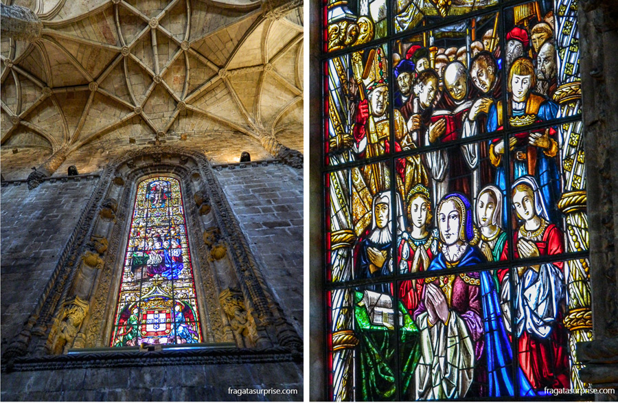
A igreja e o mosteiro estão ligados de uma forma que parece ser apenas um edifício. O interior da igreja tornou-se espetacular com o acréscimo de belíssimos vitrais.
FONTE: Patrimônio do Mundo, Editora Nova Cultural e sites indicados nos links desse texto.
Observação: se você quiser continuar “viajando” com o nosso blog, clique no botão “seguir” localizado no canto inferior direito dessa página. Você também pode “viajar” pelo Brasil conhecendo nosso livro impresso 66 x Brasil e sua versão digital 66 Belezas do Brasil.Turm von Belém und Hieronymus-Kloster
Portugal ist definitiv ein Land mit vielen Attraktionen, welche die Touristen begeistern. Seine Hauptstadt bietet eine Reihe von natürlichen und kulturhistorischen Attraktionen. Der Turm von Belém und das Kloster Mosteiro dos Jerônimos zeichnen sich durch große Schönheit und historische Symbolik aus. Über diese beiden Denkmäler wollen wir in diesem Beitrag sprechen.
Der Torre de Belém und das Mosteiro dos Jerônimos wurden 1983 in die UNESCO-Liste als Weltkulturerbe aufgenommen, was ihre Bedeutung für die Welt beweist.
Der Turm von Belém wurde zur Feier der Expedition von Vasco da Gama errichtet und symbolisiert die großen maritimen Entdeckungen, die zum Fundament der modernen Welt geworden sind. Im 15. Jahrhundert entdeckten die Portugiesen die Inseln Madeira, Kap Verde, die Azoren, wobei die wichtigsten Fakten die Entdeckung des Seewegs nach Indien durch Vasco da Gama im Jahr 1498, die Entdeckung Brasiliens und die Konsolidierung des Kolonialreiches im Westen durch die Eroberung von Goa, Ormuz und Malakka durch Afonso de Albuquerque, waren.
Er wurde zwischen 1515 und 1521 erbaut, liegt in der Nähe des Mosteiros dos Jerônimos und erhebt sich wie der Bug eines Schiffes über den Gewässern des Tejo.
Der ursprüngliche Entwurf des Gebäudes wird Garcia de Resende zugeschrieben, einem Chronisten von König João II (1455-1495), dessen Hauptziel es war, eine Festung zur Verteidigung des Hafens von Lissabon zu sein. Die architektonische Gestaltung des Gebäudes erinnert an die traditionellen Burgen des mittelalterlichen Europas und sein Baustil ist durch die Anpassung an den manuelinischen Stil gekennzeichnet, ein künstlerischer Stil, der sich während der Regierungszeit von König Manuel I entwickelte, auch bekannt als „portugiesische Gotik“. Das auf den Zinnen geschnitzte Kreuz des Christusordens ist in den Denkmälern dieser Zeit zu sehen und unterstreicht die Bedeutung, die diese religiöse Vereinigung in Portugal hatte.
Das Mosteiro dos Jerônimos ist eine weitere Perle der portugiesischen Architektur. Es wurde auf Initiative von König D. Manuel I. gebaut, um die großen Entdeckungen zu feiern. Der vollständige Name dieses Denkmals ist Kloster Santa Maria de Belém und es wurde dem Jerónimos-Orden gestiftet und fand seinen Ursprung in einer kleinen Kapelle, die von Infante D. Henrique, dem Seefahrer gegründet wurde, der auch die Schule von Sagres erschuf, er war somit der Hauptförderer der maritimen Entdeckungen und zog die berühmtesten Kosmographen der Zeit an diese Schule
Sein Bau begann im Jahr 1502 und dauerte bis 1551.
Dieses Gebäude ist ein Paradebeispiel für den manuelinischen Stil mit traditionellen Elementen der gotischen Dekoration, gemischt mit neuen Elementen wie Spitzenarbeiten, die hauptsächlich Portale und Fenster schmückten.
Falls Sie einmal Lissabon besuchen, dann sollten Sie einen Besuch einplanen, um diese beiden historischen Denkmäler kennen zu lernen.
QUELLE: Welterbe, Editora Nova Cultural und Stätten, die in den Links in diesem Text angegeben sind.
Hinweis: Falls Sie unserem Blog folgen wollen, dann klicken Sie unten rechts einfach auf “Weiter”, Sie werden dann zukünftig automatisch informiert. Sie können auch durch Brasilien reisen und unser Buch 66 SEHENSWÜRDIGKEITEN IN BRASILIEN kennenlernen und 66 x Brazil – A Mosaic of Beauties.
Belém Tower and Jeronimos Monastery
Portugal is definitely a country with many attractions for tourists. Its capital offers a number of natural and cultural-historical attractions. The Belém Tower and the Mosteiro dos Jerônimos Monastery are characterized by great beauty and historical symbolism. We want to talk about these two monuments in this post.
The Torre de Belém and the Mosteiro dos Jerônimos were added to the UNESCO World Heritage List in 1983, which proves their importance to the world.
The Tower of Belém was built to celebrate the Vasco da Gama expedition and symbolizes the great maritime discoveries that have become the foundation of the modern world. In the 15th century the Portuguese discovered the islands of Madeira, Cape Verde, the Azores, the most important facts being the discovery of the sea route to India by Vasco da Gama in 1498, the discovery of Brazil and the consolidation of the colonial empire in the west through the conquest of Goa, Ormuz and Malacca by Afonso de Albuquerque, were.
It was built between 1515 and 1521, it is located near the Mosteiros dos Jerônimos and rises like the bow of a ship over the waters of the Tagus.
The original design of the building is attributed to Garcia de Resende, a chronicler of King João II (1455-1495) whose main aim was to be a fortress in defense of the port of Lisbon. The architectural design of the building is reminiscent of the traditional castles of medieval Europe and its architectural style is characterized by adapting it to the Manueline style, an artistic style that developed during the reign of King Manuel I, also known as “Portuguese Gothic”. The Cross of the Order of Christ carved on the battlements can be seen in the monuments of this period and highlights the importance that this religious association had in Portugal.
The Mosteiro dos Jerônimos is another pearl of Portuguese architecture. It was built on the initiative of King D. Manuel I to celebrate the great discoveries. The full name of this monument is Santa Maria de Belém Monastery and it was donated to the Jerónimos Order and had its origin in a small chapel founded by Infante D. Henrique, the navigator who also created the Sagres School, he was thus the main promoter of maritime discoveries and attracted the most famous cosmographers of the time to this school.
Its construction began in 1502 and lasted until 1551.
This building is a prime example of the Manueline style with traditional elements of Gothic decoration mixed with new elements such as lace work that mainly adorned portals and windows.
Church and monastery are connected in what appears to be a single building. The interior of the church was designed spectacularly with beautiful stained glass.
If you once visit Lisbon, then you should plan a visit to get to know these two historical monuments.
SOURCE: World Heritage, Editora Nova Cultural and sites indicated in the links in this text.
Note: If you want to follow our “Travels” on the blog, simply click on “Seguir” in the lower right corner, you will be then automatically informed in the future. You can continue traveling with us with our book Brazil´s 66 Beautiful Sites and 66 x Brazil – A Mosaic of Beauties.
Apresentar lugares visitados ao redor do mundo e proporcionar um intercâmbio de informações com nossos visitantes./Display places visited around the world and provide an exchange of information with our visitors./Weltweit besuchte Orte vorstellen und einen Informationsaustausch mit unseren Besuchern anregen.

 Realizamos uma viagem muito interessante ao sul da América do Sul, visitamos El Calafate

 que foi nos buscar em El Calafate e foi durante essa viagem de quase 3 horas, em torno de 215 km, que tivemos o prazer de sentir o gostinho de percorrer a Rota 40.
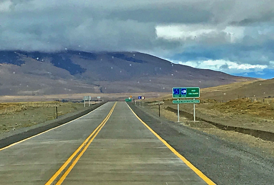


 e pudemos também observar a presença de grupos de guanacos liderados pelo macho alpha.
 Nesta área aparecem os pumas durante a noite que caçam os guanacos.
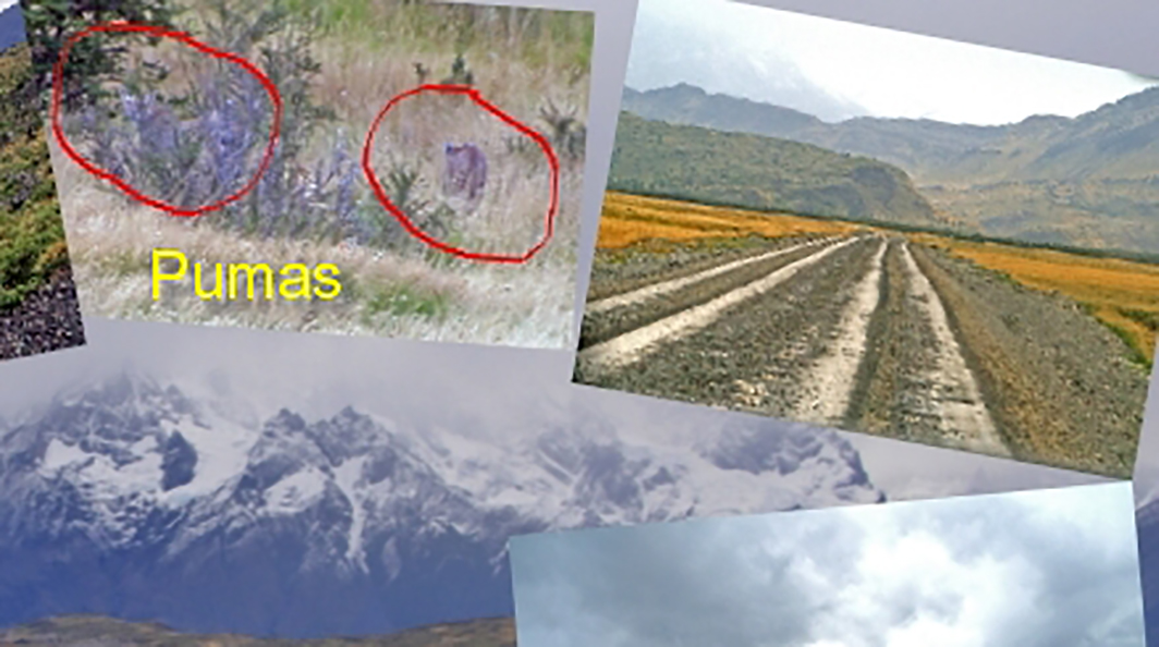


 Route 40 – the most famous road in Argentina


