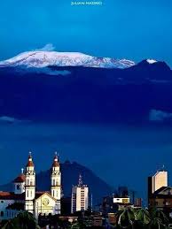
Todos os posts de Erich e Marcia

Erich é alemão, editor e fotógrafo, e eu sou arquiteta. Desenvolvemos uma parceria de trabalho e, em consequência, já publicamos três livros impressos e cinco digitais. Dois dos impressos versam sobre o estado do Rio Grande do Norte (66 Razões para descobrir o Rio Grande do Norte e deliciar-se com ele e Guia das Belezas do Rio Grande do Norte com exemplos de conservação ambiental), e o terceiro sobre o Brasil (66 x Brasil). Os livros digitais são: 66 x Brazil (somente em inglês), Natal e as belas praias do Rio Grande do Norte, Deserto do Atacama –Neve e Céu Azul, 66 Belezas do Brasil, 66 Sehenswürdigkeiten in Brasilien e Aventuras e Impressões de Viagens.Os três primeiros estão disponíveis na Ibooks da Apple e os outros na Amazon.com.São livros informativos e de fotografias, alguns dos quais contêm textos explicativos, em várias línguas, sobre os locais retratados. Viajamos muito para fotografar e conhecer os lugares que enfocamos em nossos livros.

Český Krumlov

Český Krumlov é uma encantadora cidade no sul da República Tcheca, famosa por seu centro histórico medieval bem preservado e seu impressionante castelo. Situada em uma curva do rio Moldava, a cidade é Patrimônio Mundial da UNESCO desde 1992.

O Castelo de Český Krumlov é o segundo maior da República Tcheca, depois do Castelo de Praga. Combina elementos góticos, renascentistas e barrocos. O teatro barroco do castelo é um destaque, sendo um dos mais antigos do mundo ainda em funcionamento.

As ruelas estreitas, casas coloridas e cafés acolhedores criam uma atmosfera única. A cidade também abriga várias galerias e museus, como o Centro Egon Schiele.

Durante o verão, diversos eventos culturais animam a cidade, como o Festival Internacional de Música e a Festa da Rosa de Cinco Pétalas, de estilo medieval. Atividades ao ar livre, como canoagem ou caminhadas ao longo do rio, também são muito populares.

Český Krumlov é um lugar onde a história ganha vida – romântico, inspirador e inesquecível.

Para conhecer mais sobre essa bela cidade, clique aqui.

Český Krumlov ist eine malerische Kleinstadt im Süden Tschechiens, die durch ihre gut erhaltene mittelalterliche Altstadt und das beeindruckende Schloss bekannt ist. Die Stadt liegt an einer Schleife der Moldau und gehört seit 1992 zum UNESCO-Weltkulturerbe.

Das Schloss Český Krumlov ist nach der Prager Burg das zweitgrößte historische Bauwerk des Landes. Es vereint gotische, Renaissance- und barocke Elemente. Besonders sehenswert ist das barocke Schlosstheater, eines der ältesten erhaltenen seiner Art.

Die engen Gassen, farbenfrohen Häuser und kleinen Cafés machen den besonderen Charme der Stadt aus. Zahlreiche Galerien und Museen, darunter das Egon-Schiele-Zentrum, laden zum Entdecken ein.

Im Sommer finden viele kulturelle Veranstaltungen statt, wie das Internationale Musikfestival oder das mittelalterliche Fest „Fünfblättrige Rose“. Auch Aktivitäten wie Kanufahren oder Spaziergänge entlang der Moldau sind sehr beliebt.

Český Krumlov ist ein Ort, an dem Geschichte lebendig wird – romantisch, inspirierend und unvergesslich

Um mehr über diese wunderschöne Stadt zu erfahren, klicken Sie hier.

Český Krumlov is a charming small town in southern Czech Republic, famous for its well-preserved medieval center and impressive castle. Nestled in a bend of the Vltava River, it has been a UNESCO World Heritage Site since 1992.

The Český Krumlov Castle is the second largest historical building in the country after Prague Castle. It features Gothic, Renaissance, and Baroque elements. One of its highlights is the Baroque theatre, one of the oldest surviving in the world.

The narrow streets, colorful houses, and cozy cafés give the town its special charm. There are many galleries and museums to explore, including the Egon Schiele Art Center.

In summer, the town hosts many cultural events, such as the International Music Festival and the medieval-style Five-Petalled Rose Festival. Outdoor activities like canoeing or riverside walks are also very popular.

Český Krumlov is a place where history comes to life – romantic, inspiring, and unforgettable.

To learn more about this beautiful city, click here.

Way-O-Tapu, maravilha da natureza/Wunder der Natur/wonder of nature

  • Wai-O-Tapu está localizado na Ilha Norte da Nova Zelândia, ao sul de Rotorua.
  • É uma maravilha geotérmica com fenômenos naturais espetaculares.
  • A área faz parte do campo vulcânico de Taupō, muito ativo geologicamente.
  • O nome “Wai-O-Tapu” significa “água sagrada” na língua Māori.
  • Os visitantes encontram fontes termais coloridas, poças de lama e crateras fumegantes.
  • Uma das atrações mais famosas é a Champagne Pool.
  • A piscina tem cerca de 65 metros de diâmetro e cores vibrantes.
  • A borda laranja é causada por depósitos de arsênio e antimônio.
  • O cheiro de enxofre é constante e típico das áreas geotérmicas.
  • O gêiser Lady Knox é outra atração popular.
  • Ele entra em erupção todos os dias por volta das 10:15 – com ajuda humana.
  • O jato pode atingir até 20 metros de altura.
  • Poças de lama borbulhante também ficam nas proximidades.
  • É um paraíso para fotógrafos e amantes da natureza.
  • Trilhas conduzem por paisagens coloridas.
  • Lagos de enxofre, piscinas verdes e fendas fumegantes criam visões únicas.
  • A atividade termal resulta de processos vulcânicos profundos.
  • Wai-O-Tapu é um parque natural protegido.
  • Os turistas devem permanecer nas trilhas sinalizadas.
  • Algumas piscinas atingem temperaturas acima de 100 graus Celsius.
  • As cores dos lagos vão de verde fluorescente a amarelo brilhante.
  • Minerais como enxofre, óxido de ferro e silício causam essa diversidade.
  • O ambiente é áspero, mas fascinante.
  • A fauna também se adaptou às condições quentes.
  • O centro de visitantes oferece informações sobre a geologia local.
  • A entrada é paga, mas vale a pena.
  • Wai-O-Tapu é uma das atrações naturais mais visitadas da Nova Zelândia.
  • A atmosfera parece quase extraterrestre.
  • Uma visita é inesquecível.
  • Wai-O-Tapu mostra a força bruta da natureza em uma beleza colorida.

  • Wai-O-Tapu liegt auf der Nordinsel Neuseelands, südlich von Rotorua.
  • Es ist ein geothermisches Wunderland mit spektakulären Naturphänomenen.
  • Das Gebiet gehört zum Taupō-Vulkanfeld, das geologisch sehr aktiv ist.
  • Der Name “Wai-O-Tapu” bedeutet „heiliges Wasser“ in der Sprache der Māori.
  • Besucher erleben farbenfrohe heiße Quellen, Schlammtümpel und dampfende Krater.
  • Eine der bekanntesten Attraktionen ist der Champagne Pool.
  • Der Pool ist rund 65 Meter im Durchmesser und hat leuchtende Farben.
  • Die orangefarbene Umrandung entsteht durch Ablagerungen von Arsen und Antimon.
  • Der Schwefelgeruch ist allgegenwärtig und typisch für geothermische Gebiete.
  • Der Lady Knox Geysir ist eine weitere beliebte Attraktion.
  • Er bricht täglich um ca. 10:15 Uhr aus – durch menschliche Auslösung.
  • Die Fontäne kann bis zu 20 Meter hoch sprühen.
  • In der Nähe befinden sich auch brodelnde Schlammtümpel.
  • Das Gebiet ist ein Paradies für Fotografen und Naturfreunde.
  • Wanderwege führen durch farbenprächtige Landschaften.
  • Schwefelseen, grüne Wasserbecken und dampfende Spalten bieten einzigartige Eindrücke.
  • Die Thermalaktivität ist das Ergebnis vulkanischer Prozesse tief unter der Erde.
  • Wai-O-Tapu ist ein geschützter Naturpark.
  • Touristen sind angehalten, die markierten Wege nicht zu verlassen.
  • Die Temperaturen mancher Becken erreichen über 100 Grad Celsius.
  • Die Farben der Seen reichen von giftgrün bis leuchtend gelb.
  • Mineralien wie Schwefel, Eisenoxid und Silizium verursachen die Farbvielfalt.
  • Die Umgebung ist rau, aber faszinierend.
  • Auch Vögel und Insekten haben sich an die heißen Bedingungen angepasst.
  • Das Besucherzentrum bietet interessante Informationen zur Geologie der Region.
  • Eintritt wird erhoben, aber es lohnt sich.
  • Wai-O-Tapu ist eine der meistbesuchten Naturattraktionen Neuseelands.
  • Die Atmosphäre wirkt fast außerirdisch.
  • Ein Besuch bleibt unvergesslich.
  • Wai-O-Tapu zeigt die rohe Kraft der Natur in farbenfroher Schönheit.

  • Wai-O-Tapu is located on New Zealand’s North Island, south of Rotorua.
  • It is a geothermal wonderland with spectacular natural phenomena.
  • The area is part of the geologically active Taupō Volcanic Zone.
  • The name “Wai-O-Tapu” means “sacred water” in the Māori language.
  • Visitors see colorful hot springs, mud pools, and steaming craters.
  • One of the most famous attractions is the Champagne Pool.
  • The pool is about 65 meters wide and displays vibrant colors.
  • The orange edge is caused by deposits of arsenic and antimony.
  • The smell of sulfur is ever-present and typical for geothermal sites.
  • The Lady Knox Geyser is another popular attraction.
  • It erupts daily around 10:15 a.m. with human assistance.
  • The water jet can reach up to 20 meters in height.
  • Bubbling mud pools are also found nearby.
  • It’s a paradise for photographers and nature lovers.
  • Walking tracks lead through colorful landscapes.
  • Sulfur lakes, green pools, and steaming fissures create unique sights.
  • The thermal activity results from volcanic processes deep underground.
  • Wai-O-Tapu is a protected natural park.
  • Tourists are asked to stay on marked paths.
  • Some pools reach temperatures over 100 degrees Celsius.
  • The lake colors range from neon green to bright yellow.
  • Minerals like sulfur, iron oxide, and silica cause the color diversity.
  • The environment is harsh but fascinating.
  • Birds and insects have adapted to the hot conditions.
  • The visitor center provides geological information about the region.
  • There is an entrance fee, but it’s worth it.
  • Wai-O-Tapu is one of New Zealand’s most visited natural sites.
  • The atmosphere feels almost otherworldly.
  • A visit is truly unforgettable.
  • Wai-O-Tapu showcases the raw power of nature in vibrant beauty.

30 Aspectos sobre Singapura/30 Fakten über Singapur/30 Facts about Singapore

  1. Singapura é uma cidade-estado no Sudeste Asiático.
  2. Fica ao sul da Malásia.
  3. Singapura tem cerca de 5,9 milhões de habitantes.
  4. A moeda oficial é o Dólar de Singapura.
  5. Singapura é conhecida por sua limpeza.
  6. O chiclete é fortemente regulado lá.
  7. A cidade é um importante centro financeiro.
  8. Há quatro línguas oficiais: inglês, mandarim, malaio e tâmil.
  9. O inglês é a principal língua de ensino.
  10. Singapura é marcada pelo multiculturalismo.
  11. A comida é diversificada e deliciosa.
  12. A comida de rua nos “hawker centres” é muito popular.
  13. O Aeroporto de Changi é um dos melhores do mundo.
  14. Marina Bay Sands é um hotel famoso.
  15. O Jardim Botânico é Patrimônio Mundial da UNESCO.
  16. Singapura é um país muito seguro.
  17. Existem leis e regras rigorosas.
  18. O transporte público é muito eficiente.
  19. A cidade é moderna e limpa.
  20. O horizonte urbano é impressionante.
  21. Singapura está localizada perto do equador.
  22. O clima é quente e úmido o ano todo.
  23. Chove com frequência, especialmente à tarde.
  24. O feriado nacional é em 9 de agosto.
  25. Singapura tornou-se independente em 1965.
  26. Há muitos arranha-céus e parques.
  27. A população é bem-educada.
  28. A educação tem grande importância.
  29. Muitas empresas internacionais estão sediadas lá.
  30. O turismo é uma importante fonte de renda.

  1. Singapur ist ein Stadtstaat in Südostasien.
  2. Er liegt südlich von Malaysia.
  3. Singapur hat etwa 5,9 Millionen Einwohner.
  4. Die offizielle Währung ist der Singapur-Dollar.
  5. Singapur ist bekannt für seine Sauberkeit.
  6. Kaugummi ist dort streng reguliert.
  7. Die Stadt ist ein bedeutendes Finanzzentrum.
  8. Es gibt vier Amtssprachen: Englisch, Mandarin, Malaiisch und Tamil.
  9. Englisch ist die Hauptunterrichtssprache.
  10. Singapur ist multikulturell geprägt.
  11. Das Essen ist vielfältig und lecker.
  12. Der Hawker-Street-Food-Stil ist sehr beliebt.
  13. Der Flughafen Changi ist einer der besten der Welt.
  14. Die Marina Bay Sands ist ein berühmtes Hotel.
  15. Der botanische Garten gehört zum UNESCO-Welterbe.
  16. Singapur ist ein sehr sicheres Land.
  17. Es gibt strenge Gesetze und Regeln.
  18. Der öffentliche Nahverkehr ist sehr effizient.
  19. Die Stadt ist sehr modern und sauber.
  20. Die Skyline ist beeindruckend.
  21. Singapur liegt fast am Äquator.
  22. Es ist ganzjährig warm und feucht.
  23. Es regnet häufig, besonders am Nachmittag.
  24. Der Nationalfeiertag ist am 9. August.
  25. Singapur wurde 1965 unabhängig.
  26. Es gibt viele Wolkenkratzer und Parks.
  27. Die Bevölkerung ist gut ausgebildet.
  28. Bildung hat einen hohen Stellenwert.
  29. Es gibt viele internationale Unternehmen.

Tourismus ist eine wichtige Einkommensquelle

  1. Singapore is a city-state in Southeast Asia.
  2. It lies south of Malaysia.
  3. Singapore has about 5.9 million inhabitants.
  4. The official currency is the Singapore Dollar.
  5. Singapore is known for its cleanliness.
  6. Chewing gum is strictly regulated there.
  7. The city is a major financial hub.
  8. There are four official languages: English, Mandarin, Malay, and Tamil.
  9. English is the main language of instruction.
  10. Singapore is shaped by multiculturalism.
  11. The food is diverse and delicious.
  12. Hawker street food is very popular.
  13. Changi Airport is one of the best in the world.
  14. Marina Bay Sands is a famous hotel.
  15. The Botanic Gardens are a UNESCO World Heritage Site.
  16. Singapore is a very safe country.
  17. There are strict laws and rules.
  18. Public transportation is very efficient.
  19. The city is modern and clean.
  20. The skyline is impressive.
  21. Singapore is located near the equator.
  22. It is warm and humid all year round.
  23. It rains frequently, especially in the afternoon.
  24. The national holiday is on August 9.
  25. Singapore became independent in 1965.
  26. There are many skyscrapers and parks.
  27. The population is well educated.
  28. Education is highly valued.
  29. Many international companies are based there.
  30. Tourism is an important source of income.

Chapada Diamantina

A Chapada Diamantina está localizada no estado da Bahia, no nordeste do Brasil, e é famosa por suas paisagens montanhosas, cachoeiras espetaculares e grutas impressionantes. O Parque Nacional da Chapada Diamantina cobre cerca de 152 mil hectares e protege uma rica biodiversidade.

O nome “Diamantina” vem da corrida dos diamantes no século XIX, quando a região atraiu garimpeiros de todo o país. Hoje, cidades como Lençóis, Vale do Capão, Igatu e Mucugê são pontos de partida para trilhas incríveis e aventuras na natureza.

Entre as atrações mais famosas estão:

  • Cachoeira da Fumaça (com 340 metros de altura)
  • Poço Encantado e Poço Azul (com águas cristalinas e flutuantes)
  • Morro do Pai Inácio, com vista panorâmica
  • Gruta da Lapa Doce e Pratinha

A região oferece também cultura local rica, culinária típica, artesanato e hospitalidade acolhedora. É ideal para ecoturismo, trilhas, fotografia e experiências autênticas no interior do Brasil.

Die Chapada Diamantina liegt im Bundesstaat Bahia im Nordosten Brasiliens und ist bekannt für ihre atemberaubenden Landschaften mit Bergen, Höhlen und spektakulären Wasserfällen. Der Nationalpark Chapada Diamantina erstreckt sich über etwa 152.000 Hektar und schützt eine einzigartige Flora und Fauna.

Der Name “Diamantina” stammt aus dem 19. Jahrhundert, als dort Diamanten gefunden wurden und viele Glückssucher in die Region strömten. Heute sind Orte wie Lençóis, Vale do Capão, Mucugê und Igatu beliebte Ausgangspunkte für Wanderungen und Naturerlebnisse.

Highlights der Region sind:

  • Der Cachoeira da Fumaça, mit 340 Metern einer der höchsten Wasserfälle Brasiliens
  • Der Poço Encantado und Poço Azul, mit glasklarem, schwebendem Wasser
  • Der Morro do Pai Inácio, mit spektakulärem Rundblick
  • Tropfsteinhöhlen wie die Gruta da Lapa Doce

Die Chapada ist ein Paradies für Wanderer, Naturfreunde, Fotograf:innen und alle, die authentische brasilianische Kultur erleben möchten – samt lokaler Küche, Musik und Gastfreundschaft.

Chapada Diamantina is located in the state of Bahia, in northeastern Brazil. It’s famous for its dramatic landscapes, high waterfalls, mystical caves, and rich biodiversity. The Chapada Diamantina National Park spans around 152,000 hectares and is a prime destination for ecotourism.

The name “Diamantina” comes from the diamond rush of the 1800s, when miners flocked to the area. Today, towns like Lençóis, Vale do Capão, Igatu, and Mucugê serve as gateways to some of Brazil’s most stunning natural attractions.

Top highlights include:

  • The Cachoeira da Fumaça, a 340-meter waterfall
  • The magical Poço Encantado and Poço Azul, with crystal-clear water
  • The iconic Morro do Pai Inácio, offering panoramic views
  • Limestone caves like Gruta da Lapa Doce

Visitors can enjoy hiking, swimming, cave exploring, and soaking in local culture through food, music, and artisan crafts. Chapada Diamantina is a true hidden gem for nature lovers and adventurers alike.

Cidade do Panamá/Panama-Stadt/Panama City

Cidade do Panamá é a capital do Panamá e está localizada na costa do Pacífico da América Central.

Foi fundada em 1519 pelos espanhóis e foi um ponto de partida importante para expedições à América do Sul. Hoje, é uma metrópole moderna com arranha-céus impressionantes, centros comerciais, museus e bairros coloniais como o Casco Viejo, que é Patrimônio Mundial da UNESCO.

Cidade do Panamá é um centro econômico, político e cultural significativo na região. O horizonte da cidade lembra Miami ou Dubai. A arquitetura moderna mistura-se com o patrimônio histórico. Turistas apreciam o contraste entre tradição e inovação.

A cidade é especialmente conhecida pelo Canal do Panamá, que fica a poucos quilômetros do centro. O canal é uma via navegável artificial que liga o Atlântico (pelo Mar do Caribe) ao Pacífico. Foi construído entre 1904 e 1914 sob liderança dos EUA e é considerado uma das maiores obras de engenharia do século XX.

O Canal do Panamá tem cerca de 82 quilômetros de comprimento e economiza aos navios a longa e perigosa viagem ao redor do Cabo Horn, no sul da América. Cerca de 14.000 navios passam pelo canal a cada ano. O melhor lugar para observá-lo é a Eclusa de Miraflores, onde os visitantes podem ver o funcionamento ao vivo.

A importância econômica do canal é enorme – tanto para o Panamá quanto para o comércio mundial. Desde a transferência do canal dos EUA para o Panamá em 1999, ele é administrado pela Autoridade do Canal do Panamá (ACP).

No geral, a Cidade do Panamá é uma mistura fascinante de história, desenvolvimento moderno e importância internacional – com o Canal do Panamá como seu coração.

Para conhecer mais sobre o Panamá, clique aqui.

Panama-Stadt ist die Hauptstadt von Panama und liegt an der Pazifikküste Mittelamerikas.

Sie wurde 1519 von den Spaniern gegründet und war einst ein wichtiger Ausgangspunkt für die Expeditionen nach Südamerika. Heute ist die Stadt eine moderne Metropole mit beeindruckenden Hochhäusern, Einkaufszentren, Museen und kolonialen Vierteln wie Casco Viejo, das zum UNESCO-Weltkulturerbe gehört.

Panama-Stadt ist ein bedeutendes wirtschaftliches, politisches und kulturelles Zentrum in der Region. Die Skyline erinnert an Städte wie Miami oder Dubai. In der Stadt mischen sich moderne Architektur mit historischer Substanz. Touristen genießen den Kontrast zwischen Tradition und Innovation.

Besonders bekannt ist Panama-Stadt wegen des Panama-Kanals, der nur wenige Kilometer vom Stadtzentrum entfernt liegt. Der Kanal ist eine künstliche Wasserstraße, die den Atlantik (über das Karibische Meer) mit dem Pazifik verbindet. Er wurde zwischen 1904 und 1914 unter der Leitung der USA gebaut und gilt als eines der größten technischen Meisterwerke des 20. Jahrhunderts.

Der Panama-Kanal ist etwa 82 Kilometer lang und spart Schiffen den langen und gefährlichen Weg um das Kap Hoorn in Südamerika. Jährlich durchqueren rund 14.000 Schiffe den Kanal. Der wichtigste Ort zur Besichtigung ist die Miraflores-Schleuse, wo Besucher den Betrieb live beobachten können.

Die wirtschaftliche Bedeutung des Kanals ist enorm – für Panama selbst, aber auch für den weltweiten Handel. Seit der Übergabe des Kanals von den USA an Panama im Jahr 1999 wird er vollständig von der Autoridad del Canal de Panamá (ACP) verwaltet.

Insgesamt ist Panama-Stadt eine faszinierende Mischung aus Geschichte, moderner Entwicklung und internationaler Bedeutung – mit dem Panama-Kanal als Herzstück.

Um mehr über Panama zu erfahren, klicken Sie hier.

Panama City is the capital of Panama and is located on the Pacific coast of Central America.

It was founded in 1519 by the Spanish and was once an important starting point for expeditions to South America. Today, it is a modern metropolis with impressive skyscrapers, shopping malls, museums, and colonial districts like Casco Viejo, which is a UNESCO World Heritage Site.

Panama City is a significant economic, political, and cultural hub in the region. Its skyline resembles cities like Miami or Dubai. Modern architecture blends with historic charm. Tourists enjoy the contrast between tradition and innovation.

The city is especially famous for the Panama Canal, which is just a few kilometers from the city center. The canal is an artificial waterway that connects the Atlantic Ocean (via the Caribbean Sea) with the Pacific Ocean. It was built between 1904 and 1914 under U.S. leadership and is considered one of the greatest engineering achievements of the 20th century.

The Panama Canal is about 82 kilometers long and saves ships the long and dangerous journey around Cape Horn in South America. Around 14,000 ships pass through the canal every year. The best place to see it in action is the Miraflores Lock, where visitors can watch operations live.

The canal’s economic importance is immense – both for Panama and for global trade. Since its transfer from the U.S. to Panama in 1999, it has been managed entirely by the Panama Canal Authority (ACP).

All in all, Panama City is a fascinating blend of history, modern development, and international significance – with the Panama Canal as its heart.

To learn more about Panama, click hier.

Fernando de Noronha

Fernando de Noronha é um lindo arquipélago no Oceano Atlântico, conhecido por suas praias deslumbrantes, águas cristalinas e rica vida selvagem.

Fonte/Quelle/Source: https://igeologico.com.br/geologia-de-fernando-de-noronha-uma-historia-vulcanica-de-milhoes-de-anos/

O grupo de ilhas pertence ao Brasil e é um destino popular para amantes da natureza e mergulhadores. A ilha principal está a cerca de 354 km da costa de Pernambuco. Para chegar lá, a maioria dos visitantes voa de Recife ou Natal para Fernando de Noronha. Os voos são relativamente curtos, cerca de 1,5 horas.

Fonte/Quelle/Source:https://igeologico.com.br/geologia-de-fernando-de-noronha-uma-historia-vulcanica-de-milhoes-de-anos/

É importante reservar os voos com antecedência, pois o número de passageiros é limitado para proteger o meio ambiente. Na ilha, há várias opções de acomodação, desde albergues simples até resorts luxuosos. Recomenda-se alugar um veículo para chegar facilmente às diferentes praias e atrações. As atividades populares incluem snorkeling, mergulho e trilhas na natureza intocada. O acesso à ilha é pago e os visitantes devem pagar uma taxa ambiental. Fernando de Noronha é um verdadeiro paraíso para aqueles que apreciam a beleza da natureza e desejam relaxar.

Em Fernando de Noronha, há muitas praias deslumbrantes que valem a pena visitar.

O Praia do Sancho é considerado uma das praias mais bonitas do mundo, com sua areia fina e água cristalina, ideal para snorkeling. O Praia do Leão é conhecido por sua paisagem impressionante e é um local popular para observar tartarugas. O Praia das Conchas oferece uma atmosfera tranquila e é perfeito para relaxamento e piqueniques. A Baía dos Porcos também oferece vistas espetaculares e é um lugar favorito para fotógrafos. Cada uma dessas praias tem seu próprio charme e é imperdível para quem visita a ilha.

Para conhecer mais sobre Feranando de Noronha, clique aqui e aqui.

Fernando de Noronha ist ein wunderschöner Archipel im Atlantischen Ozean, bekannt für seine atemberaubenden Strände, kristallklares Wasser und reiche Tierwelt.

Fonte/Quelle/Source: https://igeologico.com.br/geologia-de-fernando-de-noronha-uma-historia-vulcanica-de-milhoes-de-anos/

Die Inselgruppe gehört zu Brasilien und ist ein beliebtes Ziel für Naturliebhaber und Taucher. Die Hauptinsel ist nur etwa 354 km von der Küste Pernambuco entfernt. Um dorthin zu gelangen, fliegen die meisten Besucher von Recife oder Natal nach Fernando de Noronha. Die Flüge sind relativ kurz, etwa 1,5 Stunden.

Fonte/Quelle/Source:https://igeologico.com.br/geologia-de-fernando-de-noronha-uma-historia-vulcanica-de-milhoes-de-anos/

Es ist wichtig, die Flüge im Voraus zu buchen, da die Anzahl der Passagiere begrenzt ist, um die Umwelt zu schützen. Auf der Insel gibt es verschiedene Unterkünfte, von einfachen Hostels bis hin zu luxuriösen Resorts. Es wird empfohlen, ein Fahrzeug zu mieten, um die verschiedenen Strände und Sehenswürdigkeiten bequem erreichen zu können. Beliebte Aktivitäten sind Schnorcheln, Tauchen und Wandern in der unberührten Natur. Der Zugang zur Insel ist kostenpflichtig, und Besucher müssen eine Umweltgebühr entrichten. Fernando de Noronha ist ein wahres Paradies für diejenigen, die die Schönheit der Natur schätzen und sich entspannen möchten.

In Fernando de Noronha gibt es zahlreiche atemberaubende Strände, die einen Besuch wert sind.

Der Praia do Sancho gilt als einer der schönsten Strände der Welt, mit seinem feinen Sand und klarem Wasser, ideal zum Schnorcheln. Der Praia do Leão ist bekannt für seine beeindruckende Kulisse und ist ein beliebter Ort für Schildkrötenbeobachtungen. Der Praia das Conchas bietet eine ruhige Atmosphäre und eignet sich perfekt für Entspannung und Picknicks. Auch der Baía dos Porcos bietet spektakuläre Ausblicke und ist ein beliebter Spot für Fotografen. Jeder dieser Strände hat seinen eigenen Charme und ist ein Muss für Besucher der Insel.

Um mehr über Fernando de Noronha zu erfahren, klicken Sie hier und hier.

Fernando de Noronha is a beautiful archipelago in the Atlantic Ocean, known for its stunning beaches, crystal-clear waters, and rich wildlife.

Fonte/Quelle/Source: https://igeologico.com.br/geologia-de-fernando-de-noronha-uma-historia-vulcanica-de-milhoes-de-anos/

The island group belongs to Brazil and is a popular destination for nature lovers and divers. The main island is about 354 km from the coast of Pernambuco. To get there, most visitors fly from Recife or Natal to Fernando de Noronha. The flights are relatively short, about 1.5 hours.

Fonte/Quelle/Source:https://igeologico.com.br/geologia-de-fernando-de-noronha-uma-historia-vulcanica-de-milhoes-de-anos/

It is important to book flights in advance, as the number of passengers is limited to protect the environment. On the island, there are various accommodations ranging from simple hostels to luxurious resorts. It is recommended to rent a vehicle to easily reach the different beaches and attractions. Popular activities include snorkeling, diving, and hiking in the pristine nature. Access to the island is subject to a fee, and visitors must pay an environmental fee. Fernando de Noronha is a true paradise for those who appreciate the beauty of nature and wish to relax.

In Fernando de Noronha, there are many stunning beaches worth visiting.

Praia do Sancho is considered one of the most beautiful beaches in the world, with its fine sand and clear water, ideal for snorkeling. Praia do Leão is known for its impressive scenery and is a popular spot for turtle watching. Praia das Conchas offers a tranquil atmosphere and is perfect for relaxation and picnics. Baía dos Porcos also provides spectacular views and is a favorite spot for photographers. Each of these beaches has its own charm and is a must for visitors to the island.

To learn more about Fernando de Noronha click here and here.

Os 10 lugares mais hospitaleiros do mundo/Die Top 10 gastfreundlichsten Orte der Welt/The top 10 most hospitable places in the world

Além de Quedlinburg, outras cidades também impressionam no ranking dos lugares mais hospitaleiros do mundo. Entre outras, St. Augustine, na Flórida – a cidade mais antiga da América, fundada em 1565 – ocupa o quinto lugar. De acordo com o Booking.com, Chester, na Inglaterra, é particularmente impressionante devido à sua cativante mistura de arquitetura romana, medieval e Tudor. Somado à simpatia dos moradores locais, isso garante à cidade inglesa o 10º lugar no ranking.

A classificação completa em resumo:

  1. Sigiriya, Sri Lanka
Fonte/Quelle/Source: https://www.nathab.com/blog/sigiriya
  1. Cazorla, Espanha
Fonte/Quelle/Source: https://www.expedia.com.br/Castelo-De-La-Yedra-Cazorla.d553248621533071721.Guia-de-Viagem
  1. Urubici, Brasil
Fnte/Quelle/Source: https://turismo.uai.com.br/noticias/ecoturismo-tranquilidade-e-ate-neve-conheca-urubici-em-santa-catarina/
  1. Taupo, Nova Zelândia
Fonte/Quelle/Source: https://oquefazeremsuaviagem.com/nova-zelandia/o-que-fazer-em-taupo-na-nova-zelandia/

5. Santo Agostinho, Estados Unidos

Fonte/Quelle/Source: https://www.tripadvisor.com.br/Attractions-g34599-Activities-St_Augustine_Florida.html
  1. Orvieto, Itália
Fonte/Quelle/Source: https://www.getyourguide.com/pt-br/orvieto-l1592/orvieto-excursao-a-pe-privativa-com-a-catedral-de-orvieto-t409353/?ranking_uuid=a00c234a-2e7a-4c36-99ac-ec6fbc062077
  1. Manizales, Colômbia
Fonte/Quelle/Source: https://br.pinterest.com/pin/2462974780022294/
  1. Quedlinburg, Alemanha

  1. Koh Lanta, Tailândia
Fonte/Quelle/Source: https://www.natucate.com/en/blog/travel-guide/thailand-ko-lanta
  1. Chester, Reino Unido
Fonte/Quelle/Source: https://www.womenshealth.pt/1678142935/esta-e-a-cidade-mais-bonita-do-mundo-segundo-a-ciencia/

Die Top 10 gastfreundlichsten Orte der Welt

Neben Quedlinburg überzeugen auch weitere Städte in dem Ranking der gastfreundlichsten Orte weltweit. Unter anderem landet auf Platz 5 St. Augustine in Florida – die älteste Stadt Amerikas, die 1565 gegründet wurde. Chester in England besticht laut Booking.com vor allem durch eine fesselnde Mischung aus römischer, mittelalterlicher und Tudor-Architektur. Gepaart mit seinen freundlichen Einheimischen sichert das der englischen Stadt den Platz 10 im Ranking.

Das gesamte Ranking im Überblick:

  1. Sigiriya, Sri Lanka
Fonte/Quelle/Source: https://www.nathab.com/blog/sigiriya
  1. Cazorla, Spanien
Fonte/Quelle/Source: https://www.expedia.com.br/Castelo-De-La-Yedra-Cazorla.d553248621533071721.Guia-de-Viagem
  1. Urubici, Brasilien
Fnte/Quelle/Source: https://turismo.uai.com.br/noticias/ecoturismo-tranquilidade-e-ate-neve-conheca-urubici-em-santa-catarina/
  1. Taupo, Neuseeland
Fonte/Quelle/Source: https://oquefazeremsuaviagem.com/nova-zelandia/o-que-fazer-em-taupo-na-nova-zelandia/
  1. Augustine, Vereinigte Staaten
Fonte/Quelle/Source: https://www.tripadvisor.com.br/Attractions-g34599-Activities-St_Augustine_Florida.html
  1. Orvieto, Italien
Fonte/Quelle/Source: https://www.getyourguide.com/pt-br/orvieto-l1592/orvieto-excursao-a-pe-privativa-com-a-catedral-de-orvieto-t409353/?ranking_uuid=a00c234a-2e7a-4c36-99ac-ec6fbc062077
  1. Manizales, Kolumbien
Fonte/Quelle/Source: https://br.pinterest.com/pin/2462974780022294/
  1. Quedlinburg, Deutschland

  1. Koh Lanta, Thailand
Fonte/Quelle/Source: https://www.natucate.com/en/blog/travel-guide/thailand-ko-lanta
  1. Chester, Vereinigtes Königreich
Fonte/Quelle/Source: https://www.womenshealth.pt/1678142935/esta-e-a-cidade-mais-bonita-do-mundo-segundo-a-ciencia/

 The top 10 most hospitable places in the world

In addition to Quedlinburg, other cities also impress in the ranking of the most hospitable places in the world. Among others, St. Augustine in Florida – the oldest city in America, founded in 1565 – comes in fifth place. According to Booking.com, Chester in England impresses above all with a captivating mix of Roman, medieval and Tudor architecture. Coupled with its friendly locals, this secures the English city 10th place in the ranking.

The entire ranking at a glance:

  1. Sigiriya, Sri Lanka
Fonte/Quelle/Source: https://www.nathab.com/blog/sigiriya
  1. Cazorla, Spain
Fonte/Quelle/Source: https://www.expedia.com.br/Castelo-De-La-Yedra-Cazorla.d553248621533071721.Guia-de-Viagem
  1. Urubici, Brazil
Fnte/Quelle/Source: https://turismo.uai.com.br/noticias/ecoturismo-tranquilidade-e-ate-neve-conheca-urubici-em-santa-catarina/
  1. Taupo, New Zealand
Fonte/Quelle/Source: https://oquefazeremsuaviagem.com/nova-zelandia/o-que-fazer-em-taupo-na-nova-zelandia/

5. Augustine, United States

Fonte/Quelle/Source: https://www.tripadvisor.com.br/Attractions-g34599-Activities-St_Augustine_Florida.html
  1. Orvieto, Italy
Fonte/Quelle/Source: https://www.getyourguide.com/pt-br/orvieto-l1592/orvieto-excursao-a-pe-privativa-com-a-catedral-de-orvieto-t409353/?ranking_uuid=a00c234a-2e7a-4c36-99ac-ec6fbc062077
  1. Manizales, Colombia
Fonte/Quelle/Source: https://br.pinterest.com/pin/2462974780022294/
  1. Quedlinburg, Germany

  1. Koh Lanta, Thailand
Fonte/Quelle/Source: https://www.natucate.com/en/blog/travel-guide/thailand-ko-lanta
  1. Chester, United Kingdom
Fonte/Quelle/Source: https://www.womenshealth.pt/1678142935/esta-e-a-cidade-mais-bonita-do-mundo-segundo-a-ciencia/


A histórica Quedlinburg/Historisches Quedlinburg/Historic Quedlinburg

Quedlinburg é uma cidade histórica na Saxônia-Anhalt, Alemanha.
Está situada de forma pitoresca no extremo norte das montanhas Harz.


A cidade tem cerca de 24.000 habitantes.
Quedlinburg faz parte do Patrimônio Mundial da UNESCO.
A cidade é famosa pelo seu centro histórico bem preservado.
Mais de 2.000 casas em enxaimel moldam a paisagem urbana.
A maioria das casas data da Idade Média.
A praça do mercado é um ponto de encontro central.
Lá está a impressionante prefeitura do século XIV.
A colina do castelo domina a paisagem urbana.
Ali encontra-se a Igreja Colegiada de São Servácio.
Ela abriga o famoso Tesouro de Quedlinburg.
Quedlinburg já foi a residência dos Otonianos.
O rei Henrique I acredita-se estar enterrado aqui.
A cidade foi um centro importante na Idade Média.
Hoje, atrai muitos turistas.
Há inúmeros museus e pontos turísticos.
O mercado de Natal de Quedlinburg é particularmente popular.
A cidade também é conhecida por seus jardins e parques.
Um passeio por suas ruas é como uma viagem no tempo.
O rio Bode atravessa Quedlinburg.
Existem muitos cafés e restaurantes aconchegantes.
As especialidades locais incluem queijo Harz e bolo Bienenstich.
Quedlinburg é facilmente acessível de trem.
A região ao redor convida para caminhadas.
A primavera é especialmente bela com jardins floridos.
O Castelo de Quedlinburg também merece uma visita.
No verão, ocorrem muitos eventos culturais.
Quedlinburg combina história e modernidade de forma única.

Quedlinburg ist eine historische Stadt in Sachsen-Anhalt, Deutschland.
Sie liegt malerisch am Nordrand des Harzes.


Die Stadt hat etwa 24.000 Einwohner.
Quedlinburg gehört zum UNESCO-Weltkulturerbe.
Die Stadt ist für ihre gut erhaltene Altstadt bekannt.
Über 2.000 Fachwerkhäuser prägen das Stadtbild.
Die meisten Häuser stammen aus dem Mittelalter.
Der Marktplatz ist ein zentraler Treffpunkt.
Dort steht das imposante Rathaus aus dem 14. Jahrhundert.
Der Schlossberg dominiert das Stadtbild.
Dort befindet sich die Stiftskirche St. Servatius.
Sie beherbergt den berühmten Domschatz.
Quedlinburg war einst die Residenz der Ottonen.
König Heinrich I. soll hier begraben sein.
Die Stadt war im Mittelalter ein bedeutendes Zentrum.
Heute zieht sie viele Touristen an.
Es gibt zahlreiche Museen und Sehenswürdigkeiten.
Der Quedlinburger Weihnachtsmarkt ist besonders beliebt.
Die Stadt ist auch für ihre Gärten und Parks bekannt.
Ein Spaziergang durch die Gassen ist wie eine Zeitreise.
Die Bode fließt durch Quedlinburg.
Es gibt viele gemütliche Cafés und Restaurants.
Regionale Spezialitäten sind Harzer Käse und Bienenstich.
Quedlinburg ist gut mit dem Zug erreichbar.
Die Umgebung lädt zum Wandern ein.
Besonders schön ist der Frühling mit blühenden Gärten.
Auch das Quedlinburger Schloss ist sehenswert.
Im Sommer finden viele kulturelle Veranstaltungen statt.
Quedlinburg vereint Geschichte und Moderne auf einzigartige Weise.

Quedlinburg is a historic town in Saxony-Anhalt, Germany.
It is picturesquely located at the northern edge of the Harz Mountains.


The town has about 24,000 inhabitants.
Quedlinburg is part of the UNESCO World Heritage.
The town is famous for its well-preserved old town.
More than 2,000 half-timbered houses shape the cityscape.
Most houses date back to the Middle Ages.
The market square is a central meeting point.
There stands the impressive town hall from the 14th century.
The castle hill dominates the cityscape.
There, you find the Collegiate Church of St. Servatius.
It houses the famous Quedlinburg treasure.
Quedlinburg was once the residence of the Ottonians.
King Henry I is said to be buried here.
The town was an important center in the Middle Ages.
Today, it attracts many tourists.
There are numerous museums and sights.
The Quedlinburg Christmas market is particularly popular.
The town is also known for its gardens and parks.
A walk through its alleys feels like a journey through time.
The Bode River flows through Quedlinburg.
There are many cozy cafés and restaurants.
Local specialties include Harz cheese and Bienenstich cake.
Quedlinburg is easily accessible by train.
The surrounding area invites visitors to go hiking.
Spring is particularly beautiful with blooming gardens.
Quedlinburg Castle is also worth a visit.
In summer, many cultural events take place.
Quedlinburg uniquely combines history and modernity.

Portovenere

Portovenere é uma pitoresca cidade costeira na Ligúria, Itália, situada na Riviera di Levante. Fica a oeste de La Spezia e faz parte do Patrimônio Mundial da UNESCO, junto com as Cinque Terre.

A cidade tem uma longa história que remonta à época romana. Na Idade Média, Portovenere foi desenvolvida e fortificada pelos genoveses. Ainda hoje, as antigas muralhas da cidade e o Castelo Doria são impressionantes testemunhos dessa época.

Um dos marcos da cidade é a Igreja de São Pedro, situada dramaticamente sobre uma rocha sobre o mar. Foi construída no século XIII no estilo gótico genovês e oferece uma vista espetacular.

Também merece destaque a Igreja de São Lourenço, do século XII, que abriga valiosas obras de arte religiosa.

A Gruta de Byron, nomeada em homenagem ao poeta Lord Byron, que encontrou inspiração aqui, é uma atração popular para os visitantes.

Portovenere é conhecida por suas fachadas de casas coloridas ao longo do porto, criando uma imagem pitoresca. As ruas estreitas do centro histórico convidam os visitantes a explorá-las.

Se quiser mais informações sobre Portovenere, clique aqui.

Portovenere ist eine malerische Küstenstadt in Ligurien, Italien, die an der Riviera di Levante liegt. Sie befindet sich westlich von La Spezia und gehört zum UNESCO-Weltkulturerbe, zusammen mit den Cinque Terre.

Die Stadt hat eine lange Geschichte, die bis in die römische Zeit zurückreicht. Im Mittelalter wurde Portovenere von den Genuesen ausgebaut und befestigt. Noch heute sind die alten Stadtmauern und die Burg Doria beeindruckende Zeugnisse dieser Epoche.

Ein Wahrzeichen ist die Kirche San Pietro, die dramatisch auf einem Felsen über dem Meer thront. Sie wurde im 13. Jahrhundert im gotisch-genuesischen Stil errichtet und bietet eine spektakuläre Aussicht.

Ebenfalls sehenswert ist die Kirche San Lorenzo, die aus dem 12. Jahrhundert stammt und wertvolle religiöse Kunstwerke beherbergt.

Die Grotta di Byron, benannt nach dem Dichter Lord Byron, der hier Inspiration suchte, ist eine bekannte Attraktion für Besucher.

Portovenere ist für seine bunten Häuserfassaden entlang des Hafens bekannt, die ein malerisches Bild ergeben. Die engen Gassen der Altstadt laden zum Bummel ein.

Wenn Sie weitere Informationen über Portovenere wünschen, klicken Sie hier.

Portovenere is a picturesque coastal town in Liguria, Italy, located on the Riviera di Levante. It lies west of La Spezia and is part of the UNESCO World Heritage Site, along with the Cinque Terre.

The town has a long history dating back to Roman times. In the Middle Ages, Portovenere was developed and fortified by the Genoese. Even today, the old city walls and the Doria Castle stand as impressive remnants of that era.

One of the town’s landmarks is the Church of San Pietro, dramatically perched on a rock above the sea. Built in the 13th century in the Genoese Gothic style, it offers a spectacular view.

Also worth seeing is the Church of San Lorenzo, dating back to the 12th century, which houses valuable religious artworks.

Byron’s Grotto, named after the poet Lord Byron, who found inspiration here, is a well-known attraction for visitors.

Portovenere is famous for its colorful house facades along the harbor, creating a picturesque scene. The narrow alleys of the old town invite visitors to explore them.

If you want more information  about Portovenere, click here.

Lençóis Maranhenses

O Parque Nacional dos Lençóis Maranhenses está localizado no estado brasileiro do Maranhão e é uma das paisagens naturais mais impressionantes do país. O parque cobre uma área de cerca de 1.550 km² e é famoso por suas espetaculares dunas de areia branca e lagoas turquesas, que se enchem de água durante a estação chuvosa, entre junho e setembro.

Apesar de sua aparência desértica, a região recebe uma grande quantidade de chuva anualmente, resultando na formação de diversas lagoas de água doce. Essas lagoas são alimentadas pela água da chuva e servem de habitat para várias espécies de peixes e outros animais.

As dunas do parque nacional podem atingir alturas de até 40 metros e estão em constante mudança devido ao vento. As lagoas mais famosas são Lagoa Azul e Lagoa Bonita, que atraem turistas com suas águas cristalinas.

O parque nacional foi criado em 1981 para proteger essa paisagem única. Ele faz parte do ecossistema do Cerrado e abriga uma flora e fauna diversificadas, incluindo animais selvagens como raposas, tartarugas e aves raras.

Embora a área seja protegida como parque nacional, algumas comunidades tradicionais vivem dentro dela, dedicando-se à pesca e à criação de gado. A cidade de Barreirinhas é o principal ponto de partida para passeios no parque.

As atividades para os visitantes incluem passeios de buggy, caminhadas, passeios de barco no Rio Preguiças e banhos nas lagoas. O parque nacional é considerado um dos destinos mais espetaculares do Brasil e é frequentemente descrito como uma das paisagens desérticas mais belas do mundo.

O Parque Nacional dos Lençóis Maranhenses é reconhecido como Patrimônio Natural da Organização das Nações Unidas para a Educação, a Ciência e a Cultura – UNESCO.

Der Nationalpark Lençóis Maranhenses liegt im brasilianischen Bundesstaat Maranhão und ist eine der beeindruckendsten Naturlandschaften des Landes. Der Park erstreckt sich über eine Fläche von etwa 1.550 km² und ist bekannt für seine spektakulären weißen Sanddünen und die türkisen Lagunen, die sich in der Regenzeit zwischen Juni und September mit Wasser füllen.

Trotz seines wüstenähnlichen Aussehens erhält die Region jährlich eine hohe Niederschlagsmenge, was zur Entstehung der zahlreichen Süßwasserlagunen führt. Diese sind von Regenwasser gespeist und bieten Lebensraum für verschiedene Fischarten und andere Tiere.

Die Dünen des Nationalparks können Höhen von bis zu 40 Metern erreichen und verändern sich ständig durch den Wind. Die bekanntesten Lagunen sind Lagoa Azul und Lagoa Bonita, die Touristen mit ihrem kristallklaren Wasser anlocken.

Der Nationalpark wurde 1981 gegründet, um diese einzigartige Landschaft zu schützen. Er ist Teil des Cerrado-Ökosystems und beherbergt eine vielfältige Flora und Fauna, darunter Wildtiere wie Füchse, Schildkröten und seltene Vögel.

Obwohl das Gebiet als Nationalpark unter Schutz steht, leben einige traditionelle Gemeinden darin, die sich dem Fischfang und der Viehzucht widmen. Besonders die Stadt Barreirinhas dient als Ausgangspunkt für Touren in den Park.

Aktivitäten für Besucher umfassen Buggy-Touren, Wanderungen, Bootsfahrten auf dem Rio Preguiças sowie Schwimmen in den Lagunen. Der Nationalpark zählt zu den spektakulärsten Reisezielen Brasiliens und wird oft als eine der schönsten Wüstenlandschaften der Welt beschrieben.

Der Parque Nacional dos Lençóis Maranhenses wurde als natürliches Kulturerbe der UNESCO für Bildung, Wissenschaft und Kultur anerkannt.

The Lençóis Maranhenses National Park is located in the Brazilian state of Maranhão and is one of the country’s most impressive natural landscapes. The park covers an area of about 1,550 km² and is famous for its spectacular white sand dunes and turquoise lagoons, which fill with water during the rainy season between June and September.

Despite its desert-like appearance, the region receives a high amount of annual rainfall, leading to the formation of numerous freshwater lagoons. These are fed by rainwater and provide habitat for various fish species and other animals.

The dunes of the national park can reach heights of up to 40 meters and are constantly shifting due to the wind. The most famous lagoons are Lagoa Azul and Lagoa Bonita, which attract tourists with their crystal-clear water.

The national park was established in 1981 to protect this unique landscape. It is part of the Cerrado ecosystem and is home to diverse flora and fauna, including wildlife such as foxes, turtles, and rare birds.

Although the area is protected as a national park, some traditional communities live within it, engaging in fishing and cattle raising. The town of Barreirinhas serves as the main gateway for tours into the park.

Activities for visitors include buggy tours, hiking, boat trips on the Rio Preguiças, and swimming in the lagoons. The national park is considered one of Brazil’s most spectacular destinations and is often described as one of the world’s most beautiful desert landscapes.

The Lençóis Maranhenses National Park is recognized as a Natural Heritage Site by the United Nations Educational, Scientific and Cultural Organization – UNESCO.