Arquivo da categoria: Brasil

Baía Formosa, o paraíso do campeão olímpico/Baia Formosa – Paradies des Olympiasiegers/Baia Formosa – paradise of the Olympic champion

Baía Formosa é um município do Rio Grande do Norte conhecida pelas belas praias e distante cerca de 90 km de Natal, 110 km de João Pessoa e 220 km de Recife com uma população de aproximadamente nove mil habitantes.

Ela originou-se de uma comunidade de pescadores que surgiu devido à construção do porto existente na baía. Baía Formosa tornou-se mais conhecida durante as Olímpiadas de Tóquio 2021 devido ser o local onde o campeão olímpico de surf Ítalo Ferreira nasceu cresceu e vive quando não está participando de campeonatos mundiais de surf

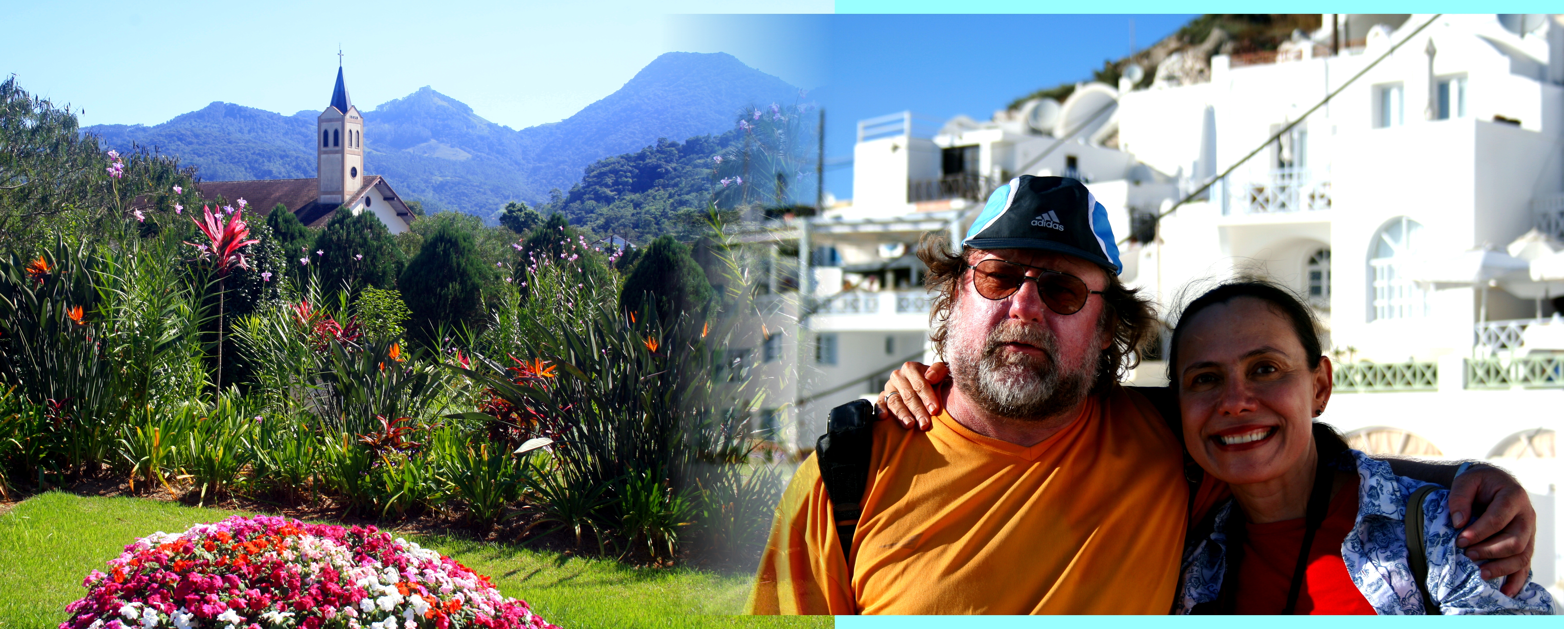
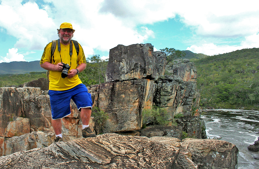
Erich e eu já visitamos várias vezes esse destino e comprovamos que o lugar tem realmente lindas paisagens.

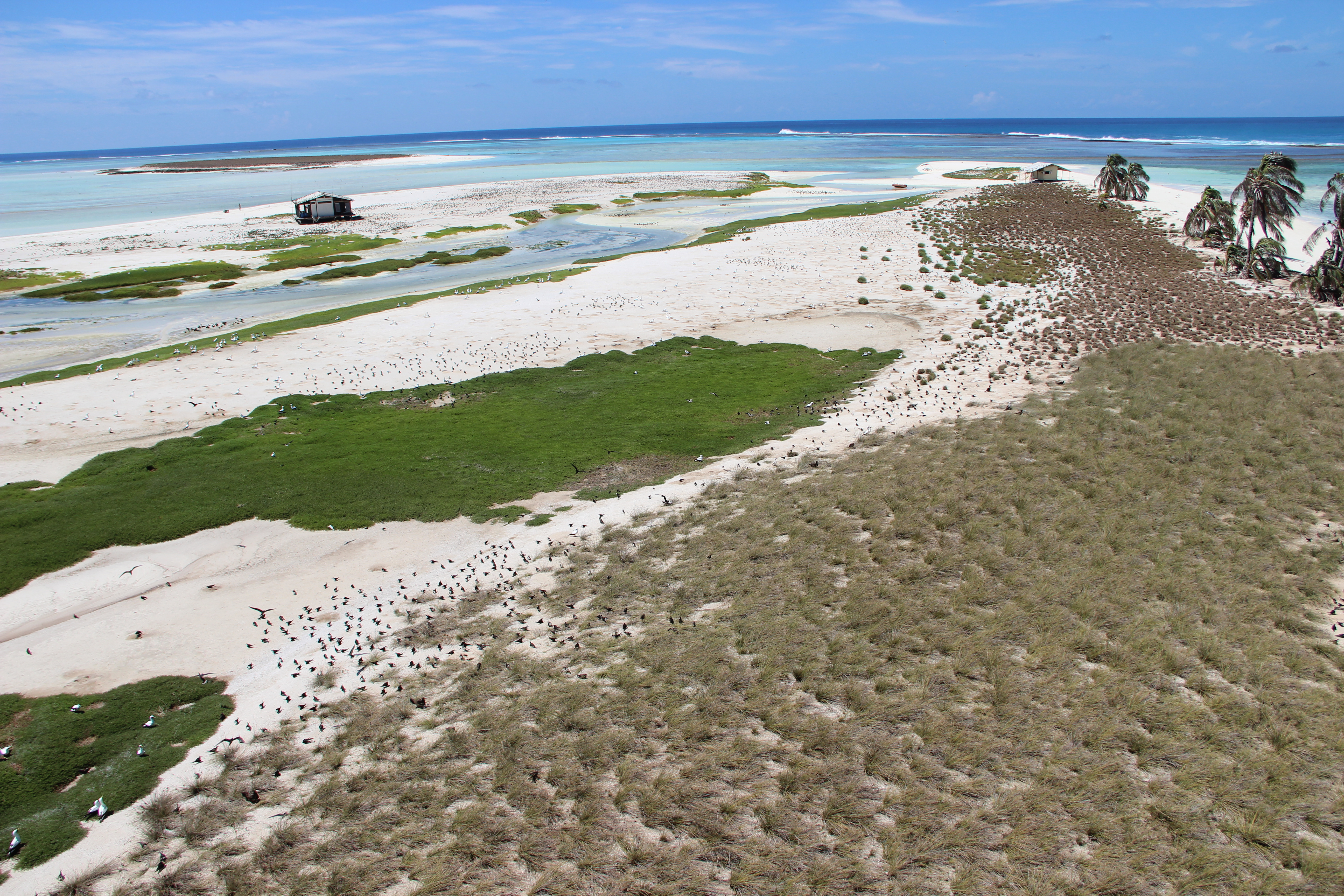
Quando você chega na cidade, do lado esquerda, já é possível apreciar a Baía dos Golfinhos, onde se localiza o porto e a comunidade de pescadores. As Praias da Cacimba e de Bacupari, também conhecida como “Praia do Mar Aberto” constituem belos cenários da costa potiguar.

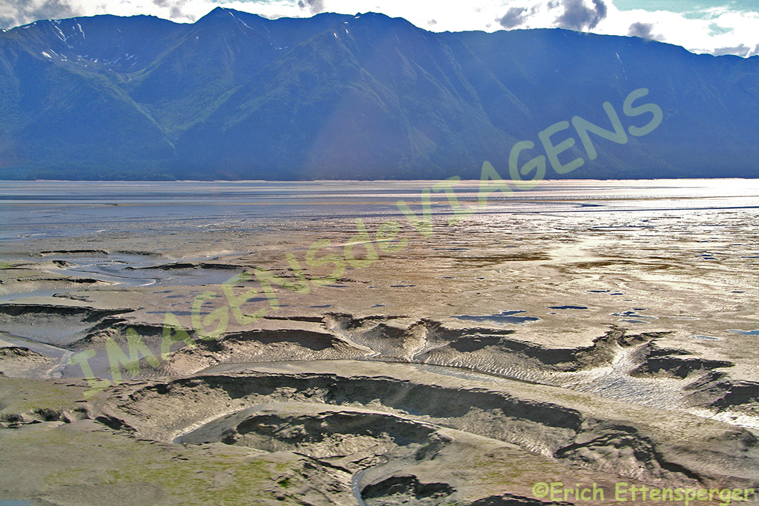
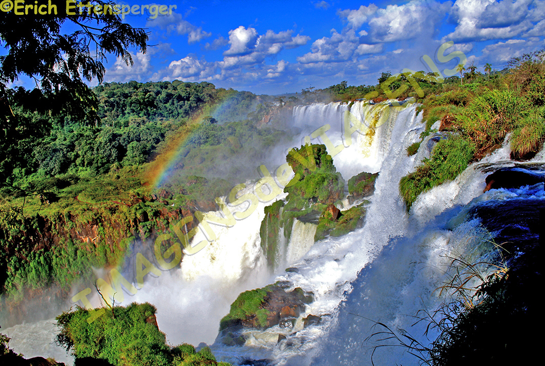
Baía Formosa tem aproximadamente 26 km de praias, sendo algumas quase desertas. Uma das sugestões do blog para quem visita Baía Formosa é realizar o passeio de buggy até a fronteiro do estado do Rio Grande do Norte com a Paraíba. Nesse tour você poderá apreciar lindas praias como a de Bacopari, do Farol, das Barreirinhas, atravessar a comunidade de Sagi e chegar até a Barra do Rio Guaju, onde localiza-se o limite do estado. Nesse passeio também é possível se visitar a Lagoa de Araraquara, também conhecida como Lagoa da Coca-Cola localizada na Reserva Particular do Patrimônio Natural Mata da Estrela Senador Antônio Farias. Essa reserva particular é o maior remanescente de Mata Atlântica sobre dunas no país e com um grande manancial hídrico.

Para quem gosta de surf, sol e mar, é o destino ideal para se curtir alguns dias de tranquilidade e contato com a natureza.

A Viação Riograndense realiza o percurso Natal – Baía Formosa , rota linha 231 saindo do Complexo Rodoviário Severino Tomaz da Silveira (Rodoviária de Natal). Para saber horários e dias, clique aqui.

Se interessou em conhecer Baía Formosa e outras belezas do Rio Grande do Norte? Conheça nossa publicação aquiaqui.

Observação: se você quiser continuar “viajando” com o nosso blog, clique no botão “seguir” localizado no canto inferior direito dessa página. Você também pode “viajar” pelo Brasil conhecendo nosso  livro impresso  66 x Brasil e sua versão digital 66 Belezas do Brasil.Baia Formosa – Paradies des Olympiasiegers

Baía Formosa ist eine Gemeinde in Rio Grande do Norte, die für ihre schönen Strände bekannt ist und etwa 90 km von Natal, 110 km von João Pessoa und 220 km von Recife mit einer Bevölkerung von etwa neuntausend Einwohnern entfernt liegt.

Sie entstand aus einer Fischergemeinde durch den Bau eines bestehenden Hafens in der Bucht. Baía Formosa wurde während der Olympischen Spiele 2021 in Tokio am weltweit bekannt, da hier der Surf-Olympiasieger Ítalo Ferreira geboren wurde, aufwuchs und lebt, wenn er nicht  gerade an Surf-Weltmeisterschaften teilnimmt.

Erich und ich haben dieses Ziel schon mehrfach besucht und möchten belegen, dass der Ort wirklich sehr schöne Landschaften offeriert.

Wenn Sie in der kleinen Stadt ankommen, dann können Sie auf der linken Seite bereits die Baía dos Golfinhos (Delfin-Bucht) bewundern, in der sich der Hafen und die Fischergemeinde selbst befinden. Die Strände von Cacimba und Bacupari, auch bekannt als „Praia do Mar Aberto“ (Strand des offenen Meeres), sind wunderschöne Szenarien an der Küste Potiguar.

Baia Formosa verfügt über etwa 26 km Strände, von denen einige fast menschenleer sind. Einer der Vorschläge unseres Blogs für diejenigen, die Baía Formosa besuchen, ist eine Buggy-Fahrt zur Grenze zwischen dem Bundesstaat Rio Grande do Norte und Paraíba. Auf dieser Tour können Sie wunderschöne Strände wie Bacopari, Farol, Barreirinhas genießen, die Gemeinde Sagi durchqueren und Barra do Rio Guaju erreichen, die Landesgrenze des Bundeslandes.

Auf dieser Tour ist es dann auch möglich, den Lagoa de Araraquara, auch bekannt als Lagoa da Coca-Cola (Coca-Cola See), im privaten Naturerbereservat Mata da Estrela Senador Antônio Farias, zu besuchen. Dieses private Reservat ist der größte Überrest des Atlantischen Regenwaldes auf Dünen des Landes und verfügt über eine große Wasserquelle.

Für all diejenigen, die Surfen, Sonne und das Meer mögen, ist es das ideale Ziel, um ein paar Tage Ruhe und Kontakt mit der Natur zu genießen.

Viação Riograndense betreibt die Route Natal – Baía Formosa, es ist die Linie 231, die vom Severino Tomaz da Silveira Busbahnhof Natal abfährt. Für Uhrzeiten und Tage klicken Sie hier.

Möchten Sie Baía Formosa und andere Schönheiten in Rio Grande do Norte kennenlernen? Entdecken Sie hierzu unsere Publikationen here und  here.

Hinweis: Falls Sie unserem  Blog folgen wollen, dann klicken Sie unten rechts einfach auf “Weiter”, Sie werden dann zukünftig automatisch informiert. Sie können auch durch Brasilien reisen und unser Buch 66 SEHENSWÜRDIGKEITEN IN BRASILIEN  kennenlernen und 66 x Brazil – A Mosaic of Beauties.

Baia Formosa – paradise of the Olympic champion

Baía Formosa is a municipality in Rio Grande do Norte, known for its beautiful beaches, about 90 km from Natal, 110 km from João Pessoa and 220 km from Recife with a population of about nine thousand.

It emerged from a fishing community through the construction of an existing port in the bay. Baía Formosa became known around the world during the 2021 Olympic Games in Tokyo, as this is where the Olympic surfing champion Ítalo Ferreira was born, grew up and lives when he is not participating in the surfing world championships.

Erich and I have already visited this destination several times and would like to prove that the place really offers very beautiful landscapes.

When you arrive in the small town you can already admire the Baía dos Golfinhos (Dolphin Bay) on the left-hand side, where the port and the fishing community itself are located. The beaches of Cacimba and Bacupari, also known as “Praia do Mar Aberto” (beach of the open sea), are beautiful scenarios on the Potiguar coast.

Baia Formosa has about 26 km of beaches, some of which are almost deserted. One of our blog’s suggestions for those visiting Baía Formosa is a buggy ride to the border between the state of Rio Grande do Norte and Paraíba. On this tour you can enjoy beautiful beaches such as Bacopari, Farol, Barreirinhas, traverse Sagi municipality and reach Barra do Rio Guaju, the state border.

On this tour it is then also possible to visit the Lagoa de Araraquara, also known as Lagoa da Coca-Cola (Coca-Cola Lake), in the private natural mountain reserve Mata da Estrela Senador Antônio Farias. This private reserve is the largest remnant of the Atlantic rainforest on dunes in the country and has a large water source.

For those who like surfing, sun and the sea, it is the ideal destination to enjoy a few days of rest and contact with nature.

Viação Riograndense runs the Natal – Baía Formosa route, route line 231 leaving from the Severino Tomaz da Silveira Road Complex (Natal Bus Station). For times and days, click here.

Would you like to get to know Baía Formosa and other beauties in Rio Grande do Norte? Discover our publications here and here.

Note: If you want to follow our “Travels” on the blog, simply click on “Seguir” in the lower right corner, you will be then automatically informed in the future. You can continue traveling with us with our book Brazil´s 66 Beautiful Sites and 66 x Brazil – A Mosaic of Beauties.


Mini Mundo, um parque que encanta crianças e adultos/Mini Mundo, ein Park, der Kinder und Erwachsene begeistert/Mini Mundo, a park that will delight children and adults

Gramado é uma charmosa cidade localizada no estado do Rio Grande do Sul, com uma população estimada de aproximadamente 37 mil habitantes e distante em torno de 117 km da capital Porto Alegre, o que equivale a mais ou menos 1 hora e 40 minutos de viagem.

Ela é visitada por milhares de turistas anualmente, eu e Erich já estivemos lá duas vezes e a visitaremos novamente brevemente.  A época em que Gramado mais visitantes é a partir do mês de outubro até dezembro quando as pessoas a visitam para apreciar a bela decoração natalina e seus eventos característicos desse período. Leia mais sobre a cidade de Gramado aqui.

Gramado possui muitos atrativos turísticos que atendem a diferentes gostos além de uma boa infraestrutura turística. Nesse post vamos enfatizar o parque Mini Mundo.

Trata-se de um parque idealizado por um pai e um avô que quiseram presentear suas duas crianças com um mundo de fantasia em miniatura que encantam até hoje os pequenos e os adultos.

Erich e eu tivemos a oportunidade de conhecer o Mini Mundo quando tivemos o prazer de nos hospedar no Hotel Rita Höppner. O parque fica em frente ao hotel e pertence ao mesmo grupo proprietário desse hotel.

Esse parque possui miniaturas de prédios de diversos lugares do planeta reproduzidos de forma fiel ao edifício original. Eu, como arquiteta, me encantei em apreciá-los. É lindo demais! Trata-se de um passeio agradável ao ar livre (nesse tempo de pandemia, as atividades em espaços abertos são muito bem-vindas) e muito instrutivo!

Além de miniaturas você vai encontrar loja de souvenires, roupas para crianças da grife Mini Mundo, serviço de alimentação, espaço infantil e a oficina onde são produzidas as réplicas dos prédios.

Nesse post apresentamos uma visão geral do que você vai encontrar lá.

Maiores informações sobre o parque Mini Mundo cliquem aqui. 

Observação: se você quiser continuar “viajando” com o nosso blog, clique no botão “seguir” localizado no canto inferior direito dessa página. Você também pode “viajar” pelo Brasil conhecendo nosso  livro impresso  66 x Brasil e sua versão digital 66 Belezas do Brasil.

Mini Mundo, ein Park, der Kinder und Erwachsene begeistert

Gramado ist eine charmante Stadt im Bundesstaat Rio Grande do Sul mit einer geschätzten Bevölkerung von etwa 37.000 Einwohnern und etwa 117 km von der Hauptstadt Porto Alegre entfernt, was einer Fahrtzeit von etwa 1 Stunde und 40 Minuten entspricht.

Es wird jährlich von Tausenden von Touristen besucht, Erich und ich waren schon zweimal dort und werden es bald wieder besuchen.

Die Zeit, in der Gramado mehr Besucher hat, ist von Oktober bis Dezember, wenn die Leute es besuchen, um die schöne Weihnachtsdekoration und die charakteristischen Ereignisse dieser Zeit zu genießen. Lesen Sie hier mehr über die Stadt Gramado.

Gramado hat neben einer guten touristischen Infrastruktur viele touristische Attraktionen für unterschiedliche Geschmäcker zu bieten. In diesem Beitrag werden wir den Mini Mundo Park in den Mittelpunkt stellen.

Es ist ein Park, der von Vater und Großvater konzipiert wurde, die ihren beiden Kindern eine Miniatur-Fantasiewelt präsentieren wollten, die noch heute Kinder und Erwachsene gleichermaßen verzaubert.

Erich und ich hatten die Gelegenheit, das Mini Mundo kennenzulernen, als wir das Vergnügen hatten, im Hotel Rita Höppner zu übernachten. Der Park befindet sich nahe dem Hotel und gehört derselben Gruppe an, die auch dieses Hotel besitzt.

Dieser Park offeriert Miniaturgebäude aus verschiedenen Teilen unseres Planeten, die originalgetreu nachgebaut wurden. Als Architekt freute ich mich darüber und schätzte dies sehr. Es Ist sehr schön!

Es ist ein angenehmer Outdoor-Spaziergang (in dieser Zeit der Pandemie sind Outdoor-Aktivitäten sehr willkommen) und sehr lehrreich!

Neben den Miniaturen finden Sie einen Souvenirshop Kinderbekleidung der Marke Mini Mundo, Gastronomie, einen Kinder-Spielbereich und eine Werkstatt, in der Nachbauten der Gebäude hergestellt werden.

In diesem Beitrag präsentieren wir Ihnen einen kleinen Überblick, was Sie dort finden.

Für weitere Informationen über den Mini Mundo Park klicken Sie hier.

Hinweis: Falls Sie unserem  Blog folgen wollen, dann klicken Sie unten rechts einfach auf “Weiter”, Sie werden dann zukünftig automatisch informiert. Sie können auch durch Brasilien reisen und unser Buch 66 SEHENSWÜRDIGKEITEN IN BRASILIEN  kennenlernen und 66 x Brazil – A Mosaic of Beauties.

Mini Mundo, a park that will delight children and adults

Gramado is a charming town in the state of Rio Grande do Sul, with an estimated population of about 37,000 people and about 117 km from the capital, Porto Alegre, which is about a 1 hour and 40 minute drive away.

It is visited by thousands of tourists every year, Erich and I have been there twice and will visit it again very soon.

The time when Gramado has more visitors is from October to December when people visit to enjoy the beautiful Christmas decorations and characteristic events of that season. Read more about the city of Gramado here.

In addition to a very good tourist infrastructure, Gramado has many tourist attractions to offer for different tastes. In this post we will focus on Mini Mundo Park.

It’s a park that was designed by a father and grandfather who wanted to present to their two children  a miniature fantasy world that still enchants children and also adults alike today.

Erich and I had the opportunity to get to know the Mini Mundo when we had the pleasure of staying at the Hotel Rita Höppner. The park is located near the hotel and belongs to the same group that owns this hotel.

This park offers miniature buildings from different parts of our planet that have been faithfully recreated. As an architect I was happy about it and appreciated it very much. It is very nice!

It’s a fun outdoor stroll (during this time of the pandemic, outdoor activities are very welcome) and very educational!

In addition to the miniatures, you will find a souvenir shop for children’s clothing from the Mini Mundo brand, gastronomy, a children’s play area and a workshop in which replicas of the buildings are made.

In this post we present you a small overview of what you can find there.

For more information about Mini Mundo Park, click here.

Note: If you want to follow our “Travels” on the blog, simply click on “Seguir” in the lower right corner, you will be then automatically informed in the future. You can continue traveling with us with our book Brazil´s 66 Beautiful Sites and 66 x Brazil – A Mosaic of Beauties.  


Natal vista de cima/Natal von oben gesehen/Natal seen from above

Natal é a capital do Rio Grande do Norte e de acordo com o censo do IBGE realizado em 2010 possuía, na época, 803.739 habitantes, com população estimada para o ano de 2020 de 890.480 pessoas.

Natal é o portão de entrada para se conhecer belas paisagens do estado potiguar. Quando estávamos captando imagens para o nosso Guia das Belezas do Rio Grande do Norte e do 66 x Brasil (nosso livro sobre as muitas belezas do nosso país) realizamos um voo de helicóptero para fotografar Natal e seu arredores. São essas imagens que gostaríamos de compartilhar com vocês hoje para que possam ter uma ideia de como essa cidade e seus arredores são bonitos vistos de cima. O fotofilm abaixo é de autoria de Erich Ettensperger.

Observação: se você quiser continuar “viajando” com o nosso blog, clique no botão “seguir” localizado no canto inferior direito dessa página. Você também pode “viajar” pelo Brasil conhecendo nosso  livro impresso  66 x Brasil e sua versão digital 66 Belezas do Brasil.

Natal von oben gesehen

Natal ist die Hauptstadt von Rio Grande do Norte mit einer geschätzten Bevölkerung für das Jahr 2020 von 890.480 Einwohnern.

Natal ist das Gate, um die vielen Schönheiten des Bundesstaates Rio Grande do Norte zu entdecken. Als wir Bilder für unseren Reiseführer Guia das Belezas do Rio Grande do Norte und das Fotobuch 66 x Brazil (unser Buch über die vielen Schönheiten Brasiliens) machten, unternahmen wir u.a. auch einen Helikopterflug, um Natal und seine Umgebung „von oben“ zu fotografieren.

Es sind diese Bilder, die wir heute mit Ihnen teilen möchten, damit Sie sich ein Bild davon machen können, wie schön diese Stadt und ihre Umgebung sind.Der Fotofilm unten ist von Erich Ettensperger.

Hinweis: Falls Sie unserem  Blog folgen wollen, dann klicken Sie unten rechts einfach auf “Weiter”, Sie werden dann zukünftig automatisch informiert. Sie können auch durch Brasilien reisen und unser Buch 66 SEHENSWÜRDIGKEITEN IN BRASILIEN  kennenlernen und 66 x Brazil – A Mosaic of Beauties.

Natal seen from above

Natal is the capital of Rio Grande do Norte with an estimated population of 890,480 in 2020.

Natal is the gate to discover the many beauties of the state of Rio Grande do Norte. When we took pictures for our travel guide Guia das Belezas do Rio Grande do Norte (guide of the beauties of Rio Grande do Norte) and the photo book 66 x Brazil (our book about the many beauties of Brazil), we also took a helicopter flight to photograph Natal and its surroundings “from above”.

Here are now some of these pictures that we want to share with you today so that you can get an idea of how beautiful this city and its surroundings are.The photofilm below is by Erich Ettensperger.

Note: If you want to follow our “Travels” on the blog, simply click on “Seguir” in the lower right corner, you will be then automatically informed in the future. You can continue traveling with us with our book Brazil´s 66 Beautiful Sites and 66 x Brazil – A Mosaic of Beauties.  

Edifício Copan, exemplo de grandiosidade construtiva/Copan Building – ein Beispiel für konstruktive Größe/Copan Building – an example of structural size

São Paulo é uma metrópole que possui tesouros arquitetônicos representativos da história do desenvolvimento da arquitetura brasileira do país. Um dos edifícios mais interessantes é o Edifício Copan localizado na Av. Ipiranga, 200, no bairro da República.

Fonte/Quelle/Source: Google Maps
Fonte/Quelle/Source: https://www.archdaily.com.br/br/876920/classicos-da-arquitetura-edificio-copan-oscar-niemeyer

Trata-se do maior edifício residencial do mundo, segundo o site Travelbook, baseado que o mesmo tem a maior área útil de todos os edifícios residenciais do mundo com seus 116.153 m2, segundo o Guinness Book of Records .

O Jornal da Universidade de São Paulo  o considera como o “maior conjunto de apartamentos residenciais da América Latina.Apesar de ser arquiteta e ter estudado sobre a História da Arquitetura Brasileira, não tinha tomado consciência sobre o tamanho desse prédio até que Erich, comentou comigo sobre um artigo de uma jornalista alemã Angelika Pickardt , que publicou um texto sobre ele no dia 6 de maio de 2021, no site Travelbook.de onde o menciona como o “maior prédio residencial do mundo”.

Erich e eu visitamos esse edifício quando estávamos captando imagens para nosso livro 66 x Brasil. O prédio é muito alto, tem 165 metros e é habitado por cerca de 5000 mil pessoas!!!! Impressionante, não é? O Edifício Copan é como uma pequena cidade e ele tem até Código Postal: 01046-9241.

O projeto é de autoria de Oscar Niemeyer e a obra foi construída entre 1952 e 1966.

Fonte/Quelle/Source: https://www.archdaily.com.br/br/876920/classicos-da-arquitetura-edificio-copan-oscar-niemeyer

Incialmente ele foi projetado para ser um complexo com restaurantes, galerias de artes, cinemas, lojas e até um hotel com 600 apartamentos. A ideia era homenagear São Paulo nos seus 400 anos completados em 1954. Porém, o projeto arquitetônico sofreu modificações que tornaram o edifício diferente da proposta inicial. Acho muito interessante o formato do prédio: a letra “S”.

Foto/Quelle/Source: https://guia.folha.uol.com.br/passeios/2021/01/conheca-roteiro-para-desbravar-o-melhor-da-arquitetura-de-sao-paulo.shtml

O nome COPAN é um acrônimo da Companhia Pan-Americana de Hotéis e Turismo, que o construiu.

Fonte/Quelle/Source: https://www.archdaily.com.br/br/876920/classicos-da-arquitetura-edificio-copan-oscar-niemeyer

Vejam os números sobre esse edifício:

120 mil metros quadrados de área construída

1.160 apartamentos

Capacidade para 10 mil pessoas

Capacidade para população flutuante de 25 mil pessoas

32 andares

06 blocos de apartamentos

02 níveis abaixo da Av. Ipiranga com 221 vagas de garagem

115 metros de altura

72 lojas

01 cinema

19 elevadores

6 mil metros quadrados de vidro

A tipologia dos apartamentos quanto às suas dimensões varia, existem apartamentos com 29 m2 e outros com até 214 m2.

Durante a história de vida desse prédio, ele passou por um período de decadência, porém, isso foi superado.

O Edifício Copan tem um terraço com uma vista espetacular de São Paulo e era muito procurado pelos turistas antes da pandemia.

Enfim, o Edifício Copan é definitivamente um marco na paisagem da capital paulista.FONTES:Travelbook.deJornal da USP de 26/06/2020, Site Archdayly e Dissertação de Mestrado da Arquiteta Carolina Silva Oukawa: “:Edifício Copan: uma análise arquitetônica com inspiração na análise musical”.

Observação: se você quiser continuar “viajando” com o nosso blog, clique no botão “seguir” localizado no canto inferior direito dessa página. Você também pode “viajar” pelo Brasil conhecendo nosso  livro impresso  66 x Brasil e sua versão digital 66 Belezas do Brasil.

Copan Building – ein Beispiel für konstruktive Größe

São Paulo ist eine Metropole mit vielen architektonischen Schätzen, die für die Geschichte der Entwicklung der brasilianischen Architektur im Land repräsentativ sind. Eines der interessantesten Gebäude ist das Copan-Gebäude in der Av. Ipiranga, 200, im Viertel República.

Fonte/Quelle/Source: Google Maps
Fonte/Quelle/Source: https://www.archdaily.com.br/br/876920/classicos-da-arquitetura-edificio-copan-oscar-niemeyer

Laut der Travelbook-Website ist es das größte Wohngebäude der Welt, basierend auf der Tatsache, dass es laut Guinness-Buch der Rekorde mit 116.153 m2 die größte Grundfläche aller Wohngebäude der Welt hat.

Das Journal der Universität von São Paulo betrachtet es als die „größte Gruppe von Wohn-Appartements in Lateinamerika.

Obwohl ich Architektin bin und die Geschichte der brasilianischen Architektur studiert habe, wurde mir die Größe dieses Gebäudes erst bewusst, als Erich einen Artikel der deutschen Journalistin Angelika Pickardt kommentierte, die es am 6. Mai 2021 auf der Travelbook.de-Website als das „größte Wohngebäude der Welt“ bezeichnete.

Erich und ich besuchten dieses Gebäude, als wir Fotos für unser Buch 66 x Brasilien machten. Das Gebäude ist 165 Meter hoch und beherbergt etwa 5.000 Menschen!!!!  Sehr beeindruckend, nicht wahr? Das Copan-Gebäude ist wie eine kleine Stadt und verfügt sogar über eine eigene Postleitzahl: 01046-9241.

Das Projekt wurde von Stararchitekt Oscar Niemeyer entworfen und zwischen 1952 und 1966 gebaut.

Fonte/Quelle/Source: https://www.archdaily.com.br/br/876920/classicos-da-arquitetura-edificio-copan-oscar-niemeyer

Ursprünglich war es ein Komplex mit Restaurants, Kunstgalerien, Kinos, Geschäften und sogar einem Hotel mit 600 Wohnungen. Die Idee war eine Ehrung São Paulos anlässlich seines 400. Geburtstages im Jahre 1954. Das Architekturprojekt wurde jedoch geändert, wodurch sich das Gebäude dann folglich vom ursprünglichen Vorschlag unterschied. Ich persönlich finde die Form des Gebäudes sehr interessant: der Buchstabe “S” ist darin erkennbar.

Foto/Quelle/Source: https://guia.folha.uol.com.br/passeios/2021/01/conheca-roteiro-para-desbravar-o-melhor-da-arquitetura-de-sao-paulo.shtml

Der Name COPAN ist eine Abkürzung für die Pan American Hotel and Tourism Company, die es gebaut hat.

Fonte/Quelle/Source: https://www.archdaily.com.br/br/876920/classicos-da-arquitetura-edificio-copan-oscar-niemeyer

Hier die Zahlen zu diesem Gebäude:

120 Tausend Quadratmeter bebaute Fläche

1.160 Wohnungen

Kapazität für 10 Tausend Menschen

Publikums-Kapazität von 25.000 Menschen

32 Stockwerke

6 Wohnblöcke

2 Ebenen unter der Av. Ipiranga mit 221 Parkplätzen

115 Meter hoch

72 Geschäfte

1 Kino

19 Aufzüge

6 Tausend Quadratmeter Glas

Die Typologie der Wohnungen in Bezug auf ihre Gröβe variiert, es gibt Wohnungen mit 29 m2 und andere mit bis zu 214 m2.

Während der Lebensgeschichte dieses Gebäudes hat es eine Phase des Verfalls durchlaufen, die jedoch überwunden wurde.

Edificio Copan hat eine Terrasse mit spektakulärem Blick auf São Paulo und war vor der Pandemie bei Touristen sehr beliebt.

Schließlich ist das Copan-Gebäude definitiv ein Wahrzeichen im „Häusermeer“ der Hauptstadt São Paulo.

Fonte

QUELLE:Travelbook.de, Jornal da USP de 26/06/2020, Site Archdayly e Dissertação de Mestrado da Arquiteta Carolina Silva Oukawa: “:Edifício Copan: uma análise arquitetônica com inspiração na análise musical”.

Hinweis: Falls Sie unserem  Blog folgen wollen, dann klicken Sie unten rechts einfach auf “Weiter”, Sie werden dann zukünftig automatisch informiert. Sie können auch durch Brasilien reisen und unser Buch 66 SEHENSWÜRDIGKEITEN IN BRASILIEN  kennenlernen und 66 x Brazil – A Mosaic of Beauties.

Copan Building – an example of structural size

São Paulo is a metropolis with many architectural treasures  representing  the history of the development of Brazilian architecture. One of the most interesting buildings is the Copan Building on Av. Ipiranga, 200, in the República district.

Fonte/Quelle/Source: Google Maps
Fonte/Quelle/Source: https://www.archdaily.com.br/br/876920/classicos-da-arquitetura-edificio-copan-oscar-niemeyer

According to the Travelbook website is it the largest residential building in the world based on the fact that, according to the Guinness Book of Records, it has the largest floor space of any residential building in the world at 116,153 square meters.

The Journal of the University of São Paulo regards it as the “largest group of residential apartments in Latin America.

Although I am an architect and have studied the history of Brazilian architecture, I only became aware of the size of this building when Erich commented on an article by the German journalist Angelika Pickardt, who published it on the Travelbook.de website on May 6, 2021 as the “ largest residential building in the world ”.

Erich and I visited this building when we were taking photos for our book 66 x Brazil. The building is 165 meters high and houses around 5,000 people!!!! Very impressive, isn’t it? The Copan building is like a small town and even has its own zip code: 01046-9241.

The project was designed by star architect Oscar Niemeyer and built between 1952 and 1966.

Fonte/Quelle/Source: https://www.archdaily.com.br/br/876920/classicos-da-arquitetura-edificio-copan-oscar-niemeyer

Originally it was a complex of restaurants, art galleries, cinemas, shops and even a hotel with 600 apartments. The idea was to honor São Paulo on the occasion of its 400th birthday in 1954. However, the architectural project was changed, which means that the building then became differed from the original proposal. Personally, I find the shape of the building very interesting: the letter “S” can be seen in it.

Foto/Quelle/Source: https://guia.folha.uol.com.br/passeios/2021/01/conheca-roteiro-para-desbravar-o-melhor-da-arquitetura-de-sao-paulo.shtml

The name COPAN is an abbreviation for the Pan American Hotel and Tourism Company who built it.

Fonte/Quelle/Source: https://www.archdaily.com.br/br/876920/classicos-da-arquitetura-edificio-copan-oscar-niemeyer

Here now some numbers regarding this building:

120 thousand square meters of built area

1,160 apartments

Capacity for 10 thousand people

Audience capacity of 25,000 people

32 floors

6 blocks of flats

2 levels below Av. Ipiranga with 221 parking spaces

115 meters high

72 shops

1 cinema

19 elevators

6 thousand square meters of glass

The typology of the apartments varies according to their size, there are apartments with 29 m2 and others with up to 214 m2.

During the life story of this building it went through a phase of decay, but this was overcome.

Edificio Copan has a terrace with spectacular views of São Paulo and was very popular under tourists before the pandemic.

After all, the Copan building is definitely a landmark in the „sea of houses“ in the capital São Paulo.

Fonte

Sources: Travelbook.deJornal da USP de 26/06/2020, Site Archdayly e Dissertação de Mestrado da Arquiteta Carolina Silva Oukawa: “:Edifício Copan: uma análise arquitetônica com inspiração na análise musical”.

Note: If you want to follow our “Travels” on the blog, simply click on “Seguir” in the lower right corner, you will be then automatically informed in the future. You can continue traveling with us with our book Brazil´s 66 Beautiful Sites and 66 x Brazil – A Mosaic of Beauties.  


TIRADENTES, PRECIOSIDADE MINEIRA/TIRADENTEN – EIN SCHATZ DES BERGBAUS/TIRADENTES – A MINING TREASURE

O nosso Brasil cheio de cores e belas paisagens possui cidadezinhas incríveis com um rico patrimônio histórico que valem a visita! Tiradentes, localizada a aproximadamente 195 km (em torno de 3 horas e 20 minutos) de Belo Horizonte é uma delas. O lugar é charmoso, tem eventos que atraem milhares de visitantes e é um destino amado pelos mineiros. Tiradentes, com aproximadamente 7000 mil habitantes, integra o conhecido circuito turístico de Minas Gerais denominado “Trilha dos Inconfidentes” da região da Estrada Real.

Fonte/Quelle/Source: Google Maps

Tiradentes, fundada por volta de 1702, possui um rico conjunto arquitetônico e urbanístico, no qual se destacam a Igreja de Nossa Senhora do Rosário e a Matriz de Santo Antônio,

sendo que o frontispício dessa igreja foi um dos últimos trabalhos do grande Aleijadinho.  Além desses monumentos há outros edifícios interessantes como a Capela do Bom Jesus da Pobreza, o Chafariz de São José, dentre outros.

A cidade já serviu de locação para as minisséries Hilda Furação, Memorial de Maria Moura, do filme Menino Maluquinho, das novelas Coração de Estudante. As ruas de Tiradentes aparecem na mais nova novela Global “Espelho da Vida”. Algumas cenas do filme “Chico Xavier também foram filmadas lá.

O coração da cidade está localizado no Largo das Forras onde estão localizadas pousadas, lojas, restaurantes em seu entorno. É muito agradável caminhar nessa área, você pode até fazer um passeio de charrete.

Tiradentes atrai muitos turistas no mês de janeiro quando é realizado o famoso Festival de Cinema. Em agosto é realizado o Festival Gastronômico.

Erich e eu estivemos em Tiradentes para captar imagens para nosso livro 66 x Brasil e eu, como arquiteta, fiquei encantada, é um lugar para você sempre voltar para passear naquelas ruas que nos transportam para uma outra época.

Realizamos um passeio muito agradável no trem Maria Fumaça que realiza uma viagem de 12 km entre Tiradentes e São Del Rey, cidade do presidente Tancredo Neves, onde visitamos a bela Igreja de São Francisco de Assis e passeamos pelo centro histórico.

No entorno de Tiradentes, na região do Campo das Vertentes (Ritápolis, Resende Costa, Bichinho, Carrancas, entre outras), há possibilidade de se realizar atividades de ecoturismo como a visita a grutas, realização de trilhas, rapel, passeios de bicicletas, além de outros.

Tiradentes é definitivamente um destino brasileiro que vale a visita, principalmente para os que apreciam história e cultura.

Para conhecer mais sobre Tiradentes, clique aqui.

Nota: Visitamos Tiradentes antes da pandemia, portanto, sabemos que a cidade e o mundo somente voltarão ao seu ritmo normal após o término dessa pandemia.

Observação: se você quiser continuar “viajando” com o nosso blog, clique no botão “seguir” localizado no canto inferior direito dessa página. Você também pode “viajar”pelo Brasil conhecendo nosso  livro impresso  66 x Brasil e sua versão digital 66 Belezas do Brasil.TIRADENTEN – EIN SCHATZ DES BERGBAUS

Unser Brasilien voller Farben und wunderschöner Landschaften hat unglaubliche Städte mit einem reichen historischen Erbe, die einen Besuch wert sind!

Tiradentes, ungefähr 195 km (ungefähr 3 Stunden und 20 Minuten) von Belo Horizonte entfernt, ist eine von ihnen. Der Ort ist charmant, offeriert Veranstaltungen, die Tausende von Besuchern anziehen und ist ein Ziel, das von Bergleuten geliebt wird.

Tiradentes mit rund 7.000 Einwohnern ist Teil des bekannten Touristenkreises von Minas Gerais namens „Trilha dos Inconfidentes“ in der Region Estrada Real.

Fonte/Quelle/Source: Google Maps

Tiradentes wurde um 1702 gegründet und verfügt über einen reichen architektonischen und städtischen Komplex, aus welchem die Kirche Nossa Senhora do Rosário und die Matriz de Santo Antônio hervorstechen.

Das Titelfoto* dieser Kirche war eines der letzten Werke des großen Aleijadinho. Neben diesen Denkmälern gibt es weitere interessante Gebäude wie die Kapelle von Bom Jesus da Pobreza und die Chafariz de São José. (Brunnen)

Die Stadt diente bereits als Drehort für die Miniserie Hilda Furação, Denkmal für Maria Moura, aus dem Film Menino Maluquinho, aus den Seifenopern Coração de Estudante.

Die Straßen von Tiradentes erscheinen in der neuesten globalen Seifenoper „Mirror of Life“. Dort wurden auch einige Szenen aus dem Film „Chico Xavier“ gedreht.

Das Herz der Stadt befindet sich im Largo das Forras, wo sich viele Gasthäuser, Geschäfte und Restaurants   befinden. Es ist sehr angenehm in dieser Gegend spazieren zu gehen, man kann sogar Kutschfahrten unternehmen.

Tiradentes zieht im Januar viele Touristen an, wenn das berühmte Filmfestival stattfindet. Im August findet ein Gastronomie-Festival statt.

Erich und ich besuchten Tiradentes, um Bilder für unser Buch 66 x Brasilien aufzunehmen, und ich als Architekt war begeistert, es ist ein Ort, an dem Sie immer wieder in den Straßen herumbummeln können, ein Sprung in eine andere Zeit.

Wir genossen eine sehr angenehme Fahrt auf dem Maria Fumaça-Zug, eine 12 km lange Fahrt zwischen Tiradentes und São Del Rey, der Stadt von Präsident Tancredo Neves, wo wir die wunderschöne Kirche von São Francisco de Assis besuchten und durch das historische Zentrum schlenderten.

In der Umgebung von Tiradentes, in der Region Campo das Vertentes (unter anderen Ritápolis, Resende Costa, Bichinho, Carrancas), besteht die Möglichkeit für Ökotourismus-Aktivitäten wie Höhlenbesuche, Wandern, Abseilen, Radtouren usw.

Tiradentes ist definitiv ein brasilianisches Reiseziel, das einen Besuch wert ist, insbesondere für diejenigen, die Geschichte und Kultur schätzen.

Hinweis: Falls Sie unserem  Blog folgen wollen, dann klicken Sie unten rechts einfach auf “Weiter”, Sie werden dann zukünftig automatisch informiert. Sie können auch durch Brasilien reisen und unser Buch 66 SEHENSWÜRDIGKEITEN IN BRASILIEN  kennenlernen und 66 x Brazil – A Mosaic of Beauties.

TIRADENTES – A MINING TREASURE

Our Brazil, full of colors and beautiful landscapes, has incredible cities with a rich historical heritage that are well worth a visit!

Tiradentes, about 195 km (about 3 hours and 20 minutes) from Belo Horizonte, is one of them. The place is charming, hosts events that draw thousands of visitors, and is a destination loved by miners.

Tiradentes with around 7,000 inhabitants is part of the well-known tourist circle of Minas Gerais called “Trilha dos Inconfidentes” in the Estrada Real region.

Fonte/Quelle/Source: Google Maps

Tiradentes was founded around 1702 and has a rich architectural and urban complex, of which the Church of Nossa Senhora do Rosário and the Matriz de Santo Antônio stand out.

The cover photo * of this church was one of the last works of the great Aleijadinho. In addition to these monuments, there are other interesting buildings such as the Chapel of Bom Jesus da Pobreza and the Chafariz de São José. (Fountain)

The city has already been used as a location for the mini-series Hilda Furação, Monument to Maria Moura, from the movie Menino Maluquinho, from the soap operas Coração de Estudante.

The streets of Tiradentes appear in the latest global soap opera, Mirror of Life. Some scenes from the film “Chico Xavier” were also shot there.

The heart of the city is in Largo das Forras, where there are many inns, shops and restaurants. It is very pleasant to walk in this area, you can even take a horse-drawn carriage ride.

Tiradentes attracts a lot of tourists in January when the famous film festival is held. A gastronomy festival takes place in August.

Erich and I visited Tiradentes to take pictures for our book 66 x Brazil, and as an architect I was thrilled, it’s a place where you can stroll around the streets again and again, a jump into another time.

We enjoyed a very pleasant ride on the Maria Fumaça train, a 12 km journey between Tiradentes and São Del Rey, the city of President Tancredo Neves, where we visited the beautiful church of São Francisco de Assis and strolled through the historic center.

In the surroundings of Tiradentes, in the Campo das Vertentes region (among others Ritápolis, Resende Costa, Bichinho, Carrancas) there is the possibility of ecotourism activities such as visiting caves, hiking, abseiling, cycling etc.

Tiradentes is definitely a Brazilian destination worth visiting, especially for those who appreciate history and culture.

Note: If you want to follow our “Travels” on the blog, simply click on “Seguir” in the lower right corner, you will be then automatically informed in the future. You can continue traveling with us with our book Brazil´s 66 Beautiful Sites and 66 x Brazil – A Mosaic of Beauties.  


Parque nacional chapada dos veadeiros/Chapada dos Veadeiros Nationalpark – Überschwang des Cerrado/Chapada dos Veadeiros National Park – Exuberance of the Cerrado

Você é um(a) amante da natureza? Você aprecia belas flores? Você gosta de conhecer lugares especiais? Se respondeu sim para as três perguntas, então sugiro, que quando a pandemia terminar, arrume as malas, se vacine contra febre amarela (recomendação do parque) e vá conhecer o Parque Nacional Chapada dos Veadeiros na época da floração das plantas do cerrado.


O Parque Nacional Chapada dos Veadeiros foi criado em 1961 e declarado Patrimônio Mundial da Humanidade pela UNESCO em 2001 e a entrada está distante cerca de 260 km de Brasília.

Ele está situado na parte nordeste do estado de Goiás, entre os municípios de São João d´Aliança, Nova Roma, Teresina de Goiás, Cavalcante e Alto Paraíso de Goiás.

De acordo com o ICMBIO, ele possui uma área de 240.611 hectares com vegetação predominante tipo cerrado de altitude, possui rochas com mais de um bilhão de anos, muitas nascentes e cursos d´água, além de paisagens espetaculares. Esse parque abrange áreas dos municípios de Cavalcante, Alto Paraíso de Goiás, Colinas do Sul e Teresina de Goiás.


O Parque Nacional Chapada dos Veadeiros possui como principais atrativos: a Trilha dos Cânions e Cariocas, a Trilha Seriema, a Travessia das Sete Quedas. Carrossel e Corredeiras e a Trilha dos Saltos.

O lugar é tão bonito! Você pode realizar caminhadas,

observar fauna e flora,


tomar banho de rio e cachoeira, realizar um acampamento rústico, realizar canionismo, escalada ou simplesmente contemplar as belíssimas paisagens.

Visitamos esse belo parque quando estávamos captando imagens para nosso livro 66 x Brasil. Voamos até Brasília, alugamos um carro e seguimos até Alto Paraíso de Goiás, onde nos hospedamos. De lá até a entrada do parque, no distrito de São Jorge, são 36 km de Alto Paraíso.

Tivemos o prazer de realizar uma caminhada cheia de belos cenários pela Trilha dos Cânions e Cariocas (12 km ida e volta).

O percurso é plano, pedregoso e sem muitos aclives. Durante nossa visita, o cerrado estava colorido, com muitas flores e ficamos realmente impressionados com a beleza desse bioma espetacular que é o cerrado.


Se você quiser conhecer mais sobre o Parque Nacional Chapada dos Veadeiros, clique aqui.

Dica para visitar o parque:

A época de seca se estende de maio a outubro e a de chuvas, de novembro a abril.

Observação: se você quiser continuar “viajando” com o nosso blog, clique no botão “seguir” localizado no canto inferior direito dessa página. Você também pode “viajar” pelo Brasil conhecendo nosso  livro impresso  66 x Brasil e sua versão digital 66 Belezas do Brasil.

Chapada dos Veadeiros Nationalpark – Überschwang des Cerrado

Bist du ein Naturliebhaber? Schätzen Sie schöne Blumen/Pflanzen? Möchten Sie besondere Orte kennenlernen? Wenn Sie alle drei Fragen mit Ja beantwortet haben, schlage ich vor, dass Sie nach dem Ende der Pandemie Ihre Koffer packen, sich gegen Gelbfieber impfen lassen (Parkempfehlung) und zum Nationalpark Chapada dos Veadeiros reisen, dann, wenn die Cerrado-Pflanzen (Pfanzen der Savannen) blühen.

Der Nationalpark Chapada dos Veadeiros wurde 1961 gegründet und 2001 von der UNESCO zum Weltkulturerbe erklärt. Der Eingang liegt etwa 260 km von Brasilia entfernt.

Er befindet sich im nordöstlichen Teil des Bundesstaates Goiás zwischen den Gemeinden São João d´Aliança, Nova Roma, Teresina de Goiás, Cavalcante und Alto Paraíso de Goiás.

Laut ICMBIO hat verfügt er über eine Fläche von 240.611 Hektar mit überwiegend vegetativem Cerrado in der Höhe, er hat Felsen mit einem Alter von mehr als einer Milliarde Jahren, viele Quellen und Wasserläufe sowie weiterespektakuläre Landschaften. Dieser Park umfasst Gebiete in den Gemeinden Cavalcante, Alto Paraíso de Goiás, Colinas do Sul und Teresina de Goiás.

Der Chapada dos Veadeiros Nationalpark hat als Hauptattraktionen: den Wanderpfad der Schluchten und Cariocas, den Seriema Weg, die Travessia das Sete Quedas. Karussell und Stromschnellen und der Wander-Weg von Saltos.

Der Ort ist so schön! Sie können wandern,

Fauna und Flora beobachten,

im Fluss und im Wasserfall baden, in ein rustikales Camp gehen, Canyoning betreiben, klettern oder einfach die wunderschönen Landschaften betrachten und geniessen.

Wir haben diesen wunderschönen Park besucht, als wir Bilder für unser Buch 66 x Brasilien aufgenommen haben. Wir flogen nach Brasilia, mieteten ein Auto und fuhren weiter nach Alto Paraíso de Goiás, wo wir übernachteten. Von dort aus bis zum Parkeingang im Ortsteil São Jorge sind es 36 km.

Wir hatten das Vergnügen eine Wanderung voller wunderschöner Landschaften entlang des Canyons und Cariocas Trails (12 km Hin- und Zurück) zu unternehmen.

Die Strecke ist flach, felsig und ohne viele Anstiege. Während unseres Besuches war der Cerrado (Savannen) bunt, mit vielen Blumen und wir waren wirklich beeindruckt von der Schönheit dieses spektakulären Bioms, das der Cerrado ist.

Wenn Sie mehr über den Nationalpark Chapada dos Veadeiros erfahren möchten, klicken Sie hier.

Tipp für den Besuch des Parks:

Die Trockenzeit erstreckt sich von Mai bis Oktober und die Regenzeit von November bis April.

Hinweis: Falls Sie unserem  Blog folgen wollen, dann klicken Sie unten rechts einfach auf “Weiter”, Sie werden dann zukünftig automatisch informiert. Sie können auch durch Brasilien reisen und unser Buch 66 SEHENSWÜRDIGKEITEN IN BRASILIEN  kennenlernen und 66 x Brazil – A Mosaic of Beauties.

Chapada dos Veadeiros National Park – Exuberance of the Cerrado

Are you a nature lover? Do you value beautiful flowers / plants? Would you like to get to know special places? If you answered yes to all three questions, I suggest that after the end of the pandemic, you pack your bags, get vaccinated against yellow fever (park recommendation) and travel to the Chapada dos Veadeiros National Park when the cerrado plants (plants of the savannahs) bloom.

The Chapada dos Veadeiros National Park was established in 1961 and declared a World Heritage Site by UNESCO in 2001. The entrance is about 260 km from Brasilia.

It is located in the northeastern part of the state of Goiás between the municipalities of São João d´Aliança, Nova Roma, Teresina de Goiás, Cavalcante and Alto Paraíso de Goiás.

According to ICMBIO it has an area of 240,611 hectares with mostly vegetative cerrado in height, it has rocks that are more than a billion years old, many springs and watercourses, and other spectacular landscapes. This park includes areas in the municipalities of Cavalcante, Alto Paraíso de Goiás, Colinas do Sul and Teresina de Goiás.

The Chapada dos Veadeiros National Park has as main attractions: the hiking trail of the gorges and Cariocas, the Seriema way, the Travessia das Sete Quedas. Carousel and rapids and the Saltos hiking trail.

The place is so beautiful! You can hike,

observe fauna and flora,

bathe in the river and waterfalls, go to a rustic camp, do canyoning, climb or simply look at and enjoy the beautiful landscapes.

We visited this beautiful park when we were taking pictures for our book 66 x Brazil. We flew to Brasilia, rented a car and drove on to Alto Paraíso de Goiás, where we stayed overnight. From there to the park entrance in the São Jorge district it is 36 km.

We had the pleasure of going on a hike full of beautiful landscapes along the Canyon and Cariocas Trails  (12km round trip).

The route is flat, rocky and without many climbs. During our visit the cerrado (savannah) was colorful, with lots of flowers and we were really impressed by the beauty of this spectacular biome that the cerrado is.

If you want to learn more about the Chapada dos Veadeiros National Park, click here.

Tip for visiting the park:

The dry season extends from May to October and the rainy season from November to April.

Note: If you want to follow our “Travels” on the blog, simply click on “Seguir” in the lower right corner, you will be then automatically informed in the future. You can continue traveling with us with our book Brazil´s 66 Beautiful Sites and 66 x Brazil – A Mosaic of Beauties.  

Do Parque Denali ao Oceano Pacífico, no Alasca/VOM DENALI-PARK ZUM PAZIFIK IN ALASKA/FROM DENALI PARK TO THE PACIFIC IN ALASKA

Realizamos uma viagem muito interessante entre o Parque Nacional e Reserva Denali (constituído de 2,4 milhões de hectares de terra selvagem, incluindo o ponto mais alto da América do Norte, o Monte McKinley), com 6190 metros de altura), e o porto de Whittier, localizado na cidade de mesmo nome, no distrito de Valdez-Cordova, onde embarcamos numa viagem de cruzeiro.

Realizamos esse trajeto inicialmente de ônibus,

pernoitamos duas noites na cidade de Talkeetna,

onde realizamos um tour sobre “História e Natureza da Região”, onde também aprendemos sobre o povo, a língua, as cidades do Alasca, além de apreciar belas paisagens.

Além disso, também obtivemos informações sobre a profissão de “bush pilots”,que são pilotos que voam em pequenas aeronaves para lugares remotos do Alasca, locais onde não chegam automóveis, trens ou outro tipo de transporte terrestre. Eles desempenham um papel relevante, salvando vidas, resgatando pessoas em perigo, transportando pessoas que vivem longe de hospitais, atendendo emergências médicas. Eles pilotam aviões frágeis, mas, com tecnologia avançada. Muitos deles já perderam suas vidas. O termo “bush” se refere às áreas remotas. Continuamos a viagem no dia seguinte de trem.

Vale ressaltar a beleza do trem panorâmico, com um teto de vidro onde é possível ver toda a beleza do percurso, incluindo o céu, claro, que compreende 300 milhas (482,80 km).

O roteiro é preenchido por paisagens deslumbrantes onde foi possível avistar áreas de tundra e florestas de abeto, característicos do norte do Alaska, além de percorrer áreas que são inacessíveis de automóvel.

Erich e eu ficamos impressionados com a exuberância da vegetação. O percurso do trem seguiu margeando o rio e a rota é pontilhada com lagos, montanhas e muito verde.

Há momentos que passamos também áreas onde as pessoas têm casas nas margens do lago. Na rota do trem, já próximo ao final,

passamos por Anchorage e seguimos ao longo da trilha Coastal Trail, pelo menos em uma parte. A paisagem é deslumbrante.

Antes de chegar a Whittier atravessamos o Túnel Anton Anderson Memorial e continuamos através de uma visão panorâmica espetacular! Vale ressaltar que esse túnel é o túnel rodoviário mais longo (2,5 milhas/4,02 km) da América do Norte e o primeiro projetado para temperaturas de -40 Fahrenheit e ventos de 150 mph!

Até chegar a Whittier, a visão panorâmica é espetacular! Chegamos ao porto de Whitter e de lá embarcamos para a viagem em um cruzeiro, da Princess Cruises, pelo Alaska. Há dois portos para partidas de cruzeiros. O porto de Whittier é usado pela Princess Cruises e Holland America Cruise Line, enquanto os passageiros dos cruzeiros Celebrity, Royal Caribbean Cruise Line (RCCL), Norwegian Cruise Line (NCL), Regent Seven Seas Cruises e outros utilizam o porto de Seward.

Definitivamente viajar pelo Alasca é uma experiência definitivamente inesquecível!

Observação: se você quiser continuar “viajando” com o nosso blog, clique no botão “seguir” localizado no canto inferior direito dessa página. Você também pode “viajar” pelo Brasil conhecendo nosso  livro impresso  66 x Brasil e sua versão digital 66 Belezas do Brasil.

VOM DENALI-PARK ZUM PAZIFIK IN ALASKA

Wir machten eine sehr interessante Reise vom Denali-Nationalpark und dem Denali-Reservat (bestehend aus 2,4 Millionen Hektar wildem Land einschließlich des höchsten Berges in Nordamerika, dem Mount McKinley mit 6190 Metern) und dem Hafen Whittier im Bezirk Valdez-Cordova, von wo aus wir eine Alaska-Kreuzfahrt unternahmen.

Diese Reise begann zunächst mit dem Bus,

dann verbrachten wir zwei Nächte in der Stadt Talkeetna,

von wo aus wir eine Tour namens „Geschichte und Natur der Region“ machten, bei welcher wir neben vielen Informationen über die Menschen, die Sprache und die Städte Alaskas auch sehr schöne Landschaften genießen durften.

Darüber hinaus erfuhren wir viel über den Beruf der “Buschpiloten”, bei denen es sich um Piloten handelt, die kleine Flugzeuge zu total abgelegenen Orten in Alaska fliegen, wo Autos, Züge oder andere Landtransporte nicht hinkommen können. Sie spielen eine wichtige Rolle, retten Leben, retten Menschen in Not, transportieren Menschen, die weit entfernt von Krankenhäusern leben, und nehmen an medizinischen Notfällen teil. Sie fliegen zerbrechliche Flugzeuge jedoch mit fortschrittlicher Technologie. Viele von ihnen verloren hierbei auch ihr Leben. Der Begriff “Busch” bezieht sich auf  diese total abgelegenen Gebiete.

Am nächsten Tag setzten wir dann unsere Reise mit einem Zug fort.

Erwähnenswert ist die Schönheit des Panoramazuges mit einem Glasdach, durch welches Sie die ganze Schönheit dieser 482,8 km langen Strecke genieen können.

Die Reiseroute ist voller atemberaubender Landschaften, in denen es uns möglich war, Regionen mit Tundra- und Tannenwäldern zu sehen, die für Nordalaska charakteristisch sind, sowie Gegenden zu bereisen, welche mit dem Auto nicht erreichbar sind.

Erich und ich waren beeindruckt von der Überschwänglichkeit der Vegetation. Die Zugfahrt führte weiter entlang Flüssen, vielen Seen, Bergen, Häusern an Seeufern  und viel Grün.

Wir passierten Anchorage, dem Ausgangspunkt unserer Reise in Alaska,

 und folgten zumindest teilweise dem Coastal Trail. Die Landschaft ist atemberaubend.

Bevor wir Whittier erreichten durchquerten wir den Anton Anderson Memorial Tunnel, uns eröffneten sich spektakuläre Panoramaausblicke! Es ist erwähnenswert, dass dieser Tunnel der längste Straßentunnel (4,02 km) in Nordamerika ist, der für Temperaturen von -40 Fahrenheit und Winde von 150 Meilen pro Stunde ausgelegt ist!

In Whitter gibt es zwei Häfen für Kreuzfahrtschiffe. Der Hafen von Whittier wird von Princess Cruises und Holland America Cruise Line genutzt, während Passagiere von Celebrity Cruises, Royal Caribbean Cruise Line (RCCL), Norwegian Cruise Line (NCL), Regent Seven Seas Cruises den anderen Hafen von Seward nutzen.

Auf jeden Fall sind Reisen in Alaska ein unvergessliches Erlebnis!

Hinweis: Falls Sie unserem  Blog folgen wollen, dann klicken Sie unten rechts einfach auf “Weiter”, Sie werden dann zukünftig automatisch informiert. Sie können auch durch Brasilien reisen und unser Buch 66 SEHENSWÜRDIGKEITEN IN BRASILIEN  kennenlernen und 66 x Brazil – A Mosaic of Beauties.

FROM DENALI PARK TO THE PACIFIC IN ALASKA

We made a very interesting trip from Denali National Park and Denali Reserve (consisting of 2.4 million acres of wild land including the highest mountain in North America, Mount McKinley wit 6,190 meters) and Port Whittier in the Valdez-Cordova district, from where we took an Alaska cruise.

This trip started first with the bus,

then we spent two nights in the city of Talkeetna,

from where we did a tour called “History and Nature of the Region”, during which beside getting a lot of information about the people, the language and the cities of Alaska we were able to enjoy very beautiful landscapes.

We also learned a lot about the profession of “bush pilots,” who are pilots who fly small planes to totally remote locations in Alaska where cars, trains or other land transport cannot get. They play an important role, saving lives, saving people in need, transporting people who live far from hospitals and participating in medical emergencies. However, they fly fragile planes but with advanced technology. Many of them lost their lives in the process. The term “bush” refers to these totally remote areas.

The next day we continued our journey by train.

It is worth mentioning the beauty of the panoramic train with a glass roof through which you can enjoy the full beauty of this 482.8 km long route.

The itinerary is full of breathtaking landscapes where we were able to see regions of tundra and fir forests that are characteristic of northern Alaska as well as areas that are inaccessible by car.

Erich and I were impressed by the exuberance of the vegetation. The train journey continued along rivers, many lakes, mountains, houses on the banks of lakes and lots of greenery.

We passed Anchorage, the starting point of our trip in Alaska,

and at least partially we followed the Coastal Trail. The landscape is breathtaking.

Before we reached Whittier we crossed the Anton Anderson Memorial Tunnel and many spectacular panoramic views opened up! It’s worth noting that this tunnel is the longest road tunnel (4.02 km) in North America, rated for temperatures of -40 Fahrenheit and winds of 150 mph!

There are two cruise ship ports in Whitter. The port of Whittier is used by Princess Cruises and Holland America Cruise Line, whilst passengers of Celebrity Cruises, Royal Caribbean Cruise Line (RCCL), Norwegian Cruise Line (NCL), Regent Seven Seas Cruises the other port of Seward use.

In any case, traveling in Alaska is an unforgettable experience!

Note: If you want to follow our “Travels” on the blog, simply click on “Seguir” in the lower right corner, you will be then automatically informed in the future. You can continue traveling with us with our book Brazil´s 66 Beautiful Sites and 66 x Brazil – A Mosaic of Beauties.  


Bens Naturais Brasileiros tombados pela UNESCO/Von der UNESCO gelistete brasilianische Naturgüter/Brazilian natural assets listed by UNESCO

A Organização das Nações Unidas para a Educação, a Ciência e a Cultura – UNESCO criou a “Lista do Patrimônio Mundial, Cultural e Natural” através da Convenção Geral da UNESCO, realizada em Paris em 1972, cujo objetivo consiste em, principalmente, conceituar esse patrimônio mundial, cultural e natural, levando em consideração que sua proteção é de interesse de toda humanidade.

É muito importante elas sejam protegidas, pois, nos tempos atuais, os bens os espaços naturais estão ameaçados por todo tipo de degradação.

O Brasil tem a honra de possuir sete bens naturais nessa lista:

1 – Parque Nacional de Iguaçu, em Foz do Iguaçu, Paraná e Argentina (1986)

O Parque Nacional do Iguaçu atrai milhares de visitantes anualmente. Ele possui o maior remanescente de Mata Atlântica da Região Sul do Brasil, além de ter uma rica biodiversidade de flora e fauna. Esse parque possui um dos mais belos conjuntos de quedas     d´água do planeta.

2 – Mata Atlântica – Reservas do Sudeste, São Paulo e Paraná (1999)

Fonte/Quelle/Source: http://portal.iphan.gov.br/pagina/detalhes/44

As reservas da Mata Atlântica do Sudeste são constituídas por aproximadamente 470 mil hectares de grande biodiversidade que esse bioma contém e são formadas por vinte e cinco Unidades de Conservação. Montanhas com florestas densas, estuários, ilhas costeiras, dunas, cachoeiras são alguns dos cenários exuberantes que se inicia na Serra da Juréia (Iguape, São Paulo) e se estende até a Ilha do Mel (Paranaguá, Paraná). Essas reservas possuem muitas espécies endêmicas e raras.

3 – Costa do Descobrimento – Reservas da Mata Atlântica, Bahia e Espírito Santo (1999)

Fonte/Quelle/Source: https://meioambiente.culturamix.com/gestao-ambiental/reservas-do-patrimonio-mundial-costa-do-descobrimento-da-mata-atlantica

As Reservas da Mata Atlântica localizadas em terras da Bahia e Espírito Santo, abriga os remanescentes mais preservados da Mata Atlântica da região Nordeste e possui uma área de 112 mil hectares. Essas reservas possuem áreas com grande valor cênico paisagísticos com biodiversidade variadas e rica. Há paisagens de praias com recifes de coral e arenitos, além de formações rochosas como cadeias de montanhas, platôs e uma orla caracterizada por planícies arenosas.

4 – Complexo de Áreas Protegidas da Amazônia Central (2000)

O Complexo de Conservação da Amazônia Central é composto pelo Parque Nacional do Jaú, a Reserva Sustentável Amanã e a Estação Ecológica Anavilhanas e possui mais de seis milhões de hectares no Estado do Amazonas. Esse complexo possui uma das biodiversidades mais ricas do planeta, além de paisagens espetaculares com florestas de igapó, várzea, rios, canais e igarapés, dentre outros. São encontrados nessa área muitas espécies ameaçadas de extinção.

5 – Complexo de Áreas Protegidas do Pantanal, Mato Grosso e Mato Grosso do Sul (2000)

Esse Complexo possui uma área de 187.818 hectares e está localizado na Região Central do Brasil. Ele é composto por quatro Unidades de Conservação: Parque Nacional do Pantanal Mato-Grossense e as Reservas Particulares de Proteção Natural de Dorochê, Acurizal e Penha. Ele possui um dos ecossistemas mais ricos em vida silvestre, além de formar o maior sistema inundado contínuo de água doce do mundo. Esse sistema inclui ainda terras do norte do Paraguai e o leste da Bolívia, o que constitui o Chaco.

6 – Áreas protegidas do Cerrado: Chapada dos Veadeiros e Parque Nacional das Emas, Goiás

O Parque Nacional da Chapada dos Veadeiros, com 240.586,56 hectares e o Parque Nacional das Emas, com 132.787,86 hectares abrigam áreas com o bioma tipo cerrado. As duas Unidades de Conservação possuem paisagens espetaculares constituídas de saltos, corredeiras, cânions, além da biodiversidade do Cerrado com seus belos exemplares de fauna e flora.

7 – Ilhas Atlânticas Brasileiras: Reservas de Fernando de Noronha e Atol das Rocas

Ilha de Fernando de Noronha/Fernando de Noronha Island. Foto: Zélia Brito

Ilhas do Farol e do Cemitério/Farol and Cemitério Islands/ Foto: Zélia Brito

O Parque Nacional Marinho de Fernando de Noronha possui uma área de 10.929,47 hectares e possui o bioma tipo marinho costeiro. A Reserva Biológica do Atol das Rocas possui o mesmo tipo de bioma e uma área de 35.186,41 hectares. Essas Unidades de Conservação possuem grande riqueza biológica e relevante diversidade, destacando-se a sua importância no que se refere às aves marinhas tropicais do Oceano Atlântico Ocidental. Elas integram a lista dos bens naturais do Patrimônio Mundial da Humanidade desde 2001. FONTE: ICMBIO.

Para conhecer mais sobre esses bens naturais, clique aqui.

Nossos agradecimentos a Zélia Brito, fotógrafa e Gestora do Atol das Rocas, pelas fotos que ilustram o item sete deste post.

Observação: se você quiser continuar “viajando” com o nosso blog, clique no botão “seguir” localizado no canto inferior direito dessa página. Você também pode “viajar” pelo Brasil conhecendo nosso  livro impresso  66 x Brasil e sua versão digital  66 Belezas do Brasil.

Von der UNESCO gelistete brasilianische Naturgüter

Die Organisation der Vereinten Nationen für Erziehung, Wissenschaft und Kultur – UNESCO hat im Rahmen des 1972 in Paris abgehaltenen UNESCO-Generalkonvents die „Liste des Welt-, Kultur- und Naturerbes“ erstellt, deren Hauptziel es ist,    seinen Schutz für die ganze Menschheit hervorzuheben.

Es ist sehr wichtig, dass sie geschützt werden, da diese Welterbegüter und natürlichen Räume gegenwärtig durch alle Arten von Verschlechterung bedroht sind.

Brasilien hat die Ehre, sieben natürliche Schätze auf dieser Liste zu haben:

1 – Iguaçu-Nationalpark in Foz do Iguaçu, Paraná und Argentinien (1986)

Der Iguaçu-Nationalpark zieht jährlich Tausende von Besuchern an. Er hat den größten Rest des Atlantischen Waldes in der südlichen Region Brasiliens und verfügt über eine reiche Artenvielfalt an Flora und Fauna. Dieser Park offeriert einen der schönsten Wasserfälle der Welt.

2 – Atlantischer Wald – Südosten, Reservate São Paulo und Paraná (1999)

Fonte/Quelle/Source: http://portal.iphan.gov.br/pagina/detalhes/44

Die atlantischen Waldreservate des Südostens bestehen aus ungefähr 470.000 Hektar großer biologischer Vielfalt, die dieses Biom enthält, und werden von 25 Naturschutzeinheiten gebildet. Berge mit dichten Wäldern, Flussmündungen, Küsteninseln, Dünen und Wasserfällen sind einige der üppigen Szenarien, die in der Serra da Juréia (Iguape, São Paulo) beginnen und sich bis nach Ilha do Mel (Paranaguá, Paraná) erstrecken. Diese Reservate haben viele endemische und seltene Arten.

3 – Küste der Entdeckung- Atlantische Waldreservate, Bahia und Espírito Santo (1999)

Fonte/Quelle/Source: https://meioambiente.culturamix.com/gestao-ambiental/reservas-do-patrimonio-mundial-costa-do-descobrimento-da-mata-atlantica

Die atlantischen Waldreservate in den Ländern Bahia und Espírito Santo beherbergen die am besten erhaltenen Überreste des atlantischen Urwaldes im Nordosten und haben eine Fläche von 112.000 Hektar. Diese Reservate haben Gebiete von großem landschaftlichen Wert mit vielfältiger und reicher Artenvielfalt. Es gibt Landschaften mit Stränden mit Korallenriffen und Sandsteinen sowie Felsformationen wie Gebirgszügen, Hochebenen und einem von Sandebenen geprägten Rand.

4 – Komplex des zentralen Amazonas-Schutzgebiets (2000)

Der Central Amazon Conservation Complex umfasst den Jaú-Nationalpark, das Amanã Sustainable Reserve und die Anavilhanas Ecological Station und umfasst mehr als sechs Millionen Hektar im Bundesstaat Amazonas. Dieser Komplex verfügt über eine der reichsten Artenvielfalten der Welt sowie über spektakuläre Landschaften mit Igapó, Tieflandwäldern, Flüssen, Kanälen und Bächen. In diesem Gebiet gibt es viele gefährdete Arten.

5 – Komplex von Schutzgebieten des Pantanal, Mato Grosso und Mato Grosso do Sul (2000)

Dieser Komplex hat eine Fläche von 187.818 Hektar und befindet sich in der Zentralregion von Brasilien. Es besteht aus vier Naturschutzgebieten: dem Pantanal Mato-Grossense-Nationalpark und den privaten Naturschutzgebieten Doroche, Acurizal und Penha. Es hat eines der reichsten Ökosysteme in der Tierwelt und bildet das größte kontinuierlich überflutete Süßwassersystem der Welt. Dieses System umfasst auch Land in Nordparaguay und Ostbolivien, das den Chaco bildet.

6 – Cerrado-Schutzgebiete: Chapada dos Veadeiros und Emas-Nationalpark, Goiás

Der Chapada dos Veadeiros-Nationalpark mit 240.586,56 Hektar und der Emas-Nationalpark mit 132.787,86 Hektar sind Schutzgebiete mit dem Cerrado-Biom. Die beiden Naturschutzgebiete verfügen über spektakuläre Landschaften aus Wasserfällen, Stromschnellen und Schluchten sowie über die Artenvielfalt des Cerrado mit seinen wunderschönen Exemplaren von Fauna und Flora.

7 – Brasilianische Atlantikinseln: Reservate Fernando de Noronha und Atol das Rocas

Ilha de Fernando de Noronha/Fernando de Noronha Island. Foto: Zélia Brito

Ilhas do Farol e do Cemitério/Farol and Cemitério Islands/ Foto: Zélia Brito

Der Fernando de Noronha National Marine Park erstreckt sich über eine Fläche von 10.929,47 Hektar und verfügt über ein Küstenbiom. Das Biologische Reservat Atol das Rocas hat die gleiche Art von Biom und eine Fläche von 35.186,41 Hektar. Diese Schutzeinheiten verfügen über einen großen biologischen Reichtum und eine relevante Vielfalt, was ihre Bedeutung für tropische Seevögel im westlichen Atlantik unterstreicht. Sie sind seit 2001 Teil der Liste der Naturgüter des Weltkulturerbes. QUELLE: ICMBIO.

Um mehr über diese natürlichen Naturerbeschätze zu erfahren, klicken Sie hier.

Wir danken Zélia Brito, Fotografin und Managerin von Atol das Rocas, für die Fotos, die Punkt sieben dieses Beitrags veranschaulichen.

Hinweis: Falls Sie unserem  Blog folgen wollen, dann klicken Sie unten rechts einfach auf “Weiter”, Sie werden dann zukünftig automatisch informiert. Sie können auch durch Brasilien reisen und unser Buch 66 SEHENSWÜRDIGKEITEN IN BRASILIEN  kennenlernen und 66 x Brazil – A Mosaic of Beauties.

Brazilian natural assets listed by UNESCO

The United Nations Education, Science and Culture Organization – UNESCO, as part of the UNESCO General Convention held in Paris in 1972, drew up the “List of World, Cultural and Natural Heritage”, the main aim of which is to emphasize its protection for all humanity.

It is very important that they are protected as these world heritage sites and natural spaces are currently under threat from all kinds of degradation.

Brazil is honored to have seven natural treasures on this list:

1 – Iguaçu National Park in Foz do Iguaçu, Paraná and Argentina (1986)

Iguaçu National Park attracts thousands of visitors annually. It has the largest remnant of the Atlantic Forest in the southern region of Brazil and has a rich biodiversity of flora and fauna. This park offers one of the most beautiful waterfalls in the world.

2 – Atlantic Forest – Southeast, São Paulo and Paraná Reserves (1999)

The Southeast Atlantic Forest Reserves consist of approximately 470,000 hectares of great biodiversity containing this biome and are made up of 25 Conservation Units. Mountains with dense forests, estuaries, coastal islands, dunes and waterfalls are some of the lush scenarios that start in the Serra da Juréia (Iguape, São Paulo) and extend to Ilha do Mel (Paranaguá, Paraná). These reserves have many endemic and rare species.

Fonte/Quelle/Source: http://portal.iphan.gov.br/pagina/detalhes/44

3 – Coast of Discovery- Atlantic Forest Reserves, Bahia and Espírito Santo (1999)

Fonte/Quelle/Source: https://meioambiente.culturamix.com/gestao-ambiental/reservas-do-patrimonio-mundial-costa-do-descobrimento-da-mata-atlantica

The Atlantic forest reserves in the countries of Bahia and Espírito Santo are home to the best preserved remains of the Atlantic jungle in the northeast and cover an area of ​​112,000 hectares. These reserves have areas of great scenic value with diverse and rich biodiversity. There are landscapes with beaches with coral reefs and sandstones, as well as rock formations such as mountain ranges, plateaus and an edge shaped by sand plains.

4 – Central Amazon Conservation Area Complex (2000)

The Central Amazon Conservation Complex includes Jaú National Park, Amanã Sustainable Reserve and Anavilhanas Ecological Station and covers more than six million hectares in the state of Amazonas. This complex has one of the richest biodiversity in the world as well as spectacular landscapes of Igapó, lowland forests, rivers, canals and streams. There are many endangered species in this area.

5 – Complex of protected areas of the Pantanal, Mato Grosso and Mato Grosso do Sul (2000)

This complex covers an area of ​​187,818 hectares and is located in the central region of Brazil. It consists of four nature reserves: the Pantanal Mato-Grossense National Park and the private nature reserves Doroche, Acurizal and Penha. It has one of the richest ecosystems in the animal kingdom and forms the largest continuously flooded freshwater system in the world. This system also includes land in northern Paraguay and eastern Bolivia that make up the Chaco.

6 – Cerrado Protected Areas: Chapada dos Veadeiros and Emas National Park, Goiás

The Chapada dos Veadeiros National Park with 240,586.56 hectares and the Emas National Park with 132,787.86 hectares are protected areas with the Cerrado biome. The two nature reserves have spectacular landscapes of waterfalls, rapids and ravines, as well as the biodiversity of the Cerrado with its beautiful specimens of fauna and flora.

7 – Brazilian Atlantic Islands: Fernando de Noronha and Atol das Rocas Reserves

Ilha de Fernando de Noronha/Fernando de Noronha Island. Foto: Zélia Brito

Ilhas do Farol e do Cemitério/Farol and Cemitério Islands/ Foto: Zélia Brito

Fernando de Noronha National Marine Park covers an area of 10,929.47 hectares and has a coastal biome. The Atol das Rocas Biological Reserve has the same type of biome and an area of 35,186.41 hectares. These protection units have great biological richness and a relevant diversity, which underlines their importance for tropical seabirds in the western Atlantic. They have been part of the list of natural assets of the world heritage since 2001. SOURCE: ICMBIO.

To find out more about these natural treasures, click here.

Our thanks to Zélia Brito, photographer and Manager of Atol das Rocas, for the photos that illustrate item seven of this post.

Note: If you want to follow our “Travels” on the blog, simply click on “Seguir” in the lower right corner, you will be then automatically informed in the future. You can continue traveling with us with our book Brazil´s 66 Beautiful Sites and 66 x Brazil – A Mosaic of Beauties.