O Brasil é um país rico em belezas. Há uma grande diversidade de atrativos turísticos, com destaque para os naturais e histórico-culturais. Quando Erich e eu estávamos captando imagens para o nosso livro 66 x Brasil, tivemos o prazer de visitar os 14 bens inscritos na Lista do Patrimônio Mundial da UNESCO.
Dentre esses bens, vamos destacar nessa postagem o Centro Histórico da cidade de Goiás, pérola situada na região centro-oeste do Brasil.
Localização do estado de Goiás no Brasil/Lage des Bundesstaates Goiás in Brasilien/Location of Goiás State in Brazil
A cidade é conhecida como Goiás Velho e para os mais próximos também e denominada de “Goiás Belo” e é mesmo, pois a cidadezinha com 25 mil habitantes é charmosa, emoldurada pela Serra Dourada
e banhada pelo Rio Vermelho, vale uma visita de uns dois dias. São 140 km de distância entre Goiás Velho e a capital Goiânia.
Fonte/Quelle/Source: Google Maps
A cidade de Goiás Velho foi fundada pelo bandeirante Bartolomeu Bueno da Silva Filho durante o século XVIII, no ciclo do ouro, com o nome de Vila Boa de Goiás e foi capital do estado de Goiás até 1930.
O conjunto arquitetônico do centro histórico de Goiás comprova a adaptação das técnicas de construção trazidas pelos bandeirantes paulistas às condições locais, onde foram utilizados materiais da própria região, sendo essa uma das principais razões pelas quais o centro histórico passou a integrar a lista da UNESCO em 2001.
A visita a cidade de Goiás é para ser realizada com um belo passeio à pé pelo seu centro, com suas ruas sinuosas, onde é possível apreciar o casario histórico (existe quase 500 edifícios),
com seus detalhes arquitetônicos,
visitar a Igrejas de São Francisco de Paula,
de Nossa Senhora da Boa Morte (onde o funciona o Museu de Arte Sacra), de Nossa Senhora do Carmo, de Santa Bárbara (localizada no alto de um morro,
OLYMPUS DIGITAL CAMERA
são 100 degraus para chegar lá,
mas, tem uma vista linda da cidade), de Nossa Senhora do Rosário, de Nossa Senhora d´Abadia, o Chafariz da Boa Morte,
o Palácio do Conde dos Arcos, o Museu das Bandeiras onde é possível conhecer um pouco da história da presença dos bandeirantes na região.
Lembro que no final da nossa caminhada, sentamos em um banquinho da Praça do Coreto e ficamos apreciando a tranquilidade de uma cidade do interior.
Para quem é gosta de poesia, vale a pena visitar a casa de Cora Coralina, na ponte da Lapa, conhecer o local onde a poetisa escrevia sua obra e também fazia seus doces, afinal ela era uma doceira de mão de cheia.
Se você for visitar Goiás, inclua no seu roteiro realizar trilhas no Parque Estadual da Serra Dourada, curtir a natureza! A trilha que conduz a Cachoeira das Andorinhas é famosa! Você também pode ver o por do sol do alto do Morro das Lajes.
Para finalizar, não esqueça de provar um pastelinho (com casca crocante e recheio de doce de leite)
Observação: se você quiser continuar “viajando” com o nosso blog, clique no botão “seguir” localizado no canto inferior direito dessa página. Você também pode “viajar” pelo Brasil conhecendo nosso livro impresso 66 Brasil e sua versão digital 66 Belezas do Brasil.
DAS HISTORISCHE ZENTRUM VON GOIÁS
Brasilien ist ein Land reich an Schönheiten. Es existiert eine große Vielfalt an touristischen Attraktionen mit Schwerpunkt der natürlichen und den historisch-kulturellen. Als Erich und ich die Fotos für unser Buch 66 x Brasilien machten, hatten wir auch das groβe Vergnügen, den 14 Orten einen Besuch abzustatten, die in der UNESCO Welt-Kultur-Erbeliste eingetragen sind.
Unter all diesen warden werden wir diesen heutigen Beitrag der Altstadt Goias widmen, der Perle in der Region Mittelwesten Brasiliens.
Localização do estado de Goiás no Brasil/Lage des Bundesstaates Goiás in Brasilien/Location of Goiás State in Brazil
Die Stadt ist als Goiás Velho (altes Goiás) bekannt und Nachbarn nennen es auch „Goiás Belo“(schönes Goiás) genannt wegen der schönen Lage der Stadt mit seinen 25.000 Einwohnern, eingerahmt von den Bergen der Serra Dourada
am Fluss Rio Vermelho gelegen. Ein mehrtägiger Besuch lohnt sich allemal. Es sind 140 km von Goiás zur Hauptstadt des Bundeslandes, Goiânia.
Fonte/Quelle/Source: Google Maps
Die Stadt Goiás Velho wurde vom Pionier Bartolomeu Bueno da Silva Filho während des achtzehnten Jahrhunderts, dem Gold-Zyklus mit dem Namen Vila Boa von Goiás gegründet sie und sie war die Hauptstadt des Bundesstaates Goias bis1930.
Das architektonische Ensemble des historischen Zentrums von Goiás beweist die Anpassungfähigkeiten der angewandten Techniken von den Pionieren aus São Paulo an die örtlichen Gegebenheiten. All die Konstruktionen mit den Materialien aus der Region sind einer der Hauptgründe, warum das historische Zentrum 2001 Eingang in die UNESCO-Liste fand.
Der Besuch in der Stadt Goiás lässt sich mit einem schönen Spaziergang durch sein Zentrum mit seinen gewundenen alten Straßen verbinden. Sie sehen das historische Zentrum mit fast 500 Gebäuden
mit all seinen architektonischen Details.
Besuchen Sie die Kirchen Igrejas de São Francisco de Paula,
de Nossa Senhora da Boa Morte (wo sich das Museum für sakrale Kunst befindet), die Kirchen Nossa Senhora do Carmo und Santa Bárbara, oben auf einem Hügel gelegen
und mit 100 Treppenstufen zu erreichen,
aber es belohnt mit einem schönen Blick auf die Stadt. Weiterhin besuchenswert die Kirchen Nossa Senhora do Rosário, de Nossa Senhora d´Abadia, der Brunnen da Boa Morte (des guten Todes),
der Palast des Grafen Palácio do Conde dos Arcos und das Museum der Fahnen (Museu das Bandeiras), wo man mehr über die Geschichte der Präsenz der Pioniere in der Region erfahren kann.
Ich erinnere mich, dass wir am Ende unseres Spazierganges beim Musikpavillon auf dem Coreto-Platz gesessen haben und die Ruhe dieser ländlichen Stadt genossen haben.
Für diejenigen, die Poesie mögen, lohnt es sich, das Haus von Cora Coralina bei der Brücke Ponte da Lapa zu besuchen, den Ort kennenzulernen, wo die Dichterin schrieb und auch ihre Süßigkeiten herstellte, letztendlich war sie eine Konditorin.
Falls Sie nach Goiás fahren verpassen Sie es nicht auf ihrer Route in den Bergen im Park der Serra Dourada eine Tour zu unternehmen – genießen Sie die Natur! Der Weg, der zum Wasserfall Cachoeira das Andorinhas führt, ist berühmt! Sie können auch den Sonnenuntergang vom Gipfel des Morro das Lajes genießen.
Zum Schluss, vergessen Sie es nicht, einen kleinen Kuchen (mit krokanter Hülle und einer leckerer Füllung mit Dulce de Leche) zu probieren
und eine Goiano Fleischpastete zu essen, hum … lecker!
Hinweis: Falls Sie unserem Blog folgen wollen, dann klicken Sie unten rechts einfach auf “Weiter”, Sie werden dann zukünftig automatisch informiert. Sie können auch durch Brasilien reisen und so unser Buch 66 SEHENSWÜRDIGKEITEN IN BRASILIEN kennenlernen.
THE HISTORICAL CENTER OF GOIÁS
Brazil is a country rich in beauties. There is a great variety of tourist attractions with a focus on natural and historical-cultural ones.
When Erich and I made the photos for our book 66 x Brazil we also had the great pleasure of visiting the 14 places listed in the UNESCO World Cultural Heritage List.
Among all these places, we will dedicate today’s contribution to Goias Old Town, the pearl of the Midwestern Brazil.
Localização do estado de Goiás no Brasil/Lage des Bundesstaates Goiás in Brasilien/Location of Goiás State in Brazil
The city is known as Goiás Velho (Old Goiás) and neighbors call it too “Goiás Belo” (Beautiful Goiás), so called because of the beautiful location of the city with its 25,000 inhabitants, framed by the mountains of the Serra Dourada
on the River Rio Vermelho. A multi-day visit is well worth it. It is 140 km from Goiás to the capital of the state, Goiânia.
Fonte/Quelle/Source: Google Maps
The Town of Goiás Velho was founded by the pioneer Bartolomeu Bueno da Silva Filho during the eighteenth century, the golden cycle called then Vila Boa of Goias and the town was the capital of the state of Goias until 1930.
The architectural ensemble of the historical center of Goiás proves the adaptability of applied techniques of the pioneers from São Paulo to the local conditions. All the constructions with materials from the region are one of the main reasons why the historical center was included in the list of UNESCO in 2001.
A visit to the town of Goiás can be combined with its winding old streets with a nice walk through its center. You will see the historic center with almost 500 buildings
with all its architectural details.
Visit the Churches of São Francisco de Paula,
Nossa Senhora da Boa Morte (where the Museum of Sacred Art is located), the churches of Nossa Senhora do Carmo and Santa Bárbara, located up on a hill
OLYMPUS DIGITAL CAMERA
and reached by 100 steps,
it rewards then with a nice view of the city. Also worth visiting are the churches Nossa Senhora do Rosário, Nossa Senhora d’Abadia, the fountain da Boa Morte (fountain of the good death),
the Palace Palácio do Conde dos Arcos and the Museum of the Banners (Museu das Bandeiras), where you can find more information about the history of the presence of the pioneers in the region.
I remember that at the end of our walk we sat at the music pavilion on the Coreto Square and enjoyed the tranquility of this rural town.
For those who like poetry, it is worth visiting the house of Cora Coralina at the Bridge Ponte da Lapa, getting to know the place where the poet wrote and also made her sweets, and in the end she was a pastry chef.
If you go to Goiás do not miss out on your route in the mountains the Serra Dourada park – to enjoy nature! The path that leads to the waterfall Cachoeira das Andorinhas is famous! You can also enjoy the sunset from the top of Morro das Lajes.
Finally, do not forget to try a cupcake (with a crunchy shell and a delicious filling of dulce de leche)
Note: If you want to follow our “Travels” on the blog, simply click on “Seguir” in the lower right corner, you will be then automatically informed in the future. You can continue traveling with us with our book Brazil´s 66 Beautiful Sites.
Avistei Vancouver pela primeira vez do alto do deck do navio onde eu apreciava a chegada em um novo porto, durante a viagem de cruzeiro que realizei pelo Alaska e finalizada em Vancouver. A cidade de Vancouver surgiu no horizonte linda devido sua localização circundada por montanhas e pelas águas do Oceano Pacífico. A manhã estava cinzenta e fria, apesar do verão. Torci para que no dia seguinte fosse ensolarado.
Na tarde da chegada, deixei a bagagem no hotel. Erich e eu fomos visitar um dos grandes atrativos de Vancouver: o Parque da Ponte Suspensalocalizado na área da cidade chamada de Capilano.
Há um ônibus, grátis, que transporta turistas até lá. Apesar de gratuito, os motoristas esperam que você dê uma gorjeta. O parque é sensacional! Além da ponte suspensa,
há o passeio pelas passarelas onde você caminha entre o topo das árvores, fantástico! A entrada do parque custa 41 dólares canadenses (em torno de R$ 116,00). Sim, é caro, mas, a América do Norte é cara!!!
No dia seguinte fizemos o passeio no ônibusHop on Hop off.
Erich e eu sempre achamos que é uma forma de ter um a visão geral da cidade, quando se visita pela primeira vez. Nesse caso, somente eu estava visitando Vancouver pela primeira vez, pois Erich já havia estado na cidade três vezes e me disse que ela era mais charmosa em 1976. Nesse passeio o que me mais chamou a atenção foi o Stanley Parque, o pulmão verde de Vancouver. O parque tem trilhas, jardins, praias, restaurantes, lojinhas, ciclovias, passeios de transportes puxados por cavalos, dentre outros atrativos. Era domingo, dia de sol e eu acredito que a metade da população de Vancouver estava lá.
Passeamos pela área onde há uma exposição de totens, que nos fazem lembrar os primeiros povos que habitaram o Canadá, muito interessante!
Outra dica de passeio é ir a Praia de Kitsliano, destino preferido de muitos que visitam a cidade no verão. Há outras praias como a English Bay e Sunset Beach.
Se quiser fazer umas comprinhas, vá ao bairro Gastown que tem muitas lojas charmosas.
A cidade de Vancouver tem aproximadamente 650 mil habitantes e parte dela é formada por chineses. A cidade tem a segunda maior Chinatown da América do Norte.
Outro passeio recomendado é subir na Vancouver Lookout, torre de observação da cidade, um dos marcos visuais da cidade.
Se você gosta de passeios de barco, pode realizar passeios no False Creek, que é um braço de mar entre o Science World e a English Bay.
Vancouver sediou os Jogos Olímpicos de Inverno em 2010 e para isso foi construído um complexo constituído pelo terminal de navios, de hidroaviões, hotel, centro de convenções, posto de informações turísticas, dentre outros. Essa área é chamada de Waterfront, é muito agradável caminhar por lá.
Aliás, foi caminhando por lá que descobrimos a existência de um tour virtual chamado “Voe por cima do Canadá”, onde são mostradas imagens fantásticas do país com trilha sonora espetacular. Se for visitar Vancouver, coloque na sua agenda, não vai se arrepender.
Outra atração de Vancouver é caminhar pelo Monte Gouse e ver a cidade do alto. Não fiz esse passeio, mas, amigos fizeram e gostaram muito.
São muitos os atrativos de Vancouver. Recomendo que visite a cidade no verão, a cidade é mais animada. Porém, o inverno de Vancouver não é como Toronto, onde as temperaturas são muito baixas.
Definitivamente, Vancouver é um destino que vale a visita!
Observação: se você quiser continuar “viajando” com o nosso blog, clique no botão “seguir” localizado no canto inferior direito dessa página. Você também pode “viajar” pelo Brasil conhecendo nosso livro impresso 66 Brasil e sua versão digital 66 Belezas do Brasil.
VANCOUVER, WELTOFFEN UND STILVOLL!
Ich erblickte Vancouver zum ersten Mal von der Spitze des Kreuzfahrtschiffes bei der Ankunft im Hafen am Ende unserer Kreuzfahrt durch Alaska.
Die Stadt Vancouver erschien am Horizont wunderschön gelegen und umgeben von den Gewässern Pazifischen Ozeans und den Bergen. Der Morgen war grau und kalt trotz des Sommers. Ich hoffte, dass der nächste Tag sonniger sein würde.
Wir ließen unser Gepäck im Hotel und wir besuchten soglleich eine der großen Attraktionen von Vancouver: den Suspension Bridge Parkin der Gegend namens Capilano.
Es gibt einen kostenlosen Bus, der die Touristen dorthin bringt. Obwohl kostenlos erwarten die Fahrer, dass Sie ein Trinkgeld geben. Der Park ist sensationell!
Nach der Hängebrücke gibt es einen Baum-Rundweg, wo sie hoch oben zwischen den Bäumen auf Brücken herumspazieren, fantastisch!
Der Parkzugang kostet 41 kanadische Dollar (ca. R$ 116,00). Ja, das ist teuer, aber Nordamerika ist teuer!!!
Am nächsten Tag benutzten wir den Hop on Hop off Bus.
Erich und ich glauben, dass es immer die beste Möglichkeit ist, bei einem ersten Besuch relativ einfach, einen ersten Überblick über die Stadt zu bekommen. In diesem Fall war nur ich zum ersten Mal in Vancouver, denn Erich war schon dreimal in der Stadt und erzählte mir, dass sie 1976 noch charmanter war.
Auf dieser Tour hat mich vor allem der Stanley Park, die grüne Lunge von Vancouver, begeistert. Der Park verfügt über Wanderwege, Gärten, Strände, Restaurants, Geschäfte, Radwege, Pferdekutschenfahrten usw.
Es war Sonntag, ein warmer, sonniger Tag, und ich hatte das Gefühl, dass halb Vancouver dort im Park war.
Wir besuchten den Bereich mit einer Anzahl von Totems, welche uns an die ursprünglichen Bewohner Kanadas, die Indianer, erinnerten, sehr interessant!
Übrigens, falls Sie sich für dieses Thema interessieren, dann lohnt ein Besuch im Anthropolischen Museum von Vancouver.
Ein weiterer Tipp ist der Strand von Kitsliano, ein bevorzugtes Ziel für viele, welche die Stadt im Sommer besuchen. Es gibt weitere Strände wie Englisch Bay und Sunset Beach .
Wollen Sie Einkaufen, dann besuchen Sie das Viertel Gastown mit viele charmanten Geschäften.
Die Stadt Vancouver hat etwa 650.000 Einwohner und ein Groβeil davon sind ursprünglich Chinesen. In der Stadt ist das zweitgrößte Chinatown in Nordamerika.
Ein weiterer empfehlenswerter Besuch ist der Vancouver Lookout, der Aussichtsturm der Stadt, einer der visuellen Wahrzeichen der Stadt.
Falls Sie Bootfahrten mögen, dann können Sie das auf dem False Creek unternehmen, einem Meeresarm zwischen Science World und English Bay.
2010 fand in Vancouver die Winterolympiade statt und zu diesem Zweck wurde unter anderem ein riesiger Komplex bestehend aus einem Kreuzfahrtsschiffterminal, einem Wasserflugzeuganlegebereich und Terminal, einem Hotel, einem Kongresszentrum, einer Touristeninformationsstation usw. gebaut. Dieser Bereich wird Waterfront genannt und ist sehr angenehm für Spaziergänge.
Übrigens entdeckten wir dort die Existenz einer virtuellen Tour namens “Fly over Canada“, wo fantastische Bilder des Landes mit spektakulärem Soundtrack und Effekten gezeigt und spürbar werden. Falls Sie Vancouver besuchen planen Sie dies ein, es kann zwar Wartezeiten geben, aber Sie werden es nicht bereuen.
Eine weitere Attraktion von Vancouver ist es, den Mount Gouse zu besuchen und die Stadt von oben, vom Hausberg also, zu betrachten. Ich habe diese Tour zwar nicht gemacht, aber Freunde haben diesen Ausflug sehr genossen.
Es gibt sehr viele Sehenswürdigkeiten in Vancouver. Ich empfehle, die Stadt im Sommer zu besuchen, weil die Winter kälter sind mit Temperaturen zwischen 2 und 8 Grad Celsius.
Vancouver ist definitiv ein Reiseziel, das einen Besuch wert ist!
Hinweis: Falls Sie unserem Blog folgen wollen, dann klicken Sie unten rechts einfach auf “Weiter”, Sie werden dann zukünftig automatisch informiert. Sie können auch durch Brasilien reisen und unser Buch 66 SEHENSWÜRDIGKEITEN IN BRASILIEN kennenlernen.
VANCOUVER, COSMOPOLITAN AND STYLISH!
I first saw Vancouver from the top of the cruise ship arriving at the port at the end of our cruise through Alaska.
The city of Vancouver appeared beautifully on the horizon surrounded by the waters of the Pacific Ocean and the mountains. The morning was gray and cold despite the summer. I hoped that the next day would be sunny.
We left our luggage at the hotel and visited one of Vancouver’s major attractions: Suspension Bridge Parkin the area called Capilano.
There is a free bus that brings the tourists there. Although free the drivers expect you to tip. The park is sensational!
After crossing the suspension bridge, there is a tree trail where you can walk on bridges high up among the trees, fantastic!
The park access costs 41 Canadian dollars (about R$ 116.00). Yes, that’s expensive, but North America is expensive !!!
The next day we used the Hop on Hop off bus.
Erich and I believe that for getting a first overview of the city it is always the best way during a first visit. In this case it was only me for the first time in Vancouver, because Erich had been to the city three times and told me that in 1976 the City was even more charming.
On this tour I especially loved the Stanley Park, the green lung of Vancouver. The park has hiking trails, gardens, beaches, restaurants, shops, bike paths, horse-drawn carriage rides etc. It was Sunday, a warm, sunny day, and I felt that half of Vancouver was there in the park.
We visited the area with a number of totems that reminded us of the original inhabitants of Canada, the Indians, very interesting!
By the way, if you are interested in this topic, then visit the Vancouver Museum of Anthropology.
Another tip is the beach of Kitsliano, a favorite destination for many who visit the city during the summer. There are other beaches such as English Bay and Sunset Beach.
If you want to shop then visit the Gastown area with its many charming shops.
The city of Vancouver has about 650,000 inhabitants and a large part of them are originally Chinese. In the city you find the second largest Chinatown in North America.
Another recommended visit is the Vancouver Lookout, the city’s observation tower, one of the city’s visual landmarks.
If you like boat excursions then you can do so on False Creek, a branch oft he sea between Science World and English Bay.
In 2010 the Winter Olympics took place in Vancouver and for this purpose among other things a huge complex consisting of a cruise ship terminal, a seaplane landing area and terminal, a hotel, a convention center, a tourist information lobby and many other things were built. This area is called Waterfront and it is very pleasant for walks.
Incidentally we discovered there the existence of a virtual tour called “Fly over Canada“, where fantastic images of the country with spectacular soundtrack and effects are shown and felt. If you visit Vancouver plan for this, there may be even waiting times, but you will not regret it.
Another attraction of Vancouver is to visit Mount Gouse and see the city from above, from the local mountain. I did not do this tour, but friends really enjoyed this tour.
There are many attractions in Vancouver. I recommend to visit the city in summer because the winters can be cold with temperatures between 2 and 8 Celsius.
Vancouver is definitely a destination worth visiting!
Note: If you want to follow our “Travels” on the blog, simply click on “Seguir” in the lower right corner, you will be then automatically informed in the future. You can continue traveling with us with our book Brazil´s 66 Beautiful Sites.
Você é daquelas pessoas que gosta de sair da rotina e passar uns três, quatro dias numa cidade moderna, agradável e com muitos bons restaurantes, museus e passeios legais? Santiago, a capital do Chile é uma boa sugestão.
Erich e eu já estivemos em Santiago três vezes, sendo que a primeira vez fizemos o roteiro oficial de turista, incluindo os passeios no Turistik (o ônibus tipo hop on hop off) para conhecer os principais atrativos turísticos. Passeamos a pé pelo centro histórico, vimos a troca da guarda, visitamos Valparaíso e Vina del Mar, curtimos bastante! Da última vez, visitamos a cidade na volta de uma viagem à Patagônia Chilena, no verão, em março, e foi, mais uma vez bastante agradável.
O voo entre São Paulo e Santiago tem duração de, aproximadamente, 3 horas e 20 minutos e é um destino recomendado para se passar dias tranquilos.
Dessa vez, visitamos o Parquemet, de onde avistamos belas vistas da cidade,
usamos o teleférico, fomos ao mirante do Shopping Center Sky Costanera
e curtimos bares e restaurantes no bairro da Providência, aliás, um ótimo bairro para se hospedar.
Mas, Santiago oferece mais, como visita às vinícolas (Concha Y Toro,
Cosino Macul e Santa Carolina, essas duas próximas à Santiago e outras mais afastadas como Casas del Bosque, Emiliana, dentre outras), ao Pueblito los Dominicos, para comprar artesanato,
aos museus como o Museu Interativo Mirador, o Museu Chileno de Arte Precolombino,
aliás, muitíssimo interessante, além de muitas outras opções de passeios.
A Catedral Metropolitana de Santiago tem um interior tão belo!
A Plaza das Armas, o Palácio de la Moneda, tudo muito bonito!
Ah, para quem gosta de mercados, o Mercado Central de Santiago vale a visita!
Essa postagem apresenta impressões sobre Santiago para quem já conhece a cidade e quer apenas tomar um bom vinho e relaxar.
Existem passeios que você também pode fazer a partir de Santiago, tipo bate-volta como visitar os balneários de Vina del Mar e Valparaíso, visitar o Vale Nevado (só vale a visita no inverno e se assegure se está nevando antes de ir).
Santiago é realmente uma boa pedida e por isso é um destino muito querido de brasileiros!
Dica: a cidade tem um trânsito terrível entre as 17 e 19:30 horas, por isso evite se locomover nesse horário, além do metrô estar lotado! Cancelei uma reserva que fiz em um restaurante no bairro de Vitacura porque não consegui sair da Providência para lá e chegar no horário da reserva.
Observação: se você quiser continuar “viajando” com o nosso blog, clique no botão “seguir” localizado no canto inferior direito dessa página. Você também pode “viajar” pelo Brasil conhecendo nosso livro impresso 66 Brasil e sua versão digital 66 Belezas do Brasil.
SANTIAGO – EINE STADT FÜR NICHT NUR EINEN BESUCH
Gehören Sie auch zu jenen Menschen, die gerne einmal die tägliche Routine hinter sich lassen wollen und drei, vier Tage in einer modernen, schönen Stadt mit vielen guten Restaurants, Museen und legalen Spaziergängen verbringen wollen?
Santiago, die Hauptstadt von Chile, ist ein guter Vorschlag hierfür.
Erich und ich waren nun schon drei Mal in Santiago. Das erste Mal machten wir die offizielle touristische Route mit dem Hop-on Hop-off Bus, sehr angenehm, um die Haupttouristenattraktionen kennenzulernen. Wir schlenderten durch das historische Zentrum, sahen die Wachablösung, besuchten Valparaiso und Vina del Mar, hatten viel Spaß!
Das letzte Mal besuchten wir die Stadt im März 2018, als wir wieder aus dem chilenische Patagonien zurückkamen, und wieder war es sehr angenehm.
Der Flug von São Paulo nach Santiago dauert ca. 3 Stunden und 20 Minuten und es ist ein empfehlenswertes Ziel für ein paar ruhige Tage.
Dieses Mal besuchten wir das Parquemet, von wo aus wir eine wunderschöne Aussicht auf die Stadt genossen, hierfür benutzten wir die Seilbahn,
wir fuhren hinauf zum Aussichtspunkt des Einkaufszentrums Sky Costanera
und wir genossen die netten Bars und Restaurants im Bezirk Providencia, wo wir auch unsere Unterkunft hatten.
Aber Santiago bietet mehr, neben einem Besuch der Weingüter (Concha Y Toro,
Cosino Macul und Santa Carolina, beide ganz in der Nähe von Santiago und andere etwas weiter entfernt wie das Casas del Bosque, Emiliana, u. a.), sollten Sie das Pueblito los Dominicos besuchen, um Kunsthandwerk zu bewundern und zu kaufen.
Empfehlenswert auch dieMuseen wie das Interaktive Mirador Museum, das Chilenische Museum für präkolumbische Kunst
Die Metropolitan Kathedrale von Santiago bietet ein sehr schönes Interieur!
Der Platz Plaza de Armas, der Palast Palacio de la Moneda, alles sehr schön!
Oh, und für diejenigen, die Märkte mögen, ist der Central Market in Santiago sehr lohnenswert für einen Besuch!
Dieser Beitrag präsentiert Eindrücke von Santiago für all diejenigen, die die Stadt bereits kennen und sie einfach nur wieder besuchen, um gute Weine zu trinken und um zu entspannen.
Es gibt Ein-Tages-Ausflüge von Santiago aus zum Badeort Vina del Mar und nach Valparaiso oder besuchen Sie das Tal Vale Nevado (lohnt sich nur im Winter und wenn es geschneit hat).
Santiago verfügt über ein wirklich gutes Image und so ist es ein sehr beliebtes Reiseziel bei den Brasilianern!
Hinweis 1: Der Verkehr in der Stadt ist zwischen 17.30 und 19.30 Uhr fürchterlich, vermeiden Sie es also, zu dieser Zeit unterwegs zu sein, auch die U-Bahn ist dann hoffnungslos überfüllt! Ich musste deshalb sogar auch schon eine Reservierung in einem Restaurant stornieren.
Hinweis 2: Falls Sie unserem Blog folgen wollen, dann klicken Sie unten rechts einfach auf “Weiter”, Sie werden dann zukünftig automatisch informiert.
Are you also one of those people who would like to leave the daily routine behind and spend three, four days in a modern, beautiful city with many fine restaurants, museums and legal walks?
Santiago, the capital of Chile, is a good suggestion for this.
Erich and I have been to Santiago three times already. The first time we made the official tourist route with the hop-on hop-off bus, very pleasant to get to know the main tourist attractions.
We strolled through the historic center, saw the changing of the guard, visited Valparaiso and Vina del Mar, we had a good time!
The last time we visited the city in March 2018 when we came back from Chilean Patagonia and again, it was very pleasant.
The flight from São Paulo to Santiago takes about 3 hours and 20 minutes and is a recommended destination for a few quiet days.
This time we visited the Parquemet, from where we enjoyed a beautiful view of the city, we used the cable car,
we drove up to the vantage point of the shopping center Sky Costanera
and we enjoyed the nice bars and restaurants in the district Providencia, where we had our accommodation.
But Santiago offers more, in addition to a visit to the wineries (Concha Y Toro,
Cosino Macul and Santa Carolina, both very close to Santiago and others a little further away like the Casas del Bosque, Emiliana, etc.), you should head to the Pueblito Dominicos visit to admire and buy handicrafts.
Also recommended are the museums such as the Interactive Mirador Museum, the Chilean Museum of Pre-Columbian Art
The Interior of the Metropolitean Cathedral is wonderful…!!!
The square Plaza de Armas, the Palace Palacio de la Moneda, all very beautiful!
Oh, and for those who like markets, the Central Market in Santiago is very worth a visit!
This article presents impressions of Santiago for those who already know the city and just visit it again to drink good wines and relax.
There are one-day excursions from Santiago to the seaside resort of Vina del Mar and Valparaiso or visit the valley Vale Nevado (worth it only in winter and when it has snowed).
Santiago has a really good image and so it is a very popular destination among Brazilians!
Note: The traffic in the city is terrible between 5.30pm and 7.30pm, so avoid traveling at this time and also the subway will be hopelessly overcrowded! Therefore I had even to cancel a reservation in a restaurant.
Note: If you want to follow our “Travels” on the blog, simply click on “Seguir” in the lower right corner, you will be then automatically informed in the future. You can continue traveling with us with our book Brazil´s 66 Beautiful Sites.
Os monumentos geológicos com suas marcas e formas tem muito o que nos contar sobre a evolução da terra, sobre os processos ocorridos na face do nosso planeta e isso definitivamente me encanta.
Erich e eu gostamos de visitar áreas naturais que dizem muito através de suas formas e cores. Durante a elaboração do nosso livro 66 x Brasil tivemos o prazer de conhecer lugares incríveis no nosso Brasil privilegiado com paisagens fascinantes.
Nesse post vamos tratar sobre a beleza espetacular do Parque Estadual Vila Velha localizado no estado do Paraná, administrado pelo Instituto Ambiental do Paraná, no município de Ponta Grossa, nas margens da rodovia BR-376, km 515.
Essa Unidade de Conservação está distante 20 km do centro de Ponta Grossa e 94 km de Curitiba, o que corresponde a aproximadamente 1 hora e 15 minutos de automóvel e de 2 horas e 15 minutos de ônibus.
O Parque Estadual de Vila Velha compreende uma área de 3.122,11 hectares e possui um conjunto de formações rochosas, esculturas naturais com altura de até 30 metros que assumem formas diferentes e de acordo com a imaginação popular, algumas possuem nomes que lembram suas formas como é o caso da famosa “Taça”, são os arenitos.
Além dessas formações, existe no parque as furnas, que são depressões que parecem com crateras, com diâmetro médio de 80 metros.
A primeira dica importante é sobre o horário para chegar no parque. Procure chegar cedo, o parque abre as 8:00 e fecha às 15:30. Por isso, procure chegar no inicio da manhã ou no começo da tarde para melhor aproveitar a visita.
Durante a visita a essa unidade de conservação, você vai contemplar a paisagem, as incríveis formações rochosas,
a flora,
fauna e também pode participar de atividades de educação ambiental quando agendado previamente com a administração do parque, que dispões de três trilhas abertas ao público, são autoexplicativas, mas, a presença de um guia de turismo é obrigatória. Quando você chega ao parque, deve dirigir-se ao centro de visitantes onde são repassadas informações gerais sobre a visita e onde você compra o ingresso, além de ver um vídeo explicativo. De lá, os visitantes são conduzidos em um veículo do parque aos locais a serem visitados. As trilhas são as seguintes, todas com grau de dificuldade leve:
– Trilha Arenitos e Bosque, a mais famosa, onde você pode ver as famosas formações rochosas, tem 2.671 metros de extensão, o percurso tem a duração aproximada de 2 horas. Foi a trilha que mais nos impressionou com a beleza dos arenitos.
– Trilha Furnas, de formato circular, você tem acesso ao mirante e as Furnas 1 e 2, tem extensão de 500 metros.
– Trilha Lagoa Dourada, dá acesso a lagoa com águas limpas e transparentes. O percurso tem 400 metros e o tempo de percurso é de 40 minutos.
A visita ao Parque Estadual Vila Velha é definitivamente um passeio que vale a pena. As agências de turismo de Curitiba também oferecem o tour como um bate e volta e o valor varia entre R$ 150 a 200. Nós alugamos um carro e foi fácil chegar ao local. A empresa de ônibus Princesa dos Campos faz a rota Curitiba – Ponta Grossa e tem parada em frente à entrada do parque. O bilhete custa R$ 41,60. Para maiores informações sobre o parque ligue (42) 3228-1138 ou clique aqui.
Observação: se você quiser continuar “viajando” com o nosso blog, clique no botão “seguir” localizado no canto inferior direito dessa página. Você também pode “viajar” pelo Brasil conhecendo nosso livro impresso 66 Brasil e sua versão digital 66 Belezas do Brasil.
DER PARK VON VILA VELHA
Die geologischen Denkmäler mit ihren Markierungen und Formen können uns viel über die Entwicklung der Erde, über die Prozesse, die sich auf unserem Planeten abspielten, erzählen und das liebe ich definitiv.
Erich und ich besuchen gerne Naturregionen, die durch ihre Formen und Farben über eine groβe Aussagekraft verfügen. Bei der Ausarbeitung unseres Buches 66 x Brasilien hatten wir das Vergnügen, unglaubliche Orte in unserem privilegierten Brasilien mit faszinierenden Landschaften zu sehen.
In diesem Blogpost werden wir die spektakuläre Schönheit des Vila Velha State Park im Bundesstaat Paraná beschreiben, verwaltet von dem Umweltinstitut von Paraná, in der Gemeinde Ponta Grossa, entlang der BR-376 Autobahn, km 515.
Diese Naturschutzeinheit ist 20 km vom Zentrum von Ponta Grossa und 94 km von Curitiba entfernt, was in etwa 1 Stunde und 15 Minuten mit dem Auto und 2 Stunden und 15 Minuten mit dem Bus entspricht.
Der Vila Velha State-Park umfasst eine Fläche von 3.222,11 Hektar und verfügt über eine Reihe von Felsformationen, natürlichen Skulpturen mit einer Höhe von bis zu 30 Metern, die verschiedenste Formen angenommen haben und der populären Phantasie folgend entsprechende Namen bekommen haben wie z.B. die berühmte „Tasse“ aus Sandstein.
Zusätzlich zu diesen Formationen gibt es im Park die sogenannten Furnas, Vertiefungen, die wie Krater aussehen mit einem durchschnittlichen Durchmesser von 80 Metern.
Der erste wichtige Tipp für den Park ist es frühzeitig anzukommen, der Park öffnet um 8:00 und schließt schon um 15:30.
Während des Besuchs dieses Naturschutzparkes werden Sie die Landschaft, die unglaublichen Felsformationen,
die Flora
und Fauna betrachten können, sie können auch an Umwelterziehungsaktivitäten teilnehmen, die zuvor mit der Verwaltung des Parks jedoch geplant werden müssen; es existieren drei für die Öffentlichkeit zugängliche Wege, diese sind selbsterklärend aber die Anwesenheit eines Parkführers ist obligatorisch.
Wenn Sie im Park ankommen, sollten Sie zum Besucherzentrum gehen, wo sie allgemeine Informationen über den Besuch finden und wo Sie auch das Ticket kaufen können sowie ein informatives Video gezeigt wird.
Von dort aus werden die Besucher dann mit einem parkeigenen Fahrzeug vom Park zu den Sehenswürdigkeiten gefahren.
Die Wanderwege sind alle wie folgt von leichtem Schwierigkeitsgrad:
– Der Arenitos und Bosque Trail ist der berühmteste, man sieht all die berühmten Felsformationen, dieser ist 2.671 Meter lang, der Rundkurs dauert ungefähr 2 Stunden. Es war der Weg, der uns am meisten wegen der Schönheit der Sandsteinformationen beeindruckte.
– Beim Furnas Trail im Kreisformat haben Sie Zugang zu einem Aussichtspunkt und Sie sehen Furnas 1 und 2, seine Länge entspricht etwa 500 Metern.
– Der Trail Lagoa Dourada bietet den Zugang zur Lagune mit sauberem und transparentem Wasser. Die Route hier sind 400 Meter und Sie brauchen etwa 40 Minuten.
Ein Besuch des Vila Velha State Park ist auf jeden Fall einen Ausflug wert. Die Reisebüros in Curitiba bieten auch diese Tour an für ungefähr 150 bis 200 R$.
Wir mieteten ein Auto und der Park war leicht zu erreichen.
Die Busgesellschaft Princesa dos Campos fährt die Strecke Curitiba – Ponta Grossa und hält vor dem Parkeingang. Das Ticket kostet R $ 41,60. Für weitere Informationen über den Park rufen Sie unter der Nummer (42) 3228-1138 oder klicken Sie hier.
Hinweis: Falls Sie unserem Blog folgen möchten, dann klicken Sie einfach auf die Schaltfläche “folgen” in der unteren rechten Ecke dieser Seite. Sie können auch mittels unseres Buches 66 x Brasiliendurch Brasilien reisen und so das Land kennenlernen.
THE STATE PARK OF VILA VELHA
The geological monuments with their markings and shapes can tell us a lot about the evolution of the earth, about the processes that took place on our planet, and I definitely love that.
Erich and I like to visit natural regions that have great expressiveness through their shapes and colors. In preparing our book 66 x Brazilwe had the pleasure of seeing incredible places in our privileged Brazil with fascinating landscapes.
In this blogpost we will describe the spectacular beauty of Vila Velha State Park in the state of Paraná, managed by the Environmental Institute of Paraná in the municipality of Ponta Grossa, along the BR-376 motorway, km 515.
This natural protection unit is 20 km from the center of Ponta Grossa and 94 km from Curitiba, which is approximately 1 hour and 15 minutes by car and 2 hours and 15 minutes by bus.
Covering an area of 3,222,11 hectares, the Vila Velha State Park has a series of rock formations, natural sculptures of up to 30 meters in height, that have taken on a variety of forms, and have been given their names by popular fantasy such as: the famous “cup” of sandstone.
In addition to these formations are in the park the so-called Furnas, depressions that look like craters with an average diameter of 80 meters.
The first important tip for the park is to arrive early, the park opens at 8:00 and closes already at 15:30.
Whilst visiting this nature reserve you will be able to view the landscape, the incredible rock formations,
the flora
and fauna, and participate in environmental education activities that must be planned beforehand with the management of the park; there are three public trails, these are self-explanatory but the presence of a park guide is mandatory.
When you arrive at the Park you should first go to the Visitor Center where you can find general information about the visit, where you can also buy the ticket and seeing an informative video.
From there visitors are then driven by a park-owned vehicle to the sights.
The trails are all of easy difficulty as follows:
– The Arenitos and Bosque Trail is the most famous, you can see all the famous rock formations, this one is 2,671 meters long, the circuit takes about 2 hours. It was the path that impressed us most because of the beauty of the sandstone formations.
– The Furnas Trail in circular format gives you access to a lookout point and you can see the Furnas 1 and 2, the trail is about 500 meters long.
– The Lagoa Dourada Trail provides access to the lagoon with clean and transparent water. The route here is 400 meters and it takes you about 40 minutes.
A visit to the Vila Velha State Park is definitely worth a visit. The travel agencies in Curitiba also offer this tour for about R$ 150 to R$ 200.
We rented a car and like this the park was easy to get to.
The bus company Princesa dos Campos runs the route Curitiba – Ponta Grossa and stops in front of the park entrance. The ticket costs R$ 41.60. For more information about the park call (42) 3228-1138 or click here.
Note: If you want to follow our blog, just click on the “follow” button in the lower right corner of this page. You can also travel through Brazil using ourbook 66x Brazil to get to know the country.
A Família Gross da Ilha Terschelling na Holanda está descobrindo o Marrocos com dois motor homes durante o verão de 2018. Uma viagem inspiradora de quase 6000 km saindo de Tager via as Montanhas Rif percorrendo algumas cidades imperiais, atravessando o país do Leste para o a costa sudoeste, rumo ao leste novamente via as Montanhas Atlas na direção do deserto de Quarzazate, passando pelo Vale das Datas para o impressionante “Desfiladeiro de Torda”, alcançando as altas e espetaculares dunas de Merzouga.
Eu visitei a antiga cidade de Fez há 34 anos atrás pela primeira vez. Em 1984 foi uma experiência incrível! E foi o mesmo agora. A terceira maior cidade do país, tendo mais de um milhão de habitantes atualmente, tornou-se mais moderna, com mais tráfego na periferia. Mas toda a antiga Medina permanece esmagadoramente misteriosa, com centenas de pequenas ruas sinuosas, escondendo milhares de lojas que comercializam artesanato em madeira, ferro, ouro, prata, roupas de lã, e especialmente couro.
Fotos de Fez Medina. Incluindo tanário./Fez Medina pictures. Including tannary.Fotos de Fez Medina. Incluindo tanário./Fez Medina pictures. Including tannary.Fotos de Fez Medina. Incluindo tanário./Fez Medina pictures. Including tannary.
Em algum momento, a pessoa sente-se voltando para a idade média, vendo curtidores trabalhando sob condições extremamente difíceis em quintais fedorentos com pés descalços para preparar peles de animais.
Fotos de Fez Medina. Incluindo tanário./Fez Medina pictures. Including tannary.
Por outro lado, que maravilha poder ainda descobrir e ver a riqueza de todos esses produtos de feitos à mão! Graças aos nossos amigos do Hostelling de Fez, queridos Khaoula e Abdulla, onde passamos duas noites confortáveis e recebemos informações essenciais para o resto da nossa viagem.
Saímos de Fez em direção ao sul pela N8 para chegar à alta cidade berbere de Azrou, localizada a 1200 metros de altitude, no Médio Atlas, depois de uma jornada de dias, cercada por pinheiros e algumas das mais antigas florestas de cedro da África. Esses magníficos cedros gigantes podem alcançar 70 a 80 metros.
Pequenas famílias de macacos selvagens, chamados Barbary chimpanzés são a segunda atração para ver e fotografar. “Nos alimente e você pode fotografar”, eles parecem nos fazer entender. Combinado!
Jens in the Monkey forest near Azrou.
Azrou é também famosa pelos tapetes berberes. Não pudemos resistir e compramos cinco…
Como nossos filhos são surfistas, tivemos que pegar a estrada para a costa oeste. Depois de dias dirigindo por Melnes & Casablanca (que nós pretendemos visitar mais tarde) chegamos em um lugar de pescadores chamado Qualidia, onde começamos uma viagem espetacular pela costa na direção sul. Dirigindo na direção do alto das falésias, as vistas impressionantes são surpreendentes após cada topo da colina. A cidade de Safi é conhecida pela sua cerâmica excelente. Nós passamos muitas horas conhecendo o processo de fabricação. A cidade costeira de Essaouria é um ponto turístico popular, ainda autêntico com suas casas brancas e um ar descontraído, não somente na praia.
boy along the coastal trip to Essouria
O porto fortificado protege uma frota de centenas de pequenos barcos de pesca de madeira azul
Barcos no Porto de Essaouria/ /boats and Essaouria Harbour.
que – pelo menos naquele dia – parece ser vigiado por um velho homem com cabelo rastafári e turbante colorido.
Homem rastafári e o Porto de Essaouria/ rasta man and Essaouria Harbour.
30 minutos mais abaixo na estrada da costa o pequeno local de Sidi Kaouki é uma espécie de surf Mekka para os nativos.
A fantástica longa praia normalmente tem ondas excelentes. Infelizmente, isso não ocorreu durante os dois dias que estivemos lá.
Mas nada é melhor que o ar hippie do lugar quando o sol se põe vermelho e roxo no mar tranquilo ao som de uma música reggae e com um cuscuz marroquino.
Marrakech nos recebeu com gotas de chuva e dez milhões de turistas. Os arredores das Montanhas Altas estavam cobertas de nuvens escuras. Marrakesh é a destinação preferida dos estrangeiros que visitam Marrocos.
coloração de lã em Marrakech./wool coloring in Marrakech.
Voos cheios, trens e ônibus de turistas chegam diariamente para despejar sua carga nos hotéis, pensões, hostellings e área de camping. Será que foi o mau tempo e a massiva abordagem de pessoas oferecendo serviços turísticos que nos fizeram permanecer apenas um dia curto e uma noite lá? Os músicos, os vendedores de comida,
e todos aqueles inúmeros donos de lojas na antiga Medina estão fazendo o melhor para desafiar e lutar contra a água da chuva que cai. Os vendedores do mercado de especiarias, as barracas com produtos de padaria, os ferreiros de cobre com suas extraordinárias criações, a cerâmica, tapete, roupas ou pele de carneiro que eles oferecem … nós caminhamos e eventualmente – como a maioria dos outros – nos abrigamos.
Cruzamos as altas Montanhas Atlas
em um dia nublado e a chuva que caíra na noite anterior e deixara as partes da estrada de terra molhada, transformou o dia em uma aventura barulhenta e espetacular.
Atravessando as altas Montanhas Atlas/crossing the High Atlas.
Depois de passar o ponto mais alto de 2500 metros, a vista para o deserto é inesquecível e magnífica. A erosão torna a terra turquesa, vermelha e amarela em um local e quase preta e rochosa no outro. Na nossa frente o deserto infinito.
A pequena, mas tão bonita, Ait Benhaddou é o lugar para se sentir numa aventura de Indiana Jones.
Na verdade, cenas de até 20 filmes como “Lawrence of Arábia” ou “Jesus of Nazareth” foram filmadas na kasbah (cidade antiga, Medina) excelente e bem preservada.
Kasba´s no Vale das Datas e no Ait Benhaddou/kasba’s in the Valley of the Dates and at Ait Benhaddou.Kasba´s no Vale das Datas e no Ait Benhaddou/kasba’s in the Valley of the Dates and at Ait Benhaddou.
No topo da pequena fortificação acima da kasbah você tem uma vista magnífica do deserto pedregoso, do rio Qunila e das altas montanhas nevadas do Atlas. Passamos a noite nos jardins do Hotel & Restaurante Kasbah du Jardin, uma ótima localização para um filme também.
Kasba´s no Vale das Datas e no Ait Benhaddou/kasba’s in the Valley of the Dates and at Ait Benhaddou.
A cidade de Quarzazate, outrora uma guarnição e centro administrativo francês, é agora um local de grande crescimento, com muitos hotéis e vários estúdios de cinema modernos. Você pode visitá-los. Nós demos uma olhada no Museu Central do Cinema mas não conseguimos entrar no “clima de cinematográfico” porque havia muitas salas vazias feitas de isopor e papel marché.
Dirigimos n a empoeirada rota das palmeiras e, em certos momentos ainda verdes, através do Vale das Datas para ver aquelas kasbahs esquecidas, mas, ainda impressionantes de um glorioso passado marroquino, quando as caravanas de camelos do Saara usaram essa trilha para ir mais ao norte para Marrakesh ou Meknes para trazer a mercadoria.
Kasba´s no Vale das Datas e no Ait Benhaddou/kasba’s in the Valley of the Dates and at Ait Benhaddou.
Nossa viagem nos leva a Tinerhir e o incrivelmente belo Vale das Gargantas de Todra.
Vale do Todra/Valley du Todra
O desfiladeiro em si é um caminho de leito de rio estreito e sinuoso com rochas salientes em ambos os lados de várias centenas de metros de altura. Certamente espetacular. Mas o vale verde ao sul, em direção a Tinerhir, é o ponto mais bonito da nossa rota. O rio fornece uma abundância de água fresca para fluir através de sistemas de irrigação, construídos por antigos habitantes, para aqueles campos incontáveis para cultivar arroz, vegetais, frutas ou palmeiras. Passamos por aldeias berberes completamente abandonadas e destruídas de um passado glorioso. Os campos e jardins, ainda muito funcionais e em uso, me lembram do que eu vi na Ásia: pássaros tropicais cantam suas canções, som de grilos em todos os lugares, famílias de agricultores trabalham para colher suas porções de comida para o dia, transportados por burros sobrecarregados.
Retratos e paisagens do Vale do Troda/portraits and landscape of Valley du Todra
As pessoas são gentis e amigáveis.
portrait of man in shallaba and horseRetratos de marroquinos/Portraits von Marokkanern
Um mundo natural em paz! Nós passamos dois dias curtindo esse paraíso.
Tempo voa. Uma semana apenas para ver muito mais. Nós transportamos uma agricultor que estava pedindo carona que estava passando o dia andando por vilarejos empoeirados e mercados movimentados.Ele fala inglês e nos explica como é essencial cultivar, colher e vender nas melhores datas. Muito interessante.
Os furgões de VW nos trazem eventualmente ao mais distante destino do leste de nossa viagem, as dunas do deserto magníficas de Merzouga.
A areia fina e branca das dunas altas de até 350 metros enchem nossos sapatos, calças, camisa, cuecas, meias, cabelos, orelhas e nariz ao subirmos nelas.
Dunas de Mezouga/Dünen von Mezouga.
Eu costumava ser um atleta razoavelmente treinado, mas eu preciso de toda a minha energia para chegar ao topo de uma duna de areia de 300 metros de altura em cerca de 30 minutos. A recompensa é imbatível: uma vista espetacular durante o anoitecer, ver o por do sol no Deserto do Saara. Vemos do alto, as caravanas de camelos com turistas, sentimos o vento aquecido do deserto, a lua surgindo. Estamos sentados no topo do mundo! Isso é real?
Agora seguimos para o norte, em direção a Gorges du Ziz, ao longo da rota para Rich, através do alto e médio Atlas com chuva forte novamente, vendo a extrema pobreza dos pastores berberes ao longo das trilhas de montanha frias, úmidas e ventosas, seus cães, esperando na estrada para pegar um pouco de pão dos carros que passam. Nós desejamos ter comprado mais pão… .. Nós pegamos novamente um nativo que estava pedindo carona. Embora não seja capaz de se comunicar, ele se senta ao lado de minha esposa por muitas horas durante o trajeto chuvoso, sem palavras e sorrindo de vez em quando. Tarde da noite acampamos novamente na área de Azrou. Ainda está chovendo e 25 graus, mais frio, como no dia anterior no deserto. Nos sentimos cansados pela primeira vez.
Meknes, outra Cidade dos Reis, é charmosa e possui a elegância do passado, muitas vezes chamado de Versalhes de Marrocos. Meknes é cidade descontraída, orgulhosa de sua história imperial, que vale a pena visita-la por alguns dias para explorar os museus, mesquitas, as ruínas romanas e árabes e a autêntica medina. Meknes é abençoada com uma longa história de hospitalidade e cooperação entre tribos do norte da África, influência francesa e espanhola e suas respectivas culturas. Nós passamos um dia agradável caminhando pelas ruas históricas e tratando com donos de loja que comercializam de forma antiga.
Nós nos lembramos que dois dos nossos filhos precisam voltar para Casablanca amanhã.Decidimos um pouco tarde levá-los naquela mesma noite a Rabat, onde iriam tomar o trem rápido para Casablanca. É um pouco estranho dar adeus na estação de trem e isso marca o fim da nossa viagem em família. Depois disso, passamos a uma última noite acampando ao norte de Rabat e de lá, seguimos na direção da rodovia ocidental que dentro de várias horas nos levou para Tanger. Foi nossa última tarde agradável na antiga medina e nosso último Tagine
Tagine dish
antes que a balsa nos levasse de volta para a Espanha naquela mesma noite. Obrigado Marrocos, país colorido e obrigado a todas as pessoas bonitas e solidárias ao longo dessa viagem.
Observação: se você quiser continuar “viajando” com o nosso blog, clique no botão “seguir” localizado no canto inferior direito dessa página.Você também pode “viajar” pelo Brasil conhecendo nosso livro 66 Brasil.
Einleitung
Die Familie Gross von der Insel Terschelling in den Niederlanden entdeckt im Frühjahr dieses Jahres Marokko in 2 Wohnmobilen. Eine inspirierende Reise von fast 6000 km führt sie von Tanger über das Rif – Gebirge zu einigen der Königsstädte, sie durchquert das Land von der Ost – zur Südwestküste, dann geht es wieder in Richtung Osten über das Atlasgebirge in Richtung des Wüstenareals Quarzazate, über das „Valley of the Dates“ zu der beeindruckenden “Schlucht von Torda“, um dann die spektakulären Dünen von Merzouga zu erreichen.
Ich habe die alte Stadt Fez vor 34 Jahren zum ersten Mal gesehen. Im Jahr 1984 war es ein Wow-Erlebnis! So war es jetzt auch wieder. Die drittgrößte Stadt des Landes, die heute mehr als 1 Million Einwohner zählt, ist in den Außenbezirken sicherlich moderner und verkehrsreicher geworden. Aber die ganze alte Medina bleibt überwältigend mysteriös, mit ihren hunderten von kleinen, gewundenen Straßen, die Tausende von Läden verbergen, die künstlerische Kunstfertigkeit in der Vorbereitung von Wolle, Holz, Eisen, Gold, Silber, Kupfer und besonders die Lederproduktion. Irgendwann fühlt man sich in das Mittelalter zurückversetzt und sieht Gerber, die unter extrem harten Bedingungen in stinkenden Hinterhöfen mit bloßen Füßen arbeiten, um Tierhäute zu präparieren.
Fotos de Fez Medina. Incluindo tanário./Fez Medina pictures. Including tannary.Fotos de Fez Medina. Incluindo tanário./Fez Medina pictures. Including tannary.Fotos de Fez Medina. Incluindo tanário./Fez Medina pictures. Including tannary.
Auf der anderen Seite, wie wunderbar ist es, immer noch in der Lage zu sein, mit Ihren Augen den Reichtum all dieser Produkte zu entdecken und zu sehen!
Fotos de Fez Medina. Incluindo tanário./Fez Medina pictures. Including tannary.
Dank unserer fantastischen Freunde im Fez (Hostelling International) Hostel, liebe Khaoula und Abdulla, verbringen wir zwei angenehme Nächte und bekommen wichtige Insider-Informationen für den Rest unserer Reise.
Wir verlassen Fez in Richtung Süden auf der N8 und erreichen nach einer Tagesreise die auf 1.200 Metern Höhe gelegene Berberstadt Azrou im Mittleren Atlas, umgeben von Pinien und einigen der ältesten Zedernwäldern Afrikas. Diese prächtigen Zedern-Riesen können eine Höhe von 70 bis 80 Metern erreichen.
Kleine Familien von wilden Affen, Berberaffen, sind die zweite Attraktion, um sie zu sehen und zu fotografieren. “Füttere uns und Sie können Fotos schießen”, sie scheinen uns zu verstehen. Abgemacht!
Jens in the Monkey forest near Azrou.
Azrou ist auch berühmt für seine Berberteppiche. Wir können der Versuchung nicht widerstehen und haben bis zu fünf … gekauft.
Da unsere Söhne Golfsurfer sind, müssen wir auf der Autobahn zur Westküste fahren. Nach ein paar Tagen Fahrt entlang Meknes & Casablanca (die wir später sehen wollen) erreichen wir den schönen Fischerort Qualidia, wo eine spektakuläre Straße entlang der Küste im Süden beginnt. In Richtung der Spitze der Klippen mit überwältigenden Ansichten nach jedem Hügel.
Die Stadt Safi ist bekannt für ihre hervorragende Töpferei. Wir verbringen mehrere Stunden, um den gesamten Produktionsprozess zu sehen.
Die Küstenstadt Essaouria ist mit ihren weißen Häusern und einer entspannten Atmosphäre, nicht nur entlang des langen Sandstrandes, ein beliebter Touristenort.
Der befestigte Hafen schützt eine Flotte hunderter kleiner Fischerboote aus blauem Holz,
Barcos no Porto de Essaouria/ /boats and Essaouria Harbour.
die – zumindest an diesem Tag – von einem bunten alten Rasta-Mann bewacht werden.
Homem rastafári e o Porto de Essaouria/ rasta man and Essaouria Harbour.
30 Minuten weiter entlang der Küstenstraße ist der kleine Ort Sidi Kaouki eine Art Surf-Mekka für die Insider.
Der fantastische lange Strand bietet normalerweise ausgezeichnete Wellen. Leider nicht während unserer zwei Tage Zwischenstopp.
Aber nichts vermag die Atmosphäre für jedes junge und ältere Hippiegemüt übertreffen, wenn dann die Sonne in Rot und Violett mit Reggae-Musik und marokkanischem Couscous langsam in ein ruhiges Meer versinkt.
Marrakesch begrüßt uns mit Regen und zehntausenden Touristen. Das nahegelegene Atlasgebirge ist mit dunklen Wolken bedeckt. Marrakesch ist das ausländische Reiseziel von Marokko.
coloração de lã em Marrakech./wool coloring in Marrakech.
Volle Flüge, Schnellzüge und Busse kommen jeden Tag an, um dann ihre Ladungen in den Hotels, Pensionen, Hostels und auf dem Campingplatz zu verteilen.
Ist es sowohl das Wetter als auch die Überbelegung durch die professionelle Tourismusindustrie, die uns dazu veranlasst, nur einen kurzen Tag und eine Nacht zu bleiben?
und all die unzähligen Ladenbesitzer in der alten Medina geben ihr Bestes, um dem Wasser (Regen) zu trotzen. Die Gewürzmarktverkäufer, die Stände mit Backwaren, die Kupferschmiede mit ihren außergewöhnlichen Kreationen, die Töpfer-, Teppich-, Textil- oder Schaffell-Angebote … wir gehen mit und schließlich – suchen auch wir Schutz vor dem Regen.
Wir überqueren den Hohen Atlas
an einem wolkigen Tag und der Regen, der in der Nacht zuvor gefallen war und manche Teile der ungepflasterten Straße weggespült hatte, macht den Tag zu einem schlammigen, spektakulären Abenteuer.
Atravessando as altas Montanhas Atlas/crossing the High Atlas.
Nach dem 2.500 Meter höchsten Punkt ist der Ausblick auf das Dessert einfach unvergesslich und prächtig. Durch die Erosion wird die Erde an einer Stelle türkis, rot und gelb und auf der anderen Seite fast schwarz und felsig. Vor uns die endlose Wüste.
Der kleine, aber sehr schöne Ort Ait Benhaddou lässt einen das Gefühl von Indiana Jones spüren. Tatsächlich wurden hier Szenen für bis zu 20 Filmen gedreht, wie “Lawrence von Arabien” oder “Jesus von Nazareth”, und die hervorragend erhaltene Kasbah ist in einem so guten Zustand, weil die Filmindustrie in sie investiert hat.
Kasba´s no Vale das Datas e no Ait Benhaddou/kasba’s in the Valley of the Dates and at Ait Benhaddou.Kasba´s no Vale das Datas e no Ait Benhaddou/kasba’s in the Valley of the Dates and at Ait Benhaddou.
Auf der Spitze der kleinen Festung oberhalb der Kasbah haben Sie einen herrlichen Blick auf die Steinwüste, den Fluss Qunila und den schneebedeckten Atlas. Wir verbringen die Nacht in den Gärten des Hotel & Restaurant Kasbah du Jardin, ein großartiger Ort für einen Film.
Kasba´s no Vale das Datas e no Ait Benhaddou/kasba’s in the Valley of the Dates and at Ait Benhaddou.
Quarzazate City, einst eine französische Garnison und Verwaltungszentrum, ist heute ein großer, boomender Ort mit vielen Hotels und mehreren modernen Filmstudios. Man kann sie alle besuchen. Wir haben uns das zentrale Filmmuseum angeschaut, konnten uns aber mit all den leeren Räumen aus Pappe und “Pappmaschee” nicht wirklich anfreunden.
Wir nahmen dann die meist staubige und zuweilen stille grüne Palmenroute durch das Valley of the Dates (Tal der Datteln), um jene vergessenen, aber immer noch beeindruckenden Kasbahs (Festungen) aus einer glorreichen marokkanischen Vergangenheit zu sehen, als die Kamelkarawanen aus der Sahara diesen Weg weiter nördlich nutzten, um in Marrakesch oder Meknes Handel zu betreiben.
Kasba´s no Vale das Datas e no Ait Benhaddou/kasba’s in the Valley of the Dates and at Ait Benhaddou.
Unsere Reise führt uns weiter nach Tinerhir und das unglaublich schöne Tal der Gorges du Todra.
Vale do Todra/Valley du Todra
Die Schlucht selbst ist eine sehr eindrucksvolle gewundene schmale Flussbettstrecke mit überhängenden Felsen auf beiden Seiten von mehreren hundert Metern Höhe. Sicherlich spektakulär. Aber das grüne Tal nach Süden, in Richtung Tinerhir, war bei weitem unser schönstes Wandergebiet. Der Fluss bietet reichlich frisches Wasser, um über die in der Vergangenheit angelegten Bewässerungssysteme in die unzähligen Felder zu fließen, in denen Reis, Gemüse, Obst oder Palmen wachsen. Wir wandern durch völlig verlassene und zerstörte Berberdörfer einer glorreichen Vergangenheit. Die Felder und Gärten, immer noch sehr funktionell und in Gebrauch, erinnern mich an das, was ich oft in Asien erlebt habe: tropische Vögel singen ihre Lieder, Kricket – Sound überall, Bauernfamilien arbeiten, um ihre Essen-Portionen für den Tag zu ernten, unterstützt von überladenen Eseln.
Retratos e paisagens do Vale do Troda/portraits and landscape of Valley du Todra
Die Leute sind hilfsbereit und freundlich.
portrait of man in shallaba and horseRetratos de marroquinos/Portraits von Marokkanern
Eine natürliche Welt in Frieden! Wir verbringen zwei Tage in diesem Paradies.
Die Zeit vergeht wie im Fluge. Eine kleine Woche noch, um noch viel mehr zu sehen. Wir nehmen einen Dattel-Bauer mit, der während eines langen Tagestrips per Anhalter staubige Dörfer und belebte Marktplätze per Anhalter befährt. Er spricht Englisch und erklärt uns das Wesentliche über Anbau, Ernte und Verkauf der besten Datteln. Hochinteressant!
Die VW-Vans bringen uns schließlich zum östlichsten Ziel unserer Reise, den herrlichen Wüstendünen von Merzouga.
Der feine, weiße Sand der bis zu 350 Meter hohen Dünen füllt Schuhe, Hosen, Hemd, Unterhosen, Socken, Haare, Ohren und Nase beim Aufstieg.
Dunas de Mezouga/Dünen von Mezouga.
Ich war einmal ein vernünftig trainierter Jogger, aber ich brauche meine volle Energie, um die Spitze einer 300 Meter hohen Sanddüne in etwa 30 Minuten zu erreichen. Die Belohnung jedoch ist unschlagbar: eine spektakuläre Aussicht während des frühen Abends, die Sonne über der Sahara-Wüste beobachtend. Kamelkarawanen von Touristen weit unten in der Abenddämmerung, die Wärme der Wüstenwinde, der Mond kommt auf. Wir sitzen auf dem Gipfel der Welt! Ist das alles wirklich echt??
Unsere Reise führt jetzt nach Norden in Richtung der Gorges du Ziz, auf dem Weg nach Rich, durch den hohen und mittleren Atlas wieder begleitet von starken Regenfälle. Wir sehen die extreme Scheu der Berber Hirten entlang der kalten, nassen und windigen Bergwege, ihre Hunde an der Straße wartend, um Brot von vorbeifahrenden Autos zu erhalten. Wir sollten mehr Brot gekauft haben….. Wir nehmen wieder einen einheimischen Anhalter mit. Da er nicht in der Lage ist zu kommunizieren, sitzt er während der regnerischen Überfahrt viele Stunden neben meiner Frau, sprachlos und lächelt von Zeit zu Zeit. Spät in der Nacht campen wir wieder in der Gegend von Azrou. Es regnet immer noch und ist 25 Grad kälter als am Vortag in der Wüste. Wir fühlen uns zum ersten Mal müde.
Meknes, eine weitere Stadt der Könige, ist von bezaubernder Eleganz der Vergangenheit, häufig auch das Versailles von Marokko genannt. Meknes ist ein stressfreier Ort, der Stolz seiner imperialen Geschichte, es lohnt sich ein paar Tage zu bleiben, um die Museen, Moscheen, römischen und arabischen Ruinen und seine authentische Medina zu erkunden. Meknes ist gesegnet mit einer langen Geschichte der Gastfreundschaft und Zusammenarbeit zwischen nordafrikanischen Stämmen, französischem und spanischem Einfluss und ihren jeweiligen Kulturen. Wir verbringen einen schönen Tag mit einem Spaziergang durch die Geschichte und den alten Traditionen verpflichteten jedoch geschäftsbewussten Ladenbesitzern.
Uns ist bewusst, dass zwei unserer Söhne morgen aus Casablanca zurückfliegen müssen.
Wir entschließen uns ein wenig spät, sie noch in derselben Nacht nach Rabat zu fahren, wo sie den Schnellzug nach Casablanca nehmen können. Es ist ein etwas merkwürdiger Abschied am Bahnhof und das Ende unseres Familienausfluges. Der Rest von uns fährt – nach einer letzten Nacht nördlich von Rabat – in wenigen Stunden in Richtung Tanger.
Hier ist unser letzter angenehmer Nachmittag in der alten Medina und unsere letzte schmackhafte Tagine,
Tagine dish
bevor die Fähre uns in derselben Nacht zurück nach Spanien bringt.
Danke Marokko, farbenfrohes Land mit vielen schönen und hilfsbereiten Menschen auf dieser Reise.
Hinweis: Falls Sie unserem Blog folgen wollen, dann klicken Sie unten rechts einfach auf “Weiter”, Sie werden dann zukünftig automatisch informiert. Sie können auch durch Brasilien reisen und unser Buch 66 SEHENSWÜRDIGKEITEN IN BRASILIENkennenlernen.
Intro
The Gross family from the Island Terschelling in the Netherlands is discovering Morocco in 2 camper vans during spring this year. A inspiring trip of nearly 6000 km leading them from Tanger via the Rif Mountains towards some of the Imperial Cities, crossing the country from the east to the south west coast, heading east again via the Atlas mountains towards the desert area of Quarzazate, via the Valley of the Dates to the impressive ‘Gorge of Torda’, reaching the spectaculair high dunes of Merzouga.
I had seen the old City of Fez 34 years ago for the first time. Back in 1984 it was a wow-experience! So it was now. The third biggest City of the country, having more than 1 Million inhabitants nowadays, has certainly become more modern and full of traffic in the outskirts. But the entire old medina stays overwhelmingly mysterious, with it’s hundreds of small winding streets, hiding thousands of shops that establish artistic craftsmanship in preparation of wool, wood, iron, gold, silver, kopper and especially leather. At some point one feels to go back into the middle ages, seeing tanners working under extremely hard conditions in smelly backyards with bare feet to prepare animal skins in.
Fotos de Fez Medina. Incluindo tanário./Fez Medina pictures. Including tannary.Fotos de Fez Medina. Incluindo tanário./Fez Medina pictures. Including tannary.Fotos de Fez Medina. Incluindo tanário./Fez Medina pictures. Including tannary.
On the other hand, how wonderful to be able to still discover and see with your now eyes the richness of all those handmate products!
Fotos de Fez Medina. Incluindo tanário./Fez Medina pictures. Including tannary.
Thanks to our fantastic friends at the Fez HI hostel, dear Khaoula and Abdulla, we spend two comfortable nights and get essential inside information for the rest of our trip.
We leave Fez towards the south on the N8 to reach the 1200 Meters high Berber city of Azrou in the Middle Atlas after a days journey, surrounded by pine and some of the oldest cedar forests of Africa. Those magnificent cedar giants can reach a heights of 70 to 80 meters.
Small families of wild monkeys, Barbary apes, are the second attraction to see and photograph. ‘Feed us and you can shoot photo’s’ they seem to make us understand. Deal!
Jens in the Monkey forest near Azrou.
Azrou is also famous for its Berber carpets. We can’t resist the temptation and bought as much as five….
As our sons are golf surfers, we have to hit the highway to the west coast. After a days drive along Meknes & Casablanca (which we intend too see later) we reach the beautiful fisherman’s place Qualidia, where a spectaculair road starts along the coast down the south. Leading towards the top of the cliffs, the overwhelming views are surprising after every hilltop. The city of Safi is known for its excellent pottery. We spend several hours to see the entire production process.
The coastal city of Essaouria is a populair tourist spot, still authentic with its white houses and with a relaxed atmosphere, not only along the long sandy beach.
The fortified harbour protects a fleet of hundreds of small blue wooden fishing boats which
Barcos no Porto de Essaouria/ /boats and Essaouria Harbour.
– at least on that day – seems to be watched over by a colourful old rasta man.
Homem rastafári e o Porto de Essaouria/ rasta man and Essaouria Harbour.
30 minutes further down the coast road the small place of Sidi Kaouki is a kind of surf Mekka for the insiders.
The fantastic long beach normally provides excellent waves. Unfortunately not during our two days stopover. But nothings beats the atmosphere for any young and older hippy at hart, when the sun in red and purple goes down into a calm sea with reggae music and Moroccan couscous.
Marrakech welcomes us with heaps of rain and ten thousands of tourists. The nearby Atlas mountains are covered in dark clouds. Marrakech is the foreign visitors destination of Morocco.
coloração de lã em Marrakech./wool coloring in Marrakech.
Full flights, express trains and busses do arrive every day to spread their load in the hotels, pensions, guesthouses and campsite. Is it both the weather and that overload of professional tourist industry approach that only makes us only stay a short day and night? The musicians, food sellers,
and all those countless shop-owners at the old Medina do their very best to defy and fight the water poring down. The spice market sellers, the stalls with bakery goods, the copper smith’s with their extraordinary creations, the pottery-, carpet-, textile- or sheepskin-offers… we walk along and eventually – like most others – go for shelter.
We cross the high Atlas
on a cloudy dayand the rain that had fallen down the night before and had sometimes washed away parts of the unpaved road, turns the day into a muddy, spectaculair adventure.
Atravessando as altas Montanhas Atlas/crossing the High Atlas.
After passing the 2500 meter highest point, the view towards the dessert is just unforgettable and magnificent. The erosion turns the earth turquoise, red and yellow on one site and nearly black and rocky on the other. In front of us the endless dessert.
The small but o so beautiful Ait Benhaddou,is the place to be and getting into the adventouras feeling of ‘Indiana Jones’. In fact, scenes for as many as 20 films, like ‘Lawrence of Arabia’ or ‘Jesus of Nazareth’ have been shot here and the excellently well preserved kasbah is in such a good condition because the film industry invested in it.
Kasba´s no Vale das Datas e no Ait Benhaddou/kasba’s in the Valley of the Dates and at Ait Benhaddou.Kasba´s no Vale das Datas e no Ait Benhaddou/kasba’s in the Valley of the Dates and at Ait Benhaddou.
On the top of the small fortification above the kasbah you have a magnificent view towards the stony desert, the river Qunila and the snowy high Atlas mountains. We spend the night in the gardens at Hotel & Restaurant Kasbah du Jardin, a great location for a film too.
Kasba´s no Vale das Datas e no Ait Benhaddou/kasba’s in the Valley of the Dates and at Ait Benhaddou.
Quarzazate City, once a French garrison and administrative centre, is now a big boomy place with lots of hotels and several modern film studios. You can visit them all. We had a look at the central film museum but could not really get into the feeling with all those empty rooms made out of soft board and ‘pap marche’
We take the mostly dusty and at certain times stil green palm-tree route through the Valley of the Dates to see those forgotten but still most impressive kasbahs from a glorious Moroccan past, when the camel caravans from the Sahara used that trail to go further north to Marrakesh or Meknes to bring trade.
Kasba´s no Vale das Datas e no Ait Benhaddou/kasba’s in the Valley of the Dates and at Ait Benhaddou.
Our trip brings us to Tinerhir and the incredibly beautiful Valley of the Gorges du Todra.
Vale do Todra/Valley du Todra
The Gorges itself is a most impressive winding narrow river bed route with overhanging rocks on both sides of several hundreds meters high. Certainly spectaculair. But the green valley south, towards Tinerhir is been by far our most beautiful walking area. The river provides plenty of fresh water to flow via angient made irrigation systems into those uncountable fields to grow rice, vegetables, fruit or palm trees. We walk through completely abandoned and destroyed Berber villages of a glorious past. The fields and gardens, still very much functional and in use, do remind me of what I have often experienced in Asia: tropical birds sing their songs, cricket sound everywhere, farmer families work to harvest their portions of food for the day, supported by overloaded donkeys.
Retratos e paisagens do Vale do Troda/portraits and landscape of Valley du Todra
People are helpful and friendly.
portrait of man in shallaba and horseRetratos de marroquinos/Portraits von Marokkanern
A natural world in peace! We spend two days enjoying that paradise.
Time fly’s. A small week left to see so much more. We pick up a dates farmer, hitchhiking during a long day’s ride aslong dusty villages and busy market places. He speaks English and explains us essentials about growing, harvesting and selling the best dates. Most interesting. The VW vans eventually bring us to the most far east destination of our trip, the magnificent dessert dunes ofMerzouga.
The fine, white sand of the up to 350 Meters high dunes fills your shoes, trousers, shirt, underpants, socks, hair, ears and nose when climbing up.
Dunas de Mezouga/Dünen von Mezouga.
I used to be a reasonably trained jogger, but it takes me my full energy to reach the top of a 300 Meter high peak sand dune in about 30 minutes. The reward is unbeatable: a spectacular view during early evening, watching the sun going down across the Sahara dessert. Camel caravans of tourists far below in the evening dusk, the warmth of the desert winds, the moon coming up. We are sitting on the top of the world! Is this for real?
Our trip goes north now, towards the Gorges du Ziz, along the trail to Rich, across the high and middle Atlas through heavy rainfall again, seeing the extreem poorness of the berber shepherds aslong the cold, wet and windy mountain trails, their dogs, waiting at the road to pick up some bread from cars passing. We wish to have bought more bread….. We pick up again a local hitchhiker. Whilst not be able to communicate, he sits beside my wife for many hours during the rainy crossing, speechless and smiling from time to time. Late at night we camp again in the Azrou area. It is stil raining and 25 degrees colder as the day before in dessert. We feel tired for the first time.
Meknes, another City of the Kings, is of charming elegance of the passed, often called the Versailles of Morocco. Meknes is a hassle-free place, pride of his imperial history, well worth a couple of days exploring the museums, mosques, Roman and Arabic ruins and it’s authentic medina. Meknes is blessed with a long history of hospitality and cooperation between north African tribes, French and Spanish influence and their respective cultures. We spend a pleasant day walking through history and old fashion business minded shop owners.
We realise, that two of our sons need to fly back from Casablanca tomorrow. We decide a little late to drive them that same night to Rabat, where they catch the fast train to Casablanca. It is a little strange good bye at the train station and marks the end of our family trip. The rest of us drives – after a last night camping north of Rabat – towards the western highway within several hours to Tanger. Here is our last enjoyable afternoon in the old medina and our last tastful Tagine
Tagine dish
before the ferry brings us back to Spain that same night.
Thank you Morocco, colourful country and thanks to all beautiful and supportive people along that trip.
Note: If you want to follow our “Travels” on the blog, simply click on “Seguir” in the lower right corner, you will be then automatically informed in the future.You can continue traveling with us with our book Brazil´s 66 Beautiful Sites.
Text and photos: Jurgen Gross, holandês, de origem alemã, jornalista e foi administrador de projetos do Hostelling International. Ele já visitou mais de 80 países. Ele continua na estrada durante 5 a 6 meses por ano. Nosso agradecimento a Jurgen por compartilhar com nosso blog essa viagem fantástica!
Viajar é minha paixão. Eu tenho viajado desde meus 13 anos quando tomei uma balsa de Oostende, na Bélgica até a Inglaterra para aproveitar um verão inesquecível em Hastings, onde conheci amigos incríveis.
Eu acredito que viajar significa descobrir o novo. Eu amo a sensação de acordar cedo, calçar meus tênis e correr na direção de um dia com pequenas e grandes aventuras em um lugar desconhecido. Não importa se é uma grande cidade, no campo, na praia ou uma área rural. Primeiro, uma xícara de café forte, pão fresco e um pouco de jazz nos meus ouvidos, na maioria das vezes, isso me faz feliz e ansioso pelo o que vai acontecer.
Minha viagem recente levou-me ao Marrocos, um país que visitei pela primeira vez 34 anos passados. Voltando a 1984, eu tive que sair do país em um avião de primeiros socorros depois de ter tido uma infecção que afetou meus olhos e minhas articulações causados pela ingestão de comida estragada que comi no sul do país, já próximo a Mauritânia. Mas, sempre quis voltar.
Dessa vez, voltei com a família inteira, meus três filhos Niels, Jem, Miro e minha companheira Sigrid.
É domingo, 15 de abril. Com dois motor homes vamos embarcar na balsa que liga Algeciras à Tanger. É um dia de travessia movimentado. Centenas de caminhões com carga pesada e muitos motor homes lotados estão esperando pelas balsas que estão atrasadas. A travessia dura em torno de uma hora e meia, mas, temos que ser pacientes. Dessa vez esperamos 5 horas nas docas em Algeciras.
Ainda estávamos com alto astral quando chegamos no porto da África. A fronteira marroquina é ainda um obstáculo de uma hora e meia. Os funcionários não tinham os formulários para carros e nem para pessoas. Quando finalmente alcançamos a rodovia para Tanger (em torno de 50 km sudoeste do porto de chegada) é quase meia-noite. Meu lindo carro de 30 anos, que foi completamente renovado, revisado e estava em condições excelentes, parou de funcionar depois de meia hora. Não teve jeito de fazê-lo iniciar. Droga! Ninguém na estrada, não falávamos árabe e muito pouco francês, não tínhamos dinheiro trocado e nem chip local para pedir ajuda.
Nossa segunda van, a T4, com 18 anos, com um motor poderoso, vai carregar o outro carro, o T3. Sem problemas.
Perto de Tanger, nós chegamos na parada do pedágio. Depois de pagar pelos dois carros e explicar nossa situação com o primeiro carro puxando o segundo, o funcionário nos garantiu que não teríamos problemas para passar na cancela automática do pedágio.Claro que teve. Quando o primeiro carro passou e o segundo ia passando, a cancela fechou automaticamente e bateu fortemente no T3.O teto do carro, confeccionado na Alemanha era forte! Mas, mesmo assim, não foi possível evitar o choque! Sirenes alarmaram e a polícia que veio correndo na nossa direção. Eu esperava pagar uma multa. Mas, com a inesperada ajuda de um companheiro alemão-marroquino, que parou, traduziu e explicou a situação, o policial mudou de atitude, a suspeita desapareceu e ele se tornou mais cooperativo em nos ajudar. Já é 1:30 da manhã quando o serviço de guincho levou o carro T3. Meia hora depois, estávamos perto da área de camping, que está localizada em uma estrada muito íngreme perto da antiga Medina de Tanger.
Já na metade do caminho, o motor do caminhão de reboque morreu. O carro do reboque estavas muito pesado, numa ladeira muito íngreme…Dar uma curva numa estrada como essa é realmente excitante. Infelizmente a área de camping estava fechada desde muitos anos, pelo que parece e não tem outra alternativa.
Gotas de chuva começam a cair. Sem problemas. Nós passamos a noite nos nossos carros estacionados em uma área localizada a poucos cem metros da área de camping perto do antigo porto de Tanger, o que parece ser uma área bem movimentada.
Nosso primeiro dia em Marrocos começou cedo e brilhante. É um belo nascer do sol.
Nós estamos a pé na antiga Medina com uma linda vista do Estreito de Gibraltar. O café está perto e pessoas que nos ajudam. Nós trocamos dinheiro, compramos um chip local e chamamos um segundo reboque.
Nossos novos motoristas falam bem inglês. A ajuda fantástica de Mohammed é relevante para o resto da nossa experiencia com quase todos seus colegas marroquinos: ele é solidário, honesto e não é caro! Foi a qualidade ruim do diesel que causou problemas no filtro de combustível no meu T3. O carro estava consertado no começo da tarde numa oficina que Mohammed nos levou com um ótimo mecânico. Dessa forma, pudemos continuar nossa viagem para o sul.
Um olhar mais atento a histórica Tanger teve que esperar até a nossa volta em de três semanas.
A área rural é verde e colorida. Foi um inverno tradicional: frio e neve em algumas partes altas e muita chuva nas áreas do Norte e do Oeste nos dois lados das Montanhas Atlas.
Árvores floridas e campos cheios da primeira colheita em toda parte.
Bois, bodes e cabras aproveitam a suculenta grama. Pessoas cavalgando jumentos ou cavalos, em carroças, de vez em quando, caminhando com cargas pesadas nas costas.
Estradas ruins sinuosas e muitas vezes traiçoeiras nos levam em poucas horas a Chefchaouen, a Cidade Azul. Alguns dizem que é a pérola desconhecida do Marrocos.
Eu concordo! É realmente uma autêntica e charmosa cidade na Montanhas Rif, com certeza muito aconchegante, com menos turistas do que Marrakesh, Casablanca ou Meknes.
O que atraia os olhares dos visitantes são suas casas pintadas de azul, uma cor que tem sua origem na idade média, quando os colonos judeus vindos da Espanha a introduziram. A praça Uta el-Hammam é o centro onde se pode desfrutar de apresentações musicais e muitas pequenas casas de chá.
Naquela noite encantadora e fria, desfrutamos de nosso primeiro mercado ao ar livre (acontece uma vez por semana) e nos perdemos nas ruas estreitas e sinuosas da “kashba” fotogênica.
Saboreamos nosso primeiro “tagine”, típica comida marroquina, servida em prato cerâmico, normalmente com vegetais, carneiro e cuscuz.
Mesmo naquela época do ano, a área de camping estava lotada. Tinha motor homes de franceses, alemães e holandeses, motociclistas, ciclistas e barracas de andarilhos. Perto da área de camping está localizada a entrada da Reserva Regional Natural Bouhachem, uma grande oportunidade de descobrir o “Rif” (montanhas do Rif).
Observação: se você quiser continuar “viajando” com o nosso blog, clique no botão “seguir” localizado no canto inferior direito dessa página.Você também pode “viajar” pelo Brasil conhecendo nosso livro 66 Brasil.
MARROKKO – EIN WUNDERLAND DER FARBEN!
Two “children”
Text und Fotos: Jurgen Gross, ein Holländer mit deutschen Wurzeln , Journalist und ehemaliger Projektleiter für Hostelling International. Er hat mehr als 80 Länder besucht. Er ist nach wie vor 5 bis 6 Monate pro Jahr auf Achse.Danke an Jürgen, dass er diese fantastische Reise mit unserem Blog geteilt hat!
Reisen ist meine Leidenschaft. Das habe ich seit meinem 13. Lebensjahr getan, als ich zum ersten Mal die Fähre von Oostende in Belgien nach England genommen habe, um einen unvergesslichen Sommer in Hastings zu genießen.
Ich habe große Teile der letzten 50 Jahre auf der Straße verbracht, dabei haben mir meine Jobs als Journalist und später als Trainer und Berater für HI, die internationale Herbergskette, sehr geholfen. So habe ich auch Erich getroffen. Er arbeitete auch für Hostelling International.
Reisen bedeutet für mich, das Neue zu entdecken. Ich liebe einfach das Gefühl früh aufzustehen, meine Laufschuhe anzuziehen und zu einem Tag kleinerer und größerer Abenteuer in einer unbekannten Umgebung zu joggen. Egal ob in einer Großstadt, einem kleinen Dorf auf dem Land, am Strand oder in der Wildnis: zuerst eine Tasse starken Kaffee, etwas frisches lokales Brot und etwas jazzige Musik in meinen Ohren. Ich nehme jeden neuen Tag mit Freude und Aufregung entgegen, gespannt was nun als nächstes kommt.
Meine letzte Reise führte mich nach Marokko, ein Land, das ich vor 34 Jahren zum ersten Mal besucht hatte. 1984 musste ich mit einem SOS-Flug nach einer schweren Infektion meiner Augen und Gelenke, verursacht durch Lebensmittelvergiftung im tiefen Süden nahe der mauretanischen Grenze, das Land verlassen. Aber ich wollte immer zurückkehren!
Dieses Mal kam die ganze Familie mit, meine drei Söhne Niels, Jens und Miro und meine Partnerin Sigrid.
Es ist Sonntag, der 15. April. Mit zwei VW Campervans werden wir die Algeciras – Tanger Fähre nehmen. Ein geschäftiger Kreuzungstag. Es sieht so aus als würden an diesem Nachmittag mindestens ein paar hundert schwere Lastwagen und viele überladene Minibusse auf mehrere zu späte Fähren warten. Die Schiffsfahrt dauert in der Regel ca. 1,5 Stunden. Aber wir müssen geduldig sein. An den Docks von Algeciras sind es dann 5 Stunden Wartezeit.
Wir sind immer noch in guter Stimmung als wir dann in Dunkelheit im Hafen nach Afrika ankommen. Die marokkanische Grenze ist eine 1,5 Stunden-Hürde. Nicht die richtigen Formulare für die Autos, nicht die richtige Stimmung der Zollbeamten. Als wir schließlich die Autobahn nach Tanger (ca. 50 km südwestlich des Ankunftshafens) erreichen, ist es fast Mitternacht. Mein 30 Jahre alter, schöner VW T3, komplett renoviert und in sehr gutem Zustand, hört nach einer halben Stunde auf zu laufen. Keine Möglichkeit, den Motor wieder zu starten. Verdammt. Niemand auf der Straße, wir sprechen kein Arabisch und sehr wenig Französisch, kein Geld gewechselt, keine lokale SIM-Karte um Hilfe zu rufen. Unser zweiter Van, ein 18 Jahre alter VW T4 mit einem starken Motor wird meinen T3 abschleppen. Keine Bange.
In der Nähe von Tanger erreichen wir die Mautstation. Nachdem wir für die 2 Autos bezahlt und unsere Situation mit dem Abschleppseil erklärt haben, versichert uns der Mautstellenangestellte, dass es mit der Schranke kein Problem geben wird.
Natürlich gibt es …als ich halb durch die Barriere bin. Die Schranke schlägt schwer auf mein Auto. Zum Glück sind deutsche T3 Dachgepäckträger stark! Aber ich kann nicht anders. Ich zerschlage die Schranke komplett, Sirenen heulen auf und soglleich ist die Polizei zur Stelle. Ich erwarte eine hohe Strafe.
Aber mit der unerwarteten Hilfe eines holländisch-marokkanischen Kollegen, der zu übersetzen beginnt und zu erklären versucht, ändert unser Polizeioffizier seine Einstellung, sein Verdacht gegenüber uns schwindet und Unterstützung wird gesucht. Es ist ungefähr 1.30 Uhr morgens als ein Abschleppdienst den T3 auflädt.
Eine halbe Stunde später sind wir in der Nähe von unserem Campingplatz, der an einer sehr steilen Straße in der Nähe der alten Medina von Tanger liegt. Auf halbem Weg stirbt der Motor des Abschleppwagens ab. Zu viel Ladung, zu steil … Auf der kleinen, engen Straße zu wenden ist eine echte Aufregung. Leider ist auch der Campingplatz schon seit Jahren geschlossen und es gibt keine Alternative. Regentropfen beginnen zu fallen. Keine Bange. Wir verbringen schließlich die Nacht in unseren Autos auf einem Parkplatz ein paar hundert Meter vom Campingplatz entfernt, in der Nähe des alten Hafens von Tanger, der anscheinend ein belebter Partyspot für die lokale Schwulenszene ist.
Unser erster Tag in Marokko beginnt früh. Es ist ein wunderschöner Sonnenaufgang.
Wir sind am Fuße der alten Medina mit einer schönen Aussicht auf die Straße von Gibraltar. Kaffee ist in der Nähe und auch hilfreiche Leute. Wir wechseln Geld, kaufen eine lokale SIM-Karte und rufen einen zweiten Abschleppwagen an.
Unser neuer Fahrer spricht gut Englisch. Mohammeds fantastische Unterstützung ist repräsentativ für den Rest unserer Erfahrung mit fast allen seinen Marokkanerkollegen: Er ist am meisten unterstützend, ehrlich und nicht teuer!
Es war schlechter Diesel, der den Motor gestoppt hatte und den Kraftstofffilter meines T3 blockierte. Am frühen Nachmittag, nachdem Mohammed uns in eine nicht näher bezeichnete Garage mit einem tollen Mechaniker gebracht hatte, ist alles repariert und wir können unsere Reise in Richtung Süden beginnen. Ein genauerer Blick auf das historische Tanger muss warten bis wir in drei Wochen wieder heimfahren.
Die Landschaft ist überwältigend grün und bunt. Es war ein traditioneller Winter gewesen: kalt und verschneit in den hohen Bergen und viel Regen in und an der Nord- und Westseite der beiden Atlas Gebirgsketten. Blüten in den Bäumen, Blumen und Feldern voller erster Ernte überall.
Rinder, Schafe und Ziegen genießen das saftige Gras. Menschen auf Eseln oder Pferden, in Kutschen, manchmal sogar mit schweren Erntemengen auf dem Rücken.
Windige und oft tückische, schlechte Straßen bringen uns in wenigen Stunden nach Chefchaouen, der Blauen Stadt. Manche sagen, es ist die unbekannte Perle von Marokko.
Ich stimme zu! Es ist wirklich eine sehr authentische und charmante kleine Stadt im Rif-Gebirge, sicherlich sehr gemütlich und weniger touristisch als Marrakesch, Casablanca oder Meknes. Die auffälligsten Attraktionen der alten Medina sind ihre blau gestrichenen Häuser, eine Farbe, die ihren Ursprung im Mittelalter hat, als jüdische Siedler aus Spanien sie einführten. Der Plaza Uta el-Hammam ist das Zentrum, wo man musikalische Darbietungen und viele attraktive kleine Teehäuser genießen kann.
Mit der Kälte einer schönen Nacht genießen wir unseren ersten Open-Air-Markt (einmal pro Woche) und verirren uns in den engen, gewundenen Straßen der fotogenen ‘Kashba’.
Wir genießen unsere erste sehr schmackhafte “Tajine”, das typisch marokkanische Gericht in Töpfereigut, das normalerweise aus Lamm, Gemüse und “Cuscus” besteht.
Sogar zu dieser Jahreszeit ist der Campingplatz voll. Französische, deutsche und niederländische Campervans und Allradantriebgefährte sind auf dem Gelände mit Zelten von Radfahrern, Motorradfahrern und sogar Fernwanderern.
In der Nähe des Campingplatzes befindet sich der Eingang zum regionalen Naturschutzgebiet Bouchachem, eine großartige Gelegenheit, das “Rif” zu entdecken.
Note: If you want to follow our “Travels” on the blog, simply click on “Seguir” in the lower right corner, you will be then automatically informed in the future.
MORROCCO: A WONDERLAND OF COLOURS!
Two “children”
Text and photos:Jurgen Gross, Dutchmen from German origin. He was a projectmanager for Hostelling International and as a former journalist, he has visited more than 80 countries. He still is on the road 5 to 6 months a year. Our thanks to Jurgen for sharing with our blog this fantastic trip!
Travel is my passion. I’ve done so since I was 13 when I first took the ferry from Oostende in Belgium to England on my own to enjoy an unforgettable summer in Hastings with what became wonderful friends.
I spend big parts of the last 50 years on the road, greatly helped by my jobs as a journalist and later as a trainer and consultant for HI, the international hostel chain. This is how I met Erich. He also used to work for HI.
For me, travel means discovering the new. I just love the feeling of getting up early, putting on my running shoes and jog towards a day of smaller and bigger adventures in an unknown surrounding. It doesn’t matter, if it is in a big city, a small village out in the countryside, on the beach or in the wilderness: a cup of strong coffee first, some fresh local bread and some jazzy music in my ears usually makes me take every new day with happiness and excitement of what comes next.
My most recent trip brought me to Morocco, a country I had visited for the first time 34 years ago. Back in 1984, I had to get out of the country with an SOS flight, after a serious infection of my eyes and joints, caused by food poisoning out in the deep south near the Mauritanian boarder. But I always wanted to go back!
This time, the entire family joined, my three sons, Niels, Jens and Miro and my partner Sigrid.
It is Sunday, the 15th of April. With two VW Campervans we will take the Algeciras – Tanger ferry.A busy crossing day. Looks like at least about hundred of heavy lorries and many overloaded mini vans are waiting for several too late ferries that afternoon. The boat trip usually takes about 1,5 hours. But we have to be patient. It’s turns out to be 5 hours waiting time at the Algeciras docks.
We are still in good spirit when we arrive in the darkness at the port to Africa. The Moroccan boarder is a 1,5 hours hurdle. Not the right forms for the cars, not the right mood of the customs officers. When we eventually hit the highway to Tanger (about 50 km south-west of the arrival port) it is nearly midnight. My 30-year-old beautiful VW T3, completely renovated and in excellent condition, stops running after half an hour. No way to get the engine started again. Damn. Nobody on the road, we speak no Arabic and very little French, no money changed jet, no local SIM card to call for help. Our second Van, an18 years old VW T4 with a strong engine, will pull my T3. No worries.
Near Tanger, we enter the road toll station. After paying for the 2 cars and explaining our situation with the pulling rope, the clerk assures us, that there is no problem with the fence. Of course there is ….when I am half way through the barrier. The barrier hits my car heavily. Happily German T3 roof racks are strong! But I can’t help it; I smash the fence completely and carry it on a couple of meter. Sirens wake up the near by police that come running after us. I expect to pay a high penalty. But with the unexpected help of a fellow Dutch-Moroccan, that stops to translate and explains, our Police Officer is changing his attitude, suspicion vanishes and he becomes most supportive. It’s about h 1:30 in the morning, when a towing service loads the T3. Half an hour later we are near to our camping, which is located at a very steep road near the old Tanger medina. Half the way up, the engine of the towing truck dies. Too much load, too steep…Turning around on that small narrow road is a real excitement. Unfortunately the campsite is closed, already for years as it seems and there is no alternative. Raindrops start falling. No worries. We eventually spend the night in our cars at a parking place a few hundred meters from the campsite near the old Tanger harbour at what seems to be a busy party spot for the local gay scene.
Our first day in Morocco starts early and bright. It’s a beautiful sunrise.
We are at the foot of the old medina with a beautiful view towards the street of Gibraltar. Coffee is near and also helpful people. We change money, buy a local SIM card and call a second towing truck.
Our new driver speaks well English. Mohammed’s fantastic assistance is representative for the rest of our experience with nearly all his fellow Moroccans: he is most supportive, honest and not expensive!
It is bad diesel, which had stopped the engine and blogged the fuel filter of my T3. In the early afternoon, after Mohammed had brought us to an unspecified garage with a great mechanic, everything is fixed and we can start our trip towards the south. A closer look at historical Tanger has to wait until we leave again in three weeks time.
The countryside is overwhelmingly green and colourful. It had been an old-fashioned winter: cold and snowy in the high parts and lots of rain in and on the north and west site of the two Atlas Mountain ranges. Blossom in the trees, flowers and fields full of first crop everywhere.
Cattle, cheep and goats enjoy the juicy grass. People on donkees or horses, in carriages, sometimes even walking with heavy harvest loads on their back.
Winding and often treacherous bad roads bring us in a few hourds to Chefchaouen, the Blue City. Some say, it’s the jet unknown pearl of Morocco.
I agree! It truly is a very authentic and most charming small city in the Rif Mountains, for sure very cosy as much less touristy than Marrakech, Casablanca or Meknes. The eye catching attractions of the old medina are their blue painted houses, a colour that has its origin in the middle ages, when Jewish settlers coming from Spain introduced it. The plaza Uta el-Hammam is the centre where one can enjoy musical performances and many attractive small teahouses.
That cold by lovely night we enjoy our first open air market (once a week) and get lost in the narrow, winding streets of the photogenic ‘kashba’.
We have our first very tasty ‘tagine’, the typical Moroccan pottery dish, usually great for lam, vegetables and ‘cuscus’.
Even at that time of the year, the campsite is packed. French, German and Dutch Campervans and four-wheel drives stay site a site with tents of cyclists, motor bikers and even long distance walkers. Near the campsite is the entrance for the Bouhachem Regional Nature Reserve, a great chance to discover the ‘Rif’.
Note: If you want to follow our “Travels” on the blog, simply click on “Seguir” in the lower right corner, you will be then automatically informed in the future. You can continue traveling with us with our book Brazil´s 66 Beautiful Sites.
Você sabia que 72.000 mil brasileiros compraram ingressos para assistir os jogos da Copa do Mundo de Futebol 2018 na Rússia? Fiquei impressionada com esse número e como a Rússia era um país pouco divulgado no Brasil antes do mundial. Pois é, nesse post apresento algumas informações sobre esse país imenso.
Primeiro, é bom lembrar que a União das Repúblicas Socialistas Soviéticas-URSS foi extinta em 26 de dezembro de 1991 e hoje existe a Comunidade dos Estados Independentes integrada pela Rússia e por mais 11 países.
Fonte: Geografia nos dias atuais. 9o. ano. Autores: Cláudio Giardino, Ligia Ortega, Rosaly Braga Chianca e Virna Carvalho. Ed. Leya, pg. 134.
A Rússia é o país mais extenso do mundo e tem o seu território localizado na Europa e na Ásia sendo que os dois continentes estão separados pelos Montes Urais.
Fonte: Geografia nos dias atuais. 9o. ano. Autores: Cláudio Giardino, Ligia Ortega, Rosaly Braga Chianca e Virna Carvalho. Ed. Leya, pg. 135.
As terras russas, com cerca de 17milhões de km2, são tão extensas que o país tem 11 fusos horários! O país tem uma população de aproximadamente 143 milhões de habitantes!
Erich já visitou a Rússia três vezes e esteve em Moscou e São Petersburgo (e também Talin – capital da Estônia, Tbilisi – capital da Geórgia e Kiev – capital da Ucrânia, na época da URSS), ele ficou impressionado com a beleza das estações de metrô em Moscou,
com a Praça Vermelha (que atualmente está colorida com a presença de torcedores de diversas partes do mundo), com o rico Patrimônio Cultural de São Petersburgo.
Originalmente ele queria viajar na ferrovia Transiberiana, a maior linha férrea do mundo, com 10 000 km de extensão, que liga Moscou a Vladivostok. Aliás, o país é muito bem servido de transportes marítimos e férreos. É um país definitivamente muito, muito interessante!
São 64 jogos que estão acontecendo na Rússia durante a referida Copa em 11 cidades-sede (os jogos em Moscou estão ocorrendo em dois estádios).
São elas: Moscou, Ecaterimburgo, São Petersburgo, Rostov, Samara, Volgogrado, Kazan, Sochi, Novgorod, Kalingrado, Saransk.
Esse evento está mostrando ao mundo as belezas e curiosidades desse país incrível, com uma rica história e nomes famosos na literatura mundial como Nikolau Gógol, Fiódor Dostoievsky e Lev Tolstói, por exemplo.
O mundial também mostra a alegria dos torcedores, a má educação de alguns, como o caso do grupo de brasileiros que se comportaram de forma humilhante junto a uma mulher russa, e também mostra o comportamento exemplar dos senegaleses, brasileiros e japoneses que limparam as arquibancadas, depois do jogo na Arena de Ecaterimburgo.
Observação: se você quiser continuar “viajando” com o nosso blog, clique no botão “seguir” localizado no canto inferior direito dessa página. Você também pode “viajar” pelo Brasil conhecendo nosso livro 66 Brasil.
O Rio Grande do Norte é um dos menores estados brasileiros (52.796,791 km2) localizado no nordeste do país, é onde o mapa do Brasil faz uma curva.
É pequeno, porém rico em belezas. Sou potiguar e cresci escutando todos falarem que o Rio Grande do Norte tem de mais belo é o seu litoral recheado de praias belas. Mas, acredito que tem muito mais…
Erich e eu visitamos os principais pontos de interesse do estado para captar imagens para o nosso Guia das Belezas do Rio Grande do Norte e resolvemos elencar 10 atrações norte-rio-grandenses que consideramos que valem a visita:
Estátua de Santa Rita de Cássia, localizada no Monte Carmelo, em Santa Cruz, tem 42 metros, é um local de peregrinação para os devotos da santa.
Castelo de Zé dos Montes, localizado na Serra da Tapuia, localizado a 17 km da sede do município de Sítio Novo. A construção tem linha curvas e “ares exóticos”.
Serra de São Bento, município de grande beleza, distante 109 km de Natal, é um destino recomendado para quem quer curtir um friozinho nos meses de junho e julho
O Rio Potengi, a cidade do Natale o mar vistos a partir da Ponte Newton Navarro. Quando você avista esse conjunto, então é possível entender o porquê de se dizer que Natal tem uma localização privilegiada…
Praia do Madeiro, considero uma das praias mais belas do mundo (sem exagero), está localizada no município de Tibau do Sul, distante 72 km de Natal.
Galinhos, município situado a 166 km de distância de Natal, está localizado entre o rio e o mar, o que lhe confere um charme especial, além de possuir belas praias.
Lajedo de Soledade, é um dos mais importantes sítios arqueológicos do estado, está localizado em Soledade, distrito de Apodi, distante 420 km de Natal.
Dunas do Rosado é uma Área de Proteção Ambiental localizada nos municípios de Areia Branca e Porto do Mangue. A coloração das dunas é um espetáculo da natureza.
Cajueiro de Pirangi, considerado o maior do mundo, está localizado na Praia de Pirangi do Norte, no município de Parnamirim. A árvore realmente impressiona com seus muitos galhos que avançam pelas ruas ao seu redor.
Fortaleza dos Reis Magos, é o mais importante monumento do Rio Grande do Norte, foi construído pelos portugueses e tem a forma de uma estrela quando visto de cima. É um exemplar típico da arquitetura militar da época do Brasil Colônia de Portugal. Está localizado em Natal.
Para conhecer mais sobre o Rio Grande do Norte, clique aqui.
Observação: se você quiser continuar “viajando” com o nosso blog, clique no botão “seguir” localizado no canto inferior direito dessa página.
10 BESUCHENWERTE SEHENSWÜRDIGKEITEN IN RIO GRANDE DO NORTE
Rio Grande do Norte (RN) ist eines der kleinsten brasilianischen Bundesländer mit etwa 53.000 km2 im Nordosten des Landes gelegen, dort wo die Landkarte von Brasilien eine so auffällige Kurve macht.
RN ist klein und doch sehr reich an Schönheiten. Ich bin ein Potiguar (Name für eine Person in RN geboren), ich wuchs hier auf und hörte jedem aufmerksam zu, der über die Schönheiten RNs sprach, seine Küste mit all den schönen Stränden.
Aber ich glaube, es gibt viel mehr …
Erich und ich besuchten die wichtigsten Sehenswürdigkeiten des Bundeslandes, um Bilder für unseren Reiseführer hierüber zu machen und wir haben beschlossen hier nun die 10 Attraktionen in Rio Grande do Norte aufzulisten, die wir für besuchenwert erachten.
Die Statue von Santa Rita de Cassia, auf dem Berg Carmel in Santa Cruz, ist 42 Meter hoch, sie ist ein Wallfahrtsort für Verehrer der Heiligen Santa Rita.
Castelo de Zé dos Montes befindet sich in der Serra da Tapuia, 17 km vom Zentrum der Gemeinde Sítio Novo entfernt. Die Konstruktion offeriert viele geschwungene Linien und eine “exotische Atmospäre”.
Serra de São Bento, eine Gemeinde von großer bergiger Schönheit, 109 km von Natal entfernt, sie ist ein beliebtes Ziel für diejenigen, die in den Monaten Juni und Juli die erfrischende Bergluft genießen wollen.
Die Aussicht auf den Fluss Rio Potengi, Natal und das Meer können am Besten von der Brücke Ponte Newton Navarro aus genossen werden. Wenn Sie dieses Set sehen, dann werden Sie verstehen können, warum es heißt, dass Natal über eine privilegierte Lage verfügt …
Der Strand Madeiro Beach, der wiederholt (ohne Übertreibung) zu einem der schönsten Strände der Welt zählt, liegt in der Gemeinde Tibau do Sul, 72 km von Natal entfernt.
Galinhos, eine Gemeinde 166 km von Natal entfernt, geniesst eine privilegierte Halbinsel-Lage zwischen einem Fluss und dem Meer, sowie über viele schöne Strände.
Lajedo de Soledade ist eine der wichtigsten archäologischen Stätten des Bundeslandes, dieser Fundort befindet sich in Soledade, einem Stadtteil von Apodi, 420 km von Natal entfernt.
Die Dünen Dunas do Rosado ist ein Umweltschutzgebiet in den Gemeinden Areia Branca und Porto do Mangue. Die Färbung der Dünen ist ein Naturschauspiel, spektakulär.
Der Baum Cajueiro de Pirangi gilt in seiner Ausdehnung als der größte der Welt gilt; er steht am Strand von Pirangi do Norte in der Gemeinde Parnamirim. Der Baum beeindruckt wirklich mit seinem ausgeprägten Ast- und Zweigwerk, sodass sogar die Straßen um ihn herumgeführt werden müssen.
Die Festung Fortaleza dos Reis Magos ist das wichtigste Denkmal von Rio Grande do Norte, sie wurde von den Portugiesen gebaut und hat von oben betrachtet die Form eines Sternes. Es ist ein typisches Beispiel für die Militärarchitektur der brasilianischen Kolonie von Portugal. Sie befindet sich an der Mündung des Rio Potengi in den Atlantik in Natal.
Um mehr über Rio Grande do Norte erfahren zu können klicken Sie hier.
Hinweis: Falls Sie uns auf dem Blog folgen wollen, dann klicken Sie unten rechts einfach auf “Weiter”, Sie werden dann zukünftig automatisch informiert.
10 ATTRACTIONS IN RIO GRANDE DO NORTE
Rio Grande do Norte (RN) is one of the smallest Brazilian states with about 53,000 km2 located in the northeast of the country, there where the map of Brazil makes such an eye-catching curve.
RN is small and yet very rich in beauties. I am a Potiguar (name for a person born in RN), I grew up here and listened attentively to everyone who spoke about the beauties of RN, its coast with all these beautiful beaches.
But I think there is much more …
Erich and I visited the main attractions of the state to make pictures for our travel guide about it and we have decided to list here the 10 attractions in Rio Grande do Norte, which we consider worth visiting.
The Statue of Santa Rita de Cassia on the Mount Carmel in Santa Cruz is 42 meters high, it is a sanctuary for devotees of Santa Rita.
Die Burg Castelo de Zé dos Montes is located in the Serra da Tapuia, 17 km from the center of Sítio Novo. The construction offers many curved lines and an “exotic atmosphere”.
Die Berge von Serra de São Bento is a municipality of great mountainous beauty, 109 km from Natal, it is a popular destination for those who want to enjoy the refreshing mountain air during the months of June and July.
The views of the Rio Potengi, Natal and the sea can best be enjoyed from the bridge Ponte Newton Navarro. If you see this set then you will understand why it is said Natal has a privileged location …
The beach Madeiro Beach, which is repeatedly (without exaggeration) one of the most beautiful beaches in the world, is located in the municipality Tibau do Sul, 72 km from Natal.
Galinhos, a municipality 166 km from Natal, enjoys a privileged peninsula position between a river and the sea as well as many beautiful beaches.
Lajedo de Soledade is one of the most important archaeological sites in the state, this locality is located in Soledade, a district of Apodi 420 km from Natal.
The dunes Dunas do Rosado is an environmental protection area in the municipalities of Areia Branca and Porto do Mangue. The coloring of the dunes is a natural spectacle.
The tree Cajueiro de Pirangi is considered in its extension as the largest in the world; it is standing on the beach of Pirangi do Norte in Parnamirim. The tree really impresses with its pronounced branches and density, so even the roads around it have to be guided.
The fortress Fortaleza dos Reis Magos is the most important monument of Rio Grande do Norte, it was built by the Portuguese and has the shape of a star from above. It is a typical example of the military architecture of the Brazilian colony of Portugal. It is located at the mouth of the Rio Potengi in the Atlantic Ocean in Natal.
To learn more about Rio Grande do Norte click here.
Note: If you want to follow our “Travels” on the blog, simply click on “Seguir” in the lower right corner, you will be then automatically informed in the future.
Durante nossa viagem pelo Alaska fizemos um passeio muito agradável: saímos de Skagway e fomos de ônibus até Carcross e em Frazer tomamos o famoso trem que faz a rota White Pass & Yukon.
Durante nosso passeio visitamos no caminho, a pequena cidade de Carcross, um pequeno vilarejo com o um centrinho com edificações com fachadas coloridas e lojas charmosas.
A estrada possui belos mirantes onde se descortina paisagens deslumbrantes. Eu um determinado momento, vi um urso atravessando a rodovia, pertinho de nós… a estrada possui placas alertando sobre a presença deles.
O mais interessante desse passeio foi a rota feita de trem.
Trata-se de um percurso situado entre os Estados Unidos e o Canadá, margeado por estonteantes paisagens com alta montanhas, lagos, rios, cachoeiras. Em determinado momento, atravessamos a fronteira. Foi o momento quando o fiscal da fronteira entrou no ônibus e checou o passaporte de todos, com especial atenção aos dos estrangeiros.
A volta foi no trem da White Pass Companhia, construído em 1898 durante o Klondike Gold Rush, a estrada de ferro White Pass e o Yukon Route Narrow Gauge é um marco histórico de engenharia civil internacional tão famosa quanto o Canal do Panamá, a Torre Eiffel e a Estátua da Liberdade. A ferrovia WP & YR tem trechos desse roteiro em que estivemos a 914 metros acima do nível do mar.
Eu fiquei impressionada com a cor das montanhas que pareciam pinceladas de branco, da neve que ainda estava lá. A rota oferece paisagens deslumbrantes de cachoeiras, desfiladeiros, geleiras, além de lugares históricos. Se você fizer esse passeio no sentido Frazer-Skagway, escolha sentar no lado direito do trem.
A região de Yukon no Canadá é maravilhosa para ser ver cenários muito bonitos, para se fazer caminhadas. Definitivamente, essa rota vai ficar para sempre na minha memória.
Observação: se você quiser continuar “viajando” com o nosso blog, clique no botão “seguir” localizado no canto inferior direito dessa página. Conheça nossas publicações aqui.
WHITE PASS & YUKON ROUTE – EINE PITTORESKE EISENBAHN
Während unserer Reise durch Alaska machten wir einen wunderschönen Ausflug: Wir verließen Skagway und fuhren mit dem Bus nach Carcross und in Frazer nahmen wir dann später den berühmten Zug, der die White Pass & Yukon Route ausmacht.
Während unserer Tagestour besuchten wir unterwegs die kleine Stadt Carcross, ein kleines Dorf mit einem kleinen Center mit Gebäuden mit bunten Fassaden und charmanten Geschäften.
Die Straße offerierte uns schöne Ausblicke in atemberaubende Landschaften sehen. Irgendwann sah ich einen Bären, der in der Nähe von uns die Straße relaxed überquerte … Schilder an der Straße warnen jedoch vor ihrer Anwesenheit.
Der interessanteste Teil dieser Tour war jedoch die Eisenbahnfaht am Ende.
Es ist eine Route zwischen den USA und Kanada, umgeben von atemberaubenden Landschaften mit hohen Bergen, Seen, Flüssen und Wasserfällen. Irgendwann haben wir die Grenze überschritten. Es war der Augenblick, in dem ein Zöllner in den Bus stieg und die Pässe kontrollierte mit besonderem Augenmerk auf Ausländer.
Die Rückfahrt war mit der White Pass Company Eisenbahn, die im Jahr 1898 während des Klondike Gold Rausches gebaut wurde, die White Pass Railway und die Yukon Route Narrow Gauge ist ein Wahrzeichen des internationalen Bauingenieurwesens, so berühmt wie der Panamakanal, der Eiffelturm und die Freiheitsstatue. Die WP & YR Eisenbahn fährt entlang einiger Abschnitte dieser Route, wo wir anfänglich 914 Meter über dem Meeresspiegel waren.
Ich war beeindruckt von der Farbe der Berge, die wie weiße Pinselstriche aussahen, von dem Schnee, der immer noch da war. Die Route bietet atemberaubende Landschaften mit Wasserfällen, Schluchten, Gletschern und historischen Stätten.
Falls Sie diese Tour in Richtung Frazer-Skagway nehmen, versuchen Sie wegen der Ausblicke auf der rechten Seite des Zuges in Fahrtrichtung zu sitzen.
Die Yukon-Region von Kanada ist wunderbar, um faszinierende Landschaften zu sehen oder auch zum Wandern. Definitiv wird diese Route für immer in meiner Erinnerung bleiben.
Hinweis: Falls Sie unseren Reisen auf dem Blog folgen wollen, dann klicken Sie unten rechts einfach auf “Weiter”, Sie werden dann zukünftig automatisch informiert. Lernen Sie auch unsere Publikationen hier kennen.
WHITE PASS & YUKON ROUTE – A PITTORESKE RAILWAY
During our trip through Alaska we made a wonderful trip: we left Skagway and took a bus to Carcross and later in Frazer we took the famous train that makes up the White Pass & Yukon route.
During our day tour we visited the small town of Carcross, a small village with a small center with buildings with colorful facades and charming shops.
The road offered us beautiful views of breathtaking scenery. Eventually, I saw a bear crossing the road relaxed near us …BUT Signs on the road, however, warn of their presence.
The most interesting part of this tour, however, was the railway at the end.
It is a route between the US and Canada, surrounded by breathtaking landscapes of high mountains, lakes, rivers and waterfalls. At some point we crossed the border. It was the moment a customs officer got on the bus and checked the passports with special attention to foreigners.
The return trip was on the White Pass Company Railroad built in 1898 during the Klondike Gold Rush. The White Pass Railway and the Yukon Narrow Gauge Route is a landmark in international civil engineering, as famous as the Panama Canal, the Eiffel Tower and the Statue of Liberty. The WP & YR railway travels along some sections of this route, where we were initially 914 meters above sea level.
I was impressed by the color of the mountains, which looked like white brushstrokes, the snow that was still there. The route offers breathtaking landscapes with waterfalls, canyons, glaciers and even historic sites.
If you take this tour from Frazer to Skagway then try to sit in the direction of travel on the right side of the train because of the views.
The Yukon region of Canada is wonderful for seeing fascinating landscapes or hiking. Definitely, this route will forever be in my memory.
Note: If you want to follow our “Travels” on the blog, simply click on “Seguir” in the lower right corner, you will be then automatically informed in the future. Check out our books here.
Gramado é uma cidade localizada na Serra Gaúcha, no norte do Rio Grande do Sul, está distante 120 km de Porto Alegre, a capital do estado e com altitude de 855 metros.
A cidade, com 35 mil habitantes, é sede de muitos eventos, porém, os mais famosos são o “Natal Luz”, um megaevento que atrai milhares de visitantes, o Festival de Turismo, considerado um dos maiores feiras de negócios da América Latina, e o tradicional Festival de Cinema de Gramado.
Erich e eu já havíamos visitado Gramado para captar imagens para o nosso livro 66 X Brasil (veja aqui mais informações sobre nosso livro impresso e digital) e resolvemos voltar para comemorar o aniversário de Erich e ver as novidades na cidade e no seu entorno. Além disso, quisemos vivenciar a cidade fora da alta estação de turismo (julho, outubro, novembro, dezembro). Ficamos impressionados com a quantidade de novas atrações que Gramado e sua vizinha Canela oferecem.
Gramado continua bem organizada, povo hospitaleiro, com suas ruas floridas e com uma infraestrutura turística de fazer inveja a muitos destinos no Brasil. É grande a quantidade de bons hotéis, a cidade oferece em torno de 10 000 leitos, além de muitos restaurantes para todos os bolsos.
Como foi nossa experiência em Gramado pela segunda vez? Bom, decidimos que não iríamos alugar carro e por isso optamos por comprar um passe para dois dias do Bustour. Sim, Gramado tem um ônibus tipo “hop on hop off” com paradas em 38 pontos, incluindo a cidade de Canela, vizinha famosa. Além dessa linha turística, a cidade também possui a Jardineira das Hortênsias e a Fumacinha.
onde se pode avistar a cachoeira do Parque Caracol
e por visitar novamente o Lago Negro, as arvores do entorno do mesmo foram trazidas de Floresta Negra, na Alemanha.
O passeio é muito agradável e é nesse lago onde acontece um espetáculo de Natal imperdível! Também visitamos o Parque Temático Alemanha Encantada.
Nesse primeiro dia passamos por outros atrativos de Gramado e Canela, como a Snowland, Parques do Caracol, dos Dinossauros, Mundo Mágico, Mundo à Vapor,
Museu dos Automóveis, Parque Knorr – Aldeia de Papai Noel, Le Jardim – Parque da Lavanda, o sensacional Minimundo, dentre outros.
No segundo dia elegemos visitar o Mundo à Vapor e a cidade de Canela, cujo monumento mais importante é a Catedral de Pedra.
Nesse dia, também visitamos lojas no centro de Gramado e conhecemos a nova cervejaria Rasen Platz,
inspirada na Hofenbrauhaus de Munique, localizada na Rua Coberta de Gramado.
É muito agradável tomar um drinque nessa rua e ficar apreciando o vai e vem de pedestres em um clima de total tranquilidade.
Nas noites em que estávamos em Gramado, aproveitamos para saborear uma típica fondue suíça (sim, é escrito no feminino), que, aliás, combina muito bem com o clima frio da serra,
e também nos deliciamos com a culinária alemã.
É possível fazer passeios bem interessantes a partir de Gramado. Existem roteiros temáticos como os de tradições gaúchas, para crianças, há o chamado roteiro cervejeiro e também o de agro turismo.
São muitas as opções de passeios. Se você se interessa pelas tradições alemãs, vale a pena visitar Nova Petrópolis, cidade localizada a apenas 30 km de Gramado.
Gramado também oferece muitas outras atrações como diversos museus (Museu do Festival do Cinema, do Perfume, de Minerais e Pedras Preciosas, Super Carros, Dreamland, Medieval Castelo Saint George, Hollywood Dreams Cars e Harley Motors Show), zoológico, vinícolas, dentre outros passeios.
Em relação às compras, Gramado é famosa pela fabricação de chocolates, malhas, produtos coloniais, móveis e artesanato.
No que diz a respeito à realização de eventos, a cidade possui dois grandes centros de eventos que totalizam 35.000 m2 de área, além dos espaços dos hotéis.
Definitivamente Gramado é um destino que agrada em qualquer época do ano, para aqueles que querem curtir um friozinho e os hotéis românticos da serra, durante os meses mais frios, e para os querem mergulhar no clima natalino, o que, aliás, começa cedo em Gramado, o Natal Luz acontece a partir da segunda quinzena de outubro. Porém, se você pensa em visitar Gramado nessa época do ano, reserve seu hotel com bastante antecedência, me disseram que com até um ano de antecedência…não comprovei porque não testei, mas, fica a dica.
COMO IR DO AEROPORTO DE PORTO ALEGRE A GRAMADO DE ÔNIBUS?
É possível comprar a passagem de ônibus para ir do Aeroporto de Porto Alegre até Gramado. Você compra no site da CITRAL. Quando você chegar no aeroporto, no piso do desembarque, você se dirige para o escritório da VEPPO, localizada vizinha a loja da Citral Serra, onde você faz a troca do voucher que você imprimiu no momento da compra na Internet pela passagem. O Embarque no Aeroporto Salgado Filho deve ser feito no 2º piso do Terminal nº 1, junto ao portão de acesso ao Edifício Garagem. O trajeto dura em torno de duas horas.
COMO FOI A EXPERIÊNCIA NO BUSTOUR?
A experiência no Bustour atendeu nossas expectativas. Recomendo que antes de comprar o ticket, veja na Internet os pontos de paradas do ônibus e veja que você se interessa em conhecer. Dependendo da quantidade de pontos, você escolhe a duração do ticket que você vai comprar, é possível comprar para até 3 dias. O único ponto que não gostei do Bustour é que ele não vai até o Parque da Ferradura, um lugar lindo e que fica a apenas 5 km da parada final que é a dos Bondinhos Aéreos – Teleférico de Canela.
Observação: se você quiser continuar “viajando” com o nosso blog, clique no botão “seguir” localizado no canto inferior direito dessa página.
GRAMADO – DIE PERLE DER SERRA GAÚCHA
Gramado ist eine Stadt in der Serra Gaúcha im Norden von Rio Grande do Sul, 120 km entfernt von Porto Alegre, der Landeshauptstadt, und auf einer Höhe von 855 Metern gelegen.
Die Stadt mit 35.000 Einwohnern beherbergt viele Veranstaltungen, die bekanntesten hiervon sind die “Natal Luz“ (Mega-Weihnachtsfestival), ein Groβ-Event, der Tausende von Besuchern anzieht, die Tourismusmesse, welche als eine der größten Messen in Lateinamerika gilt, und das traditionelle Gramado Film-Festival.
Erich und ich hatten Gramado bereits vor Jahren besucht, um Bilder für unser Buch 66 x Brazil zu machen (siehe hierfür mehr Informationen über unser digitales Buch) und so beschlossen wir, Erichs Geburtstag hier zu feiern und zu sehen, was es in der Stadt und Umfeld Neues gibt.
Darüber hinaus wollten wir die Stadt auch außerhalb der Hochsaison (Juli, Oktober, November, Dezember) erleben. Wir waren sehr beeindruckt von der Menge an neuen Attraktionen, die die Stadt bietet.
Gramado bleibt sehr gut organisiert, gastfreundlich mit seinen blumigen Straßen und mit einer touristischen Infrastruktur, die viele andere Destinationen in Brasilien beneiden. Die Anzahl an guten Hotels ist groß, die Stadt bietet rund 10 000 Betten sowie viele Restaurants für jeden Geldbeutel.
Wie war nun unsere Erfahrung in Gramado beim zweiten Mal? Wir beschlossen, dass wir kein Auto mieten würden und entschieden uns daher für zwei Tage einen Pass für den “Hop on Hop off” Bus mit 38 Haltestellen einschließlich der berühmten Nachbarstadt Canela zu erwerben. Neben dieser rein touristischen Linie hat die Stadt auch die Jardineira das Hortênsias (Bus) und die Fumacinha (Zug).
Wir stoppten also zuerst bei der Seilbahn bei Canela
mit tollen Ausblicken auf den Wasserfall des Caracol-Parkes.
Wir besuchten auch wieder den kleinen See Lago Negro mit sehr angenehmen Spaziergang und einem Hauch von Schwarzwald-Atmosphäre,
auch dort im Parque Temático Alemanha Encantada.
Weitere Attraktionen auf der Route sind das Snowland, der Caracol Park, Dinosaurier, Magic World, Minimundo (sehr empfehlenswert),
Dampf-Museum, Museum der Automobiles, Knorr Park – Dorf von Santa Claus, Le Garden – Park Lavendel usw.
Am zweiten Tag besuchten wir das Dampf-Museum
und die Stadt Canela, deren wichtigstes Monument die Kathedrale Catedral de Pedra ist.
Am gleichen Tag besuchten wir auch Geschäfte im Zentrum von Gramado und lernten in der Rua Coberta de Gramado (eine überdachte Fuβgängerstraße)
die neue Brauerei Rasen-Platz kennen, (inspiriert vom Hofbräuhaus in München).
Es ist sehr schön, hier etwas zu trinken und das Kommen und Gehen der Menschen in einem Klima entspannter Ruhe zu genießen.
An den Abenden in Gramado genossen wir entweder ein typisches Schweizer Fondue, was sehr gut zum kalten Klima der Berge passt,
oder auch Delikatessen der deutschen Küche.
Von Gramado aus können interessante Touren unternommen werden, es gibt thematische Routen wie die der Gaucho-Traditionen, Touren speziell für Kinder, es existiert die sogenannte Brauereiroute oder auch Agrotourismus-Ausflüge.
Falls Sie an deutschen Traditionen interessiert sind, dann lohnt es sich Nova Petrópolis, eine Stadt nur 30 km von Gramado entfernt, zu besuchen.
Gramado offeriert viele weitere Attraktionen wie Museen des Film Festivals, Parfüm, Mineralien und Edelsteine, Super Cars, Dreamland, mittelalterliches Saint George Castle, Hollywood Dreams Autos und Harley Motors Show), einen Zoo, Weingüter, unter anderen Touren.
In Bezug auf Einkäufe ist Gramado berühmt für die Herstellung von Pralinen, Strickwaren, Kolonialwaren, Möbeln und Kunsthandwerk.
In Bezug auf die Durchführung von Veranstaltungen verfügt die Stadt über zwei große Veranstaltungszentren mit einer Gesamtfläche von 35.000 m2, zusätzlich zu den Hotelbereichen.
Gramado ist definitiv ein Reiseziel für jede Jahreszeit, für diejenigen, die in den kälteren Monaten eine Erfrischung und die romantischen Hotels in den Bergen suchen und denjenigen, die in eine Weihnachtsstimmung eintauchen möchten, welche übrigens schon sehr früh beginnt in Gramado, das Natal Luz (Weihnachtslicht-Festival) findet schon ab der zweiten Oktoberhälfte statt. Allerdings, falls Sie Gramado um diese Jahreszeit besuchen wollen, buchen Sie Ihr Hotel frühzeitig, mir wurde gesagt „bis zu einem Jahr im Voraus …“ Nur so als Tipp.
Hinweis: Falls Sie uns auf dem Blog folgen wollen, dann klicken Sie unten rechts einfach auf “Weiter”, Sie werden dann zukünftig automatisch informiert.
GRAMADO – THE PEARL OF SERRA GAÚCHA
Gramado is a city in the Serra Gaúcha in the north of Rio Grande do Sul, 120 km from Porto Alegre, the capital, and located at an altitude of 855 meters.
The town of 35,000 inhabitants hosts many events, the most famous of which are the “Natal Luz” (Mega-Christmas Festival), a large event that attracts thousands of visitors, the Tourism Fair, considered one of the largest fairs in Latin America, and the traditional Gramado Film Festival.
Erich and I had visited Gramado years ago to make pictures for our book 66 x Brazil(see more information about our digital book) and so we decided to celebrate Erich’s birthday here again and to see what it was all about City and surroundings and if there are new things.
In addition we wanted to experience the city outside the high season (July, October, November, December). We were very impressed with the amount of new attractions the city offers.
Gramado remains very well organized, hospitable with its flowery streets and tourist infrastructure that many other destinations in Brazil envy. The number of good hotels is large, the city offers about 10 000 beds and many restaurants for all budgets.
How was now our experience in Gramado the second time? We decided that we would not rent a car and therefore decided to buy a pass for the “Hop on Hop off” bus for two days with 38 stops including the famous neighboring town of Canela. In addition to this purely touristy line the city also has the Jardineira das Hortênsias (bus) and the Fumacinha (train).
We stopped first at the cable car near Canela
with great views of the waterfall of the Caracol Park.
We visited again the small lake Lago Negro with a very pleasant walk and a touch of Black Forest atmosphere,
also there is the Parque Temático Alemanha Encantada.
Other attractions on the route are the Snowland, the Caracol Park, Dinosaurs, Magic World, Minimundo (highly recommended),
Steam Museum, Museum of Automobiles, Knorr Park – Village of Santa Claus, Le Garden – Park Lavender etc.
On the second day we visited the Steam Museum
and the city of Canela whose main monument is the Cathedral Catedral de Pedra.
During the same day we also visited shops in the center of Gramado and got to know the new brewery Rasen-Platz
in Rua Coberta de Gramado (a covered pedestrian street), inspired by the Hofbräuhaus in Munich.
It is very nice to have a drink here and enjoy the comings and goings of the people in a climate of relaxed tranquility.
In the evenings in Gramado we either enjoyed a typical Swiss fondue, which fits very well with the cold climate of the mountains
or even delicacies of the German cuisine.
From Gramado interesting tours can be made, there are thematic routes such as the Gaucho traditions, tours especially for children, there is the so-called brewery route or even agritourism excursions.
If you are interested in German traditions, then it is worth visiting Nova Petrópolis, a town just 30 km from Gramado.
Gramado offers many more attractions such as many Museums like: Film Festival, Perfume, Minerals and Gems, Super Cars, Dreamland, Medieval Saint George Castle, Hollywood Dreams Cars and Harley Motors Show, you might visit also the zoo, wineries among other tours.
In terms of shopping Gramado is famous for making chocolates, knitwear, groceries, furniture and handicrafts.
In terms of organizing events the city has two large venues with a total area of 35,000 m2 in addition to the hotel areas.
Gramado is definitely a destination for every season, for those looking for a refreshment during the colder months in the romantic hotels of the mountains and for those who want to immerse themselves into a Christmas spirit, which starts very early in Gramado, the Natal Luz ( Christmas Light Festival) will take place from the second half of October. However, if you want to visit Gramado at this time of the year, book your hotel early, I was told “up to one year in advance …” just as a tip.
Note: If you want to follow our “Travels” on the blog, simply click on “Seguir” in the lower right corner, you will be then automatically informed in the future.
Apresentar lugares visitados ao redor do mundo e proporcionar um intercâmbio de informações com nossos visitantes./Display places visited around the world and provide an exchange of information with our visitors./Weltweit besuchte Orte vorstellen und einen Informationsaustausch mit unseren Besuchern anregen.


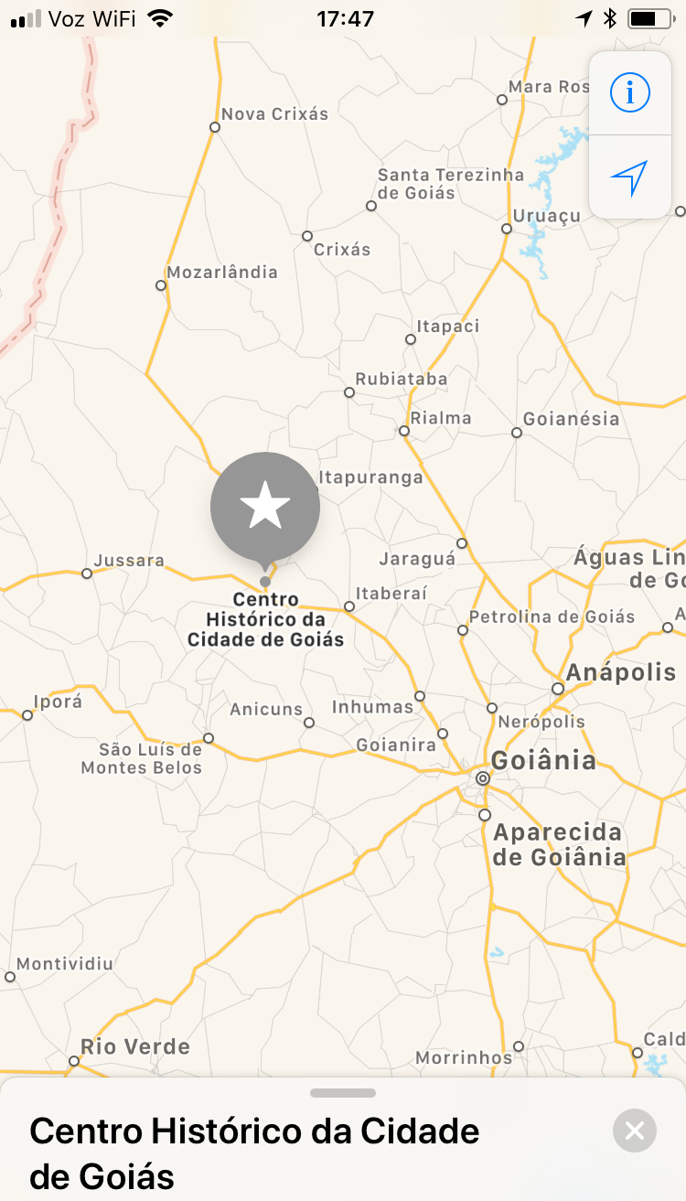


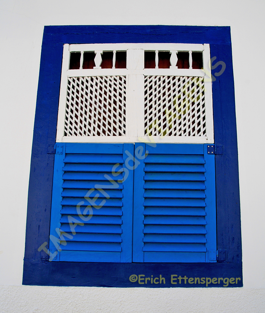


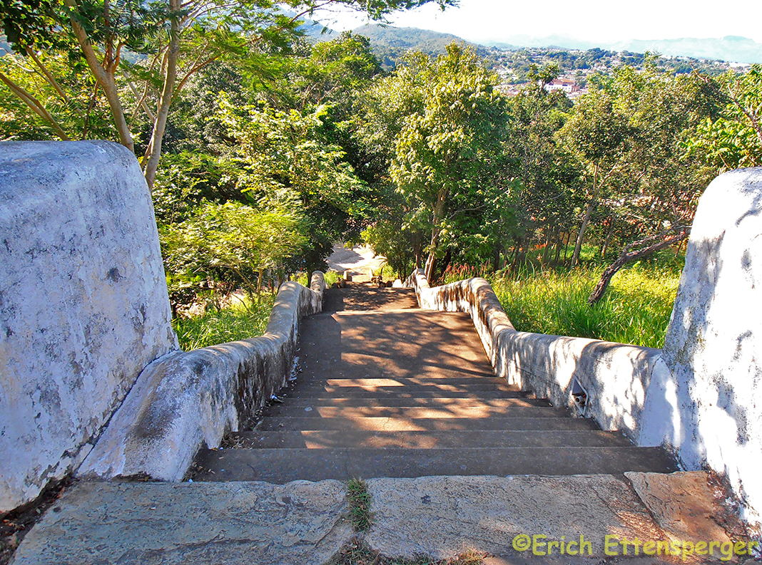

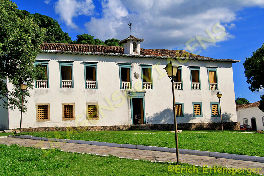

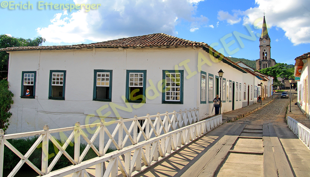
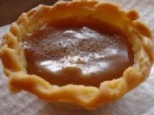


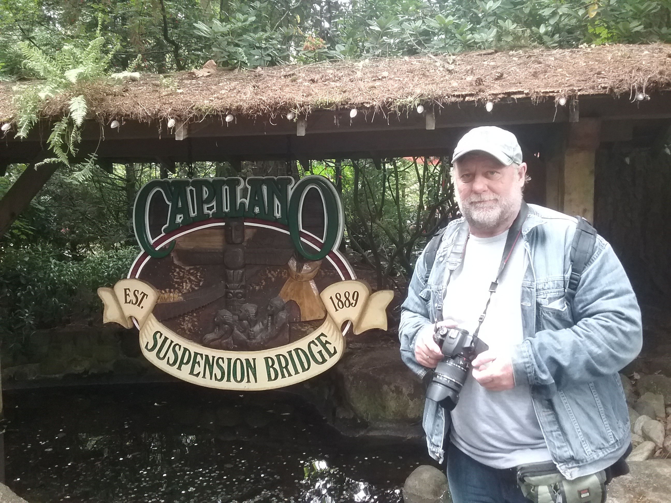

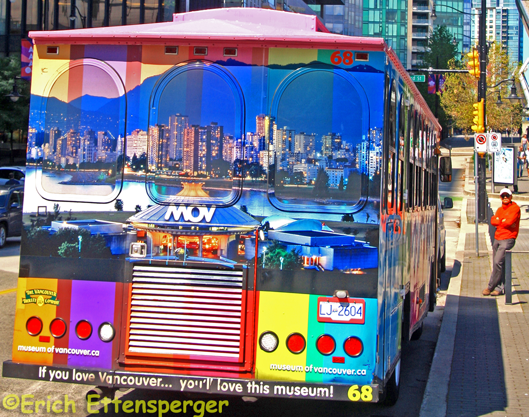


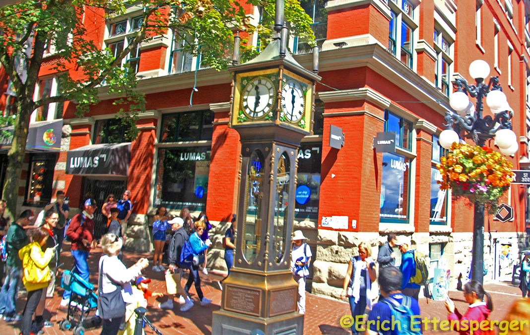


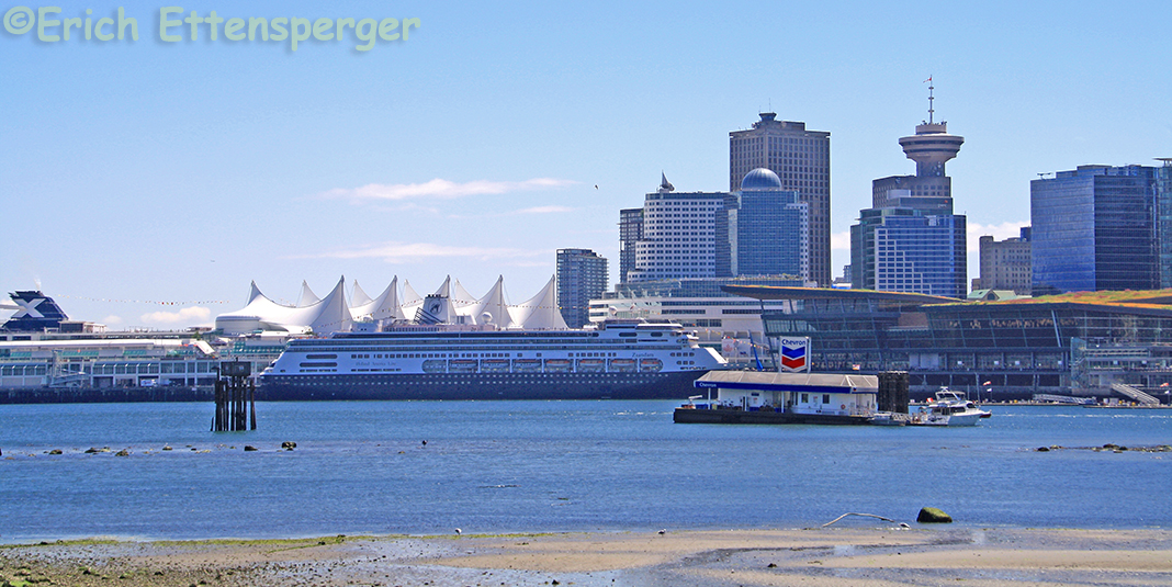


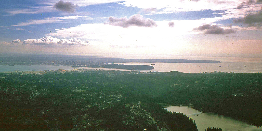
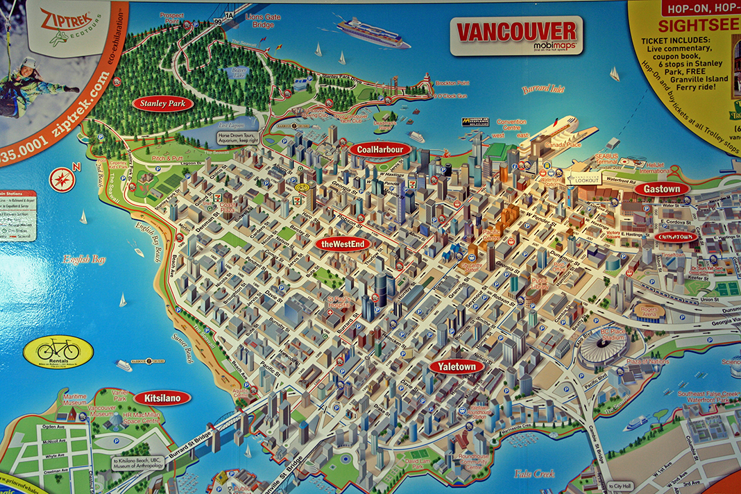

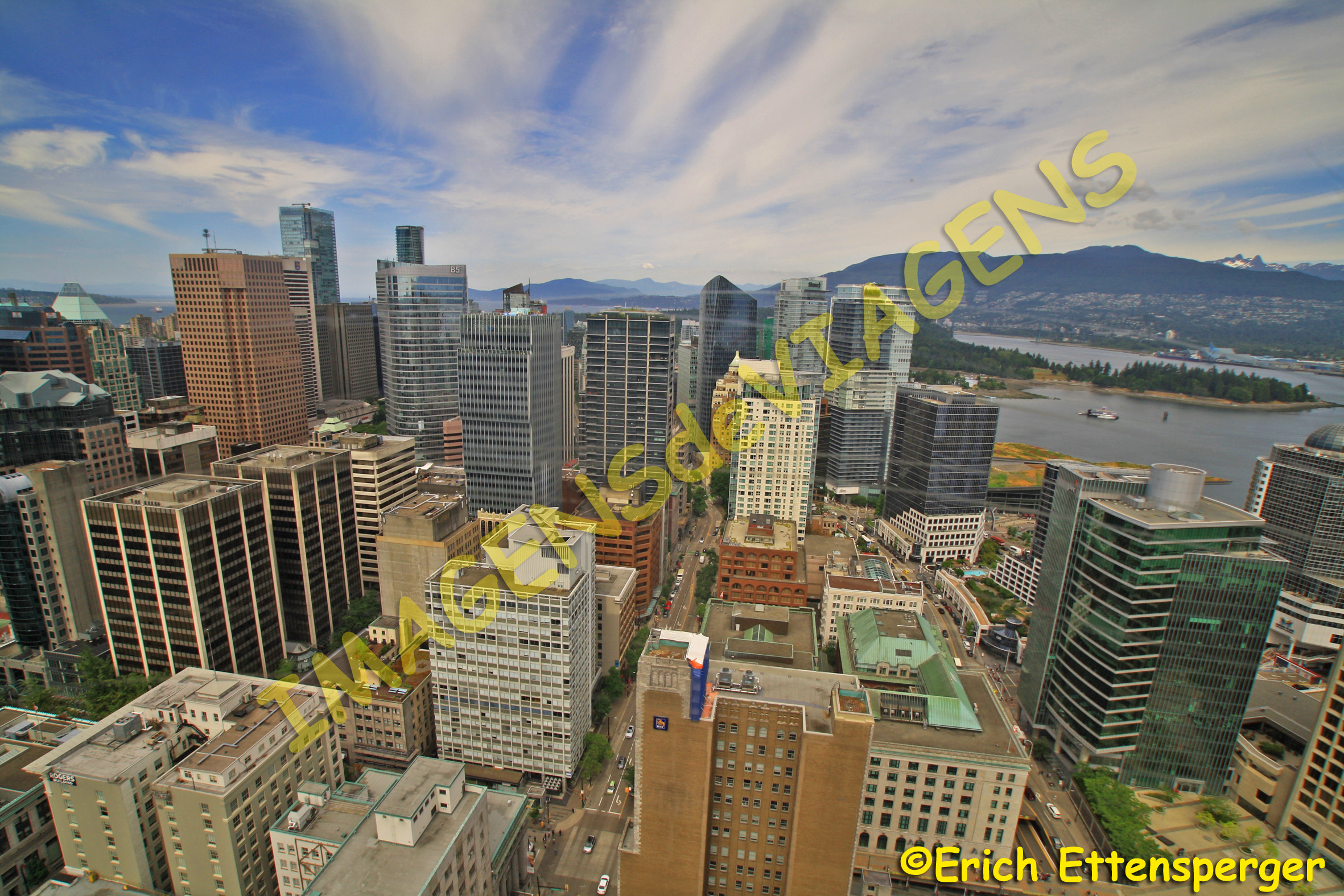

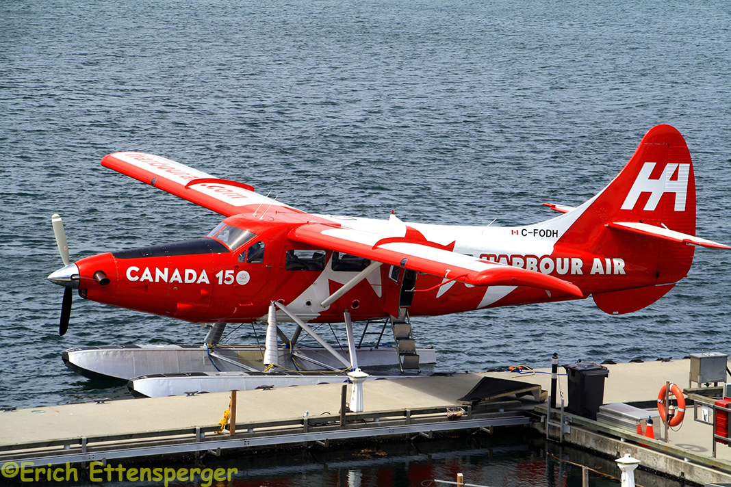
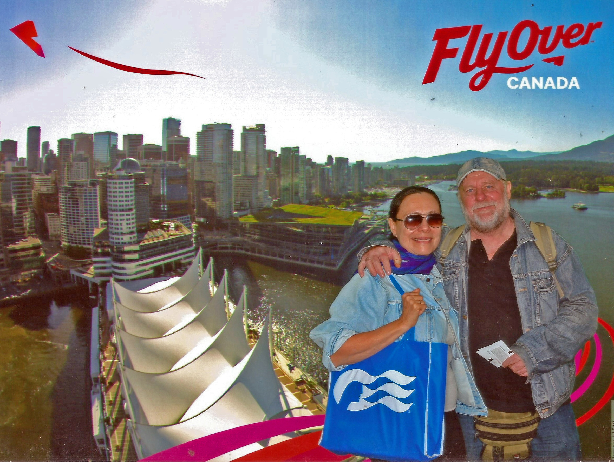


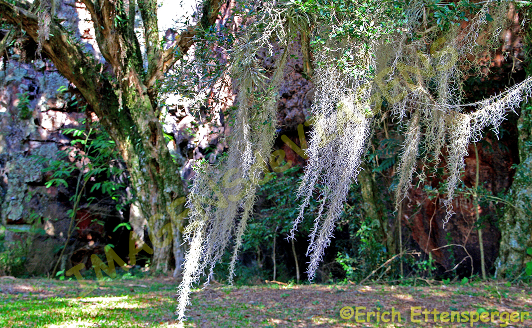
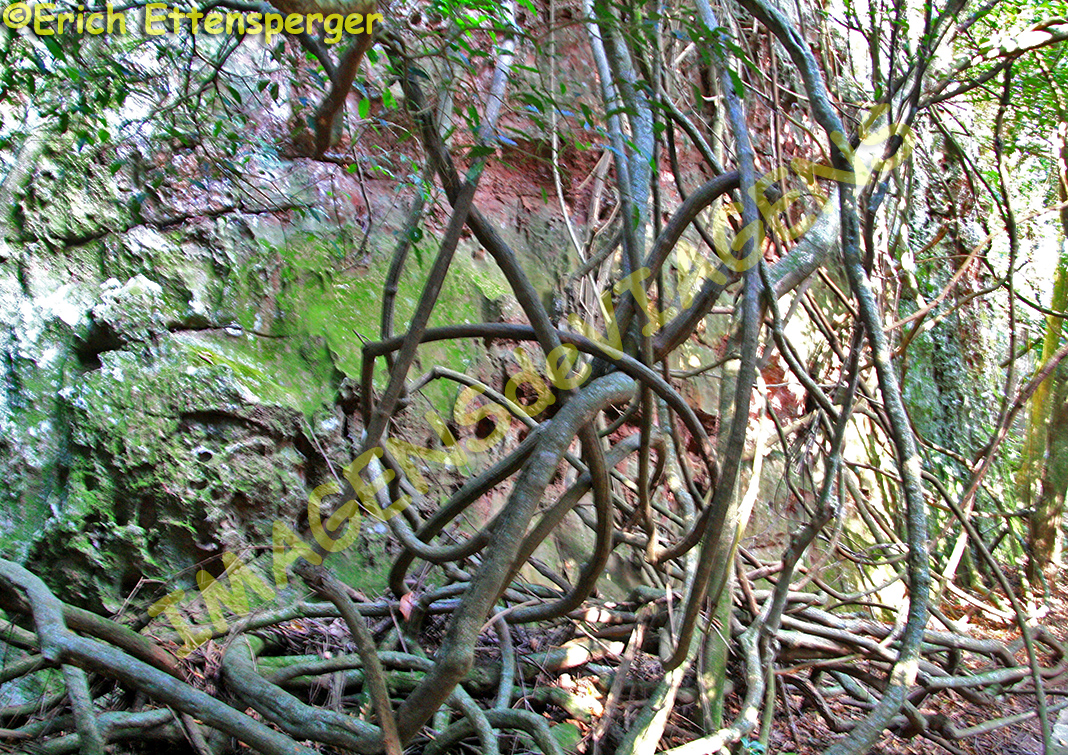

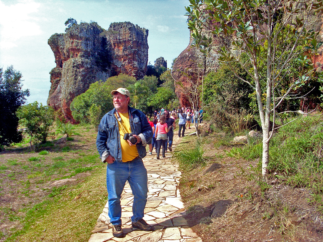


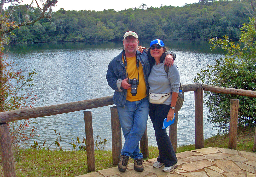


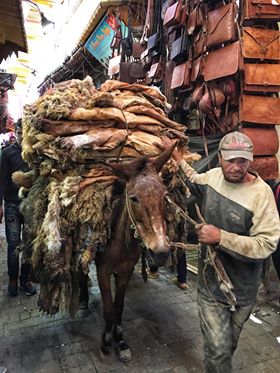


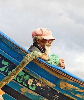


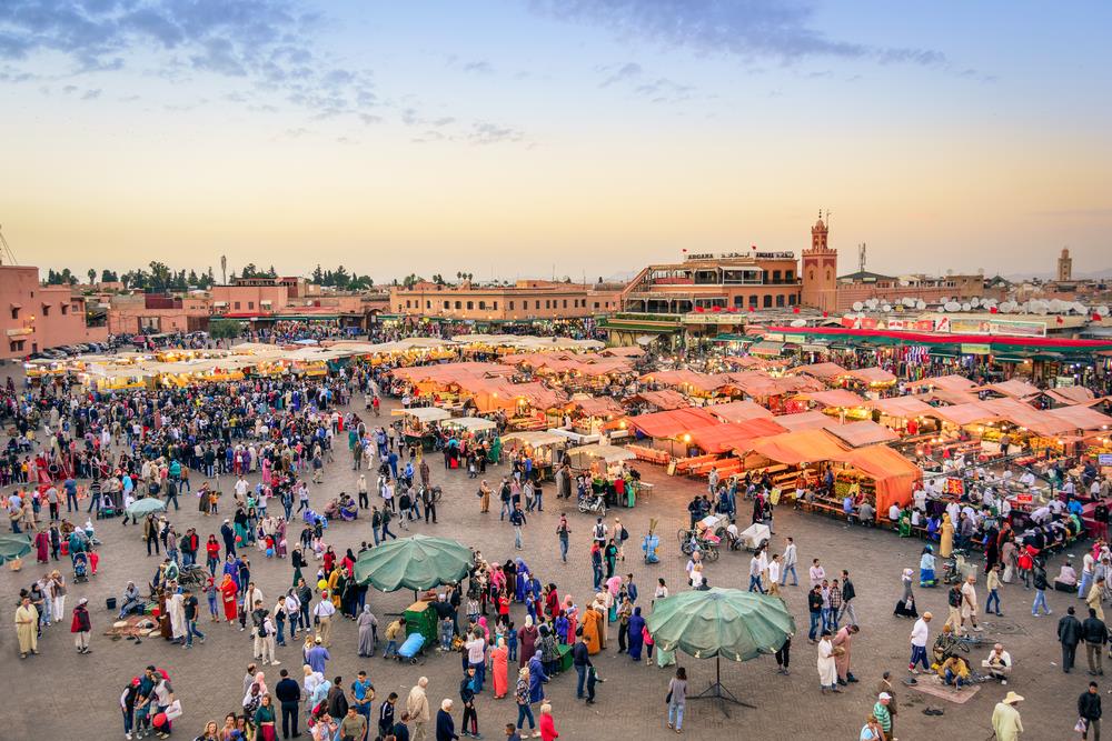


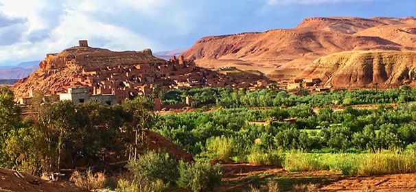

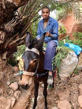

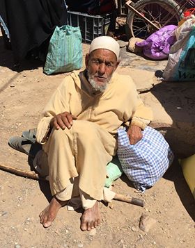


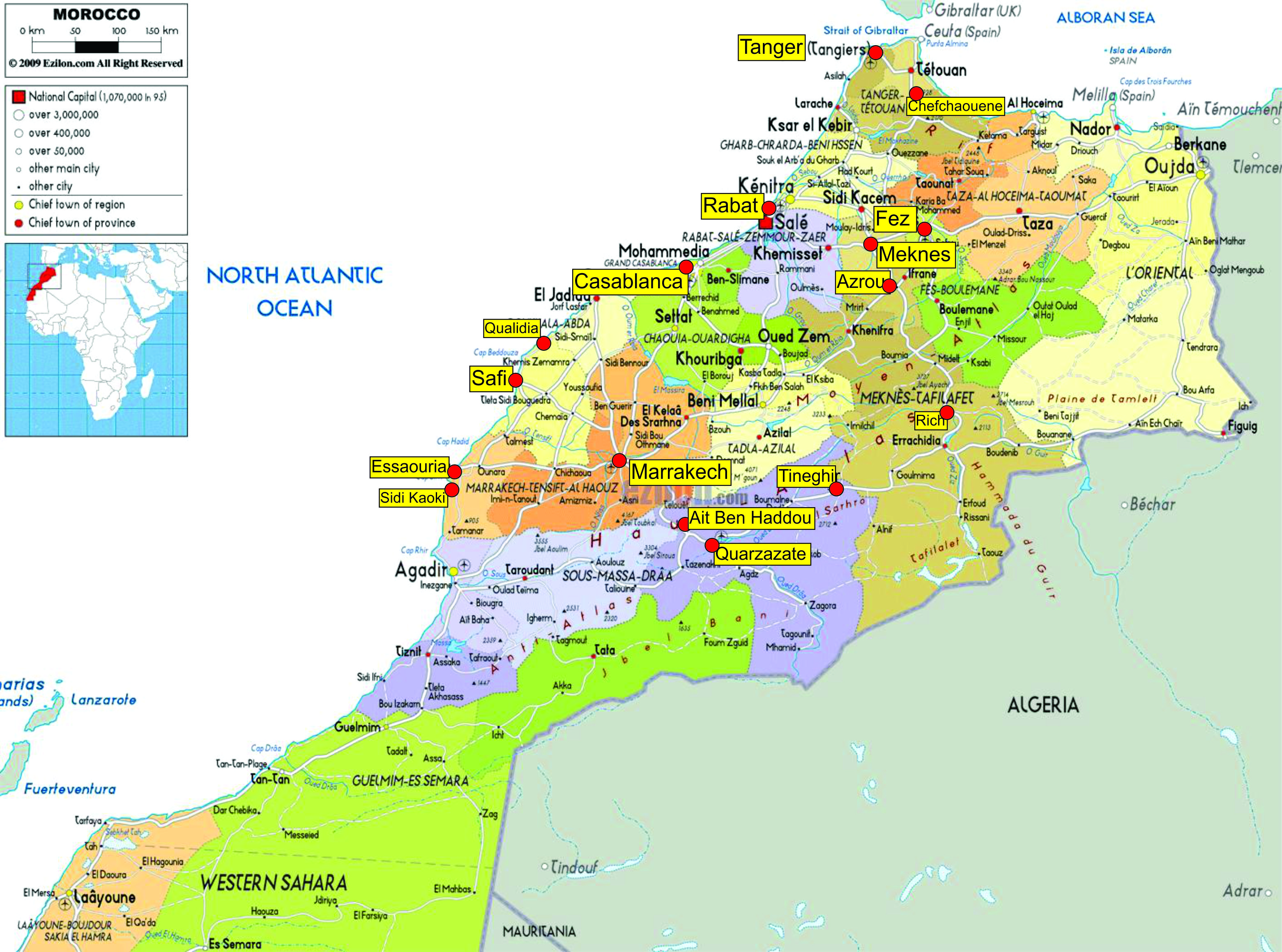


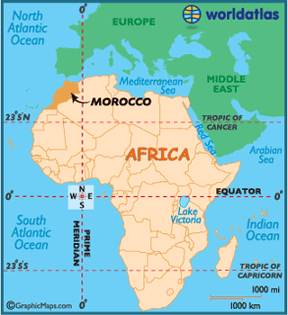

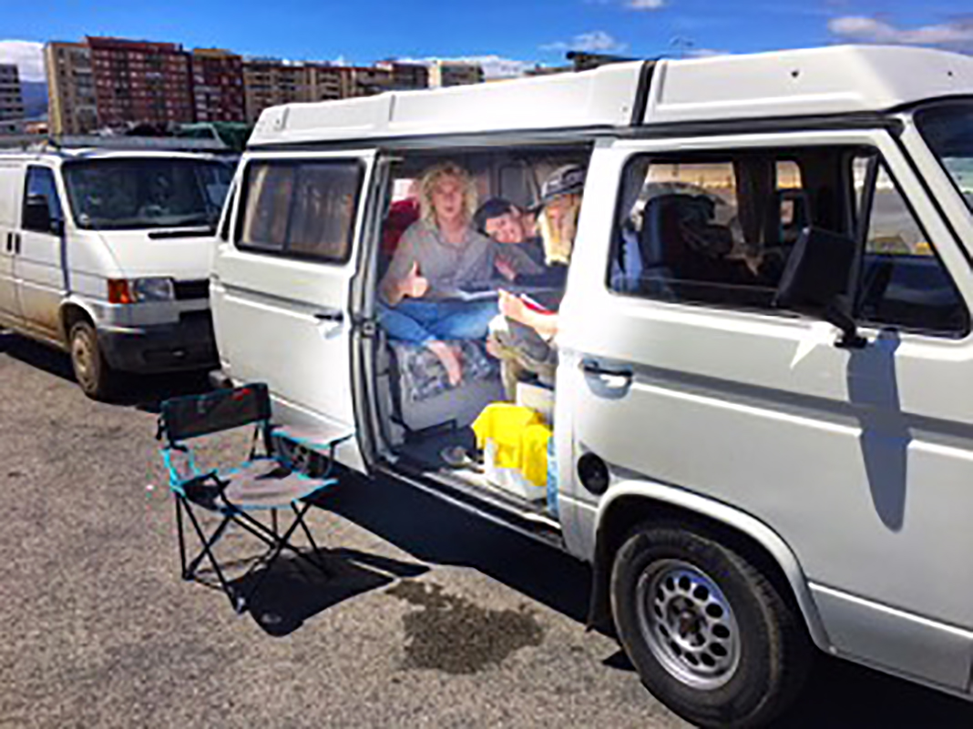


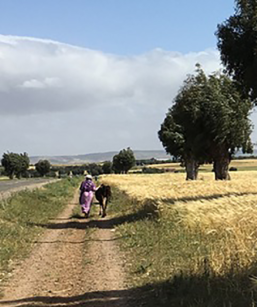
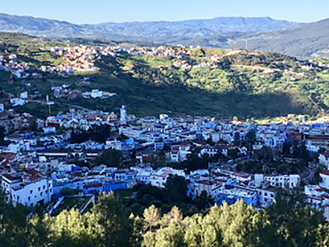
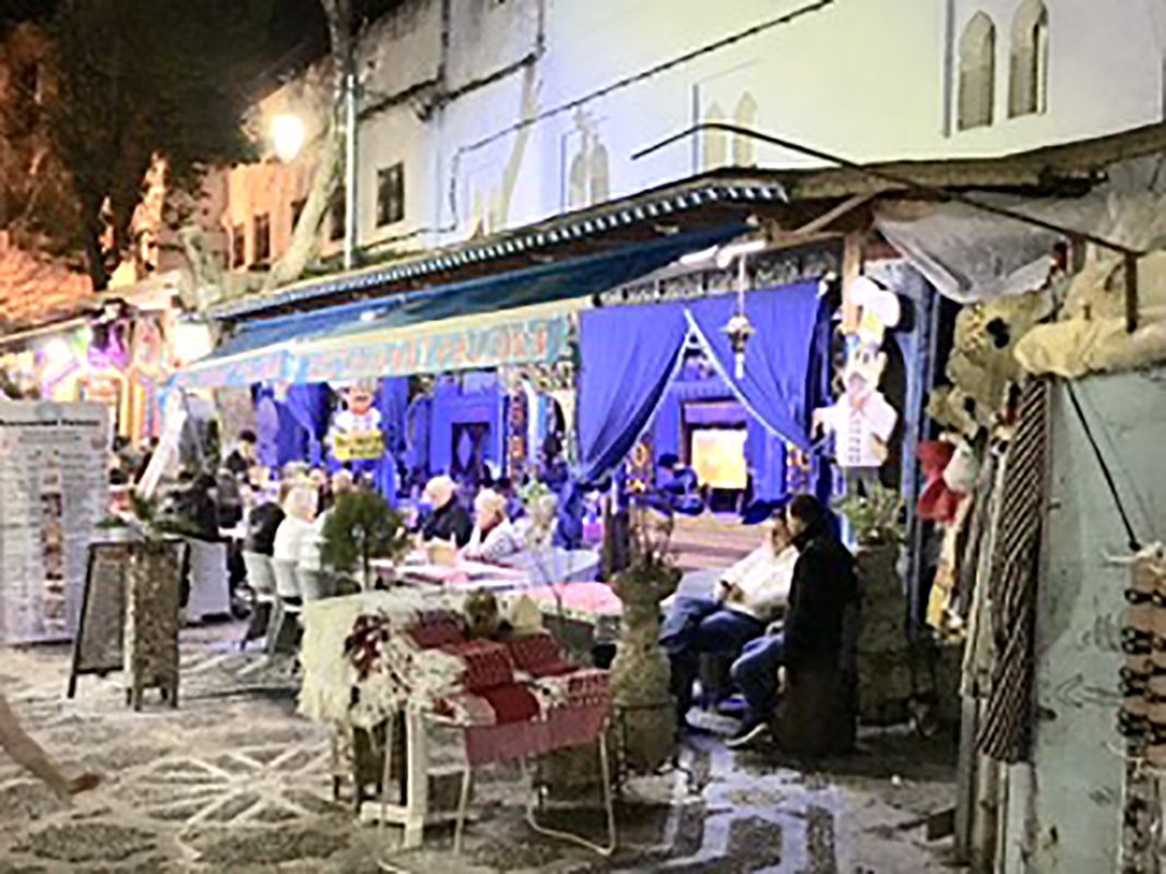


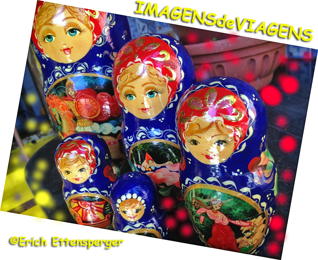

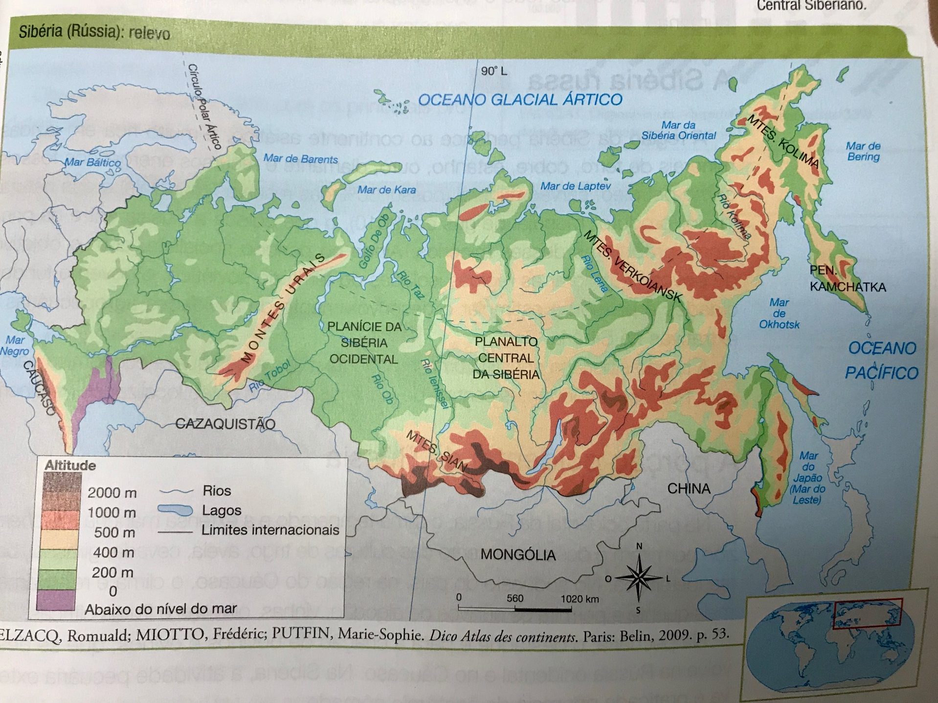
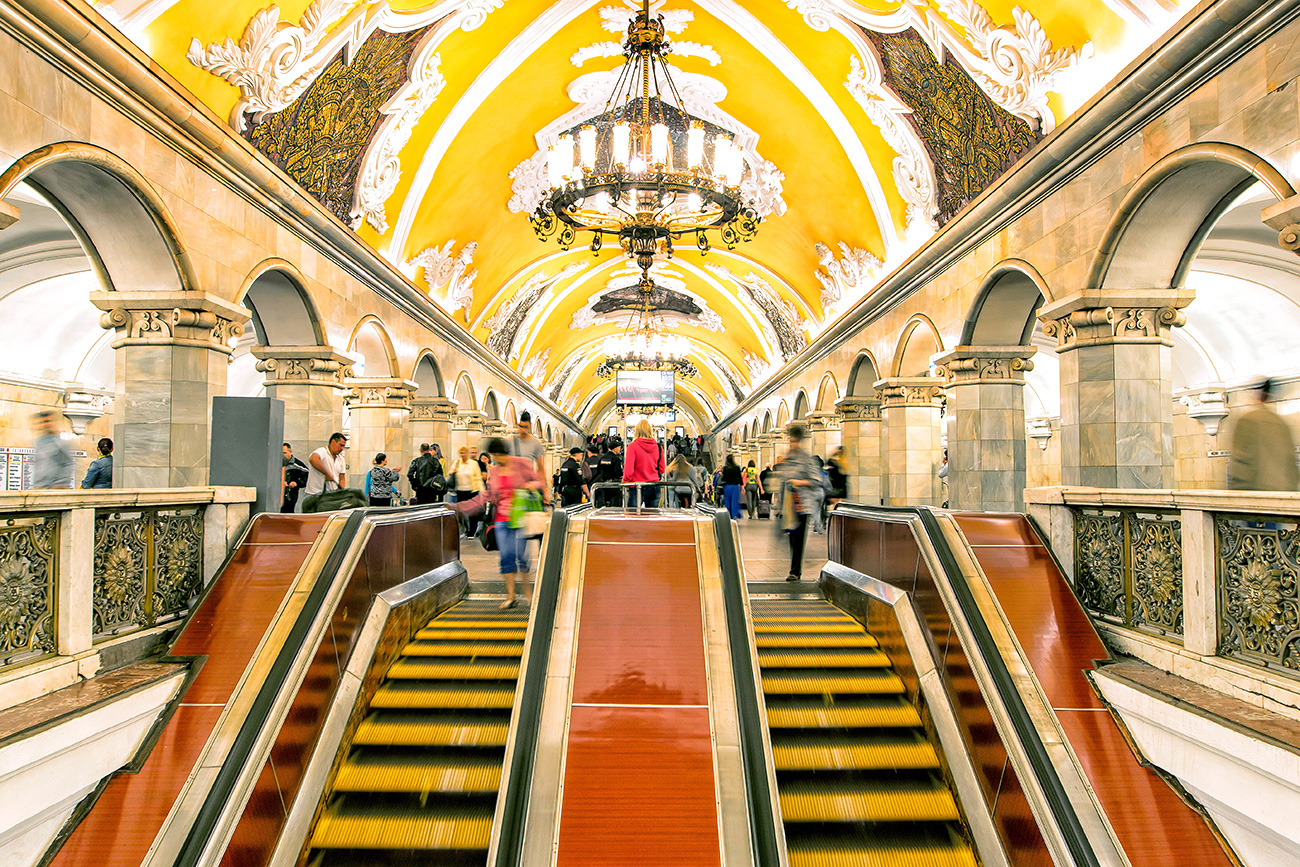


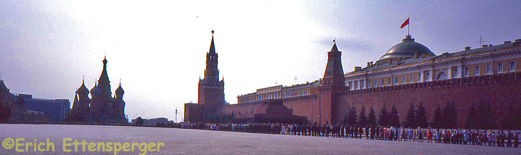


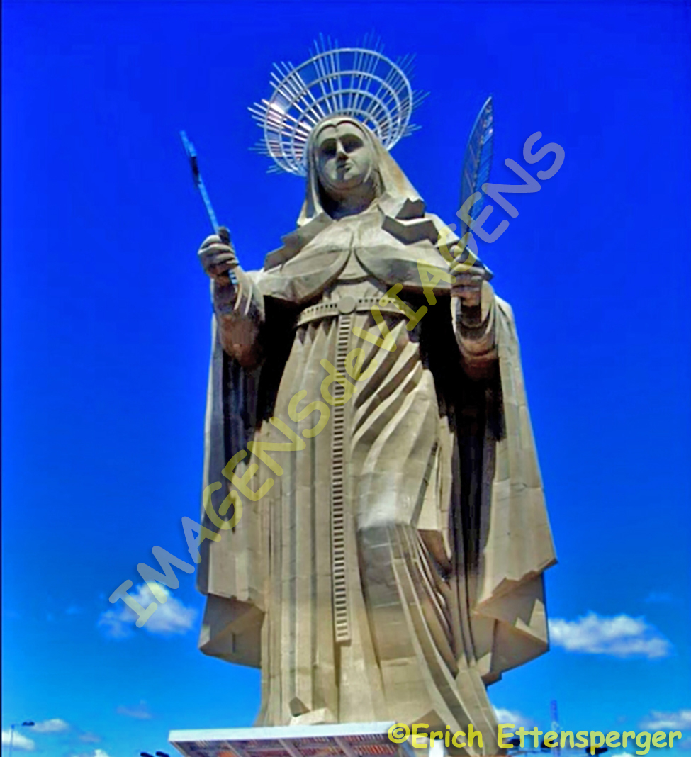


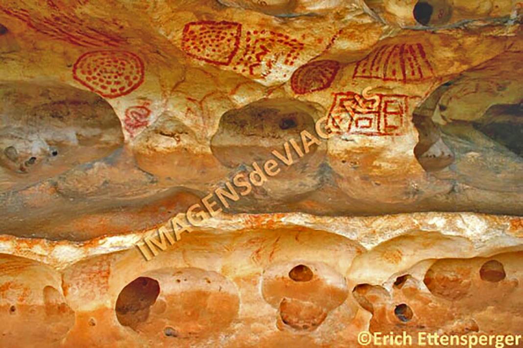
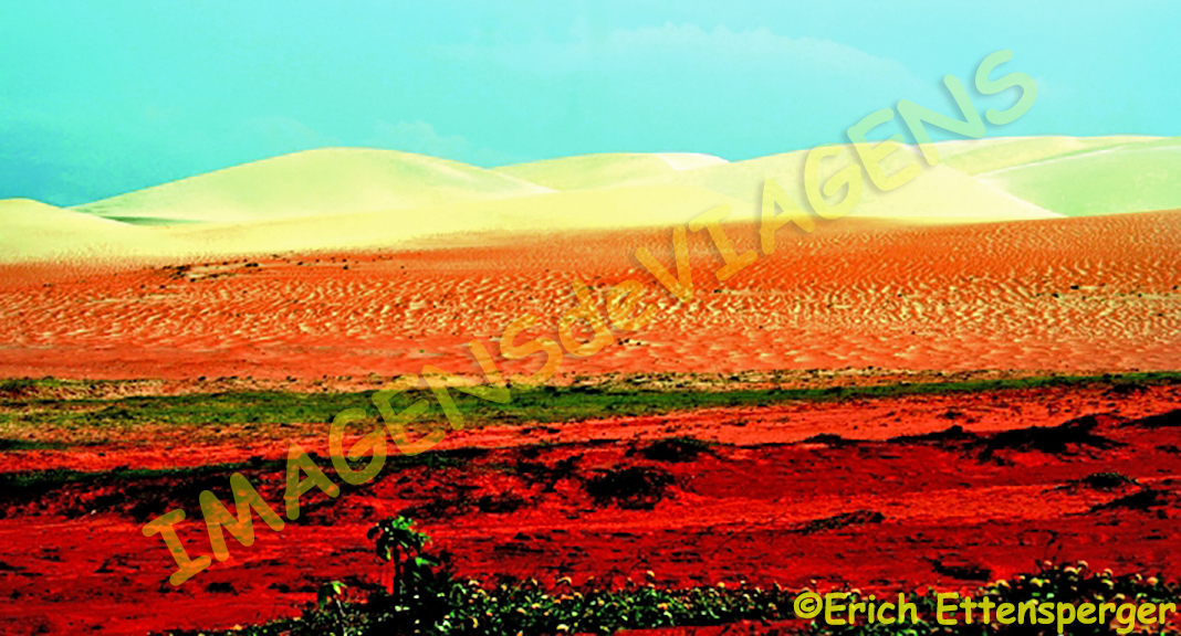


