Relato e Photos: Dâmaso e Leila Chacon, viajantes convidados
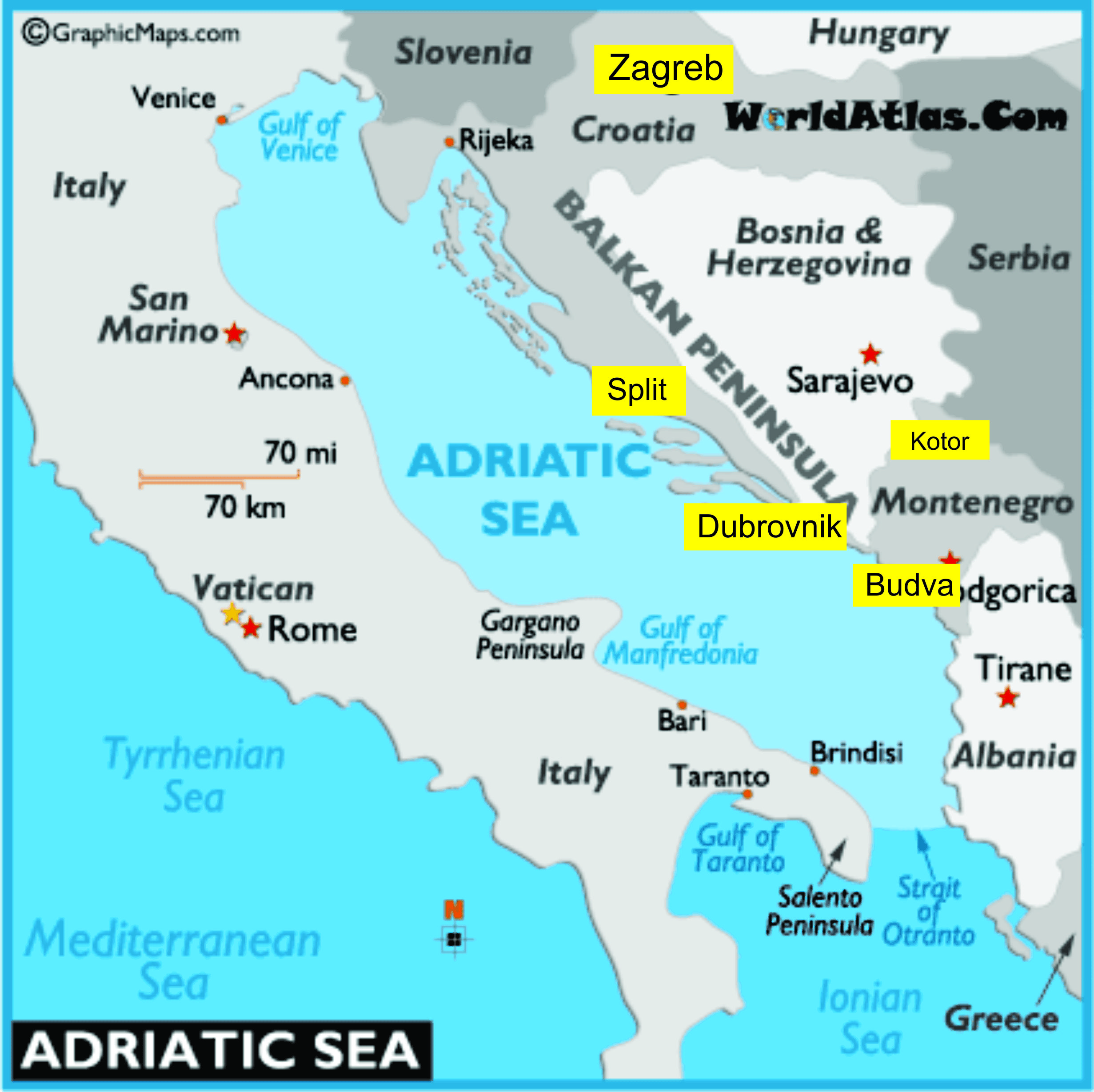
Imagine um mar circundado por belas praias e cidades com um rico patrimônio cultural e natural. Sim, estou falando sobre o Mar Adriático, parte do Mar Mediterrâneo, localizado entre o leste da costa italiana e a Península dos Bálcãs, situado no sudeste do continente europeu. Esse mar banha a Eslovênia, Croácia, Bósnia-Hezegovina, Montenegro e Albânia. Para se ter uma ideia, esses cinco países totalizam dezenove bens culturais integrantes da lista de bens tombados pela UNESCO, onde ressalta-se a famosa cidade de Dubrovinik, na Croácia e sete bens naturais com destaque especial para o Parque Nacional dos Lagos de Plitvice, na Croácia e a Região Natural e Histórica Cultural de Kotor, em Montenegro.
Já faz algum tempo que escuto relatos de pessoas sobre belas viagens que fizeram por essa região. Eu ainda não naveguei por esses lados, mas, Erich viajou por lá quando ainda era a Iugoslávia. O amigo Dâmaso Chacon e sua esposa Leila estão viajando por lá e gentilmente, dividem conosco um pouco dessa experiência.
Primeiro, eu quis saber como foi a rota que eles fizeram entre Natal, no Rio Grande do Norte até a costa dos Bálcãs. Eles voaram Natal – Fortaleza – Amsterdã – Zagreb, pela companhia aérea holandesa KLM. A partir daí, eles viajaram pela Costa Adriática de ônibus, da empresa Fixbus. A sequência da viagem foi: Zagreb – Zadar – Split – Dubrovnik – Ilha de Hvar. De Dubrovinik eles voaram, pela Croatia Airways para Zagreb e de lá, pela Air France, Paris – Fortaleza – Natal. Eles elogiaram o serviço da KLM.
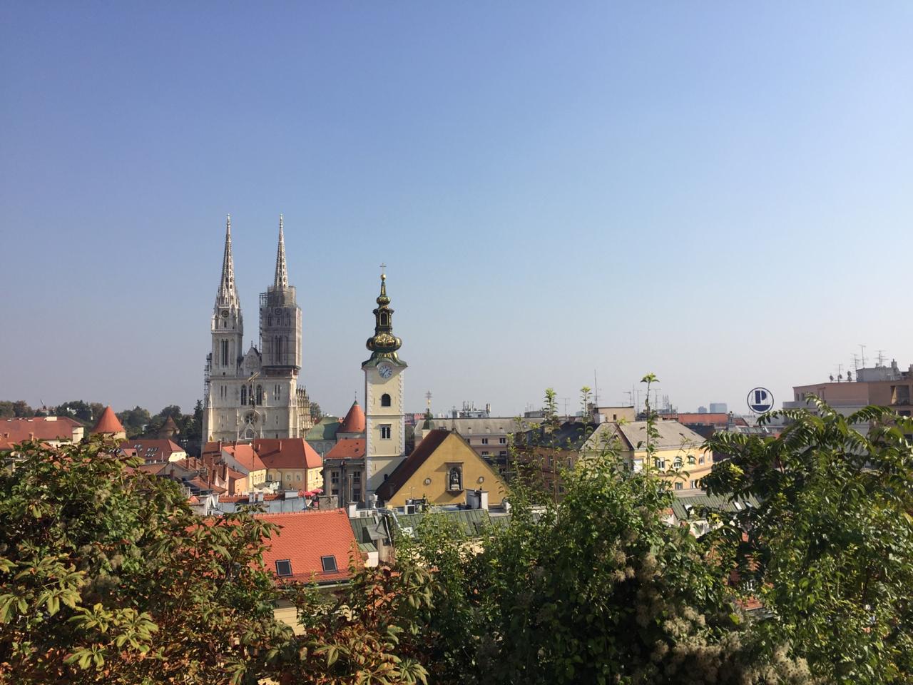
Bem, vamos às impressões sobre Zagreb, cidade que eles acharam parecida com Viena: “Zagreb, uma cidade viva, alegre que convive muito bem com a natureza.


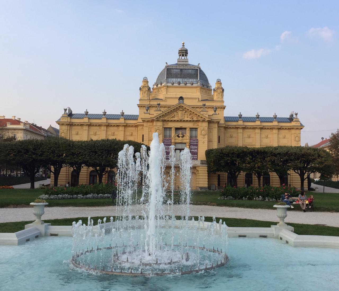

Anda-se por suas ruas e de repente, um oásis para relaxar e ter o contato direto com a natureza! Isto a torna pitoresca a cada esquina, onde um fascínio sem grandes pretensões lhe coloca em lugares bucólicos!”.

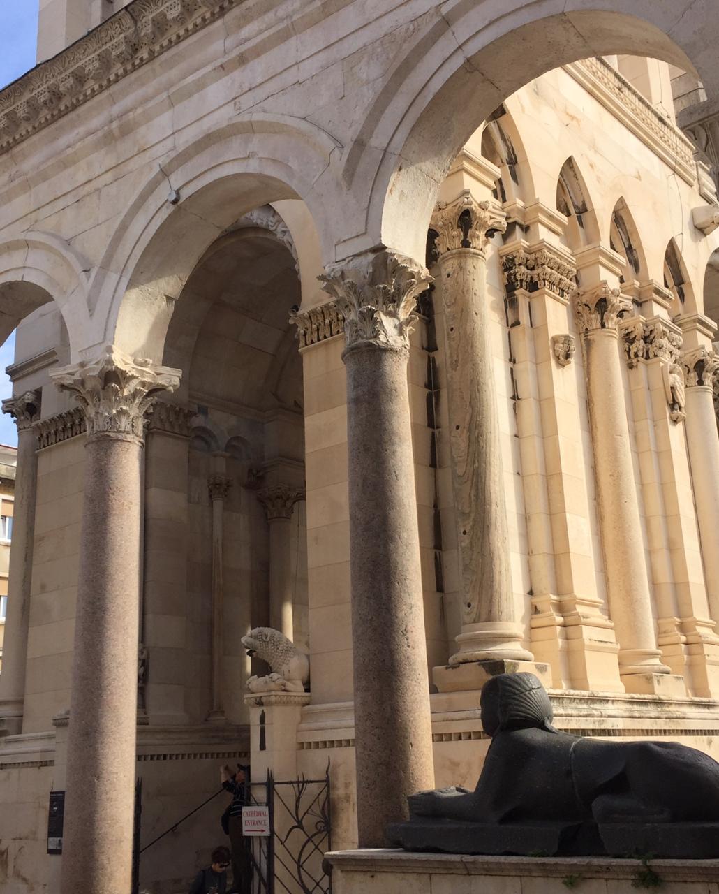
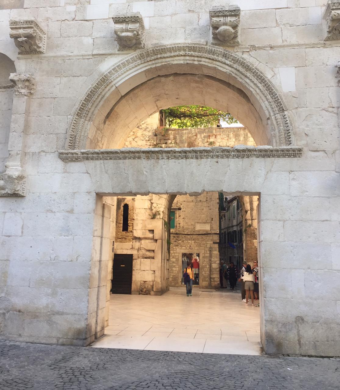
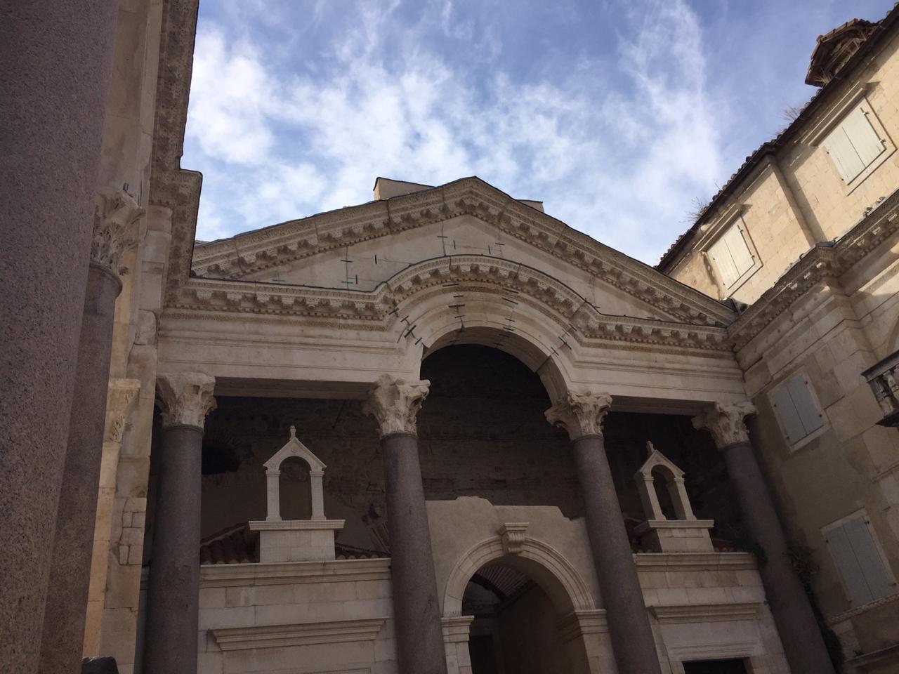
Depois de Zagreb, recebi fotos e informações sobre Split:
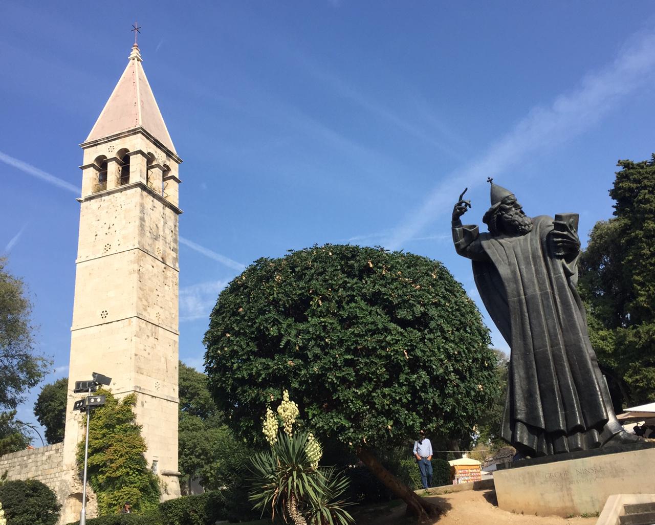
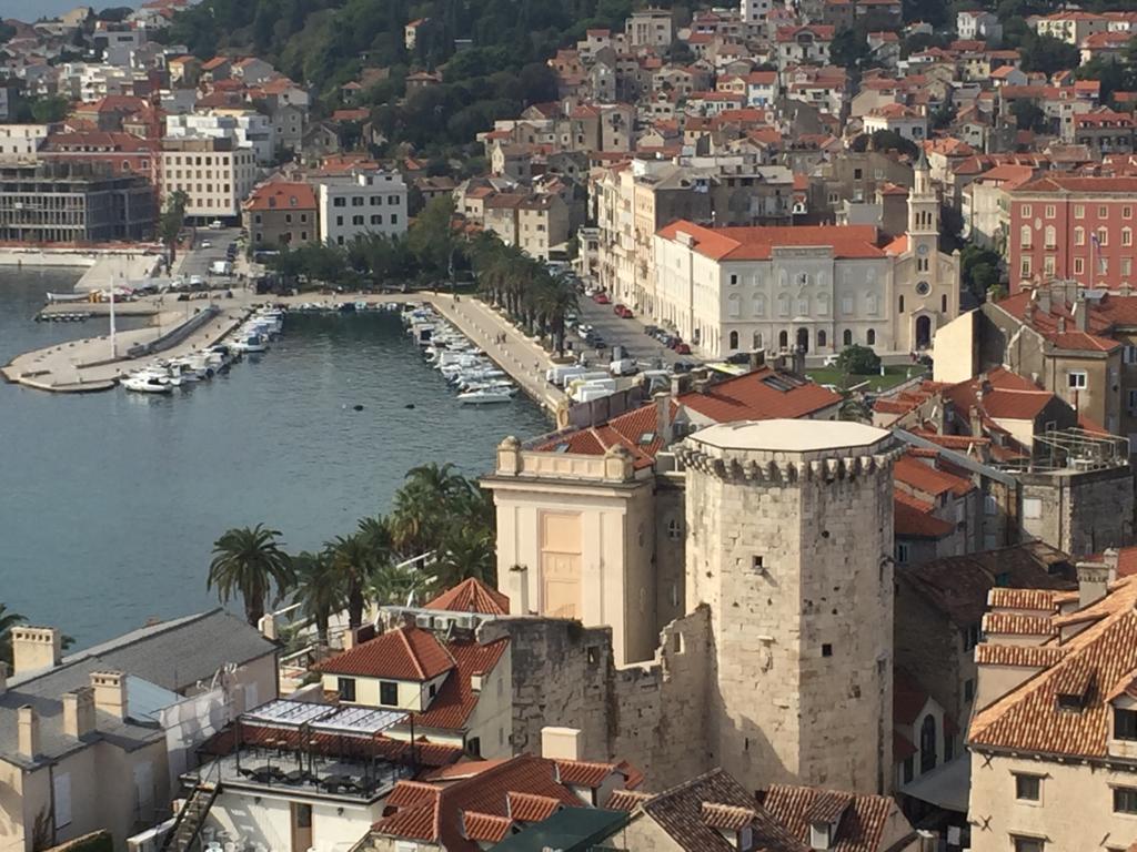
“Split, cidade onde Diocleciano, imperador romano, que era daqui mandou construir um palácio que hoje está inserido na cidade, inclusive o seu mausoléu, que hoje é uma catedral católica” (o Complexo Histórico de Split com o Palácio de Diocleciano é tombado pela UNESCO, desde 1979).


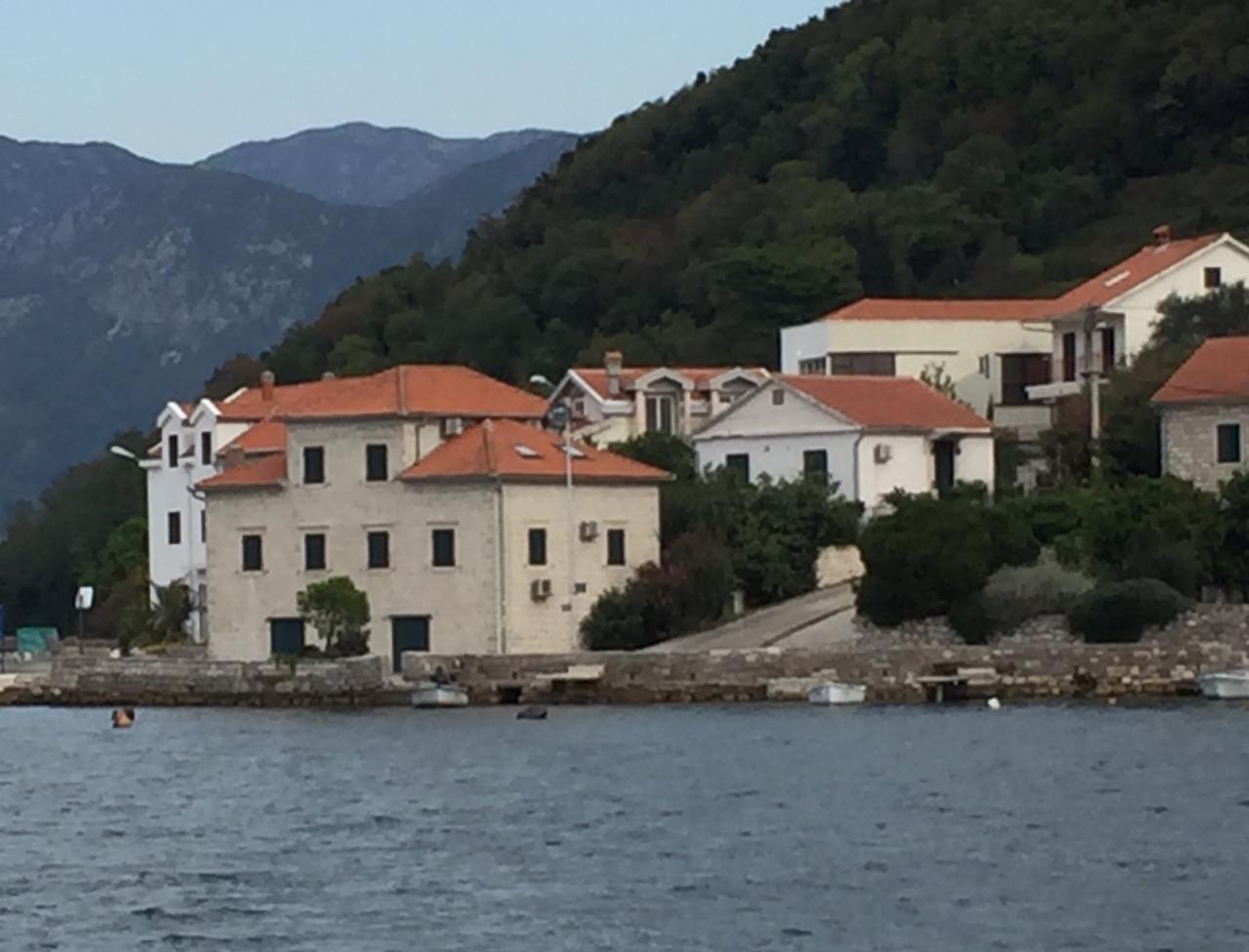
Sobre Budva e Kotor em Montenegro: “… um dos últimos povos, além de Kosovo a se separarem da Sérvia. Sua população tem certa identificação com o leste europeu, com maioria de católicos ortodoxos russos, muçulmanos e minoria católica. As mulheres ainda convivem com tradições de certa submissão ao homem!”.
Budva:


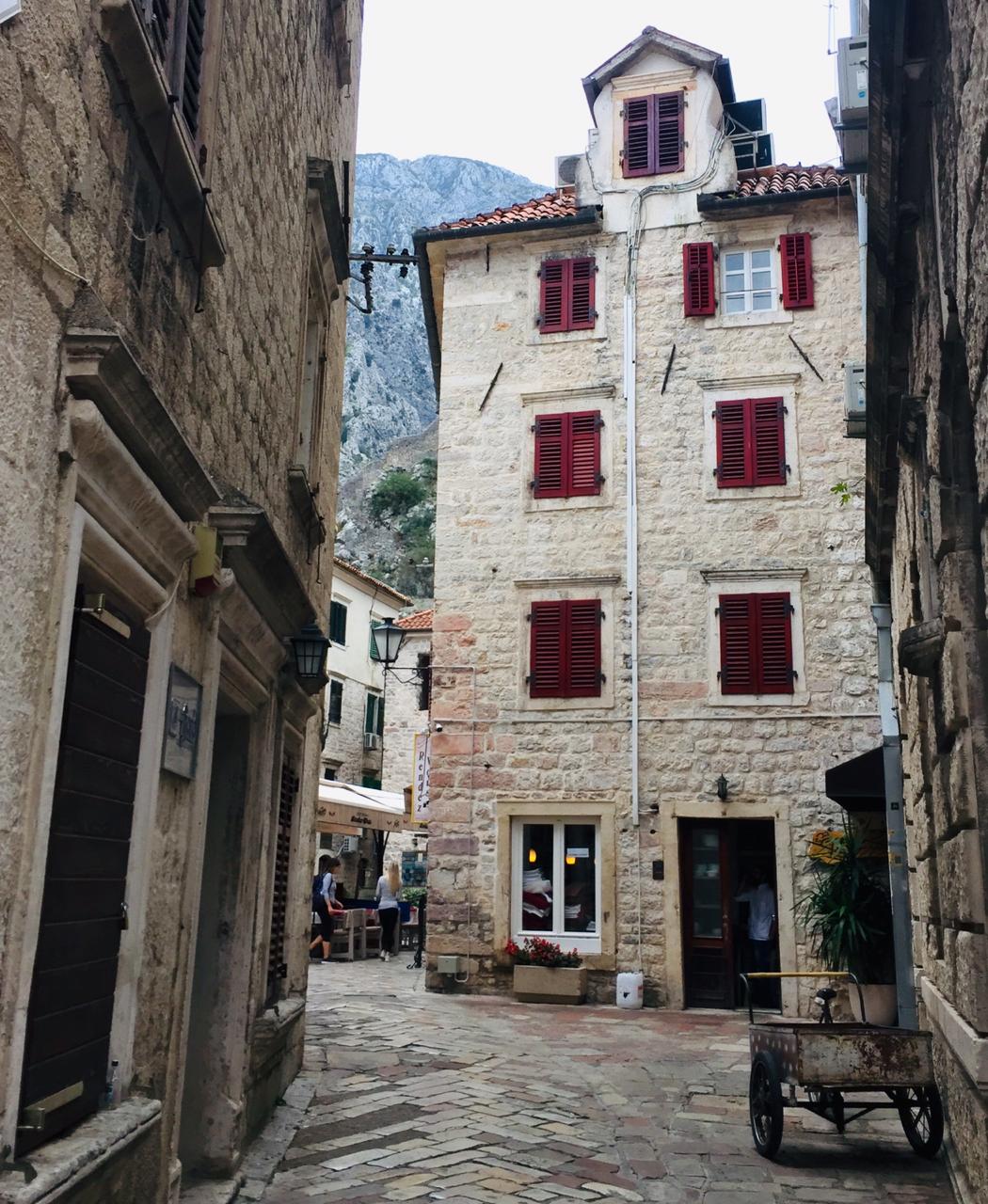
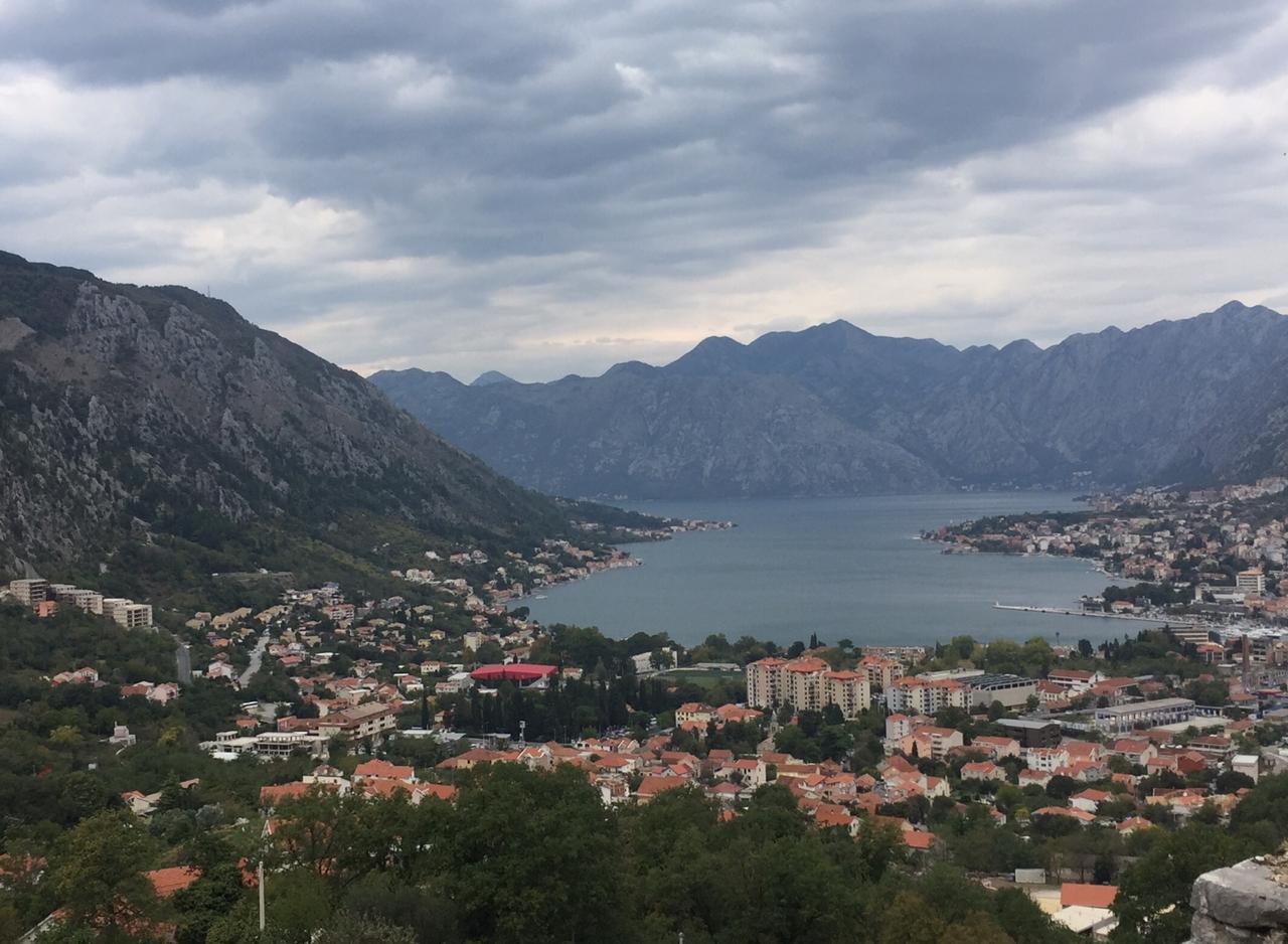
Kotor:

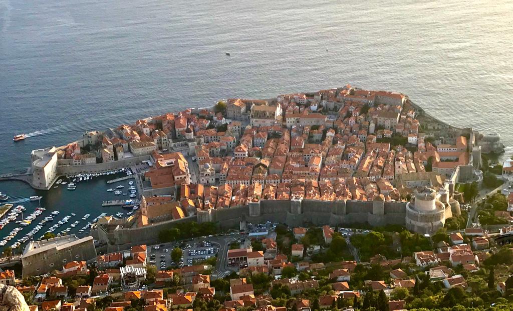
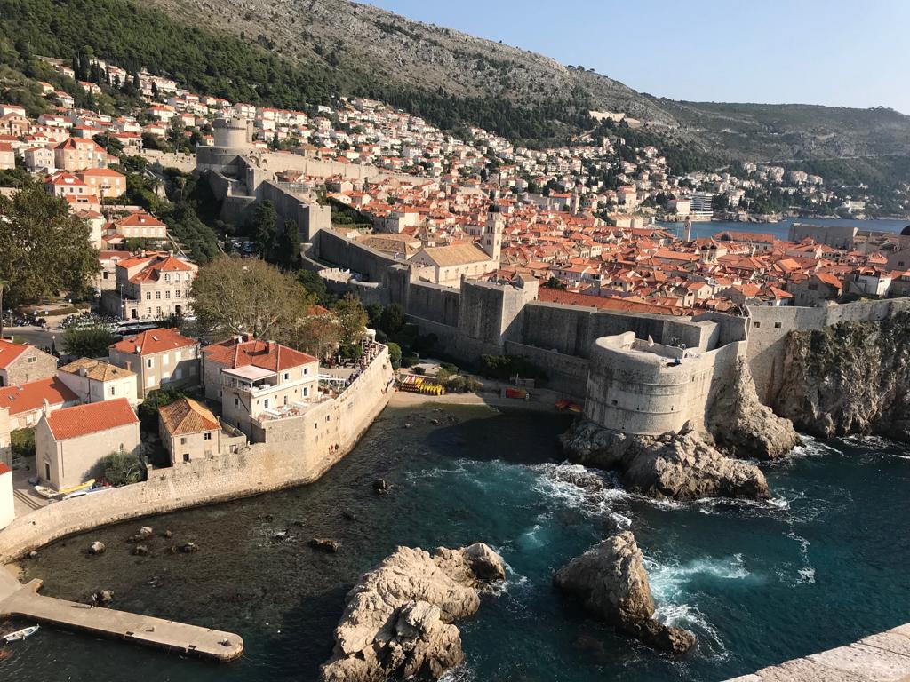
Depois de ler o relato e ver as fotos, acredito que a mais famosa das cidades visitadas é Dubrovinik, vejam o que eles comentaram: “Dubrovnik, cenário de Kings Landing, capital de Westeros dos Sete Reinos de Game of Thrones. Para quem assistiu a série, é o local da batalha de Blackwater”.


Finalmente, gostaria de dizer que depois de ver as fotos e saber mais sobre essa parte do planeta, Erich e eu já integramos esse destino na nossa lista de desejos.
Observação: se você quiser continuar “viajando” com o nosso blog, clique no botão “seguir” localizado no canto inferior direito dessa página. Você também pode “viajar” pelo Brasil conhecendo nosso livro impresso 66 Brasil e sua versão digital 66 Belezas do Brasil.

SCHÖNHEITEN DER ADRIA
Stellen Sie sich ein Meer vor, das von wunderschönen Stränden und Städten mit einem reichen kulturellen Erbe und schöner Natur umrahmt ist.
Ja, ich spreche von der Adria, einem Teil des Mittelmeers, zwischen der Ostküste Italiens und der Balkanhalbinsel im Südosten des europäischen Kontinents gelegen.
Dieses Meer umspült die Küsten Sloweniens, Kroatiens, Bosnien-Herzegowinas, Montenegros und Albaniens.
Um eine Idee zu geben, diese fünf Länder verfügen über neunzehn Attraktionen, die in der Liste des Weltkulturerbes der UNESCO registriert sind, darunter die berühmte Stadt Dubrovinik in Kroatien, darüber hinaus sieben Orte des Weltnaturerbes mit besonderem Schwerpunkt auf dem Nationalpark Plitvicer Seen in Kroatien und der natur- und kulturhistorischen Region von Kotor in Montenegro.
Seit einiger Zeit schon höre ich Berichte von Leuten über die schönen Reisen, die sie in dieser Region unternommen haben. Erich besuchte diese Region als fast alles noch Jugoslawien war. Ich war noch nicht dort unterwegs, aber mein Freund Damaso Chacon und seine Frau Leila sind dorthin gereist und teilen mit uns freundlicherweise ein wenig ihre gemachten Erfahrungen.
Zuerst wollte ich wissen, wie ihre Reiseroute zwischen Natal, Rio Grande do Norte in Brasilien und der Balkan-Küste verlaufen ist. Sie flogen Natal – Fortaleza – Amsterdam – Zagreb mit der niederländischen Fluggesellschaft KLM. Von dort aus bereisten sie die Adriaküste per Bus der Firma Fixbus.
Die Stationen der Reise waren wie folgt: Zagreb – Zadar – Split – Dubrovnik – Insel Hvar. Von Dubrovinik flogen sie dann mit Croatia Airways nach Zagreb und von dort aus weiter mit Air France nach Paris – Fortaleza – Natal. Sie lobten sehr den KLM-Service.
Nun zu den Eindrücken von Zagreb, einer Stadt, die sie Wien ähnlich fanden: “Zagreb, eine lebhafte, fröhliche Stadt, die sehr gut mit der Natur koexistiert.
Sie spazieren durch die Straßen und finden plötzlich eine Oase zum Entspannen und direktem Kontakt mit der Natur! Dies lässt es an jeder Ecke malerisch erscheinen, wo eine Faszination ohne große Ansprüche einen an idyllische Orte versetzt!”
Nach Zagreb bekam ich dann Fotos und Informationen über Split:
“Split, eine Stadt, in der Diokletian, ein römischer Kaiser, den Befehl erhielt, einen Palast zu bauen, der heute mitten in der Stadt liegt einschließlich seines Mausoleums, das heute eine katholische Kathedrale ist” (Historischer Komplex Split mit Diokletianpalast, UNESCO Weltkulturerbe seit 1979).
Über Budva und Kotor in Montenegro: “… eines der letzten Völker, abgesehen vom Kosovo, um sich von Serbien zu trennen. Die Bevölkerung hat eine gewisse Identifikation mit Osteuropa, mit der Mehrheit der russisch-orthodoxen Katholiken, Muslimen und der katholischen Minderheit. Die Frauen leben immer noch mit Traditionen einer gewissen Unterwerfung gegenüber dem Mann!”
Budva:
Kotor:
Nachdem ich den Bericht gelesen und die Fotos gesehen habe, glaube ich, dass die berühmteste der besuchten Städte Dubrovinik ist, sehen Sie nun, was sie kommentierten: “Dubrovnik, Landschaft von Kings Landing, der Hauptstadt von Westeros der Sieben Königreiche von Game of Thrones. Für diejenigen, die die Serie gesehen haben, ist dies der Schauplatz der Blackwater-Schlacht.”
Abschließend möchte ich sagen, dass Erich und ich, nachdem wir die Fotos gesehen haben und mehr über diesen Teil Europas erfahren haben, dieses Ziel bereits unserer Reise-Wunschliste hinzugefügt haben.
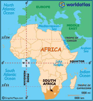
Karte: https://www.worldatlas.com/aatlas/infopage/adriaticsea.htm
Hinweis: Falls Sie unserem Blog folgen wollen, dann klicken Sie unten rechts einfach auf “Weiter”, Sie werden dann zukünftig automatisch informiert. Sie können auch durch Brasilien reisen und unser Buch 66 SEHENSWÜRDIGKEITEN IN BRASILIEN kennenlernen.
 BEAUTIES OF THE ADRIATIC
Imagine a sea framed by beautiful beaches and towns with a rich cultural heritage and beautiful nature.
Yes, I am talking about the Adriatic Sea, a part of the Mediterranean, between the eastern coast of Italy and the Balkan peninsula in the southeast of the European continent.
This sea laps the coasts of Slovenia, Croatia, Bosnia-Herzegovina, Montenegro and Albania.
To give you an idea, these five countries have nineteen attractions that are registered in the list of Culture World Heritage by UNESCO, including the famous city of Dubrovinik in Croatia, moreover, seven places of Nature World Heritage with special emphasis on the Plitvice Lakes National Park in Croatia and the natural and cultural-historical region of Kotor in Montenegro.
For some time now I have been hearing reports from people about the beautiful trips they have made in this region. Erich visited this region as almost everything was still Yugoslavia. I have not been there yet, but my friend Damaso Chacon and his wife Leila have traveled there and kindly share with us some of their experiences.
First I wanted to know how their itinerary looked like between Natal, Rio Grande do Norte in Brazil and the Balkan coast. They flew Natal – Fortaleza – Amsterdam – Zagreb with the Dutch airline KLM. From there they traveled the Adriatic coast by bus (Fixbus company).
The stations of the trip were as follows: Zagreb – Zadar – Split – Dubrovnik – Island Hvar. From Dubrovinik then they flew with Croatia Airways to Zagreb and from there on with Air France to Paris – Fortaleza – Natal. They highly praised the KLM service.
Now to the impressions of Zagreb, a city that they found similar to Vienna: “Zagreb, a lively, happy city that coexists very well with nature.
Strolling through the streets and suddenly finding an oasis to relax and get in direct contact with nature! This makes it appearing picturesque on every corner, where a fascination without much pretension puts you in idyllic places!”
After Zagreb then I got photos and information about Split:
“Split, a city where Diocletian, a Roman emperor, was ordered to build a palace that is nowadays located in the heart of the city including its mausoleum, which today is a Catholic cathedral” (Split Historical Complex with Diocletian’s Palace, UNESCO World Heritage Site since 1979).
About Budva and Kotor in Montenegro: “… one of the last peoples apart from Kosovo to secede from Serbia. The population has some identification with Eastern Europe with the majority of Russian orthodox Catholics, Muslims and the Catholic minority. The women still live with traditions of a certain submission to the man!”
Budva:
Kotor:
After reading the report and seeing the photos I believe that the most famous of the visited cities is Dubrovinik, now look at what they commented about: “Dubrovnik, landscape of Kings Landing, the capital of Westeros of the Seven Kingdoms of Game of Thrones For those who saw the series, this is the scene of the Blackwater Battle.”
To conclude, after seeing the photos and learning more about this part of Europe, Erich and I have already added this destination to our travel wish list.
Map: https://www.worldatlas.com/aatlas/infopage/adriaticsea.htm
Note: If you want to follow our “Travels” on the blog, simply click on “Seguir” in the lower right corner, you will be then automatically informed in the future. You can continue traveling with us with our book Brazil´s 66 Beautiful Sites.