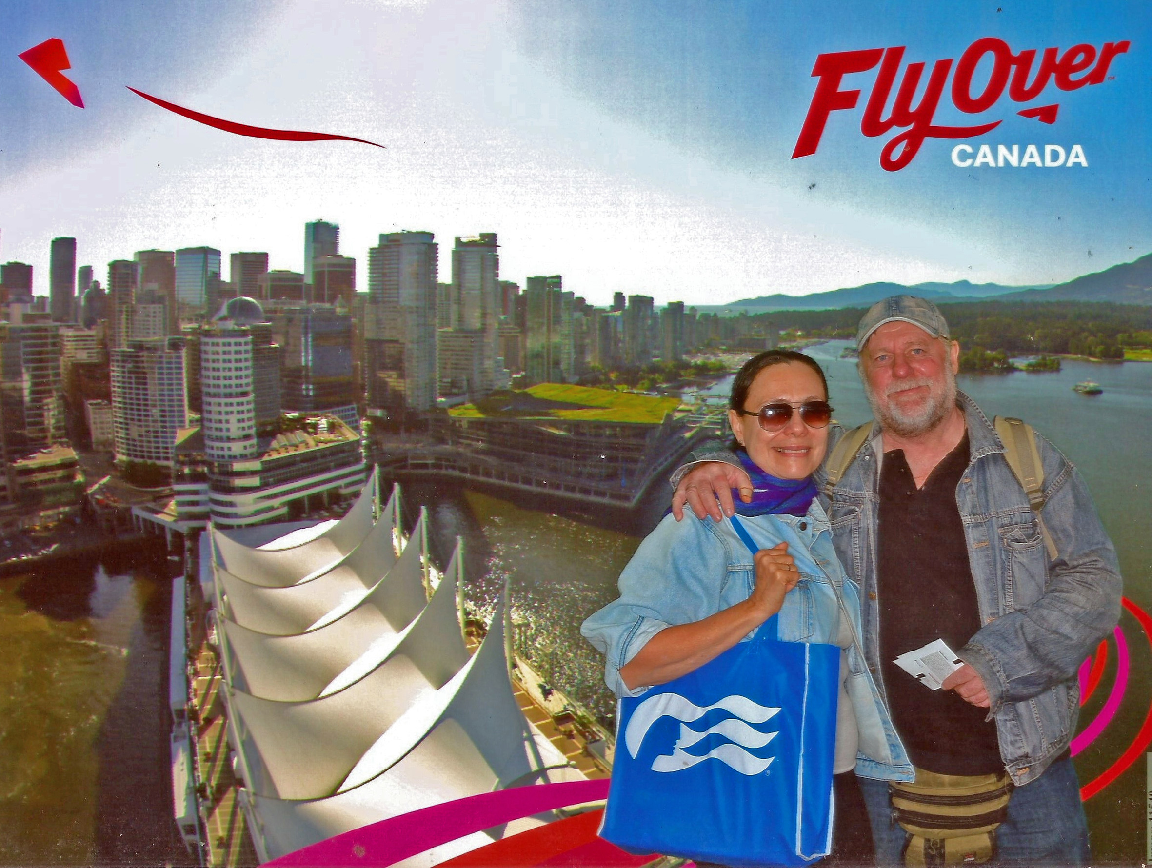
Erich e eu visitamos Anchorage (ancoradouro) no Alaska no mês de julho.

A primeira coisa que me chamou atenção foi a duração dos dias com luz solar. Para vocês terem uma ideia, vi o por do sol as 22:25 e ainda não estava escuro. Fomos dormir à meia noite e ainda havia a claridade.

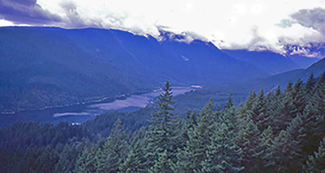
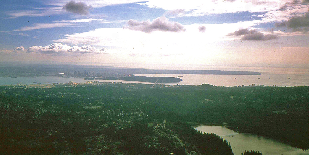
Anchorage está localizada no sul do Alaska, no final da Enseada Cook, numa península constituída pelo Braço Knik no Norte e pelo Braço Turnagain, ao sul (braço do Oceano Pacífico).

Ela tem cerca de 300 mil habitantes, é uma cidade plana, onde é fácil se deslocar.
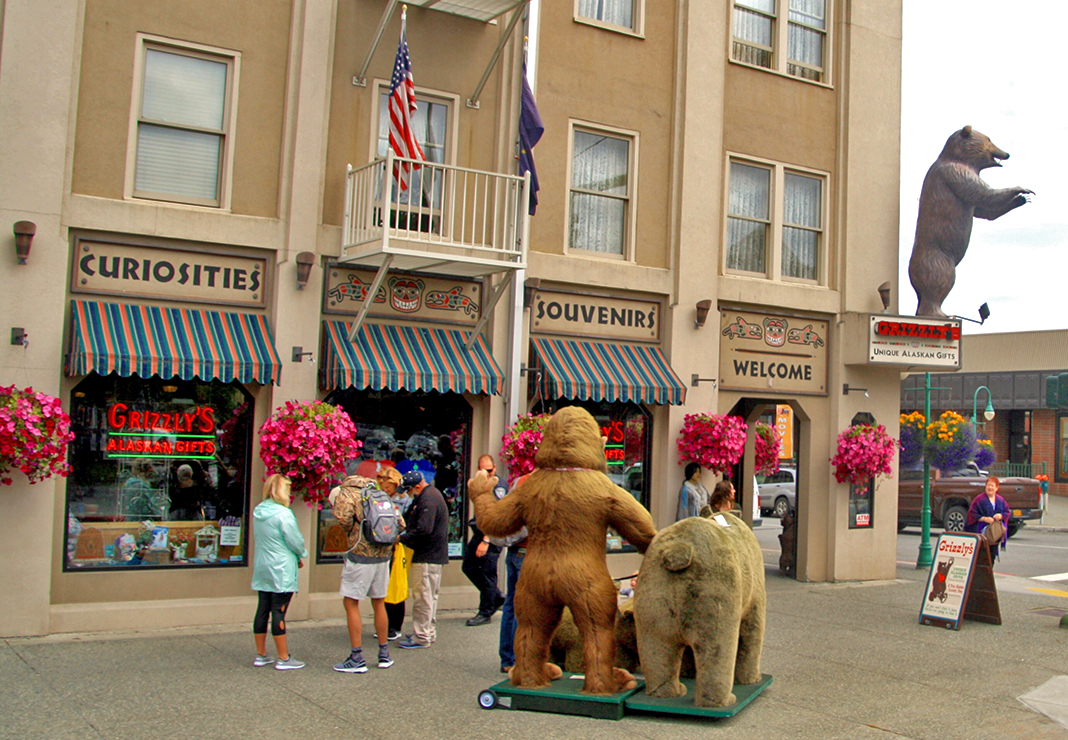
Erich a descreve como uma cidade pequena, limpa e simpática. Ela é o portão de entrada para os muitos turistas que vão começar sua viagem de cruzeiro pelo Alaska. As grandes companhias de cruzeiros têm escritórios lá: Princess Cruise, Holland America Norwegian são algumas que eu vi. Anchorage é também um importante entroncamento aéreo mundial.

A alta estação turística se estende do final de maio até setembro. Pude perceber que Anchorage se prepara lindamente para receber os visitantes com muitas flores em suas praças,


há muitos jarros com flores coloridas penduradas nos postes de energia, pelas calçadas, nos jardins. Tudo é muito bem decorado com flores e elas são espetaculares.

A cidade é muito bem servida com hotéis (são 8000 leitos), lojas de souvenires,
restaurantes. Por falar em restaurantes, fique atento(a) aos horários dos mesmos: almoço (11 as 16 horas), jantar (17 as 21 horas). Sendo que a maioria das lojas encerram as suas atividades as 21 horas.
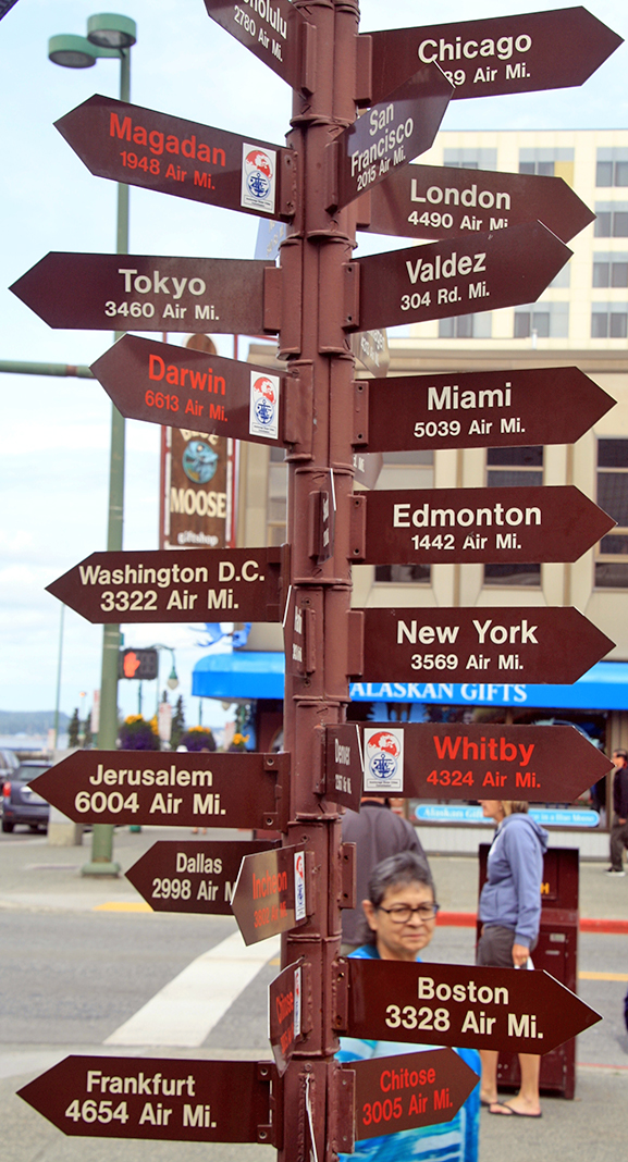
Em relação a ponto de interesse em Anchorage: city tour em um carro especial chamado trolley (bonde) com duração de 1 hora;

visita à fábrica das facas UHU, Museu de Anchorage, ao zoológico e há também uma apresentação de projeção de imagens da Aurora Boreal, pois no Alaska (Anchorage e Fairbanks é possível de vê-la).Outro atrativo do Alaska são as compras, pois o estado é considerado Zona Franca.
Em Anchorage há uma opção de passeio muito bonita, trata-se de uma trilha que margeia o Oceano Pacífico, que começa na cidade e se estende por 36 km.

É recomendável alugar uma bicicleta para percorrê-la. A loja de aluguel da bicicleta fica pertinho do começo da trilha na cidade, na esquina da ladeira que desce para a trilha, você vai ver. Erich e eu caminhamos 6 km nela.
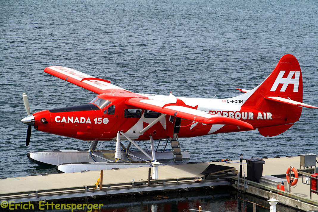
Outro atrativo interessante é fazer um voo panorâmico em hidroaviões,
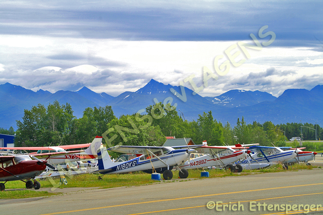
muito popular por lá. Erich queria fazer, mas, eu fiquei com medo e não fomos. Eu me arrependi amargamente. Quando estávamos lá, uma pessoa nos disse que tem muita gente lá que tem licença para pilotar um hidroavião, mas que ainda não tem para dirigir um carro. É realmente muito popular esse tipo de transporte por lá. Além dessas atrações, há também tours de um dia nos arredores, onde é possível ver belas paisagens naturais, que é o forte do Alaska.

Definitivamente recomendo Anchorage como portão de entrada para conhecer o Alaska, última fronteira do continente americano.
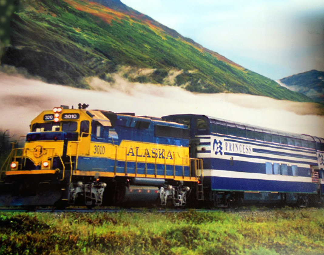
Não é um destino para você conhecer de carro, pois muitos lugares são acessíveis apenas pelo ar, por trem e pelo mar.
Seu quiser guias sobre Anchorage, clique aqui.
Observação: se você quiser continuar “viajando” com o nosso blog, clique no botão “seguir” localizado no canto inferior direito dessa página. Você também pode “viajar” pelo Brasil conhecendo nosso livro impresso 66 Brasil e sua versão digital 66 Belezas do Brasil.

ANCHORAGE – EINGANGSTOR ZU DEN SCHÖNHEITEN ALASKAS
Erich und ich besuchten Anchorage, Alaska im Juli.
Das erste, was mir auffiel, war die Länge der Tage mit Sonnenlicht. Um eine Idee zu geben, ich konnte den Sonnenuntergang um 22:25 Uhr beobachten, wir gingen um Mitternacht schlafen und es war immer noch hell.
Anchorage („Ankerplatz“) ist eine Stadt an der Bucht des Cook Inlet im US-Bundesstaat Alaska
Es hat etwa 300.000 Einwohner, ist eine flache Stadt, in der es einfach ist, sich fortzubewegen.
Erich beschreibt sie als eine kleine, saubere und freundliche Stadt. Es ist das Eingangstor für die vielen Touristen, die ihre Alaska-Kreuzfahrt hier beginnen werden. Alle die großen Kreuzfahrtgesellschaften haben Büros dort: Princess Cruise, Holland, American und Norwegian sind nur einige, die ich gesehen habe.
Es ist wichtig, hier auch die Bedeutung des Anchorage Flughafen hervorheben, heute wird es als wichtiges Drehkreuz für Flüge zwischen Asien, der Ostküste der Vereinigten Staaten und Europas angesehen.
Die Hochsaison dauert von Ende Mai bis September. Ich kann nur feststellen, dass Anchorage sehr schön vorbereitet ist, um die Besucher mit vielen Blumen auf ihren Plätzen zu begrüßen,
es gibt viele Krüge mit bunten Blumen, die an den Strommasten, auf den Bürgersteigen, in den Gärten hängen. Alles ist wunderschön mit Blumen geschmückt… spektakular.
Die Stadt ist sehr gut mit Hotels (es gibt 8000 Betten), Souvenirläden, Restaurants usw ausgestattet.
Apropos Restaurants, achten Sie auf die Zeiten: Mittagessen (11 bis 16 Uhr), Abendessen (17 bis 21 UHR). Die meisten Geschäfte schlieβen bereits um 21:00 Uhr.
Was die Sehenswürdigkeit in Anchorage betrifft: die Stadtrundfahrt in einem speziellen Bus, Trolley genannt, die etwa 1 Stunde dauert,
Besuch der UHU Knives Factory, des Anchorage Museums und des Zoos sowie eine Präsentation der Aurora Borealis in Alaska (ist in Anchorage und Fairbanks möglich). Interessant auch EINKAUFEN, der Staat gilt als Freizone.
In Anchorage gibt es eine sehr schöne Wander (Rad)möglichkeit, es ist ein Wanderweg entlang dem Pazifischen Ozean in der Stadt beginnend und sich über 36 km erstreckend.
Es ist auch empfehlenswert, das Ganze mit einem Fahrrad zu unternehmen. Der Fahrradverleih befindet sich ganz in der Nähe des Beginns des Weges, an der Ecke des kleinen Abhanges, der zum Pfad hinabführt, Sie können es nicht übersehen. Erich und ich sind 6 km der Tour darauf gelaufen.
Eine weitere interessante Attraktion ist ein Panoramaflug in einem der Wasserflugzeuge, die dort sehr beliebt sind.
Erich wollte es machen, aber ich hatte zuviel Angst. Ich bedauerte dies später bitterlich. Als wir dort waren, erzählte uns eine Person, dass es dort viele Leute gibt, die eine Lizenz haben, ein Wasserflugzeug zu fliegen, aber keine, um ein Auto zu fahren, also dort wirklich eine sehr beliebte Art von Transport.
Auf Tagestouren in die Umgebung können Sie wunderschöne Naturlandschaften erleben, dies ist die wirklich unschlagbare Stärke Alaskas.
Ich würde Anchorage definitiv als die Eingangspforte nach Alaska, der letzten Grenze des amerikanischen Kontinents, bezeichnen.
Es ist kein Ziel, um es nur per Auto zu erkunden, da viele Orte nur auf dem Luft- und/oder Seeweg erreichbar sind. Und nicht vergessen, die Eisenbahn…!!
Wenn Sie Broschüren über Anchorage haben möchten, klicken Sie hier.
Hinweis: Falls Sie unserem Blog folgen wollen, dann klicken Sie unten rechts einfach auf “Weiter”, Sie werden dann zukünftig automatisch informiert. Sie können auch durch Brasilien reisen und unser Buch 66 SEHENSWÜRDIGKEITEN IN BRASILIEN kennenlernen.

ANCHORAGE – ENTRANCE GATE TO THE BEAUTIES OF ALASKA
Erich and I visited Anchorage, Alaska, in a July.
The first thing I noticed was the length of the day with sunlight. To give an idea, I was able to watch the sunset at 22:25, we went to sleep then at midnight and it was still daylight.
Anchorage is a city on the bay of the Cook Inlet in the US state of Alaska
It has about 300,000 inhabitants, is a flat city where it is easy to get around.
Erich describes her as a small, clean and friendly city. It is the gateway for the many tourists who will begin their Alaska cruise here. All the big cruise companies have offices there: Princess Cruise, Holland, American and Norwegians are just a few that I’ve seen.
It is important to emphasize the importance of the Anchorage Airport here as well, today it is considered as an important hub for flights between Asia, the East Coast of the United States and Europe.
The high season lasts from the end of May to September. All I can say is that Anchorage is very well prepared to WELCOME the visitors with many flowers on the City places;
there are many pitchers of colorful flowers hanging from the electricity pylons, on the sidewalks, in the gardens. Everything is beautifully decorated with flowers…spectacular.
The city is very well equipped with hotels (there are 8000 beds), souvenir shops, restaurants etc.
Speaking of restaurants, pay attention to the times: lunch (11am to 4pm), dinner (5pm to 9pm). Most shops close already at 21:00.
What to see in Anchorage: the city tour on a special bus, called the Trolley, which takes about 1 hour,
visiting the UHU Knives Factory, Anchorage Museum and Zoo, and a presentation of the Aurora Borealis in Alaska (available in Anchorage and Fairbanks).
Interestingly also in general SHOPPING, the state is considered a free zone.
In Anchorage there is a very nice hiking(biking) trail, it is a trail along the Pacific Ocean in the city beginning and extending over 36 km.
It is also recommended to do this with a bicycle. The bike rental is near the beginning of the trail at the corner of the small slope that leads down to the path, you can not miss it. Erich and I walked 6 km of this tour on it.
Another interesting attraction is a panoramic flight in one of the seaplanes, which are very popular there.
Erich wanted to do it, but I was too scared. I bitterly regretted this later. When we were there one person told us that there are a lot of people who have a license to fly a seaplane, but none to drive a car, so there really is a very popular type of transportation.
On day trips in the area you can experience beautiful natural landscapes, this is the really unbeatable strength of Alaska.
I would definitely refer to Anchorage as the gateway to Alaska, the last frontier on the American continent.
It is not a destination to explore it only by car, as many places can only be reached by air and / or sea. But the train might serve as an alternative as well.
If you want brochures about Anchorage, click here.
Note: If you want to follow our “Travels” on the blog, simply click on “Seguir” in the lower right corner, you will be then automatically informed in the future. You can continue traveling with us with our book Brazil´s 66 Beautiful Sites.